File:España - División provincial y regional de 1833.svg
Jump to navigation
Jump to search

Size of this PNG preview of this SVG file: 791 × 600 pixels. Other resolutions: 317 × 240 pixels | 633 × 480 pixels | 1,013 × 768 pixels | 1,280 × 970 pixels | 2,560 × 1,940 pixels | 2,500 × 1,895 pixels.
Original file (SVG file, nominally 2,500 × 1,895 pixels, file size: 1.25 MB)
Captions
Captions
Add a one-line explanation of what this file represents
Summary
[edit]
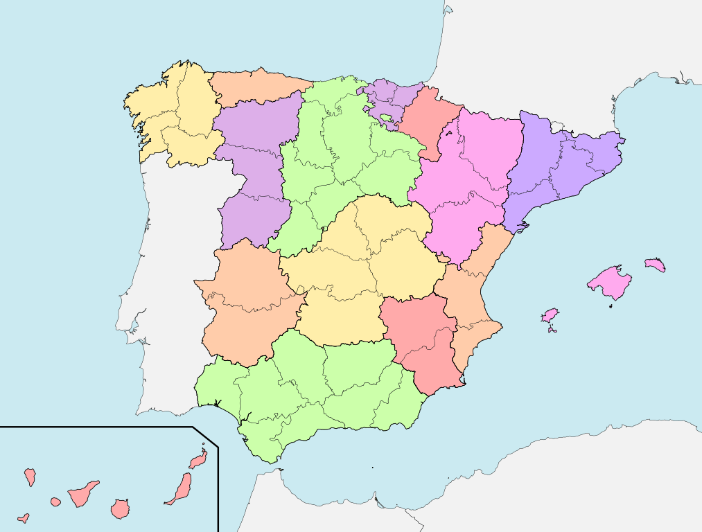
| Description | Mapa con la división territorial de España de 1833 teniéndose en cuenta las modificaciones de 1836 |
| Date | |
| Source | Own work=File:EspañaLoc.svg, de HansenBCN |
| Author | Miguillen |
| Other versions | Derivative works of this file: Kastilien 1833.svg |
Licensing
[edit]
I, the copyright holder of this work, hereby publish it under the following license:
This file is licensed under the Creative Commons Attribution 3.0 Unported license.
- You are free:
- to share – to copy, distribute and transmit the work
- to remix – to adapt the work
- Under the following conditions:
- attribution – You must give appropriate credit, provide a link to the license, and indicate if changes were made. You may do so in any reasonable manner, but not in any way that suggests the licensor endorses you or your use.
File history
Click on a date/time to view the file as it appeared at that time.
| Date/Time | Thumbnail | Dimensions | User | Comment | |
|---|---|---|---|---|---|
| current | 19:38, 11 February 2022 | | 2,500 × 1,895 (1.25 MB) | Lojwe (talk | contribs) | Frame removed |
| 02:07, 15 March 2010 |  | 2,500 × 1,895 (1.25 MB) | Miguillen (talk | contribs) | bordes | |
| 02:03, 15 March 2010 |  | 2,500 × 1,895 (1.25 MB) | Miguillen (talk | contribs) | {{Information |Description=Mapa con la división territorial de España de 1833 |Source={{own}}=File:EspañaLoc.svg, de HansenBCN |Date=2010-03-15 |Author=Miguillen |Permission= |other_versions= }} [[Category:Map |
You cannot overwrite this file.
File usage on Commons
The following 5 pages use this file:
File usage on other wikis
The following other wikis use this file:
- Usage on an.wikipedia.org
- Usage on ar.wikipedia.org
- Usage on ast.wikipedia.org
- Usage on ca.wikipedia.org
- Usage on en.wikipedia.org
- Usage on eo.wikipedia.org
- Usage on es.wikipedia.org
- Región de Murcia
- Castilla la Vieja
- Javier de Burgos
- Dialecto murciano
- Historia de la Región de Murcia
- Leonesismo
- División territorial de España en 1833
- Historia de la organización territorial de España
- Evolución de la población española en la época precensal
- Región de León
- Visión de España
- Usuario:Puchimon/Taller
- Censo de la matrícula catastral
- Usage on eu.wikipedia.org
- Usage on fr.wikipedia.org
- Usage on gl.wikipedia.org
- Usage on ja.wikipedia.org
- Usage on nl.wikipedia.org
- Usage on pt.wikipedia.org
- Usage on ru.wikipedia.org
- Usage on uk.wikipedia.org
- Usage on zh.wikipedia.org