Category:Maps of 19th-century Spain
Jump to navigation
Jump to search
Maps showing the territory of present-day ![]() Spain as it was in the 19th century.
Spain as it was in the 19th century.
| Preceded by: Maps of 18th-century Spain |
Maps of 19th-century Spain 1801 - 1900 CE |
Succeeded by: Maps of 20th-century Spain |
Subcategories
This category has the following 4 subcategories, out of 4 total.
F
- First Carlist War maps (18 F)
T
- Third Carlist War maps (2 F)
Media in category "Maps of 19th-century Spain"
The following 37 files are in this category, out of 37 total.
-
-
 Peninsular War map 1807–1814.png 1,197 × 1,027; 1.98 MB
-

-
 Mapa de España y Portugal (Gustavo Pfeiffer, 1872).jpg 8,584 × 6,329; 10.09 MB
-
 Spain and Portugal (BM 1873,0208.126).jpg 2,500 × 1,994; 1.46 MB
-

-
 Stielers Handatlas 1891 33.jpg 5,200 × 4,300; 7.84 MB
-
 Stielers Handatlas 1891 34.jpg 5,100 × 4,250; 7.12 MB
-
 Stielers Handatlas 1891 35.jpg 5,100 × 4,250; 6.85 MB
-
 Stielers Handatlas 1891 36.jpg 5,100 × 4,250; 5.35 MB
-
 Brockhaus' Konversations-Lexikon (1892) (14597764969).jpg 1,643 × 2,630; 811 KB
-
 Mapa de España y Portugal... 1-1 600 000... - por Elias Zerolo - btv1b530297335 (1 of 2).jpg 10,381 × 8,456; 17.75 MB
-
 Carlismo.jpg 503 × 393; 175 KB
-
 Conflictos primera república.svg 685 × 600; 1.29 MB
-
 Densidades de población en España (1857).png 784 × 537; 170 KB
-
 Densidades de población en España (1857).svg 568 × 387; 1.49 MB
-
 Densidades de población en España (1900).png 779 × 529; 165 KB
-
 Densidades de población en España (1900).svg 568 × 387; 1.49 MB
-
 Espagne et Portugal - btv1b84460609.jpg 7,822 × 6,072; 7.53 MB
-
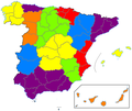
 España - División provincial y regional de 1833.svg 2,500 × 1,895; 1.25 MB
-
 Focos rebelión cantonal.svg 685 × 600; 1.05 MB
-
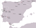
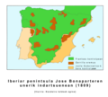 Iberiar penintsula Jose Bonaparteren unerik indartsuenean (1809).png 726 × 651; 197 KB
-
 Kastilien 1833.svg 2,500 × 1,895; 1.25 MB
-
 Map Spain 1822.png 256 × 233; 8 KB
-
 Map Spain 1833.png 467 × 394; 17 KB
-
 Map Spain 1833.PNG 467 × 394; 17 KB
-
 Mapa de España - Constitución de 1873.svg 416 × 349; 1.44 MB
-
 Mapa de España - Decreto de Escosura de 1847.svg 416 × 349; 1.44 MB
-
 Mapa de España - Proyecto de reforma de Moret de 1884.svg 416 × 349; 1.44 MB
-

-
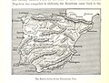
 Peninsular War battles.PNG 694 × 535; 19 KB
-
 Rebelión cantonal españa.jpg 736 × 581; 111 KB
-
 Rebelión cantonal.svg 685 × 600; 1.21 MB
-
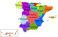 Regiones militares de 1841 en España.svg 578 × 374; 619 KB
-
 Revolución cantonal de 1873.png 685 × 600; 128 KB
-
 Revolución de 1820.svg 685 × 600; 1.09 MB
-
 Spain - Territorial division of 1822.PNG 256 × 233; 6 KB
.jpg)

_(14779589362).jpg)
.jpg)
.jpg)


_(14597764969).jpg)
.jpg)


.png)
.svg)
.png)
.svg)


.png)


