File:El Salt topo map.svg
Jump to navigation
Jump to search

Size of this PNG preview of this SVG file: 661 × 467 pixels. Other resolutions: 320 × 226 pixels | 640 × 452 pixels | 1,024 × 723 pixels | 1,280 × 904 pixels | 2,560 × 1,809 pixels.
Original file (SVG file, nominally 661 × 467 pixels, file size: 2.28 MB)
Captions
Captions
Add a one-line explanation of what this file represents
Summary
[edit]
| Description |
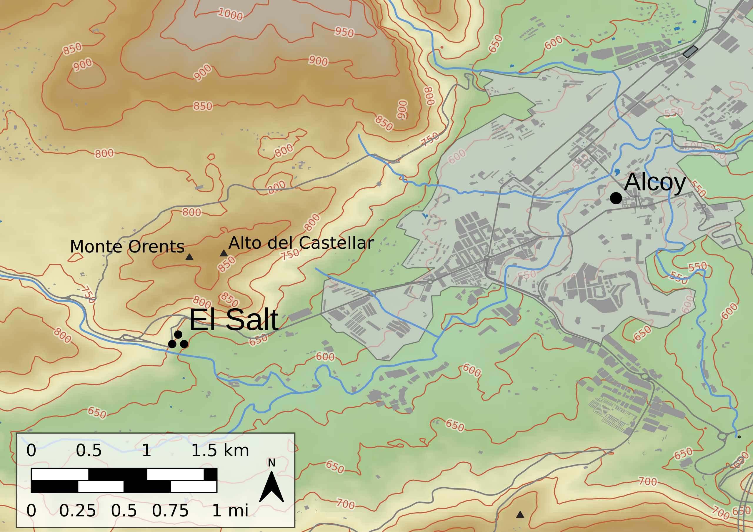
English: Area around the El Salt site |
| Date | |
| Source |
|
| Author | AntiCompositeNumber, OpenStreetMap contributors |
| SVG development |
Licensing
[edit]
I, the copyright holder of this work, hereby publish it under the following license:
This file is licensed under the Creative Commons Attribution-Share Alike 4.0 International license.
- You are free:
- to share – to copy, distribute and transmit the work
- to remix – to adapt the work
- Under the following conditions:
- attribution – You must give appropriate credit, provide a link to the license, and indicate if changes were made. You may do so in any reasonable manner, but not in any way that suggests the licensor endorses you or your use.
- share alike – If you remix, transform, or build upon the material, you must distribute your contributions under the same or compatible license as the original.
| This work contains information from OpenStreetMap, which is made available under the Open Database License (ODbL).
The ODbL does not require any particular license for maps produced from ODbL data. Prior to 1 August 2020, map tiles produced by the OpenStreetMap Foundation were licensed under the CC-BY-SA-2.0 license. Maps produced by other people may be subject to other licences. |
This image uses high-resolution digital topography data from NASA's Shuttle Radar Topography Mission (SRTM) at JPL-Caltech [1]. It is in the public domain in the United States.
|
 | |
File history
Click on a date/time to view the file as it appeared at that time.
| Date/Time | Thumbnail | Dimensions | User | Comment | |
|---|---|---|---|---|---|
| current | 13:49, 18 August 2019 | | 661 × 467 (2.28 MB) | AntiCompositeNumber (talk | contribs) | More cleanup and adjustments |
| 23:05, 17 August 2019 |  | 705 × 499 (3.87 MB) | AntiCompositeNumber (talk | contribs) | Cleanup, text to paths because of a librsvg bug (QGIS: Good at making maps, bad at making SVGs). | |
| 21:29, 17 August 2019 |  | 705 × 499 (3.72 MB) | AntiCompositeNumber (talk | contribs) | Zoom in, refine | |
| 00:32, 15 August 2019 |  | 1,052 × 738 (3.42 MB) | AntiCompositeNumber (talk | contribs) | {{Information |description ={{en|1=Area around the El Salt site}} |date =2019-08-14 |source =* Topographic data: {{Cite journal |last=NASA JPL |year=2013 |title=NASA Shuttle Radar Topography Mission Global 1 arc second |journal=NASA AppEEARS |url=https://lpdaac.usgs.gov/products/srtmgl1v003/ |publisher=NASA EOSDIS Land Processes DAAC |doi=10.5067/measures/srtm/srtmgl1.003 |access-date=2019-08-13 |doi-access=free}} * Highways, Rivers, Buildings, and other point of interest da... |
You cannot overwrite this file.
File usage on Commons
The following 3 pages use this file:
File usage on other wikis
The following other wikis use this file:
- Usage on de.wikipedia.org
- Usage on en.wikipedia.org
- Usage on www.wikidata.org