File:Ebbinghof aerial view 2016.jpg
Jump to navigation
Jump to search

Size of this preview: 800 × 533 pixels. Other resolutions: 320 × 213 pixels | 640 × 427 pixels | 1,024 × 683 pixels | 1,280 × 853 pixels | 2,560 × 1,706 pixels | 4,180 × 2,786 pixels.
Original file (4,180 × 2,786 pixels, file size: 5.7 MB, MIME type: image/jpeg)
Captions
Captions
Add a one-line explanation of what this file represents
Summary
[edit]
| Description |
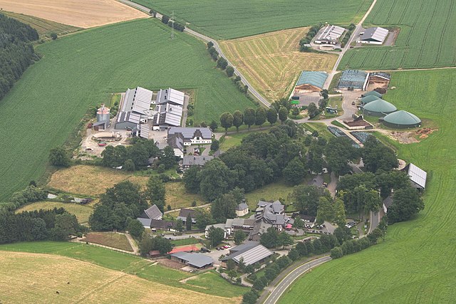
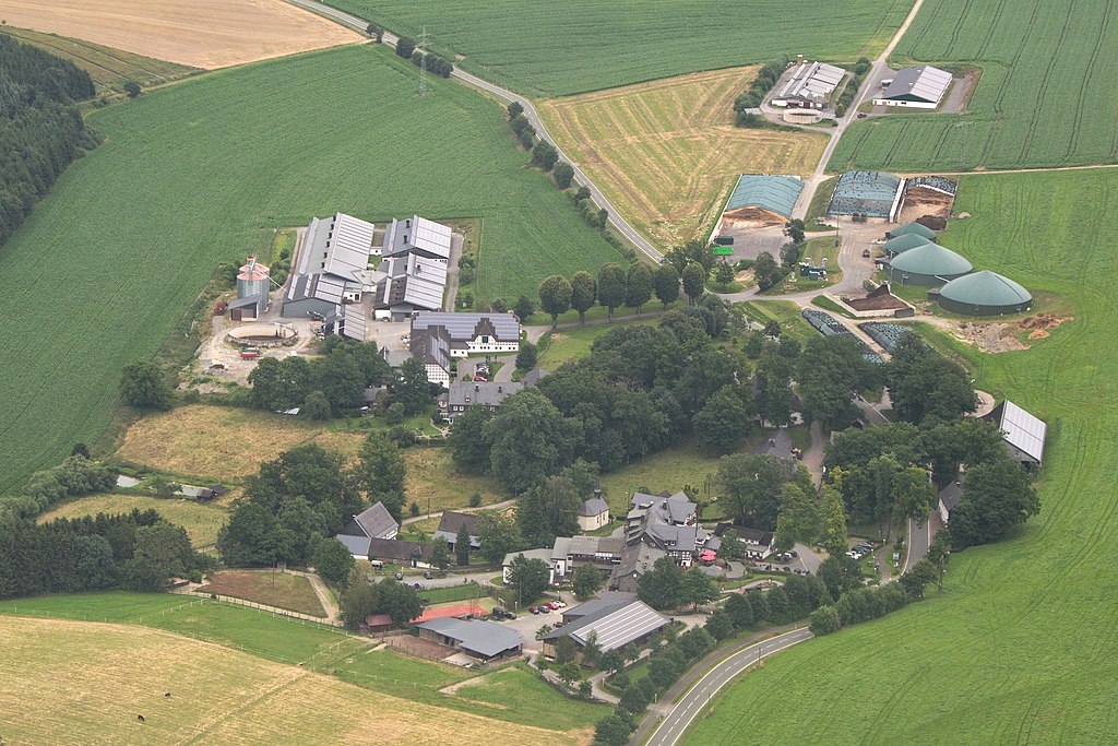
English: Ebbinghof, as seen from the West Deutsch: Ebbinghof, Blick in Richtung Osten |
| Date | |
| Source | Own work |
| Author | El Grafo |
| Camera location | | View this and other nearby images on: OpenStreetMap |
|---|
| Object location | | View this and other nearby images on: OpenStreetMap |
|---|
Licensing
[edit]
El Grafo, the copyright holder of this work, hereby publishes it under the following license:
This file is licensed under the Creative Commons Attribution-Share Alike 4.0 International license.
Attribution: © El Grafo / CC-BY-SA-4.0
- You are free:
- to share – to copy, distribute and transmit the work
- to remix – to adapt the work
- Under the following conditions:
- attribution – You must give appropriate credit, provide a link to the license, and indicate if changes were made. You may do so in any reasonable manner, but not in any way that suggests the licensor endorses you or your use.
- share alike – If you remix, transform, or build upon the material, you must distribute your contributions under the same or compatible license as the original.
| Annotations | This image is annotated: View the annotations at Commons |

|
This image has been assessed under the valued image criteria and is considered the most valued image on Commons within the scope: Ebbinghof. You can see its nomination here. |
File history
Click on a date/time to view the file as it appeared at that time.
| Date/Time | Thumbnail | Dimensions | User | Comment | |
|---|---|---|---|---|---|
| current | 20:03, 21 July 2016 | | 4,180 × 2,786 (5.7 MB) | El Grafo (talk | contribs) | == {{int:filedesc}} == {{Information |Description={{en|1=Ebbinghof, as seen from the West}}{{de|1=Ebbinghof, Blick in Richtung Osten}} |Source={{own}} |Date=2016-07-16 |Author=El Grafo |Permission= |other_versions= }} {{Location|51.17... |
You cannot overwrite this file.
File usage on Commons
The following 5 pages use this file:
File usage on other wikis
The following other wikis use this file:
- Usage on de.wikipedia.org
- Usage on en.wikipedia.org
- Usage on fa.wikipedia.org
- Usage on pl.wiktionary.org
- Usage on www.wikidata.org