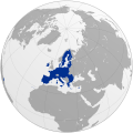
File:EU membership possible map.svg
From Wikimedia Commons, the free media repository
Jump to navigation
Jump to search

Size of this PNG preview of this SVG file: 645 × 488 pixels. Other resolutions: 317 × 240 pixels | 635 × 480 pixels | 1,015 × 768 pixels | 1,280 × 968 pixels | 2,560 × 1,937 pixels.
Original file (SVG file, nominally 645 × 488 pixels, file size: 376 KB)
File information
Structured data
Captions
Captions
Add a one-line explanation of what this file represents
Summary
[edit]| DescriptionEU membership possible map.svg |
English: Countries that could join the European Union
Deutsch: Länder, die der Europäischen Union beitreten könnten
Français : Pays susceptibles d'adhérer à l'Union européenne
|
| Date | |
| Source | |
| Author | Kolja21 |
| Other versions |
|
Licensing
[edit]I, the copyright holder of this work, hereby publish it under the following license:
This file is licensed under the Creative Commons Attribution-Share Alike 4.0 International license.
- You are free:
- to share – to copy, distribute and transmit the work
- to remix – to adapt the work
- Under the following conditions:
- attribution – You must give appropriate credit, provide a link to the license, and indicate if changes were made. You may do so in any reasonable manner, but not in any way that suggests the licensor endorses you or your use.
- share alike – If you remix, transform, or build upon the material, you must distribute your contributions under the same or compatible license as the original.
File history
Click on a date/time to view the file as it appeared at that time.
| Date/Time | Thumbnail | Dimensions | User | Comment | |
|---|---|---|---|---|---|
| current | 00:01, 15 December 2023 |  | 645 × 488 (376 KB) | Iktsokh (talk | contribs) | Georgia is recognized as an official candidate. |
| 21:22, 27 December 2022 |  | 645 × 488 (376 KB) | Danlaycock (talk | contribs) | update kosovo | |
| 09:15, 20 December 2022 |  | 645 × 488 (376 KB) | Semso98 (talk | contribs) | Bosnia and Herzegovina is candidate country since December 15, 2022. (removed empty space on the left) | |
| 09:12, 20 December 2022 |  | 760 × 488 (376 KB) | Semso98 (talk | contribs) | Bosnia and Herzegovina is candidate country since December 15, 2022. | |
| 19:35, 23 June 2022 |  | 680 × 520 (376 KB) | WikiNight (talk | contribs) | Bosnien hat Antrag gestellt | |
| 19:24, 23 June 2022 |  | 680 × 520 (376 KB) | Einsamer Schütze (talk | contribs) | Moldau und Ukraine jetzt Kandidaten | |
| 17:18, 26 April 2022 |  | 680 × 520 (376 KB) | Sbb1413 (talk | contribs) | Changed colour. | |
| 17:17, 26 April 2022 |  | 680 × 520 (376 KB) | Sbb1413 (talk | contribs) | Coloured Georgia, Ukraine and Moldova as mere applicants to avoid any dispute with their potential candidate status of the EU. | |
| 00:46, 18 March 2022 |  | 680 × 520 (376 KB) | Kolja21 (talk | contribs) | Reverted to version as of 14:18, 31 January 2020 (UTC): "Potential candidate countries" is a legally defined term. | |
| 09:22, 12 March 2022 |  | 680 × 520 (375 KB) | Sbb1413 (talk | contribs) | UA, MD, GE |
You cannot overwrite this file.
File usage on Commons
The following 44 pages use this file:
- Enlargement of the European Union
- User:Kolja21
- User:Kolja21/Maps of Europe
- User:Kolja21/Maps of the European Union
- User:Kolja21/Maps of the European Union enlargement
- File:EC-EU-enlargement animation.gif
- File:EC06-1957-58 EC and USSR map.svg
- File:EC06-1957-58 European Community map.svg
- File:EC09-1973 European Community map.svg
- File:EC09-1973 European Community map enlargement.svg
- File:EC10-1981 European Community map.svg
- File:EC10-1981 European Community map enlargement.svg
- File:EC12-1986 EC and USSR map.svg
- File:EC12-1986 European Community map.svg
- File:EC12-1986 European Community map enlargement.svg
- File:EC12-1990 European Community map.svg
- File:EC12-1990 European Community map enlargement.svg
- File:EU-Eastern Partnership.svg
- File:EU-candidate countries map.svg
- File:EU12-1992-93 European Union map.svg
- File:EU15-1995 European Union map.svg
- File:EU15-1995 European Union map enlargement.svg
- File:EU25-2004 European Union map.svg
- File:EU25-2004 European Union map enlargement.svg
- File:EU27-2007 European Union map.svg
- File:EU27-2007 European Union map enlargement.svg
- File:EU27-2007 as a single entity.svg
- File:EU27-2007 globe.svg
- File:EU27-2008 as a single entity in the world.svg
- File:EU27-2012-candidate countries map.svg
- File:EU27-2012-candidate countries only map.svg
- File:EU27-2012-further enlargement map.svg
- File:EU27-2012-states with applications.svg
- File:EU28-2013 European Union map enlargement.svg
- File:EU28-candidate countries only map.svg
- File:EU28-further enlargement map.svg
- File:EU28-states with applications.svg
- File:EU membership possible map.svg
- File:EU states with applications.svg
- File:Eu - members, candidates, association.svg
- File:Europe subregion map UN geoscheme.svg
- File:Europe subregion map world factbook.svg
- File:Map of Europe 2007 (political) de.png
- Category:Potential enlargement of the European Union
File usage on other wikis
The following other wikis use this file:
- Usage on af.wikipedia.org
- Usage on bs.wikipedia.org
- Usage on de.wikipedia.org
- Usage on fy.wikipedia.org
- Usage on gl.wikipedia.org
- Usage on pl.wikipedia.org
- Usage on roa-tara.wikipedia.org
- Usage on sl.wikipedia.org
- Usage on uk.wikipedia.org
- Usage on www.wikidata.org
Metadata
This file contains additional information such as Exif metadata which may have been added by the digital camera, scanner, or software program used to create or digitize it. If the file has been modified from its original state, some details such as the timestamp may not fully reflect those of the original file. The timestamp is only as accurate as the clock in the camera, and it may be completely wrong.
| Width | 181.90401mm |
|---|---|
| Height | 137.71484mm |


