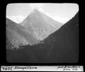
File:ETH-BIB-Almagellhorn-Dia 247-03071.tif
From Wikimedia Commons, the free media repository
Jump to navigation
Jump to search

Size of this JPG preview of this TIF file: 726 × 600 pixels. Other resolutions: 291 × 240 pixels | 581 × 480 pixels | 930 × 768 pixels | 1,240 × 1,024 pixels | 2,480 × 2,048 pixels | 2,838 × 2,344 pixels.
Original file (2,838 × 2,344 pixels, file size: 6.36 MB, MIME type: image/tiff)
File information
Structured data
Captions
Captions
Add a one-line explanation of what this file represents
Summary
[edit]| Almagellhorn
( |
|||||||||||||||||||||||||||
|---|---|---|---|---|---|---|---|---|---|---|---|---|---|---|---|---|---|---|---|---|---|---|---|---|---|---|---|
| Photographer |
creator QS:P170,Q47086867 |
||||||||||||||||||||||||||
| Title |
Almagellhorn |
||||||||||||||||||||||||||
| Description |
Wald, Berghang, Berge |
||||||||||||||||||||||||||
| Depicted place | Almagellhorn | ||||||||||||||||||||||||||
| Date |
1919 date QS:P571,+1919-00-00T00:00:00Z/9 |
||||||||||||||||||||||||||
| Medium | Fotografie : Glasdiapositiv | ||||||||||||||||||||||||||
| Dimensions |
height: 8.5 cm (3.3 in); width: 10 cm (3.9 in) dimensions QS:P2048,8.5U174728 dimensions QS:P2049,10U174728 |
||||||||||||||||||||||||||
| Collection |
institution QS:P195,Q684773 |
||||||||||||||||||||||||||
| Accession number |
ETH-Bibliothek_Dia_247-03071 |
||||||||||||||||||||||||||
| Source |
E-Pics Bildarchiv online http://doi.org/10.3932/ethz-a-000044265
|
||||||||||||||||||||||||||
| Permission (Reusing this file) |
This file is licensed under the Creative Commons Attribution-Share Alike 4.0 International license.
|
||||||||||||||||||||||||||
| Object location | 46° 05′ 13″ N, 7° 59′ 40″ E | View this and other nearby images on: OpenStreetMap |
|---|
File history
Click on a date/time to view the file as it appeared at that time.
| Date/Time | Thumbnail | Dimensions | User | Comment | |
|---|---|---|---|---|---|
| current | 10:46, 22 March 2024 |  | 2,838 × 2,344 (6.36 MB) | Enhancing999 (talk | contribs) | Cropped 15 % horizontally, 17 % vertically using CropTool with precise mode. |
| 19:39, 24 April 2018 |  | 3,335 × 2,835 (9.1 MB) | ETH-Bibliothek (talk | contribs) | GWToolset: Erstelle Mediendatei für ETH-Bibliothek. |
You cannot overwrite this file.
File usage on Commons
The following page uses this file:
File usage on other wikis
The following other wikis use this file:
- Usage on de.wikipedia.org
Metadata
This file contains additional information such as Exif metadata which may have been added by the digital camera, scanner, or software program used to create or digitize it. If the file has been modified from its original state, some details such as the timestamp may not fully reflect those of the original file. The timestamp is only as accurate as the clock in the camera, and it may be completely wrong.
| Image title | Box_34 057 |
|---|---|
| Width | 2,838 px |
| Height | 2,344 px |
| Bits per component | 8 |
| Compression scheme | Uncompressed |
| Pixel composition | Black and white (Black is 0) |
| Orientation | Normal |
| Number of components | 1 |
| Number of rows per strip | 368 |
| Horizontal resolution | 300 dpi |
| Vertical resolution | 300 dpi |
| Data arrangement | chunky format |
| White point chromaticity |
|
| Chromaticities of primarities |
|

