File:Dorset cursus southwestern terminal - geograph.org.uk - 24093.jpg
Jump to navigation
Jump to search
No higher resolution available.
Dorset_cursus_southwestern_terminal_-_geograph.org.uk_-_24093.jpg (640 × 480 pixels, file size: 139 KB, MIME type: image/jpeg)
Captions
Captions
Add a one-line explanation of what this file represents
Summary
[edit]
| Description |
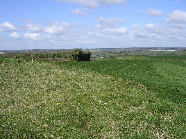
English: Dorset cursus southwestern terminal. The neolithic earthworks in this picture form the southwestern terminal of the enigmatic Dorset Cursus, on Thickthorn Down. The cursus is a linear ancient monument: a pair of parallel earth banks and ditches about 100m apart once stretched 10km to the northeast from this point, with the other terminal on Bokerley Down. Farming activity over the centuries has destroyed much of the above-ground features of the cursus, but these earthworks in particular remain. The original purpose of the cursus is still the subject of conjecture, but it is likely that it is somehow related to the many neolithic long barrows that lie on, within and without its banks. |
| Date | |
| Source | From geograph.org.uk |
| Author | Jim Champion |
| Attribution (required by the license) | Jim Champion / Dorset cursus southwestern terminal / |
| Object location | | View this and other nearby images on: OpenStreetMap |
|---|
_&language=en)
Licensing
[edit]

|
This image was taken from the Geograph project collection. See this photograph's page on the Geograph website for the photographer's contact details. The copyright on this image is owned by Jim Champion and is licensed for reuse under the Creative Commons Attribution-ShareAlike 2.0 license.
|
This file is licensed under the Creative Commons Attribution-Share Alike 2.0 Generic license.
Attribution: Jim Champion
- You are free:
- to share – to copy, distribute and transmit the work
- to remix – to adapt the work
- Under the following conditions:
- attribution – You must give appropriate credit, provide a link to the license, and indicate if changes were made. You may do so in any reasonable manner, but not in any way that suggests the licensor endorses you or your use.
- share alike – If you remix, transform, or build upon the material, you must distribute your contributions under the same or compatible license as the original.
- Remove redundant categories and try to put this image in the most specific category/categories
- Remove this template
- The location categories are based on information from this geonames tool and this OpenStreetMap tool combined with a database. You can also have a look at this tool from mysociety.
- The topic category from Geograph was Scheduled Monument (find similar images Monument at Geograph)
File history
Click on a date/time to view the file as it appeared at that time.
| Date/Time | Thumbnail | Dimensions | User | Comment | |
|---|---|---|---|---|---|
| current | 02:28, 30 January 2010 | | 640 × 480 (139 KB) | GeographBot (talk | contribs) | == {{int:filedesc}} == {{Information |description={{en|1=Dorset cursus southwestern terminal. The neolithic earthworks in this picture form the southwestern terminal of the enigmatic Dorset Cursus, on Thickthorn Down. The cursus is a linear ancient monume |
You cannot overwrite this file.
File usage on Commons
There are no pages that use this file.