Category:Long Crichel
Jump to navigation
Jump to search
English: Long Crichel is a hamlet in east Dorset, England, situated on Cranborne Chase five miles north east of Blandford Forum. The hamlet has a population of 81 .
village in the United Kingdom  | |||||
| Upload media | |||||
| Instance of |
| ||||
|---|---|---|---|---|---|
| Location |
| ||||
 | |||||
Subcategories
This category has the following 2 subcategories, out of 2 total.
L
- Long Crichel House (1 F)
M
Media in category "Long Crichel"
The following 50 files are in this category, out of 50 total.
-
 A wall of bales - geograph.org.uk - 283673.jpg 640 × 480; 77 KB
-
 Bridleway, Horse Down, Long Crichel - geograph.org.uk - 2404734.jpg 800 × 600; 97 KB
-
 Bridleway, Horse Down, Long Crichel - geograph.org.uk - 2404741.jpg 800 × 600; 124 KB
-
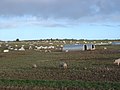
 Cows graze at Higher Farm, Long Crichel - geograph.org.uk - 2459697.jpg 640 × 480; 101 KB
-
 Farm track down towards Long Crichel - geograph.org.uk - 283870.jpg 480 × 640; 77 KB
-
 Grain silos alongside Horse Coppice - geograph.org.uk - 323185.jpg 640 × 430; 130 KB
-
 Harvested field, Long Crichel - geograph.org.uk - 2027254.jpg 640 × 480; 75 KB
-
 Harvested fields, Long Crichel - geograph.org.uk - 2027264.jpg 640 × 480; 91 KB
-
 Hedge and cereal crop, Long Crichel - geograph.org.uk - 1690500.jpg 640 × 481; 144 KB
-
 Lighting up, Long Crichel - geograph.org.uk - 1690545.jpg 640 × 480; 126 KB
-
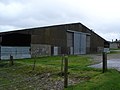
 Long Crichel, barn - geograph.org.uk - 3315171.jpg 1,024 × 746; 108 KB
-
 Long Crichel, bridleway - geograph.org.uk - 4776315.jpg 1,024 × 768; 143 KB
-
 Long Crichel, bridleway - geograph.org.uk - 4776336.jpg 1,024 × 768; 201 KB
-
 Long Crichel, bridleway junction - geograph.org.uk - 4776321.jpg 1,024 × 768; 244 KB
-

-
 Long Crichel, farm road - geograph.org.uk - 4775862.jpg 1,024 × 768; 112 KB
-
 Long Crichel, gate - geograph.org.uk - 3315174.jpg 1,024 × 768; 226 KB
-

-

-
 Long Crichel, lines of trees - geograph.org.uk - 1165536.jpg 640 × 480; 111 KB
-
 Long Crichel, maize stubble - geograph.org.uk - 4776308.jpg 1,024 × 768; 169 KB
-
 Long Crichel, maize stubble - geograph.org.uk - 4776328.jpg 1,024 × 768; 160 KB
-
 Long Crichel, marker ^ notice - geograph.org.uk - 4776324.jpg 1,600 × 1,200; 254 KB
-
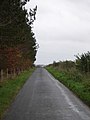
 Long Crichel, minor road - geograph.org.uk - 4776344.jpg 1,024 × 768; 177 KB
-
 Long Crichel, postbox No. BH21 160 - geograph.org.uk - 1165545.jpg 640 × 480; 74 KB
-
 Long Crichel, postbox No. BH21 44 - geograph.org.uk - 953803.jpg 480 × 640; 88 KB
-
 Long Crichel, the telephone box - geograph.org.uk - 3299589.jpg 640 × 480; 87 KB
-
 Long Crichel, Veiny Cheese Pond - geograph.org.uk - 1165539.jpg 480 × 640; 143 KB
-
 Long Crichel, woodland - geograph.org.uk - 4776303.jpg 1,024 × 768; 150 KB
-
 Pheasant (Phasianus colchicus) - geograph.org.uk - 1690534.jpg 479 × 640; 226 KB
-
 Piglets on Holly Grove Farm - geograph.org.uk - 289650.jpg 640 × 480; 79 KB
-
 Road drops into Long Crichel - geograph.org.uk - 2459681.jpg 640 × 480; 87 KB
-
-
 Barn on Higher Farm, Long Crichel - geograph.org.uk - 283849.jpg 640 × 480; 72 KB
-
 Bridleway near Long Crichel - geograph.org.uk - 426379.jpg 640 × 480; 103 KB
-

-
 Dorset cursus southwestern terminal - geograph.org.uk - 24093.jpg 640 × 480; 139 KB
-
 Farm track near Long Crichel - geograph.org.uk - 283678.jpg 480 × 640; 84 KB
-
 Farmland near Long Crichelf - geograph.org.uk - 283862.jpg 640 × 480; 53 KB
-
 Farmland south of Long Crichel - geograph.org.uk - 283872.jpg 640 × 480; 69 KB
-
 Higher Farm, Long Crichel - geograph.org.uk - 283837.jpg 640 × 480; 95 KB
-

-
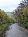 Lane down into Long Crichel - geograph.org.uk - 283861.jpg 480 × 640; 103 KB
-
 Road junction at Long Crichel - geograph.org.uk - 426434.jpg 640 × 480; 130 KB
-
 Straw bales near Long Crichel - geograph.org.uk - 426374.jpg 640 × 480; 90 KB
-
 Track to Crichel Down - geograph.org.uk - 283679.jpg 640 × 480; 56 KB
-
 Track to Lower Kitemoor - geograph.org.uk - 283936.jpg 480 × 640; 60 KB
-
 Track up Rushton Hill - geograph.org.uk - 327803.jpg 640 × 480; 102 KB
-
 Tumulus on Tarrant Hinton Down - geograph.org.uk - 283662.jpg 640 × 480; 85 KB
-


_-_geograph.org.uk_-_1690534.jpg)


