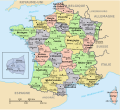
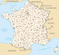
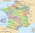
File:Départements de France nom+num.svg
From Wikimedia Commons, the free media repository
Jump to navigation
Jump to search

Size of this PNG preview of this SVG file: 635 × 580 pixels. Other resolutions: 263 × 240 pixels | 526 × 480 pixels | 841 × 768 pixels | 1,121 × 1,024 pixels | 2,242 × 2,048 pixels.
Original file (SVG file, nominally 635 × 580 pixels, file size: 475 KB)
File information
Structured data
Captions
Captions
Add a one-line explanation of what this file represents
Summary
[edit]
|
This file has been superseded by Départements de France nom+num-2015.svg. It is recommended to use the other file. Please note that deleting superseded images requires consent.
|

|
| DescriptionDépartements de France nom+num.svg |
Français : Départements et régions en France English: Départements and régions in France Deutsch: Départements und Regionen in Frankreich
Other versions
|
| Date | (UTC) |
| Source | |
| Author |
|
| This is a retouched picture, which means that it has been digitally altered from its original version. Modifications: Combination des noms et numéros des départements. The original can be viewed here: Départements de France.svg:
|
Licensing
[edit]| Public domainPublic domainfalsefalse |
| I, the copyright holder of this work, release this work into the public domain. This applies worldwide. In some countries this may not be legally possible; if so: I grant anyone the right to use this work for any purpose, without any conditions, unless such conditions are required by law. |
Original upload log
[edit]This image is a derivative work of the following images:
- File:Départements+régions_(France).svg licensed with PD-self
- 2010-01-02T22:08:27Z Solsticedhiver 588x550 (491098 Bytes) Reverted to version as of 21:49, 2 January 2010
- 2010-01-02T22:07:48Z Solsticedhiver 588x550 (489589 Bytes) nouvelle version sans artifacts étranges (j'espère)
- 2010-01-02T21:49:31Z Solsticedhiver 588x550 (491098 Bytes) correction de la version précédente sans l'infame carré noire
- 2010-01-02T20:22:52Z Solsticedhiver 588x550 (492892 Bytes) une tentative pour rendre cette carte un peu plus lisible
- 2010-01-02T19:11:21Z Solsticedhiver 588x550 (463754 Bytes) corrige Roussillon, place les départements corses sur la carte, déplace le zoom Ile-de-France et l'encadre, et améliore la lisibilité en évitant le texte qui se chevauche
- 2009-05-16T02:31:31Z Archimatth 588x550 (463910 Bytes) Suppression des traits d'union dans Pays de la Loire, et du sigle PACA.
- 2008-10-01T14:12:45Z Boism 588x550 (463938 Bytes) {{Information |Description={{fr|1=Départements et régions en France}} {{en|1=Départements and régions in France}} |Source=http://commons.wikimedia.org/wiki/Image:D%C3%A9partements_et_r%C3%A9gions_de_France.svg by [[user:B
- 2008-05-14T06:15:09Z TimothyBourke 588x550 (481071 Bytes) Changé id pour les régions (http://en.wikipedia.org/wiki/List_of_FIPS_region_codes_(D-F)#FR:_France). Bougé le gros Ile-de-France région à le bonne calque. Effacé un faux Rhône-Alpes chemin.
- 2008-05-13T11:37:09Z TimothyBourke 588x550 (487550 Bytes) Ajouté inkscape:labels pour les departements manquant. Corrigé id departement2a à departement20a (Corse-du-Sud). Corrigé id departement2b à departement20b (Haut-Corse). Corrigé id path5292 à departement82 (Tarn-et-Garo
- 2006-11-08T23:40:09Z Lithium57 588x550 (488286 Bytes)
- 2006-11-08T23:22:21Z Lithium57 588x550 (488287 Bytes)
- 2006-11-08T23:20:22Z Lithium57 588x550 (488356 Bytes)
- 2006-11-08T18:13:33Z Lithium57 588x550 (479720 Bytes)
- 2006-11-07T17:48:47Z Lithium57 588x550 (479710 Bytes)
- 2006-11-06T17:59:59Z Historicair 588x550 (479685 Bytes) {{Information |Description={{fr|1=Départements et régions en France }}{{en|1=Départements and régions in France }} |Source=http://commons.wikimedia.org/wiki/Image:D%C3%A9partements_et_r%C3%A9gions_de_France.svg by [user:Bayo|Bay
- File:Départements_de_France.svg licensed with PD-self
- 2009-05-16T03:01:01Z Archimatth 588x550 (369143 Bytes) Une seule préfecture dans le 83
- 2006-10-11T12:32:37Z Bayo 588x550 (369488 Bytes) Rétablissement de la version précédente
- 2006-05-24T11:32:56Z ThePromenader 625x625 (492502 Bytes) Reverted to earlier revision
- 2006-04-17T13:29:09Z Bayo 588x550 (369488 Bytes) remove old layers
- 2006-04-17T13:15:51Z Bayo 588x550 (487994 Bytes) classic style
- 2006-04-15T20:03:20Z Eden2004 625x625 (473368 Bytes) The same, with darker colors...
- 2006-03-01T16:50:59Z Bayo 625x625 (473349 Bytes) séparation graphique de la Corse ; mère pleine
- 2006-03-01T16:47:27Z Bayo 625x625 (472890 Bytes) séparation graphique de la Corse ; mère pleine
- 2006-02-28T12:13:44Z Bayo 625x625 (509519 Bytes) correction d'un département
- 2006-02-25T00:10:33Z Bayo 625x625 (492502 Bytes) *'''description''' : Départements de France *'''auteur''' : [[User:bayo]]
Uploaded with derivativeFX
File history
Click on a date/time to view the file as it appeared at that time.
| Date/Time | Thumbnail | Dimensions | User | Comment | |
|---|---|---|---|---|---|
| current | 11:02, 26 October 2020 |  | 635 × 580 (475 KB) | JessydeVilly (talk | contribs) | Coorecting Manche department number |
| 23:23, 23 January 2011 |  | 635 × 580 (475 KB) | Martin Meyerspeer (talk | contribs) | * font "Sans" (is wider but renders better with wikipedia's png renderer) * Spain coastlines * Corse 2A/2B uppercase | |
| 23:13, 23 January 2011 |  | 635 × 580 (475 KB) | Martin Meyerspeer (talk | contribs) | Reverted to version as of 22:33, 23 January 2011 | |
| 23:09, 23 January 2011 |  | 635 × 580 (463 KB) | Martin Meyerspeer (talk | contribs) | * better suited font (narrower at same/bigger point size), moved department names slightly * coast lines refined (Spain) | |
| 22:33, 23 January 2011 |  | 635 × 580 (475 KB) | Martin Meyerspeer (talk | contribs) | font sizes (not optimal, but previous version didn't display properly.) | |
| 22:15, 23 January 2011 |  | 635 × 580 (472 KB) | Martin Meyerspeer (talk | contribs) | {{Information |Description={{fr}}Départements et régions en France {{en}}Départements and régions in France {{de}}Départements und Regionen in Frankreich *'''description''' : Régions et départements de France avec leurs préfectures. *'''auteur''' |
You cannot overwrite this file.
File usage on Commons
The following 3 pages use this file:
File usage on other wikis
The following other wikis use this file:
- Usage on de.wikipedia.org
- Usage on fr.wikipedia.org
- Usage on he.wikipedia.org
Metadata
This file contains additional information such as Exif metadata which may have been added by the digital camera, scanner, or software program used to create or digitize it. If the file has been modified from its original state, some details such as the timestamp may not fully reflect those of the original file. The timestamp is only as accurate as the clock in the camera, and it may be completely wrong.
| Width | 634.87701 |
|---|---|
| Height | 579.62427 |


