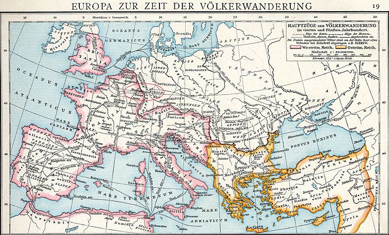
File:Crossing of the Rhine map.jpg
Jump to navigation
Jump to search

Size of this preview: 800 × 484 pixels. Other resolutions: 320 × 193 pixels | 640 × 387 pixels | 1,024 × 619 pixels | 1,280 × 774 pixels | 2,560 × 1,547 pixels | 5,476 × 3,310 pixels.
Original file (5,476 × 3,310 pixels, file size: 7.07 MB, MIME type: image/jpeg)
Categories:
- Maps from Allgemeiner Historischer Handatlas
- Maps of Migration period
- Maps of the Vandals
- Maps of the Western Roman Empire
- Maps of the European Antiquity
- Maps of Europe in the 5th century
- Old maps of the Byzantine Empire
- Old maps of the Roman Empire
- Maps of Poland in the 4th century
- Maps of Europe in the 4th century
- Old maps of the Suebi
- Old maps of Gallaecia

