File:Cheshire1832Map.png
Jump to navigation
Jump to search

Size of this preview: 800 × 565 pixels. Other resolutions: 320 × 226 pixels | 640 × 452 pixels | 1,024 × 723 pixels | 1,280 × 904 pixels | 2,000 × 1,412 pixels.
Original file (2,000 × 1,412 pixels, file size: 309 KB, MIME type: image/png)
Captions
Captions
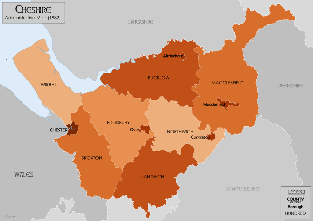
The County of Cheshire in 1832
Summary
[edit]
| Description |
English: Administrative map of Cheshire in 1832 showing Hundreds. Also showing extant Boroughs and County and City of Chester. Hundred boundaries from University of Nottingham English Place Name Society. Source data for parish boundaries - Kain, R.J.P., and Oliver, R.R. (2001) "Historic parishes of England and Wales". Unit names and Borough Boundaries from Vision of Britain website. |
| Date | |
| Source | Own work |
| Author | XrysD |
Licensing
[edit]
I, the copyright holder of this work, hereby publish it under the following license:
This file is licensed under the Creative Commons Attribution-Share Alike 4.0 International license.
- You are free:
- to share – to copy, distribute and transmit the work
- to remix – to adapt the work
- Under the following conditions:
- attribution – You must give appropriate credit, provide a link to the license, and indicate if changes were made. You may do so in any reasonable manner, but not in any way that suggests the licensor endorses you or your use.
- share alike – If you remix, transform, or build upon the material, you must distribute your contributions under the same or compatible license as the original.
File history
Click on a date/time to view the file as it appeared at that time.
| Date/Time | Thumbnail | Dimensions | User | Comment | |
|---|---|---|---|---|---|
| current | 09:47, 8 December 2019 | | 2,000 × 1,412 (309 KB) | XrysD (talk | contribs) | User created page with UploadWizard |
You cannot overwrite this file.
File usage on Commons
There are no pages that use this file.
File usage on other wikis
The following other wikis use this file:
- Usage on en.wikipedia.org
- Usage on pt.wikipedia.org