File:Bad Meinberg nahe Kurpark, Lippischer Ganzmeilenstein I (d).jpg
Jump to navigation
Jump to search
Size of this preview: 450 × 600 pixels. Other resolutions: 180 × 240 pixels | 360 × 480 pixels | 576 × 768 pixels | 768 × 1,024 pixels | 1,536 × 2,048 pixels.
Original file (1,536 × 2,048 pixels, file size: 612 KB, MIME type: image/jpeg)
Captions
Captions
Add a one-line explanation of what this file represents
Summary
[edit].jpg&action=edit§ion=1)
| Description |
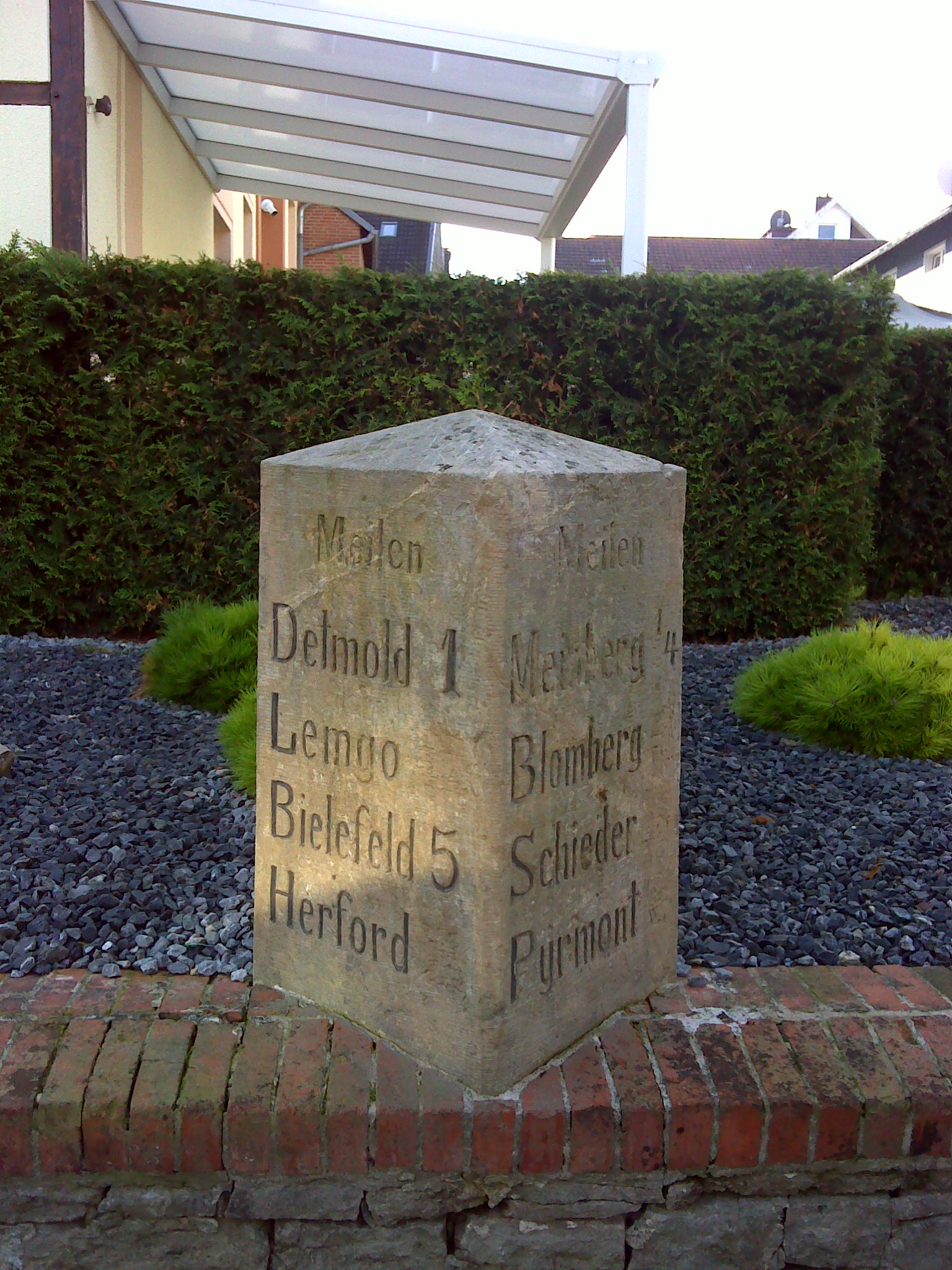
Deutsch: Bad Meinberg, Lippischer Ganzmeilenstein nahe dem Kurpark in der Pyrmonter Straße 2, südliche Straßenseite
|
| Inscription | |
| Date | Taken on 22 September 2024, 10:07 |
| Source | Self-photographed |
| Author | Manfred Schröter, Berga |
| Camera location | | View this and other nearby images on: OpenStreetMap |
|---|
.jpg¶ms=051.895178_N_0008.985695_E_globe:Earth_type:camera_region:DE-NW_alt:222_source:exif_heading:159.00&language=en)

|
This image was uploaded as part of Wiki Loves Monuments 2024.
|
Licensing
[edit].jpg&action=edit§ion=2)
Manfred Schröter, Berga, the copyright holder of this work, hereby publishes it under the following license:
This file is licensed under the Creative Commons Attribution-Share Alike 4.0 International license.
Attribution: Manfred Schröter, Berga
- You are free:
- to share – to copy, distribute and transmit the work
- to remix – to adapt the work
- Under the following conditions:
- attribution – You must give appropriate credit, provide a link to the license, and indicate if changes were made. You may do so in any reasonable manner, but not in any way that suggests the licensor endorses you or your use.
- share alike – If you remix, transform, or build upon the material, you must distribute your contributions under the same or compatible license as the original.
File history
Click on a date/time to view the file as it appeared at that time.
| Date/Time | Thumbnail | Dimensions | User | Comment | |
|---|---|---|---|---|---|
| current | 10:48, 29 September 2024 | | 1,536 × 2,048 (612 KB) | Manfred Schröter, Berga (talk | contribs) | == {{int:filedesc}} == {{Information |Description={{de|1=Bad Meinberg, Lippischer Ganzmeilenstein I nahe dem Kurpark in der ''Pyrmonter Straße 2'', südliche Straßenseite * zum Kilometerstein umfunktioniert, besondere Form * ehemaliger Einmeilenstein der Chaussee de:Detmold—Meinberg * 10 Kilometer von Detmold entfernt * auf einer Mauer vor dem ''[https://gaestehaus-am-kurpark.eu Gästehaus am Kurpark]'' * Stein [https... |
You cannot overwrite this file.
File usage on Commons
There are no pages that use this file.
.jpg&oldid=932516510)