File:Aufnahmeblatt 5254-4 1878.jpg
Jump to navigation
Jump to search

Size of this preview: 788 × 599 pixels. Other resolutions: 316 × 240 pixels | 631 × 480 pixels | 1,010 × 768 pixels | 1,280 × 974 pixels | 2,560 × 1,947 pixels | 9,684 × 7,366 pixels.
Original file (9,684 × 7,366 pixels, file size: 33.08 MB, MIME type: image/jpeg)
Captions
Captions
Add a one-line explanation of what this file represents
| Warning | The original file is very high-resolution. It might not load properly or could cause your browser to freeze when opened at full size. |
|---|
Summary
[edit]
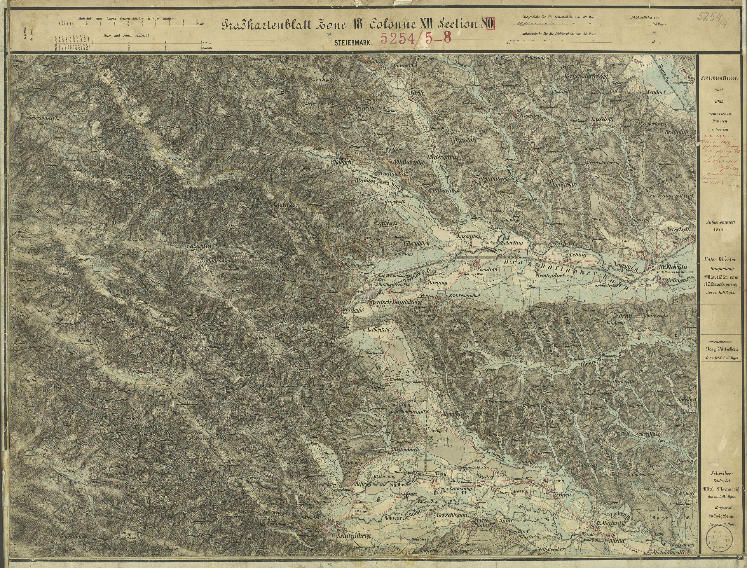
| Description | historische Landkarte: Gradkartenblatt Zone 18 Colonne XII Section SO (später 5254/4). Deutschlandsberg, Schwanberg, Osterwitz. Franzisco-josephinische (3.) Landesaufnahme der österreichisch-ungarischen Monarchie. Aufnahmeblatt 1:25.000. Aufgenommen 1877/78 |
| Date | 1877/78 mit einzelnen Nachträgen |
| Source | Archiv des Militärgeographischen Institutes |
| Author | Österreichisch-Ungarische Monarchie, Militärgeographisches Institut |
| Permission (Reusing this file) |
historisches amtliches Werk aus dem 19. Jahrhundert, freies Werk |
Licensing
[edit]
|
This work is in the public domain in its country of origin and other countries and areas where the copyright term is the author's life plus 70 years or fewer. | |
| This file has been identified as being free of known restrictions under copyright law, including all related and neighboring rights. | |
File history
Click on a date/time to view the file as it appeared at that time.
| Date/Time | Thumbnail | Dimensions | User | Comment | |
|---|---|---|---|---|---|
| current | 19:31, 22 January 2010 | | 9,684 × 7,366 (33.08 MB) | Josef Moser (talk | contribs) | schärfer |
| 20:32, 18 March 2009 |  | 9,731 × 7,409 (28.46 MB) | Josef Moser (talk | contribs) | == Beschreibung == {{Information |Description=historische Landkarte: Gradkartenblatt Zone 18 Colonne XII Section SO (später 5254/4). Deutschlandsberg, Schwanberg, Osterwitz. Franzisco-josephinische (3.) Landesaufnahme der österreichisch-ungarischen Mona |
You cannot overwrite this file.
File usage on Commons
The following page uses this file:
File usage on other wikis
The following other wikis use this file:
- Usage on de.wikipedia.org
- Stainz
- Ruine Spangstein
- Deutschlandsberg
- Bad Schwanberg
- Weststeiermark
- Sankt Martin im Sulmtal
- Laßnitz (Sulm)
- Stainztal
- Bad Gams
- Freiland bei Deutschlandsberg
- Frauental an der Laßnitz
- Groß Sankt Florian
- Limberg bei Wies
- Osterwitz
- Rassach
- Sankt Peter im Sulmtal
- Sulmeck-Greith
- Trahütten
- Hollenegg
- Unterbergla
- Wikipedia:Fragen zur Wikipedia/Archiv/2009/Woche 20
Metadata
Categories:
- Wielfresen
- Maps of Bezirk Deutschlandsberg
- Historische Landkarten zur Koralpe
- Franzisco-Josephinische Landesaufnahme, Aufnahmeblätter
- Historische Landkarten von Kloster (Steiermark)
- Historische Landkarten von Trahütten
- Historische Landkarten von Osterwitz
- Historische Landkarten von Bad Gams
- Historische Landkarten von Freiland bei Deutschlandsberg
- Historische Landkarten zur Stadt Deutschlandsberg
- Ruine Spangstein Ahnherrnschloss, Bad Schwanberg, Styria