Category:Maps of Bezirk Deutschlandsberg
Jump to navigation
Jump to search
Wikimedia category | |||||
| Upload media | |||||
| Instance of | |||||
|---|---|---|---|---|---|
| Category combines topics | |||||
| Deutschlandsberg District | |||||
district in Austria | |||||
| Instance of | |||||
| Location | Styria, Austria | ||||
| Capital | |||||
| Population |
| ||||
| Area |
| ||||
| Elevation above sea level |
| ||||
| official website | |||||
 | |||||
Subcategories
This category has the following 2 subcategories, out of 2 total.
Media in category "Maps of Bezirk Deutschlandsberg"
The following 45 files are in this category, out of 45 total.
-
Bezirk Deutschlandsberg in Österreich.png 692 × 359; 88 KB
-
Karte Aut Stmk DL.png 1,000 × 700; 98 KB
-
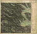
Aufnahmeblatt 5254-1.jpg 9,732 × 7,399; 37.91 MB
-
Aufnahmeblatt 5254-2.jpg 9,668 × 7,380; 34.46 MB
-
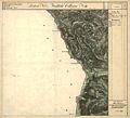
Aufnahmeblatt 5254-3 1878 farbig Glashütten, Weineben, Wolfsberg bearbeitet.jpg 9,659 × 7,398; 28.93 MB
-
Aufnahmeblatt 5254-4 1878.jpg 9,684 × 7,366; 33.08 MB
-
Aufnahmeblatt 5354-1.jpg 9,668 × 7,316; 34.83 MB
-
Aufnahmeblatt 5354-2.jpg 9,738 × 7,396; 38.16 MB
-
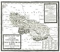
AvI Marburger Kreis mittlere Untersteiermark.jpg 10,344 × 8,947; 16.6 MB
-
Deutschlandsberg Bezirkshandkarte 1910.jpg 6,800 × 9,957; 91.47 MB
-
Ehemaliger Gerichtsbezirk Stainz.svg 413 × 329; 51 KB
-
Franziszeische Landesaufnahme Landsberg Osterwitz.jpg 7,632 × 6,962; 17.93 MB
-
Franziszeische Landesaufnahme Stainz bis Schwarzkogel.jpg 6,387 × 5,796; 16.61 MB
-
Franziszeische Landesaufnahme Weineben Glashütten.JPEG 7,680 × 6,983; 18.48 MB
-
Gemeinden im Bezirk Deutschlandsberg.png 1,800 × 800; 162 KB
-
Geologische Karte Unterdrauburg 1926.jpg 11,909 × 9,764; 65.31 MB
-
Gerichtsbezirk Deutschlandsberg.svg 1,400 × 1,115; 61 KB
-
Grabstaetten-Karte der Steiermark.jpg 3,864 × 4,014; 10.43 MB
-
Hebalm westl Rettenbach.JPEG 7,616 × 6,933; 18.27 MB
-
Hebalmumfeld.jpg 1,745 × 1,493; 1.81 MB
-
Image-Josephinische Landesaufnahme 113 Weinebene und Speikkogel.jpg 8,472 × 5,460; 16.21 MB
-
Josephinische Landesaufnahme 097 Hebalm Rosenkogel.jpg 8,416 × 5,486; 17.48 MB
-
Josephinische Landesaufnahme 098 Preitenegg.jpg 8,464 × 5,498; 17.69 MB
-
Josephinische Landesaufnahme 114 Deutschlandsberg.jpg 8,448 × 5,483; 17.74 MB
-
Josephinische Landesaufnahme Mooskirchen Grazer Feld.jpg 8,448 × 5,471; 9.02 MB
-
Josephinische Landesaufnahme Schwanberg.jpg 8,424 × 5,468; 10.01 MB
-
Josephinische Landesaufnahme Stainz Wildon.jpg 8,392 × 5,449; 11.71 MB
-
Karte A Steiermark DL (2015).svg 1,050 × 730; 21 KB
-
Karte A Stmk 2020 DL+LB (SW).png 1,000 × 700; 164 KB
-
Karte A Stmk 2020 DL+LB+SO (Süd).png 1,000 × 700; 164 KB
-
Karte A Stmk DL+G+GU+HF+LB+SO+VO+WZ.png 1,000 × 700; 165 KB
-
Karte der Steiermark als Brustschild des Doppeladlers.jpg 4,710 × 5,196; 24.33 MB
-
Karte Eisenbahnen Sudweststeiermark.jpg 2,478 × 1,568; 1.05 MB
-
Kloster 1932 Gemeinde.jpg 837 × 678; 409 KB
-
Kreiseinteilung Graz Marburg 1855.jpg 1,245 × 780; 512 KB
-
Kronland Steiermark vor 1850.jpg 8,432 × 9,659; 122.54 MB
-
Landgerichtskarte Marburg.jpg 5,821 × 4,398; 22.11 MB
-
Leere Karte Gemeinden im Bezirk DL.png 645 × 645; 14 KB
-
Marburger Kreis 1760.jpg 7,417 × 5,386; 16.87 MB
-
Municipalities Bezirk Deutschlandsberg.svg 523 × 560; 204 KB
-
Prähistorische Karte Radimsky Umgebung Wies, Sulmtal.jpg 2,898 × 2,031; 2.76 MB
-
Steiermark Perthes 1855.jpg 6,358 × 5,241; 36.55 MB
-
Steiermark Seutter 1728.jpg 6,467 × 5,342; 39.02 MB
-
Steiermark Vischer 1678.jpg 8,916 × 7,835; 55.17 MB
-
Weststeiermark, slawisches Gebiet um 1848.jpg 708 × 612; 318 KB


