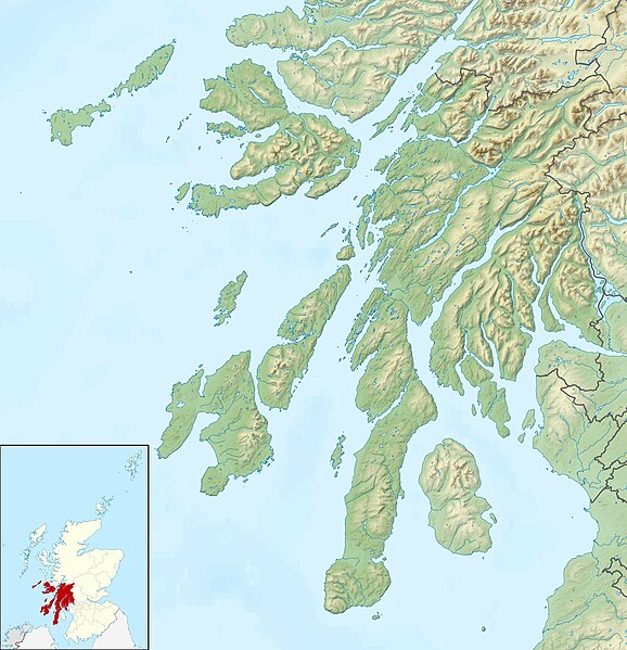
File:Argyll and Bute UK relief location map.jpg
From Wikimedia Commons, the free media repository
Jump to navigation
Jump to search

Size of this preview: 578 × 599 pixels. Other resolutions: 231 × 240 pixels | 463 × 480 pixels | 741 × 768 pixels | 987 × 1,024 pixels | 2,003 × 2,077 pixels.
Original file (2,003 × 2,077 pixels, file size: 655 KB, MIME type: image/jpeg)
File information
Structured data
Captions
Captions
Add a one-line explanation of what this file represents
| DescriptionArgyll and Bute UK relief location map.jpg |
Relief map of Argyll and Bute, UK. Equirectangular map projection on WGS 84 datum, with N/S stretched 175% Geographic limits:
|
| Date | |
| Source |
|
| Author | Nilfanion, created using Ordnance Survey data |
| Permission (Reusing this file) |
This file is licensed under the Creative Commons Attribution-Share Alike 3.0 Unported license. Attribution: Contains Ordnance Survey data © Crown copyright and database right
|
| Other versions | File:Argyll and Bute UK blank map.svg - Blank map |
File history
Click on a date/time to view the file as it appeared at that time.
| Date/Time | Thumbnail | Dimensions | User | Comment | |
|---|---|---|---|---|---|
| current | 12:15, 30 November 2011 |  | 2,003 × 2,077 (655 KB) | Nilfanion (talk | contribs) | {{Information |Description=Relief map of Argyll and Bute, UK. Equirectangular map projection on WGS 84 datum, with N/S stretched 175% Geographic limits: *West: 7.2W *East: 4.5W *North: 56.8N *South: 55.2N |Source=[[w:Ordnance Surve |
You cannot overwrite this file.
File usage on Commons
The following 2 pages use this file:
File usage on other wikis
The following other wikis use this file:
- Usage on ar.wikipedia.org
- Usage on ba.wikipedia.org
- Usage on bg.wikipedia.org
- Usage on ca.wikipedia.org
- Usage on ceb.wikipedia.org
- Usage on de.wikipedia.org
- Loch Lomond
- Staffa
- Isle of Bute
- Loch Awe
- Kilchurn Castle
- Duart Castle
- Holy Loch
- Castle Stalker
- Ben Arthur
- Loch Eck
- Loch Tulla
- Slate Islands (Schottland)
- Davaar
- Jura-Sund
- Straße von Corryvreckan
- Campbeltown Loch
- Kilbrannan-Sund
- Dunstaffnage Castle
- Loch Finlaggan
- Nave Island
- Sgarbh Breac
- Beinn na Caillich (Islay)
- Sgorr nam Faoileann
- Glas Bheinn (Islay)
- Beinn Bheigeir
- Beinn Bhàn (Islay)
- Beinn Uraraidh
- Beinn Sholum
- Lagavulin Bay
- Loch Sholum
- Lochan Sholum
- Loch Uigeadail
- Texa
- Dunyvaig Castle
- Proaig Bay
- Claggain Bay
- Aros Bay
- Loch Leòdamais
- Loch Kinnabus
- Loch Ard Achadh
- Loch nan Gillean (Islay)
View more global usage of this file.