Category:Ordnance Survey Boundary Line maps
Jump to navigation
Jump to search
Media in category "Ordnance Survey Boundary Line maps"
The following 200 files are in this category, out of 4,541 total.
(previous page) (next page)-
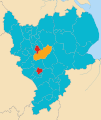
2019 European Parliament election in the United Kingdom area results (East Midlands).svg 1,099 × 1,305; 1.61 MB
-
2019 European Parliament election in the United Kingdom area results (East of England).svg 1,210 × 1,266; 2.21 MB
-
2019 European Parliament election in the United Kingdom area results (Scotland).svg 1,023 × 1,345; 2.87 MB
-
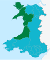
2019 European Parliament election in the United Kingdom area results (Wales).svg 1,047 × 1,252; 325 KB
-
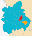
2019 European Parliament election in the United Kingdom area results (West Midlands).svg 1,161 × 1,306; 1.33 MB
-
20200421163557!Christchurch UK locator map.svg 1,425 × 990; 997 KB
-
2021 Cambridgeshire and Peterborough mayoral first and second round results.svg 2,128 × 1,203; 1.14 MB
-
2021 Cambridgeshire and Peterborough mayoral second round results.svg 512 × 576; 673 KB
-
2021 Cornwall Council election.svg 1,088 × 779; 3.42 MB
-
2021 London mayoral election, first round results by ward.svg 512 × 396; 4.41 MB
-
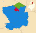
2021 Nuneaton and Bedworth Borough Council election map.png 1,385 × 1,266; 165 KB
-
2021 Three Rivers District Council election.svg 931 × 1,266; 246 KB
-
2021 United Kingdom local elections for mayors.svg 1,536 × 1,673; 8.91 MB
-
2021 United Kingdom local elections in county councils.svg 1,536 × 1,673; 10 MB
-
2021 United Kingdom local elections in district, borough and unitary councils.svg 1,536 × 1,673; 15.62 MB
-
2021 West of England mayoral election, first and second rounds.svg 2,699 × 1,172; 1.17 MB
-
2021 West of England mayoral election, first round.svg 512 × 446; 753 KB
-
2021 West of England mayoral election, second round.svg 512 × 446; 753 KB
-
2022 Ceredigion County Council election map.png 1,200 × 1,004; 128 KB
-
2022 United Kingdom local elections.png 4,800 × 7,800; 2.06 MB
-
2023 UK Local Elections Control.svg 807 × 813; 2.79 MB
-
2023 UK Local Elections.svg 807 × 813; 2.7 MB
-
2024 Wales Blaenau Gwent Community map.svg 512 × 655; 240 KB
-
2024 Wales Caerphilly Community map.svg 512 × 725; 345 KB
-
2024 Wales Cardiff Community map.svg 512 × 546; 319 KB
-
2024 Wales Communities map with principal areas.svg 512 × 612; 1.05 MB
-
2024 Wales Communities map.svg 512 × 612; 1.01 MB
-
2024 Wales Flintshire Community map.svg 512 × 568; 394 KB
-
2024 Wales Monmouthshire Community map.svg 512 × 682; 603 KB
-
2024 Wales Neath Port Talbot Community map.svg 512 × 666; 548 KB
-
2024 Wales Pembrokeshire Community map.svg 512 × 393; 1.19 MB
-
2024 Wales Rhondda Cynon Taf Community map.svg 512 × 737; 369 KB
-
2024 Wales Swansea Community map.svg 512 × 472; 651 KB
-
A38 UK road map.svg 1,108 × 1,345; 2.22 MB
-
Abbey, Barking and Dagenham UK ward map.svg 1,108 × 1,266; 472 KB
-
Aberdeen City Council election 2012.svg 1,425 × 1,189; 830 KB
-
Aberdeen new routes map.svg 1,425 × 1,189; 638 KB
-
Aberdeen UK blank map.svg 1,425 × 1,189; 671 KB
-
Aberdeen UK location map.svg 1,425 × 1,189; 630 KB
-
Aberdeen UK parish map (blank).svg 1,425 × 1,189; 720 KB
-
Aberdeen UK relief location map.jpg 2,003 × 1,670; 213 KB
-
Aberdeen UK ward map (blank).svg 1,425 × 1,189; 823 KB
-
Aberdeen UK ward map 2017 (blank).svg 1,425 × 1,189; 796 KB
-
Aberdeenshire UK blank map.svg 1,425 × 1,253; 1.12 MB
-
Aberdeenshire UK location map.svg 1,425 × 1,253; 1.84 MB
-
Aberdeenshire UK parish map (blank).svg 1,425 × 1,253; 1.68 MB
-
Aberdeenshire UK relief location map.jpg 2,000 × 1,758; 519 KB
-
Aberdeenshire UK ward map (blank).svg 1,425 × 1,253; 1.49 MB
-
Aberdeenshire UK ward map 2017 (blank).svg 1,425 × 1,253; 1.52 MB
-
Adur UK local election 2004 map.svg 1,425 × 1,170; 191 KB
-
Adur UK local election 2010 map.svg 1,425 × 1,170; 190 KB
-
Adur UK local election 2012 map.svg 1,425 × 1,170; 192 KB
-
Adur UK local election 2016 map.svg 1,425 × 1,170; 190 KB
-
Adur UK local election 2018 map.svg 1,425 × 1,170; 190 KB
-
Adur UK local election 2021 map.svg 1,425 × 1,170; 192 KB
-
Adur UK locator map.svg 1,425 × 995; 896 KB
-
Adur UK ward map 2010 (blank).svg 1,425 × 1,170; 190 KB
-
Ainderby Miers with Holtby UK parish locator map.svg 1,425 × 1,037; 4.3 MB
-
Airmyn UK parish locator map.svg 1,425 × 1,107; 1.68 MB
-
Aislaby, Scarborough UK parish locator map.svg 1,425 × 1,037; 4.3 MB
-
Aldbrough, East Riding of Yorkshire UK parish locator map.svg 1,425 × 1,107; 1.68 MB
-
Alibon UK ward map.svg 1,108 × 1,266; 472 KB
-
Allerdale UK local election 1999 map.svg 1,015 × 1,345; 883 KB
-
Allerdale UK local election 2003 map.svg 1,015 × 1,345; 883 KB
-
Allerdale UK local election 2007 map.svg 1,015 × 1,345; 883 KB
-
Allerdale UK local election 2011 map.svg 1,015 × 1,345; 883 KB
-
Allerdale UK locator map.svg 1,140 × 1,345; 1.2 MB
-
Allerdale UK ward map 2010 (blank).svg 1,015 × 1,345; 881 KB
-
Allerthorpe UK parish locator map.svg 1,425 × 1,107; 1.68 MB
-
Altarnun and Stoke Climsland electoral division map 2021.svg 1,306 × 1,266; 1.79 MB
-
Altarnun electoral division map 2013.svg 1,227 × 1,190; 1.6 MB
-
Altham UK ward locator map.svg 1,363 × 1,349; 241 KB
-
Amber Valley UK local election 2000 map.svg 1,170 × 1,305; 501 KB
-
Amber Valley UK local election 2002 map.svg 1,170 × 1,305; 500 KB
-
Amber Valley UK local election 2003 map.svg 1,170 × 1,305; 500 KB
-
Amber Valley UK local election 2004 map.svg 1,170 × 1,305; 500 KB
-
Amber Valley UK local election 2011 map.svg 1,170 × 1,305; 500 KB
-
Amber Valley UK local election 2018 map.svg 1,170 × 1,305; 500 KB
-
Amber Valley UK local election 2021 map.svg 1,170 × 1,305; 501 KB
-
Amber Valley UK locator map.svg 884 × 1,305; 1,000 KB
-
Amber Valley UK ward map 2010 (blank).svg 1,170 × 1,305; 500 KB
-
Anchorsholme ward map 2010.svg 1,079 × 1,305; 197 KB
-
Angus UK blank map.svg 1,425 × 1,400; 834 KB
-
Angus UK location map.svg 1,425 × 1,400; 1.14 MB
-
Angus UK parish map (blank).svg 1,425 × 1,400; 1.07 MB
-
Angus UK relief location map.jpg 1,998 × 1,962; 471 KB
-
Angus UK ward map (blank).svg 1,425 × 1,400; 1.01 MB
-
Angus UK ward map 2017 (blank).svg 1,425 × 1,400; 1 MB
-
Anlaby with Anlaby Common UK parish locator map.svg 1,425 × 1,107; 1.68 MB
-
AONB within Cornwall map.svg 1,224 × 1,187; 1.36 MB
-
Argyll and Bute UK blank map.svg 1,336 × 1,384; 3.15 MB
-
Argyll and Bute UK location map.svg 1,336 × 1,384; 3.65 MB
-
Argyll and Bute UK parish map (blank).svg 1,336 × 1,384; 2.61 MB
-
Argyll and Bute UK relief location map.jpg 2,003 × 2,077; 655 KB
-
Argyll and Bute UK ward map (blank).svg 1,336 × 1,384; 3.26 MB
-
Arnold and Carlton unparished area UK locator map.svg 1,118 × 1,306; 207 KB
-
Arnside and Silverdale AONB locator map.svg 1,648 × 2,000; 1.04 MB
-
Arun District Council election 2011 map.svg 1,425 × 925; 384 KB
-
Arun UK local election 2003 map.svg 1,425 × 925; 384 KB
-
Arun UK local election 2007 map.svg 1,425 × 925; 384 KB
-
Arun UK locator map.svg 1,425 × 995; 896 KB
-
Arun UK ward map 2010 (blank).svg 1,425 × 925; 383 KB
-
Arun UK ward map 2015 (blank).svg 1,425 × 925; 451 KB
-
Ashfield UK local election 2003 map.svg 1,011 × 1,305; 299 KB
-
Ashfield UK local election 2007 map.svg 1,011 × 1,305; 299 KB
-
Ashfield UK local election 2011 map.svg 1,011 × 1,305; 298 KB
-
Ashfield UK locator map.svg 1,030 × 1,305; 906 KB
-
Ashfield UK ward map 2010 (blank).svg 1,011 × 1,305; 297 KB
-
Ashfield UK ward map 2015 (blank).svg 1,011 × 1,305; 383 KB
-
Ashford Borough Council election 2011 map.svg 1,199 × 1,266; 641 KB
-
Ashford UK local election 2003 map.svg 1,199 × 1,266; 641 KB
-
Ashford UK local election 2007 map.svg 1,199 × 1,266; 640 KB
-
Ashford UK locator map.svg 1,425 × 1,000; 1.18 MB
-
Ashford UK parish map 2011 (blank).svg 1,199 × 1,266; 669 KB
-
Ashford UK ward map 2010 (blank).svg 1,199 × 1,266; 640 KB
-
Ashford unparished area UK locator map.svg 1,199 × 1,266; 656 KB
-
Ashley Bristol UK ward map.svg 1,138 × 1,266; 709 KB
-
Aslackby and Laughton Lincolnshire UK parish map.svg 1,086 × 1,305; 3.7 MB
-
Asselby UK parish locator map.svg 1,425 × 1,107; 1.68 MB
-
Atwick UK parish locator map.svg 1,425 × 1,107; 1.68 MB
-
Aunsby and Dembleby UK parish locator map.svg 1,086 × 1,305; 3.7 MB
-
Avenue Kingston upon Hull UK ward map 2010.svg 1,319 × 1,305; 179 KB
-
Avenue Kingston upon Hull UK ward map 2018.svg 1,319 × 1,305; 195 KB
-
Avon UK constituency map (blank).svg 1,425 × 1,241; 1.13 MB
-
Avon UK district map (blank).svg 1,425 × 1,241; 1,003 KB
-
Avon UK locator map 1974.svg 1,108 × 1,345; 482 KB
-
Avon UK parish map (blank).svg 1,425 × 1,241; 1.91 MB
-
Avon UK ward map (blank).svg 1,425 × 1,241; 1.85 MB
-
Avonmouth Bristol UK ward map.svg 1,138 × 1,266; 709 KB
-
Aylesbury Vale UK local election 2003 map.svg 1,187 × 1,266; 890 KB
-
Aylesbury Vale UK local election 2007 map.svg 1,187 × 1,266; 889 KB
-
Aylesbury Vale UK local election 2011 map.svg 1,187 × 1,266; 890 KB
-
Aylesbury Vale UK local election 2015 map.svg 1,187 × 1,266; 926 KB
-
Aylesbury Vale UK locator map.svg 1,070 × 1,266; 921 KB
-
Aylesbury Vale UK ward map 2010 (blank).svg 1,187 × 1,266; 889 KB
-
Aylesbury Vale UK ward map 2015 (blank).svg 1,187 × 1,266; 923 KB
-
Babergh District Council election 2011 map.svg 1,425 × 873; 768 KB
-
Babergh UK local election 2003 map.svg 1,425 × 873; 769 KB
-
Babergh UK local election 2007 map.svg 1,425 × 873; 768 KB
-
Babergh UK locator map.svg 1,425 × 927; 1,024 KB
-
Babergh UK ward map 2010 (blank).svg 1,425 × 873; 767 KB
-
Badenoch and Strathspey UK blank map.svg 1,385 × 1,424; 1.08 MB
-
Badenoch and Strathspey UK location map.svg 1,385 × 1,424; 1.49 MB
-
Badenoch and Strathspey UK relief location map.jpg 2,002 × 2,059; 703 KB
-
Bainton, East Riding of Yorkshire UK parish locator map.svg 1,425 × 1,107; 1.68 MB
-
Bamber Bridge unparished area UK locator map.svg 1,425 × 1,038; 355 KB
-
Barking and Dagenham London UK blank ward map.svg 1,108 × 1,266; 471 KB
-
Barking and Dagenham London UK labelled ward map 2002.svg 1,037 × 1,195; 83 KB
-
Barking and Dagenham London UK location map.svg 1,108 × 1,266; 3.16 MB
-
Barking and Dagenham UK local election 2002 map.svg 1,108 × 1,266; 472 KB
-
Barking and Dagenham UK local election 2006 map.svg 1,108 × 1,266; 472 KB
-
Barking and Dagenham UK local election 2010 map.svg 1,108 × 1,266; 471 KB
-
Barking and Dagenham UK locator map.svg 1,425 × 1,140; 1.06 MB
-
Barmby Moor UK parish locator map.svg 1,425 × 1,107; 1.68 MB
-
Barmby on the Marsh UK parish locator map.svg 1,425 × 1,107; 1.68 MB
-
Barmston and Fraisthorpe UK parish locator map.svg 1,425 × 1,107; 1.68 MB
-
Barnby, North Yorkshire UK parish locator map.svg 1,425 × 1,037; 4.3 MB
-
Barnet London UK blank ward map 2002 to 2022.svg 1,131 × 1,266; 651 KB
-
Barnet London UK blank ward map 2022.svg 1,131 × 1,266; 643 KB
-
Barnet London UK labelled ward map 2002.svg 1,025 × 1,160; 158 KB
-
Barnet London UK location map.svg 1,131 × 1,266; 1.78 MB
-
Barnet UK local election 1978 map.svg 1,131 × 1,266; 665 KB
-
Barnet UK local election 1982 map.svg 1,131 × 1,266; 665 KB
-
Barnet UK local election 1986 map.svg 1,131 × 1,266; 665 KB
-
Barnet UK local election 1990 map.svg 1,131 × 1,266; 665 KB
-
Barnet UK local election 1994 map.svg 1,131 × 1,266; 666 KB
-
Barnet UK local election 1998 map.svg 1,131 × 1,266; 669 KB
-
Barnet UK local election 2002 map.svg 1,131 × 1,266; 652 KB
-
Barnet UK local election 2006 map.svg 1,131 × 1,266; 652 KB
-
Barnet UK local election 2010 map.svg 1,131 × 1,266; 652 KB
-
Barnet UK local election 2014 map.svg 1,131 × 1,266; 655 KB
-
Barnet UK local election 2018 map.svg 1,131 × 1,266; 652 KB
-
Barnet UK local election 2022 map.svg 1,131 × 1,266; 644 KB
-
Barnet UK locator map.svg 1,425 × 1,140; 1.06 MB
-
Barnfield UK ward locator map.svg 1,363 × 1,349; 241 KB
-
Barnsley UK local election 2004 map.svg 1,425 × 981; 421 KB
-
Barnsley UK local election 2008 map.svg 1,425 × 981; 419 KB
-
Barnsley UK local election 2010 map.svg 1,425 × 981; 419 KB
-
Barnsley UK local election 2011 map.svg 1,425 × 981; 419 KB
-
Barnsley UK local election 2018 map.svg 1,425 × 981; 420 KB
-
Barnsley UK local election 2021 map.svg 1,425 × 981; 421 KB
-
Barnsley UK locator map.svg 1,425 × 974; 691 KB
-
Barnsley UK ward map 2010 (blank).svg 1,425 × 981; 419 KB
-
Barnsley unparished area UK locator map.svg 1,425 × 981; 456 KB
-
Barrow-in-Furness UK local election 2008 map.svg 833 × 1,345; 367 KB
-
Barrow-in-Furness UK local election 2010 map.svg 833 × 1,345; 366 KB
-
Barrow-in-Furness UK local election 2011 map.svg 833 × 1,345; 366 KB
-
Barrow-in-Furness UK locator map.svg 1,140 × 1,345; 1.2 MB
-
Barrow-in-Furness UK ward map 2010 (blank).svg 833 × 1,345; 365 KB
-
Barrow-in-Furness unparished area UK locator map.svg 833 × 1,345; 315 KB
-
Barrowford UK ward locator map.svg 1,425 × 1,214; 313 KB
-
Barton and Sandhills ward map, Oxford 2010.svg 990 × 1,266; 257 KB
