File:Ant-pen-map-Graham-Coast.PNG
Jump to navigation
Jump to search
Size of this preview: 436 × 599 pixels. Other resolutions: 175 × 240 pixels | 349 × 480 pixels | 720 × 989 pixels.
Original file (720 × 989 pixels, file size: 256 KB, MIME type: image/png)
Captions
Captions
Add a one-line explanation of what this file represents
Summary
[edit]
| Description |
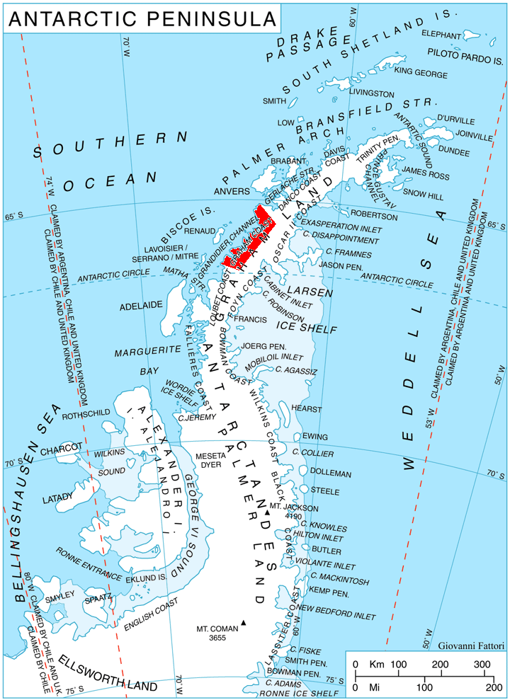
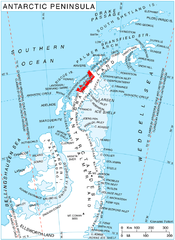
English: Location of Graham Coast, Antarctica. |
| Date | |
| Source | Own work, using map File:Ant-pen map.png by Giovanni Fattori. |
| Author | Edited by Apcbg |
Licensing
[edit]
I, the copyright holder of this work, hereby publish it under the following licenses:

|
Permission is granted to copy, distribute and/or modify this document under the terms of the GNU Free Documentation License, Version 1.2 or any later version published by the Free Software Foundation; with no Invariant Sections, no Front-Cover Texts, and no Back-Cover Texts. A copy of the license is included in the section entitled GNU Free Documentation License. |
This file is licensed under the Creative Commons Attribution 3.0 Unported license.
- You are free:
- to share – to copy, distribute and transmit the work
- to remix – to adapt the work
- Under the following conditions:
- attribution – You must give appropriate credit, provide a link to the license, and indicate if changes were made. You may do so in any reasonable manner, but not in any way that suggests the licensor endorses you or your use.
You may select the license of your choice.
File history
Click on a date/time to view the file as it appeared at that time.
| Date/Time | Thumbnail | Dimensions | User | Comment | |
|---|---|---|---|---|---|
| current | 16:27, 8 October 2010 | | 720 × 989 (256 KB) | Apcbg (talk | contribs) | {{Information |Description={{en|1=Location of Graham Coast, Antarctica.}} |Source={{own}}, using map File:Ant-pen map.png by Giovanni Fattori. |Author=Edited by Apcbg |Date=2010-10-08 |Permission= |other_versions= }} [[Category:Maps of |
You cannot overwrite this file.
File usage on Commons
There are no pages that use this file.
File usage on other wikis
The following other wikis use this file:
- Usage on bg.wikipedia.org
- Usage on de.wikipedia.org
- Usage on en.wikipedia.org
- Lawrie Glacier
- Barilari Bay
- Bigo Bay
- Birley Glacier
- Graham Coast
- Cadman Glacier
- Caulfeild Glacier
- Weir Glacier
- Funk Glacier
- Frölich Peak
- Hugi Glacier
- Sphinx Island
- Holtedahl Bay
- Luke Glacier
- Rickmers Glacier
- Larrouy Island
- Leroux Bay
- Lever Glacier
- Chorul Peninsula
- Plas Point
- Nevsha Cove
- Kenderova Buttress
- Chargan Ridge
- Alabak Island
- Mount Radotina
- Strelcha Spur
- Mitino Buttress
- Vardun Point
- Cherkovna Point
- Prestoy Point
- Dodunekov Bluff
- Nauchene Nunatak
- Ezerets Knoll
- Usage on es.wikipedia.org
- Usage on eu.wikipedia.org
- Usage on it.wikipedia.org
- Usage on nn.wikipedia.org
- Usage on no.wikipedia.org
- Usage on pl.wikipedia.org
- Usage on pt.wikipedia.org
- Usage on uk.wikipedia.org
- Usage on www.wikidata.org
- Usage on zh.wikipedia.org
View more global usage of this file.