File:Altamira Para vs Maranhao.png
From Wikimedia Commons, the free media repository
Jump to navigation
Jump to search

Size of this preview: 681 × 600 pixels. Other resolutions: 272 × 240 pixels | 545 × 480 pixels | 872 × 768 pixels | 1,162 × 1,024 pixels | 1,344 × 1,184 pixels.
Original file (1,344 × 1,184 pixels, file size: 29 KB, MIME type: image/png)
File information
Structured data
Captions
Captions
Add a one-line explanation of what this file represents
| DescriptionAltamira Para vs Maranhao.png |
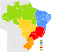
English: Locator map of Brazil's two "Altamira" localities.
Português: Localização das dois "Altamiras" do Brasil
Deutsch: Lage der beiden brasilianischen Orte namens "Altamira" |
||||||||
| Date | |||||||||
| Source | Image:Brazil State Map.svg | ||||||||
| Author | Ulamm 19:47, 20 December 2007 (UTC) | ||||||||
| Permission (Reusing this file) |
I, Felipe Menegaz, the copyright holder of this work, hereby publishes it under the following licenses:
This file is licensed under the Creative Commons Attribution-Share Alike 2.5 Generic, 2.0 Generic and 1.0 Generic license. Attribution: I, Felipe Menegaz
You may select the license of your choice. |
||||||||
| Other versions |
|
Maps of Brazil]] [[Category:Locator maps of municipalities of Brazil by state
File history
Click on a date/time to view the file as it appeared at that time.
| Date/Time | Thumbnail | Dimensions | User | Comment | |
|---|---|---|---|---|---|
| current | 20:13, 20 December 2007 |  | 1,344 × 1,184 (29 KB) | Ulamm (talk | contribs) | |
| 19:47, 20 December 2007 |  | 1,344 × 1,184 (30 KB) | Ulamm (talk | contribs) | {{Information |Description= {{en|Brazil Labelled Map.}} {{pt|Mapa Clicável do Brasil.}} {{Inkscape}} |Source=Image:Brazil State Map.svg |Date= June 11, 2007 |Author= ~~~~ |Permission= {{User:João Felipe C.S/License}} |other_versions= <gallery> Imag |
You cannot overwrite this file.
File usage on Commons
The following page uses this file:


