File:AkitaMapCurrent.png
Jump to navigation
Jump to search

Size of this preview: 653 × 600 pixels. Other resolutions: 261 × 240 pixels | 523 × 480 pixels | 981 × 901 pixels.
Original file (981 × 901 pixels, file size: 34 KB, MIME type: image/png)
Captions
Captions
Add a one-line explanation of what this file represents
Summary
[edit]
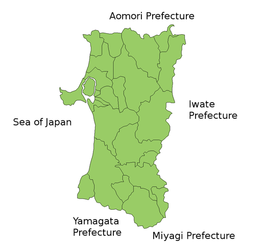
Map of Akita Prefecture, Japan.
Thanks to Aoki Shigenobu and [1]. Colors from Image:TokyoMapCurrent.png by User:Fg2.
Licensing
[edit]

|
Shigenobu AOKI, the copyright holder of this work, allows anyone to use it for any purpose including unrestricted redistribution, commercial use, and modification. |
File history
Click on a date/time to view the file as it appeared at that time.
| Date/Time | Thumbnail | Dimensions | User | Comment | |
|---|---|---|---|---|---|
| current | 05:31, 19 July 2006 | | 981 × 901 (34 KB) | Akanemoto~commonswiki (talk | contribs) | Reverted to earlier revision |
| 11:59, 18 July 2006 |  | 600 × 800 (12 KB) | Akanemoto~commonswiki (talk | contribs) | remove texts | |
| 10:33, 18 July 2006 |  | 981 × 901 (34 KB) | Akanemoto~commonswiki (talk | contribs) | Map of Akita Prefecture, Japan. Thanks to Aoki Shigenobu and [http://aoki2.si.gunma-u.ac.jp/map/map.html]. Colors from Image:TokyoMapCurrent.png by User:Fg2. Category:Maps of Akita prefecture Category:Maps in English |
You cannot overwrite this file.
File usage on Commons
The following page uses this file:
File usage on other wikis
The following other wikis use this file:
- Usage on az.wikipedia.org
- Usage on ckb.wikipedia.org
- Usage on cs.wikipedia.org
- Usage on gan.wikipedia.org
- Usage on lt.wikipedia.org
- Usage on no.wikipedia.org
- Usage on ru.wikipedia.org
- Usage on sv.wikipedia.org