File:AMH-7682-NA Map of the bay of Axim.jpg

Original file (2,400 × 1,778 pixels, file size: 394 KB, MIME type: image/jpeg)
Captions
Captions
Summary
[edit]Nederlands: Kaart van de baai van Axim
English: Map of the bay of Axim( |
||||||||||||||||||||||||
|---|---|---|---|---|---|---|---|---|---|---|---|---|---|---|---|---|---|---|---|---|---|---|---|---|
| Author |
Nederlands: Anoniem / Anonymous (landmeter / kaartenmaker)
English: Anoniem / Anonymous (land surveyor / mapmaker) |
|||||||||||||||||||||||
| Title |
Nederlands: Kaart van de baai van Axim
English: Map of the bay of Axim |
|||||||||||||||||||||||
| Description |
Nederlands: Kaart van de baai van Axim.
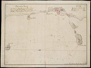
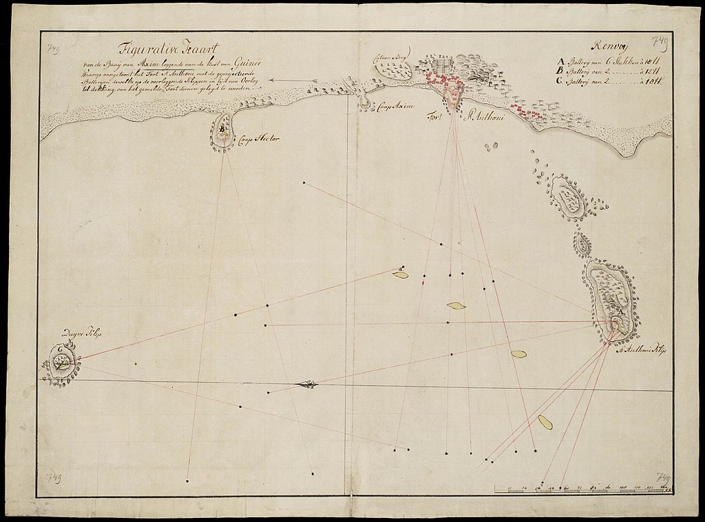
Figurative Kaart van de Baaij van Axim leggende aan de kust van Guinée / Waarop aangetoont het Fort St. Anthoni met de geprojecteerde / Batterijen dewelke op de voorleggende Klippen in tijd van Oorlog / tot dekking van het gemelde Fort dienen gelegd te worden. Titel catalogus Leupe (NA): Figuratieve kaart van de Baay van Axim, leggende aan de Kust van Guinea, waarop aangetoont het Fort St. Anthoni met de geprojecteerde Batteryen dewelke op de voorleggende klippen in tyd van oorlog, tot dekking vna het gemelde fort dienen gelegd te worden. Notities verso: No. 11 Baij van Axim. Register 8, Deel 1, Folio 32, Portefeuille .. [geschreven op een blauw etiket] / 446 [met vette cijfers gestempeld op een etiketje]. Legenda: Renvoij: A. Batterij van 6 stukken à 18 [?] / B. Batterij van 2 ....... à 12 [?] / C. Batterij van 2 ....... à 18 [?]. Op verschillende plekken op de kaart: 749 [in potlood]. Aangegeven zijn de afstanden waarmee vanuit de verschillende fortificaties geschoten kan worden.English: Map of the bay of Axim. -Figurative Kaart van de Baaij van Axim leggende aan de kust van Guin??e / Waarop aangetoont het Fort St. Anthoni met de geprojecteerde / Batterijen dewelke op de voorleggende Klippen in tijd van Oorlog / tot dekking van het gemelde Fort dienen gelegd te worden.
Title in the Leupe catalogue (NA): Figuratieve kaart van de Baay van Axim, leggende aan de Kust van Guinea, waarop aangetoont het Fort St. Anthoni met de geprojecteerde Batteryen dewelke op de voorleggende klippen in tyd van oorlog, tot dekking vna het gemelde fort dienen gelegd te worden. Notes on reverse: No. 11 Baij van Axim. Register 8, Deel 1, Folio 32, Portefeuille .. [inscribed on a blue label] / 446 [stamped in bold figures on a small label]. Key: Renvoij: A. Batterij van 6 stukken ?? 18 [?] / B. Batterij van 2 ....... ?? 12 [?] / C. Batterij van 2 ....... ?? 18 [?] Inscribed in various places on the chart: 749 [in pencil]. Indicated are the distances over which the artillery can shoot from the various fortifications. |
|||||||||||||||||||||||
| Date | between 1700 and 1800 | |||||||||||||||||||||||
| Medium |
Nederlands: ingekleurde tekening op papier
English: coloured drawing on paper |
|||||||||||||||||||||||
| Dimensions | height: 64 cm (25.1 in); width: 47.5 cm (18.7 in) | |||||||||||||||||||||||
| Collection |
|
|||||||||||||||||||||||
| Accession number |
NL-HaNA_4.VEL_749 (old number: VEL0749) |
|||||||||||||||||||||||
| Inscriptions |
Figurative Kaart van de Baaij van Axim leggende aan de kust van Guinée
|
|||||||||||||||||||||||
| Notes |
English: Subjects: chart / map / plan, key, fortification, building
Nederlands: Onderwerpen: plattegrond / kaart, legenda, vesting, gebouw
English: Post: this image is related to a WIC trading post called Axim |
|||||||||||||||||||||||
| Source/Photographer |
|
|||||||||||||||||||||||
| Permission (Reusing this file) |
|
|||||||||||||||||||||||

| Object location | | View this and other nearby images on: OpenStreetMap |
|---|
File history
Click on a date/time to view the file as it appeared at that time.
| Date/Time | Thumbnail | Dimensions | User | Comment | |
|---|---|---|---|---|---|
| current | 10:07, 11 June 2014 | | 2,400 × 1,778 (394 KB) | HuskyBot (talk | contribs) | == {{int:filedesc}} == {{Artwork |title = {{nl|1=Kaart van de baai van Axim}} {{en|1=Map of the bay of Axim}} |description = {{nl|1=Kaart van de baai van Axim. ''Figurative Kaart van de Baaij van Axim leggende... |
You cannot overwrite this file.
File usage on Commons
The following page uses this file: