File:74079-Les Clefs-Géologie-Leg.pdf
Jump to navigation
Jump to search

Size of this JPG preview of this PDF file: 800 × 565 pixels. Other resolutions: 320 × 226 pixels | 640 × 452 pixels | 1,024 × 723 pixels | 1,280 × 904 pixels | 1,754 × 1,239 pixels.

Original file (1,754 × 1,239 pixels, file size: 1.49 MB, MIME type: application/pdf, 2 pages)
Captions
Captions
Add a one-line explanation of what this file represents
Summary
[edit]| Description |
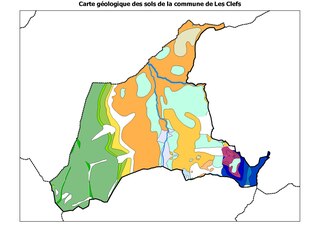
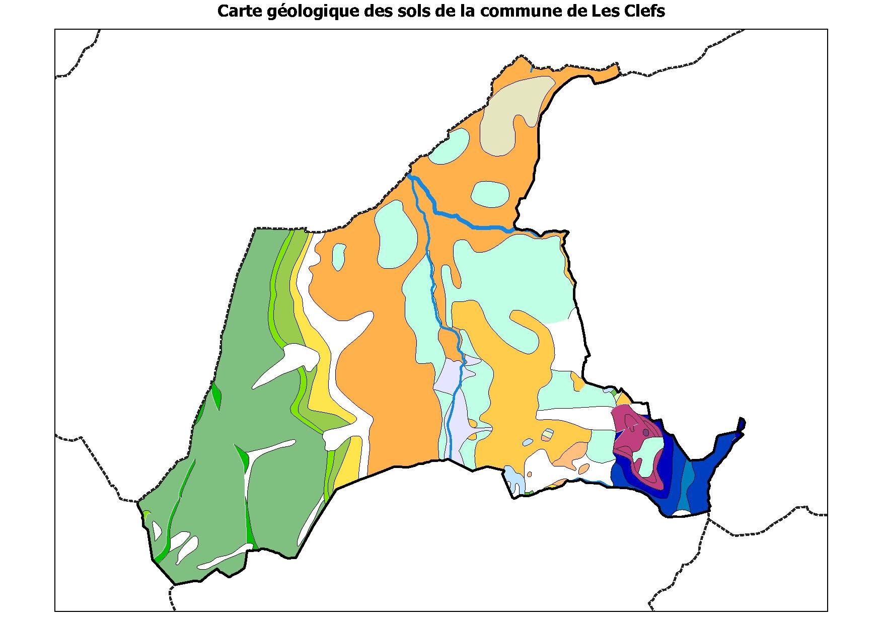
Français : Légende de la carte géologique de la commune de Les Clefs dans le département de la Haute-Savoie (France) |
| Date | |
| Source |
Own work • Sources des données : – Découpage administratif communal et départemental : Export simple de janvier 2020 - vérifié et simplifié à 5 m sur le site du portail de données libres du gouvernement français, élaboré avec le concours des contributeurs à OpenStreetMap – Infrastructures (routes, fer, bâtiments) : : Export openstreetmap de Geofabrik- version du 29 juin 2019 – Cours d'eau : Cours d'eau - Métropole 2014 - BD Carthage – Géologie : cartes géologiques départementales à 1/50 000 (Bd Charm-50). • Assemblé et enrichi dans fr:QGis. |
| Author | Poudou99 |
Licensing
[edit]I, the copyright holder of this work, hereby publish it under the following license:
This file is licensed under the Creative Commons Attribution-Share Alike 4.0 International license.
- You are free:
- to share – to copy, distribute and transmit the work
- to remix – to adapt the work
- Under the following conditions:
- attribution – You must give appropriate credit, provide a link to the license, and indicate if changes were made. You may do so in any reasonable manner, but not in any way that suggests the licensor endorses you or your use.
- share alike – If you remix, transform, or build upon the material, you must distribute your contributions under the same or compatible license as the original.
File history
Click on a date/time to view the file as it appeared at that time.
| Date/Time | Thumbnail | Dimensions | User | Comment | |
|---|---|---|---|---|---|
| current | 03:02, 13 February 2021 |  | 1,754 × 1,239, 2 pages (1.49 MB) | Poudou99 (talk | contribs) | pattypan 20.04 |
You cannot overwrite this file.
File usage on Commons
There are no pages that use this file.
Metadata
Categories:
- Geological maps of Les Clefs
- Gres verts helvetiques - maps
- Facies Urgonien - maps
- Gault Formation in France - maps
- Talus in Haute-Savoie - maps
- Grès de Taveyanne - maps
- Grès à roseaux - maps
- Lithographic limestones Formation - maps
- Calcaires lithographiques clairs à foraminifères planctoniques
- Couches des Diablerets - maps
- Calcaires dolomitiques et cargneules (Nappe supérieure-Klippe de Sulens)
- Cargneules (Klippe des Annes)
- Alternating units of dolomite (rock), dolomitic limestone and argilite (Triassic; Klippe des Annes)
- Alternating limestone, argilite and dolomitic limestone (Triassic; Nappe supérieure-Klippe de Sulens)
- Dolomies, calcaires dolomitiques et argilites rouges (Triassic; Klippe des Annes)
- Calcaires biodétritiques à chailles, calcaires argileux, calcaires crinoïdiens à chailles (Hettangian-Sinemurian, Jurassic; Klippe des Annes)
- Calcaires spathiques, marnes et calcaires argileux (Sinemurian, Jurassic; Klippe des Annes)
- Calcaires massifs et calcaires argileux noirs (Pliensbachian, Jurassic; Klippe des Annes)
- Calcaires siliceux à spicules (Zone externe, terrains subalpins) - maps
- Marnes silto-gréseuses (Zone externe, terrains subalpins) - maps