Commons:Wiki Loves Monuments in Switzerland/Valais/S

From Wikimedia Commons, the free media repository
Jump to navigation Jump to search

Saas-Balen

Location Upload Photo Object Cat. Coordinates KGS-Nr
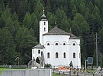
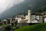
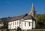
Saas-Balen Upload a file Rundkirche Mariä Himmelfahrt
Rundkirche Mariä Himmelfahrt A 46°09′13″N 7°55′36″E / 46.1535°N 7.92676°E / 46.1535; 7.92676 6967
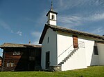
Saas-Balen Upload a file Kapelle St. Antonius
Kapelle St. Antonius B 46°08′18″N 7°55′52″E / 46.13839°N 7.93111°E / 46.13839; 7.93111 6969
Saas-Balen Upload a file
Bidermatten ISOS 46°08′12″N 7°55′46″E / 46.1368°N 7.92952°E / 46.1368; 7.92952

Saas-Fee

Location Upload Photo Object Cat. Coordinates KGS-Nr
Saas-Fee Upload a file
Kapelle zur Hohen Stiege, mit Kapellenweg B 46°06′37″N 7°56′02″E / 46.11026°N 7.93399°E / 46.11026; 7.93399 6970

Saas-Grund

Location Upload Photo Object Cat. Coordinates KGS-Nr
Saas-Grund Upload a file
Gebäude mit wassergetriebenen Anlagen B 46°07′55″N 7°56′15″E / 46.13192°N 7.93742°E / 46.13192; 7.93742 6971
Saas-Grund Upload a file
Kapelle Hl. Dreifaltigkeit B 46°07′52″N 7°56′10″E / 46.13117°N 7.93607°E / 46.13117; 7.93607 6972
Saas-Grund Upload a file
Kirche St. Bartholomäus (Ausstattung) B 46°07′26″N 7°56′12″E / 46.12385°N 7.93674°E / 46.12385; 7.93674 6973
Saas-Grund Upload a file Rippenhelm des ehemaligen Kirchturms
Rippenhelm des ehemaligen Kirchturms B 46°07′24″N 7°56′15″E / 46.1232°N 7.93747°E / 46.1232; 7.93747 6974

Saillon

Location Upload Photo Object Cat. Coordinates KGS-Nr
Saillon Upload a file Fortifications (Enceinte avec 5 tourelles, Porte du Scex, Porte de Fully, Porte de Leytron)
Fortifications (Enceinte avec 5 tourelles, Porte du Scex, Porte de Fully, Porte de Leytron) A 46°10′17″N 7°11′05″E / 46.17126°N 7.18479°E / 46.17126; 7.18479 10448
Saillon Upload a file Tour Bayard
Tour Bayard A 46°10′14″N 7°10′57″E / 46.1705°N 7.18263°E / 46.1705; 7.18263 6975
Saillon Upload a file [[File:|150x150px|Maison d'habitation / Wohnhaus]]
Maison d'habitation / Wohnhaus B 46°10′44″N 7°11′38″E / 46.17891°N 7.19388°E / 46.17891; 7.19388 10578
Saillon Upload a file Saillon
Saillon ISOS 46°10′00″N 7°11′00″E / 46.166666666°N 7.183333333°E / 46.166666666; 7.183333333

Saint-Gingolph

Location Upload Photo Object Cat. Coordinates KGS-Nr
Saint-Gingolph Upload a file Musée des Traditions et des Barques du Léman
Musée des Traditions et des Barques du Léman B 46°23′34″N 6°48′16″E / 46.39272°N 6.80431°E / 46.39272; 6.80431 10703
Saint-Gingolph Upload a file
Ancien Hôtel de la Croix-Blanche (gendarmerie) B 46°23′33″N 6°48′16″E / 46.39252°N 6.80446°E / 46.39252; 6.80446 7096
Saint-Gingolph Upload a file chapelle de la Ste-Famille
chapelle de la Ste-Famille B 46°23′33″N 6°48′14″E / 46.39262°N 6.80402°E / 46.39262; 6.80402 7097
Saint-Gingolph Upload a file
Château (maison de commune) B 46°23′34″N 6°48′15″E / 46.39275°N 6.8043°E / 46.39275; 6.8043 7098
Saint-Gingolph Upload a file
Dépendance du château, soit maison de Rivaz-de-Nucé B 46°23′34″N 6°48′16″E / 46.39266°N 6.80443°E / 46.39266; 6.80443 7099
Saint-Gingolph Upload a file Saint-Gingolph
Saint-Gingolph ISOS 46°24′N 6°48′E / 46.4°N 6.8°E / 46.4; 6.8

Saint-Léonard

Location Upload Photo Object Cat. Coordinates KGS-Nr
Saint-Léonard Upload a file
Crête des Barmes, gravures rupestres néolithiques A 46°15′53″N 7°25′25″E / 46.26472°N 7.42372°E / 46.26472; 7.42372 9702
Saint-Léonard Upload a file Ancienne cure
Ancienne cure B 46°15′23″N 7°25′05″E / 46.25626°N 7.41801°E / 46.25626; 7.41801 7103
Saint-Léonard Upload a file
Gravures rupestres en dessus du lac souterrain B 46°15′21″N 7°25′46″E / 46.25573°N 7.42956°E / 46.25573; 7.42956 7104
Saint-Léonard Upload a file Maison Zen-Ruffinen
Maison Zen-Ruffinen B 46°15′21″N 7°25′05″E / 46.25591°N 7.41814°E / 46.25591; 7.41814 7105

Saint-Martin

Location Upload Photo Object Cat. Coordinates KGS-Nr
Saint-Martin Upload a file église St-Martin
église St-Martin B 46°10′21″N 7°26′38″E / 46.17237°N 7.44393°E / 46.17237; 7.44393 7109
Saint-Martin Upload a file Praz Jean, pont (17e s.)
Praz Jean, pont (17e s.) B 46°09′00″N 7°27′12″E / 46.14994°N 7.45327°E / 46.14994; 7.45327 7110

Saint-Maurice

Location Upload Photo Object Cat. Coordinates KGS-Nr
Saint-Maurice Upload a file
Archives historiques de l'Abbaye de Saint-Maurice A 46°13′10″N 7°00′12″E / 46.21941°N 7.0033°E / 46.21941; 7.0033 8825
Saint-Maurice Upload a file
Bibliothèque de l'Abbaye de Saint-Maurice B 46°13′09″N 7°00′12″E / 46.21912°N 7.00346°E / 46.21912; 7.00346 9374
Saint-Maurice Upload a file Bibliothèque du couvent des capucins de St-Maurice
Bibliothèque du couvent des capucins de St-Maurice B 46°13′11″N 7°00′20″E / 46.2196°N 7.00553°E / 46.2196; 7.00553 9375
Saint-Maurice Upload a file
Abbaye de St-Maurice d'Agaune A 46°13′09″N 7°00′12″E / 46.21929°N 7.00327°E / 46.21929; 7.00327 9703
Saint-Maurice Upload a file Maison de la Pierre
Maison de la Pierre A 46°13′10″N 7°00′17″E / 46.21942°N 7.00477°E / 46.21942; 7.00477 7118
Saint-Maurice Upload a file Musée des fortifications (partie de l'ancien musée militaire cantonal)
Musée des fortifications (partie de l'ancien musée militaire cantonal) A 46°13′24″N 7°00′10″E / 46.22337°N 7.00286°E / 46.22337; 7.00286 8710
Saint-Maurice Upload a file
Trésor et fouilles archéologiques de l'Abbaye de Saint-Maurice A 46°13′09″N 7°00′12″E / 46.21928°N 7.00341°E / 46.21928; 7.00341 8669
Saint-Maurice Upload a file château de Saint-Maurice
château de Saint-Maurice A 46°13′24″N 7°00′11″E / 46.223261°N 7.003109°E / 46.223261; 7.003109 7117
Saint-Maurice Upload a file
Ancien octroi de douane B 46°13′24″N 7°00′10″E / 46.22322°N 7.00289°E / 46.22322; 7.00289 10364
Saint-Maurice Upload a file Couvent et église des Capucins
Couvent et église des Capucins B 46°13′10″N 7°00′20″E / 46.21958°N 7.00561°E / 46.21958; 7.00561 7119
Saint-Maurice Upload a file église St-Sigismond et cure
église St-Sigismond et cure B 46°13′02″N 7°00′11″E / 46.21729°N 7.00299°E / 46.21729; 7.00299 7120
Saint-Maurice Upload a file Gare et rotonde pour locomotives
Gare et rotonde pour locomotives B 46°13′01″N 7°00′02″E / 46.21692°N 7.00062°E / 46.21692; 7.00062 7122
Saint-Maurice Upload a file Hospice et chapelle St-Jacques
Hospice et chapelle St-Jacques B 46°13′01″N 7°00′17″E / 46.21708°N 7.00464°E / 46.21708; 7.00464 7124
Saint-Maurice Upload a file Hôtel de Ville (env. 1730) avec archives
Hôtel de Ville (env. 1730) avec archives B 46°13′11″N 7°00′16″E / 46.21981°N 7.00448°E / 46.21981; 7.00448 7125
Saint-Maurice Upload a file Kaserne
Kaserne B 46°12′58″N 6°59′56″E / 46.21601°N 6.99888°E / 46.21601; 6.99888 9084
Saint-Maurice Upload a file La Gloriette
La Gloriette B 46°13′04″N 7°00′23″E / 46.21781°N 7.00644°E / 46.21781; 7.00644 7126
Saint-Maurice Upload a file
Maison de Bons B 46°13′09″N 7°00′18″E / 46.21918°N 7.00487°E / 46.21918; 7.00487 7127
Saint-Maurice Upload a file
Vérolliez, chapelle St-Maurice (champ des Martyrs) B 46°12′19″N 7°00′13″E / 46.20539°N 7.0035°E / 46.20539; 7.0035 7128
Saint-Maurice Upload a file abbaye territoriale de Saint-Maurice d'Agaune
abbaye territoriale de Saint-Maurice d'Agaune A 46°13′10″N 7°00′12″E / 46.219444444°N 7.003333333°E / 46.219444444; 7.003333333 7114
Saint-Maurice Upload a file pont sur le Rhône
pont sur le Rhône A 46°13′25″N 7°00′13″E / 46.22353°N 7.0036°E / 46.22353; 7.0036 10365
Saint-Maurice Upload a file Saint-Maurice
Saint-Maurice ISOS 46°13′08″N 7°00′17″E / 46.219°N 7.0047°E / 46.219; 7.0047

Saint-Nicolas

Location Upload Photo Object Cat. Coordinates KGS-Nr
Saint-Nicolas Upload a file Alter Kirchturm
Alter Kirchturm B 46°10′40″N 7°48′11″E / 46.17774°N 7.80306°E / 46.17774; 7.80306 7081
Saint-Nicolas Upload a file Gasenried, Kapelle St. Jakob
Gasenried, Kapelle St. Jakob B 46°10′43″N 7°49′29″E / 46.17854°N 7.82463°E / 46.17854; 7.82463 7082
Saint-Nicolas Upload a file Meierturm
Meierturm B 46°10′33″N 7°48′06″E / 46.17572°N 7.8016°E / 46.17572; 7.8016 7084

Salquenen

Location Upload Photo Object Cat. Coordinates KGS-Nr
Salquenen Upload a file Kapelle Sieben Schmerzen Mariä, auf dem Hubel
Kapelle Sieben Schmerzen Mariä, auf dem Hubel B 46°18′27″N 7°34′17″E / 46.30761°N 7.57151°E / 46.30761; 7.57151 6977
Salquenen Upload a file Kirche St. Johann Baptist (1887)
Kirche St. Johann Baptist (1887) B 46°18′42″N 7°34′15″E / 46.31175°N 7.57084°E / 46.31175; 7.57084 6978

Salvan

Location Upload Photo Object Cat. Coordinates KGS-Nr
Salvan Upload a file Les Marécottes, bassin d'accumulation CFF
Les Marécottes, bassin d'accumulation CFF A 46°06′33″N 7°00′20″E / 46.10914°N 7.00546°E / 46.10914; 7.00546 6980
Salvan Upload a file
Les trois ponts B 46°06′14″N 6°59′54″E / 46.10384°N 6.99847°E / 46.10384; 6.99847 6981
Salvan Upload a file
Pierres gravées B 46°07′14″N 7°01′15″E / 46.12047°N 7.0208°E / 46.12047; 7.0208 6982
Salvan Upload a file Le Trétien
Le Trétien ISOS 46°06′04″N 6°59′54″E / 46.101°N 6.99836°E / 46.101; 6.99836

Savièse

Location Upload Photo Object Cat. Coordinates KGS-Nr
Savièse Upload a file Hôtel du Col du Sanetsch
Hôtel du Col du Sanetsch B 46°19′15″N 7°18′08″E / 46.32077°N 7.3023°E / 46.32077; 7.3023 10579
Savièse Upload a file Pont du diable et oratoire
Pont du diable et oratoire B 46°16′15″N 7°19′20″E / 46.27093°N 7.3222°E / 46.27093; 7.3222 6983
Savièse Upload a file Ruines du château de la Soie (13e s.)
Ruines du château de la Soie (13e s.) B 46°14′37″N 7°19′36″E / 46.24359°N 7.32675°E / 46.24359; 7.32675 6984
Savièse Upload a file St-Germain, église et clocher
St-Germain, église et clocher B 46°15′03″N 7°20′59″E / 46.2507°N 7.34968°E / 46.2507; 7.34968 6985
Savièse Upload a file St-Germain, maison de commune
St-Germain, maison de commune B 46°15′04″N 7°20′58″E / 46.25101°N 7.34955°E / 46.25101; 7.34955 6986

Saxon

Location Upload Photo Object Cat. Coordinates KGS-Nr
Saxon Upload a file Ancien Casino des Bains
Ancien Casino des Bains B 46°08′47″N 7°10′15″E / 46.1464°N 7.17089°E / 46.1464; 7.17089 6987
Saxon Upload a file Ruine de l'ancienne église
Ruine de l'ancienne église B 46°08′35″N 7°10′39″E / 46.14296°N 7.17759°E / 46.14296; 7.17759 6989
Saxon Upload a file Tour ronde médiévale
Tour ronde médiévale B 46°08′32″N 7°10′40″E / 46.14226°N 7.17787°E / 46.14226; 7.17787 6990
Saxon Upload a file Villa de la famille Fama
Villa de la famille Fama B 46°08′52″N 7°10′19″E / 46.14766°N 7.17189°E / 46.14766; 7.17189 10580

Sembrancher

Location Upload Photo Object Cat. Coordinates KGS-Nr
Sembrancher Upload a file chapelle St-Jean et site archéologique
chapelle St-Jean et site archéologique B 46°04′28″N 7°08′59″E / 46.07431°N 7.14981°E / 46.07431; 7.14981 6996
Sembrancher Upload a file
Crettaz-Polet, site et nécropole préhistorique B 46°04′38″N 7°08′40″E / 46.07723°N 7.14458°E / 46.07723; 7.14458 6997
Sembrancher Upload a file église St-Etienne (clocher)
église St-Etienne (clocher) B 46°04′42″N 7°09′02″E / 46.07824°N 7.15051°E / 46.07824; 7.15051 6998
Sembrancher Upload a file Hôpital
Hôpital B 46°04′43″N 7°08′54″E / 46.07874°N 7.14825°E / 46.07874; 7.14825 6999
Sembrancher Upload a file Maison Luder
Maison Luder B 46°04′42″N 7°09′03″E / 46.07841°N 7.15077°E / 46.07841; 7.15077 7000
Sembrancher Upload a file Moulin d'Allèves
Moulin d'Allèves B 46°04′45″N 7°09′18″E / 46.07924°N 7.1549°E / 46.07924; 7.1549 7001
Sembrancher Upload a file Sembrancher
Sembrancher ISOS 46°04′41″N 7°09′04″E / 46.078°N 7.1512°E / 46.078; 7.1512

Sierre

Location Upload Photo Object Cat. Coordinates KGS-Nr
Sierre Upload a file Musée valaisan de la vigne et du vin
Musée valaisan de la vigne et du vin B 46°17′37″N 7°31′17″E / 46.29373°N 7.52149°E / 46.29373; 7.52149 10704
Sierre Upload a file Centrale électrique et bâtiments Alusuisse
Centrale électrique et bâtiments Alusuisse A 46°17′00″N 7°32′26″E / 46.2833°N 7.54049°E / 46.2833; 7.54049 7007
Sierre Upload a file château Mercier
château Mercier B 46°17′38″N 7°31′39″E / 46.29402°N 7.52753°E / 46.29402; 7.52753 7006
Sierre Upload a file château de Villa
château de Villa B 46°17′39″N 7°31′17″E / 46.29411°N 7.52134°E / 46.29411; 7.52134 7004
Sierre Upload a file chapelle St-Ginier
chapelle St-Ginier B 46°17′37″N 7°31′09″E / 46.29364°N 7.51926°E / 46.29364; 7.51926 7002
Sierre Upload a file Château Bellevue (Hôtel de Ville)
Château Bellevue (Hôtel de Ville) B 46°17′35″N 7°32′04″E / 46.293°N 7.53433°E / 46.293; 7.53433 7003
Sierre Upload a file Château des Vidomnes
Château des Vidomnes B 46°17′36″N 7°32′06″E / 46.29329°N 7.53492°E / 46.29329; 7.53492 7005
Sierre Upload a file Clinique Sainte-Claire
Clinique Sainte-Claire B 46°17′22″N 7°32′24″E / 46.2895°N 7.54011°E / 46.2895; 7.54011 10611
Sierre Upload a file
Collection d'étains B 46°17′35″N 7°32′03″E / 46.29301°N 7.53415°E / 46.29301; 7.53415 8747
Sierre Upload a file église Notre-Dame des Marais
église Notre-Dame des Marais B 46°17′42″N 7°32′02″E / 46.29495°N 7.53389°E / 46.29495; 7.53389 7008
Sierre Upload a file église Ste-Catherine
église Ste-Catherine B 46°17′37″N 7°32′10″E / 46.29359°N 7.53621°E / 46.29359; 7.53621 7009
Sierre Upload a file Sierre
Sierre ISOS 46°17′30″N 7°31′55″E / 46.2918°N 7.532°E / 46.2918; 7.532

Simplon

Location Upload Photo Object Cat. Coordinates KGS-Nr
Simplon Upload a file Altes Hospiz
Altes Hospiz A 46°14′07″N 8°00′56″E / 46.23518°N 8.01545°E / 46.23518; 8.01545 7030
Simplon Upload a file Alpe Hopsche
Alpe Hopsche B 46°15′04″N 8°01′15″E / 46.25108°N 8.02087°E / 46.25108; 8.02087 7021
Simplon Upload a file Engi, alter Sustbau
Engi, alter Sustbau B 46°13′15″N 8°01′57″E / 46.22082°N 8.03247°E / 46.22082; 8.03247 7024
Simplon Upload a file Hospiz auf dem Simplonpass
Hospiz auf dem Simplonpass B 46°14′47″N 8°01′45″E / 46.246473°N 8.029239°E / 46.246473; 8.029239 14952
Simplon Upload a file Kirche St. Gotthard
Kirche St. Gotthard B 46°11′45″N 8°03′22″E / 46.19582°N 8.0562°E / 46.19582; 8.0562 7031
Simplon Upload a file Napoleonskaserne in der Gondoschlucht («Alte Kaserne«)
Napoleonskaserne in der Gondoschlucht («Alte Kaserne«) B 46°11′11″N 8°05′30″E / 46.18626°N 8.09163°E / 46.18626; 8.09163 7032
Simplon Upload a file
Simplon Dorf ISOS 46°11′49″N 8°03′38″E / 46.1969°N 8.0605°E / 46.1969; 8.0605
Simplon Upload a file
Eggen ISOS 46°12′16″N 8°02′38″E / 46.20432°N 8.04375°E / 46.20432; 8.04375

Sion

Location Upload Photo Object Cat. Coordinates KGS-Nr
Sion Upload a file dolmen du Petit-Chasseur
dolmen du Petit-Chasseur B 46°13′51″N 7°20′57″E / 46.23087°N 7.3492°E / 46.23087; 7.3492 7043
Sion Upload a file Musée de la nature du Valais
Musée de la nature du Valais B 46°14′04″N 7°21′24″E / 46.23432°N 7.3566°E / 46.23432; 7.3566 7068
Sion Upload a file
Archives de l'Etat du Valais A 46°13′54″N 7°21′30″E / 46.23163°N 7.35833°E / 46.23163; 7.35833 8823
Sion Upload a file Bramois
Bramois ISOS 46°13′51″N 7°24′14″E / 46.23071°N 7.40393°E / 46.23071; 7.40393
Sion Upload a file
Archives du couvent des Capucins de Sion B 46°14′16″N 7°21′32″E / 46.23765°N 7.35896°E / 46.23765; 7.35896 8918
Sion Upload a file Archives de la Ville de Sion
Archives de la Ville de Sion B 46°14′01″N 7°21′30″E / 46.23349°N 7.35835°E / 46.23349; 7.35835 8889
Sion Upload a file
Archives du vénérable Chapitre cathédral de Sion A 46°14′01″N 7°21′30″E / 46.23373°N 7.35828°E / 46.23373; 7.35828 8904
Sion Upload a file
Bibliothèque du couvent des Capucins de Sion A 9349
Sion Upload a file Musée d'art du Valais
Musée d'art du Valais A 8721
Sion Upload a file
Musée de l'Evêché A 46°14′01″N 7°21′30″E / 46.23362°N 7.35825°E / 46.23362; 7.35825 8723
Sion Upload a file Musée d'histoire du Valais
Musée d'histoire du Valais A 46°14′03″N 7°21′43″E / 46.23415°N 7.36182°E / 46.23415; 7.36182 8722
Sion Upload a file
Archives de l'Evêché de Sion A 46°14′02″N 7°21′29″E / 46.2338°N 7.35816°E / 46.2338; 7.35816 8903
Sion Upload a file Couvent des Capucins
Couvent des Capucins A 46°14′16″N 7°21′32″E / 46.23771°N 7.35878°E / 46.23771; 7.35878 7058
Sion Upload a file Hôtel de Ville
Hôtel de Ville A 46°14′02″N 7°21′39″E / 46.2338°N 7.3607°E / 46.2338; 7.3607 7040
Sion Upload a file Le Vidomnat
Le Vidomnat A 10367
Sion Upload a file Ville, station / ville néolithique / moderne
Ville, station / ville néolithique / moderne A 46°13′47″N 7°21′21″E / 46.2296°N 7.3557°E / 46.2296; 7.3557 9704
Sion Upload a file château de Tourbillon
château de Tourbillon A 46°14′11″N 7°22′01″E / 46.236463888°N 7.366952777°E / 46.236463888; 7.366952777 7044
Sion Upload a file château de la Majorie
château de la Majorie A 46°14′04″N 7°21′43″E / 46.23451°N 7.36181°E / 46.23451; 7.36181 7041
Sion Upload a file Géronde, couvent, église et site
Géronde, couvent, église et site B 46°17′05″N 7°32′34″E / 46.28482°N 7.54277°E / 46.28482; 7.54277 7010
Sion Upload a file Géronde, ruine de la chapelle St-Félix
Géronde, ruine de la chapelle St-Félix B 46°17′10″N 7°32′42″E / 46.28608°N 7.5449°E / 46.28608; 7.5449 7011
Sion Upload a file Granges, colline des châteaux
Granges, colline des châteaux B 46°15′30″N 7°27′57″E / 46.25833°N 7.46586°E / 46.25833; 7.46586 7012
Sion Upload a file Granges, puits
Granges, puits B 46°15′31″N 7°27′44″E / 46.25861°N 7.46224°E / 46.25861; 7.46224 7013
Sion Upload a file
Grottes de Géronde B 46°17′00″N 7°32′38″E / 46.28338°N 7.54399°E / 46.28338; 7.54399 7014
Sion Upload a file Maison de Chastonay / Glarey
Maison de Chastonay / Glarey B 46°17′49″N 7°32′33″E / 46.29703°N 7.54261°E / 46.29703; 7.54261 7015
Sion Upload a file Maison Pancrace de Courten et archives de la fondation R. M. Rilke
Maison Pancrace de Courten et archives de la fondation R. M. Rilke B 46°17′39″N 7°32′14″E / 46.29423°N 7.53711°E / 46.29423; 7.53711 7016
Sion Upload a file Tour de Goubing
Tour de Goubing B 46°17′41″N 7°32′29″E / 46.29485°N 7.54137°E / 46.29485; 7.54137 7018
Sion Upload a file Ancien collège (Palais de Justice)
Ancien collège (Palais de Justice) B 46°14′03″N 7°21′24″E / 46.23411°N 7.35677°E / 46.23411; 7.35677 7046
Sion Upload a file Ancien hôpital des bourgeois
Ancien hôpital des bourgeois B 46°13′51″N 7°21′47″E / 46.23078°N 7.36293°E / 46.23078; 7.36293 7047
Sion Upload a file Ancienne Auberge de la Croix-Blanche
Ancienne Auberge de la Croix-Blanche B 46°14′00″N 7°21′34″E / 46.23335°N 7.35958°E / 46.23335; 7.35958 7048
Sion Upload a file Ancienne auberge du Lion d'Or
Ancienne auberge du Lion d'Or B 46°14′01″N 7°21′38″E / 46.23358°N 7.36066°E / 46.23358; 7.36066 7049
Sion Upload a file Ancienne pharmacie Uffembort (fresque)
Ancienne pharmacie Uffembort (fresque) B 46°13′59″N 7°21′40″E / 46.23308°N 7.36112°E / 46.23308; 7.36112 7050
Sion Upload a file Ancienne Préfecture du Département du Simplon (maison de Kalbermatten)
Ancienne Préfecture du Département du Simplon (maison de Kalbermatten) B 46°13′57″N 7°21′37″E / 46.23251°N 7.36017°E / 46.23251; 7.36017 7051
Sion Upload a file Archives du Chapitre
Archives du Chapitre B 46°14′04″N 7°21′32″E / 46.23448°N 7.35893°E / 46.23448; 7.35893 7033
Sion Upload a file
Arsenal B 46°13′52″N 7°21′19″E / 46.23108°N 7.35527°E / 46.23108; 7.35527 7052
Sion Upload a file
Banque Cantonale B 46°13′48″N 7°21′37″E / 46.230124°N 7.360287°E / 46.230124; 7.360287 14953
Sion Upload a file Bibliothèque du Chapitre cathédral de Sion
Bibliothèque du Chapitre cathédral de Sion B 46°14′02″N 7°21′35″E / 46.23384°N 7.3597°E / 46.23384; 7.3597 9373
Sion Upload a file
Bibliothèque et Archives cantonales B 46°13′54″N 7°21′30″E / 46.23169°N 7.35837°E / 46.23169; 7.35837 7034
Sion Upload a file Bramois, pont et chapelle
Bramois, pont et chapelle B 46°13′46″N 7°24′07″E / 46.22942°N 7.40185°E / 46.22942; 7.40185 7055
Sion Upload a file Casino
Casino B 46°14′00″N 7°21′39″E / 46.23329°N 7.36072°E / 46.23329; 7.36072 7056
Sion Upload a file Chalet Jacques Allet (Supersaxo)
Chalet Jacques Allet (Supersaxo) B 46°11′58″N 7°22′07″E / 46.19936°N 7.36865°E / 46.19936; 7.36865 6588
Sion Upload a file chapelle de Tous-les-Saints
chapelle de Tous-les-Saints B 46°14′05″N 7°21′55″E / 46.23466°N 7.36521°E / 46.23466; 7.36521 7057
Sion Upload a file Chemin des Collines, menhirs et zone archéologique
Chemin des Collines, menhirs et zone archéologique B 46°13′56″N 7°21′17″E / 46.23219°N 7.35476°E / 46.23219; 7.35476 7036
Sion Upload a file Commerces et habitations des «Rochers»
Commerces et habitations des «Rochers» B 46°13′55″N 7°21′44″E / 46.23203°N 7.36223°E / 46.23203; 7.36223 10619
Sion Upload a file Ecole
Ecole B 46°13′54″N 7°21′11″E / 46.23176°N 7.35313°E / 46.23176; 7.35313 10617
Sion Upload a file église du collège (Ste-Trinité)
église du collège (Ste-Trinité) B 46°14′00″N 7°21′43″E / 46.23345°N 7.36202°E / 46.23345; 7.36202 7059
Sion Upload a file Fontaine du Lion
Fontaine du Lion B 46°14′04″N 7°21′37″E / 46.23438°N 7.36034°E / 46.23438; 7.36034 7060
Sion Upload a file
Grange-à-l'Evêche (Musée cantonale d'archéologie) B 46°14′03″N 7°21′43″E / 46.23422°N 7.36197°E / 46.23422; 7.36197 13922
Sion Upload a file Grange-à-l'Evêque (Musée cantonal d'archéologie)
Grange-à-l'Evêque (Musée cantonal d'archéologie) B 46°14′03″N 7°21′43″E / 46.23428°N 7.36192°E / 46.23428; 7.36192 7039
Sion Upload a file Grenette
Grenette B 46°14′03″N 7°21′38″E / 46.23428°N 7.36063°E / 46.23428; 7.36063 7061
Sion Upload a file
Maison Bagaïni B 46°13′45″N 7°21′50″E / 46.22917°N 7.36384°E / 46.22917; 7.36384 10613
Sion Upload a file Maison de la Cible
Maison de la Cible B 46°14′07″N 7°21′44″E / 46.23519°N 7.36227°E / 46.23519; 7.36227 7062
Sion Upload a file Maison de la Diète
Maison de la Diète B 46°14′02″N 7°21′41″E / 46.23387°N 7.36134°E / 46.23387; 7.36134 7063
Sion Upload a file Maison d'habitation
Maison d'habitation B 46°14′13″N 7°21′36″E / 46.23682°N 7.36005°E / 46.23682; 7.36005 10616
Sion Upload a file
Maison d'habitation «Le Lézard» B 46°13′58″N 7°21′01″E / 46.23281°N 7.35023°E / 46.23281; 7.35023 10614
Sion Upload a file Maison du Chapitre (Calendes)
Maison du Chapitre (Calendes) B 46°14′02″N 7°21′35″E / 46.23384°N 7.35982°E / 46.23384; 7.35982 7064
Sion Upload a file Maison du Diable
Maison du Diable B 46°13′43″N 7°21′30″E / 46.22862°N 7.35827°E / 46.22862; 7.35827 7065
Sion Upload a file Molignon, chapelle Ste-Anne
Molignon, chapelle Ste-Anne B 46°15′01″N 7°23′39″E / 46.25016°N 7.39406°E / 46.25016; 7.39406 7066
Sion Upload a file Montorge, ruines du château
Montorge, ruines du château B 46°13′50″N 7°20′04″E / 46.23058°N 7.33454°E / 46.23058; 7.33454 7067
Sion Upload a file Moulin de Sion
Moulin de Sion B 46°13′46″N 7°21′57″E / 46.22955°N 7.36576°E / 46.22955; 7.36576 10621
Sion Upload a file Palais du Gouvernement
Palais du Gouvernement B 46°14′00″N 7°21′30″E / 46.2332°N 7.35843°E / 46.2332; 7.35843 7069
Sion Upload a file Palais épiscopal et archives épiscopales
Palais épiscopal et archives épiscopales B 46°14′02″N 7°21′29″E / 46.23375°N 7.35814°E / 46.23375; 7.35814 7070
Sion Upload a file Pénitencier cantonal (ancienne chancellerie d'Etat)
Pénitencier cantonal (ancienne chancellerie d'Etat) B 46°14′05″N 7°21′47″E / 46.23476°N 7.36311°E / 46.23476; 7.36311 7071
Sion Upload a file Rempart de la rue des Tonneliers
Rempart de la rue des Tonneliers B 46°14′07″N 7°21′40″E / 46.23519°N 7.36112°E / 46.23519; 7.36112 7073
Sion Upload a file Sous-le-Scex (zone archéologique)
Sous-le-Scex (zone archéologique) B 46°13′58″N 7°21′46″E / 46.23276°N 7.3628°E / 46.23276; 7.3628 7076
Sion Upload a file Théâtre
Théâtre B 46°14′02″N 7°21′44″E / 46.23378°N 7.36215°E / 46.23378; 7.36215 7077
Sion Upload a file Tour et rempart (fragment)
Tour et rempart (fragment) B 46°13′59″N 7°21′44″E / 46.232946°N 7.362158°E / 46.232946; 7.362158 7079
Sion Upload a file Usine EOS
Usine EOS B 46°13′22″N 7°22′30″E / 46.22278°N 7.37487°E / 46.22278; 7.37487 10620
Sion Upload a file Vestiges de l'enceinte orientale de la ville
Vestiges de l'enceinte orientale de la ville B 46°14′06″N 7°22′09″E / 46.23501°N 7.36915°E / 46.23501; 7.36915 7080
Sion Upload a file Villa Veuillet
Villa Veuillet B 46°13′59″N 7°21′00″E / 46.23293°N 7.35004°E / 46.23293; 7.35004 10612
Sion Upload a file maison Supersaxo
maison Supersaxo A 46°14′00″N 7°21′36″E / 46.23328°N 7.35994°E / 46.23328; 7.35994 7042
Sion Upload a file Notre-Dame de Longeborgne
Notre-Dame de Longeborgne B 46°13′26″N 7°24′33″E / 46.22401°N 7.40908°E / 46.22401; 7.40908 7053
Sion Upload a file Tour des Sorciers
Tour des Sorciers B 46°14′06″N 7°21′27″E / 46.2349°N 7.35761°E / 46.2349; 7.35761 7078
Sion Upload a file église Saint-Théodule
église Saint-Théodule A 46°14′01″N 7°21′32″E / 46.23354°N 7.35902°E / 46.23354; 7.35902 7038
Sion Upload a file
Valais Nature Museum (collection) B 46°14′04″N 7°21′24″E / 46.23436°N 7.3567°E / 46.23436; 7.3567 8765
Sion Upload a file cathédrale Notre-Dame de Sion
cathédrale Notre-Dame de Sion A 46°14′03″N 7°21′34″E / 46.23404°N 7.35934°E / 46.23404; 7.35934 7035
Sion Upload a file Sion
Sion ISOS 46°13′50″N 7°21′58″E / 46.23045°N 7.36606°E / 46.23045; 7.36606
Sion Upload a file basilique de Valère
basilique de Valère A 46°14′01″N 7°21′52″E / 46.233611°N 7.364444°E / 46.233611; 7.364444 7037
Sion Upload a file Médiathèque Valais Sion
Médiathèque Valais Sion A 46°13′54″N 7°21′31″E / 46.23168°N 7.35853°E / 46.23168; 7.35853 9316

Stalden

Location Upload Photo Object Cat. Coordinates KGS-Nr
Stalden Upload a file
Embdaturm B 46°14′01″N 7°52′10″E / 46.23354°N 7.86957°E / 46.23354; 7.86957 7088
Stalden Upload a file Kapelle und Brücke zer Niwu Briggu
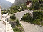
Kapelle und Brücke zer Niwu Briggu B 46°15′07″N 7°52′39″E / 46.25185°N 7.87746°E / 46.25185; 7.87746 7089
Stalden Upload a file
Kirche St. Michael B 46°14′04″N 7°52′17″E / 46.23437°N 7.87138°E / 46.23437; 7.87138 7090
Stalden Upload a file
Meierhaus B 46°14′00″N 7°52′30″E / 46.2333°N 7.87497°E / 46.2333; 7.87497 7091
Stalden Upload a file
Merjenbrücke B 46°13′37″N 7°51′49″E / 46.22699°N 7.86351°E / 46.22699; 7.86351 7092
Stalden Upload a file [[File:|150x150px|Ritibrücke]]
Ritibrücke A 46°13′46″N 7°52′16″E / 46.22953°N 7.87118°E / 46.22953; 7.87118 7086
Stalden Upload a file
Neubrück ISOS 46°15′07″N 7°51′53″E / 46.2519°N 7.8648°E / 46.2519; 7.8648
Stalden Upload a file Stalden
Stalden ISOS 46°14′00″N 7°52′00″E / 46.233333333°N 7.866666666°E / 46.233333333; 7.866666666

Staldenried

Location Upload Photo Object Cat. Coordinates KGS-Nr
Staldenried Upload a file Gspon, Kapelle St. Anna
Gspon, Kapelle St. Anna B 46°13′29″N 7°54′11″E / 46.22462°N 7.90297°E / 46.22462; 7.90297 7093

Steg-Hohtenn

Location Upload Photo Object Cat. Coordinates KGS-Nr
Steg-Hohtenn Upload a file Kirche Hl. Familie (1914)
Kirche Hl. Familie (1914) B 46°18′54″N 7°44′49″E / 46.31502°N 7.74685°E / 46.31502; 7.74685 7094
Steg-Hohtenn Upload a file
Glasmalereien der Kirche St. Barbara B 46°19′07″N 7°45′23″E / 46.31866°N 7.75649°E / 46.31866; 7.75649 6783