Commons:Wiki Loves Monuments in Switzerland/Valais/J-R
Jump to navigation
Jump to search
Kippel
| Location | Upload | Photo | Object | Cat. | Coordinates | KGS-Nr | |
|---|---|---|---|---|---|---|---|
| Kippel | 
|
Lötschentaler Museum | B | 46°23′58″N 7°46′23″E / 46.39939°N 7.7731°E | 10699 | ||
| Kippel | 
|
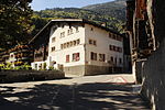
Haus Murmann | B | 46°23′57″N 7°46′20″E / 46.39914°N 7.77228°E | 6791 | ||
| Kippel | 
|
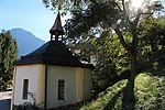
Hockenalp, Stafel mit Kapelle | B | 46°24′38″N 7°45′54″E / 46.41043°N 7.76507°E | 13915 | ||
| Kippel | 
|
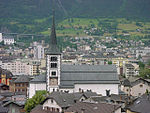
Kirche St. Martin mit Beinhaus | B | 46°23′56″N 7°46′24″E / 46.39897°N 7.77326°E | 6792 | ||
| Kippel | 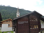
|
Lötschentaler Museum | B | 46°23′58″N 7°46′23″E / 46.39934°N 7.77306°E | 6793 | ||
| Kippel | 
|
Kippel | ISOS | 46°23′00″N 7°46′00″E / 46.383333333°N 7.766666666°E | |||
Lax
| Location | Upload | Photo | Object | Cat. | Coordinates | KGS-Nr | |
|---|---|---|---|---|---|---|---|
| Lax | 
|
Kirche St. Anna | B | 46°23′20″N 8°07′10″E / 46.38879°N 8.11935°E | 6794 | ||
Lens
| Location | Upload | Photo | Object | Cat. | Coordinates | KGS-Nr | |
|---|---|---|---|---|---|---|---|
| Lens | 
|
château de Vaas | B | 46°16′43″N 7°26′40″E / 46.2785°N 7.44449°E | 6798 | ||
| Lens | 
|
église St-Pierre et clocher | B | 46°16′44″N 7°26′42″E / 46.27881°N 7.4451°E | 6797 | ||
| Lens | 
|
Vaas, Maison peinte (ancienne auberge) | B | 46°16′06″N 7°27′12″E / 46.26831°N 7.45338°E | 6800 | ||
| Lens | 
|
Lens | ISOS | 46°16′00″N 7°26′00″E / 46.266666666°N 7.433333333°E | |||
| Lens | 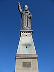
|
statue du Christ-Roi | B | 46°16′23″N 7°26′15″E / 46.27312°N 7.43756°E | 6799 | ||
Leuk
Leukerbad
| Location | Upload | Photo | Object | Cat. | Coordinates | KGS-Nr | |
|---|---|---|---|---|---|---|---|
| Leukerbad | 
|
Gemmi Daubenwand | A | 46°23′37″N 7°36′59″E / 46.39359°N 7.61649°E | 6820 | ||
| Leukerbad | 
|
Eisenzeitliches Gräberfeld | B | 6819 | |||
| Leukerbad | 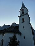
|
Kirche Maria Hilf | B | 46°22′46″N 7°37′45″E / 46.3794°N 7.6292°E | 6821 | ||
Leytron
| Location | Upload | Photo | Object | Cat. | Coordinates | KGS-Nr | |
|---|---|---|---|---|---|---|---|
| Leytron | 
|
ancienne église et clocher | B | 46°11′09″N 7°12′31″E / 46.18594°N 7.20849°E | 6822 | ||
| Leytron | 
|
Dugny et Montagnon, anciennes maisons (avec cheminées «savoyardes«) | B | 46°11′20″N 7°10′56″E / 46.18886°N 7.18217°E | 6823 | ||
| Leytron | 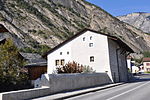
|
Maison Rossier | B | 46°11′14″N 7°12′32″E / 46.18713°N 7.209°E | 6824 | ||
Liddes
| Location | Upload | Photo | Object | Cat. | Coordinates | KGS-Nr | |
|---|---|---|---|---|---|---|---|
| Liddes | 
|
Les Moulins | A | 46°00′16″N 7°10′05″E / 46.00438°N 7.16803°E | 6825 | ||
| Liddes | 
|
chapelle St-Etienne | B | 45°59′14″N 7°11′20″E / 45.98723°N 7.18898°E | 6827 | ||
| Liddes | 
|
Maison Bastian | B | 45°59′31″N 7°11′08″E / 45.99194°N 7.18566°E | 6828 | ||
| Liddes | 
|
Liddes | ISOS | 45°59′00″N 7°11′00″E / 45.983333333°N 7.183333333°E | |||
Martigny
| Location | Upload | Photo | Object | Cat. | Coordinates | KGS-Nr | |
|---|---|---|---|---|---|---|---|
| Martigny | 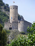
|
château de la Bâtiaz | A | 46°06′18″N 7°04′09″E / 46.105°N 7.06925°E | 6832 | ||
| Martigny | 
|
Médiathèque Valais-Martigny | A | 46°06′11″N 7°04′30″E / 46.103043°N 7.075007°E | 6831 | ||
| Martigny | 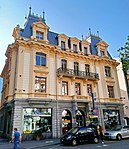
|
Musée des sciences de la terre | B | 46°06′07″N 7°04′26″E / 46.10195°N 7.07402°E | 8745 | ||
| Martigny | 
|
Ville, ville romaine et moderne | A | 46°05′55″N 7°04′26″E / 46.09862°N 7.07398°E | 9700 | ||
| Martigny | 
|
église Notre-Dame des Champs | B | 46°06′02″N 7°04′26″E / 46.10063°N 7.07384°E | 6836 | ||
| Martigny | 
|
Fondation Claude Bellanger | B | 46°05′40″N 7°03′55″E / 46.09431°N 7.0654°E | 6837 | ||
| Martigny | 
|
Hôtel Clerc | B | 46°06′12″N 7°04′19″E / 46.10337°N 7.07199°E | 10575 | ||
| Martigny | 
|
Hôtel de Ville avec archives | B | 46°06′03″N 7°04′23″E / 46.10079°N 7.07299°E | 6838 | ||
| Martigny | 
|
La Bâtiaz, chapelle Notre-Dame des 7 Douleurs (ex voto) | B | 46°06′17″N 7°04′12″E / 46.10466°N 7.06987°E | 6839 | ||
| Martigny | 
|
La Bâtiaz, pont couvert sur la Drance | B | 46°06′18″N 7°04′16″E / 46.10492°N 7.07099°E | 6840 | ||
| Martigny | 
|
Le Manoir (maison Ganioz) | B | 46°06′09″N 7°04′20″E / 46.1024°N 7.07212°E | 6841 | ||
| Martigny | 
|
Maison du St-Bernard (Prévôté) | B | 46°06′01″N 7°04′24″E / 46.10014°N 7.07345°E | 6842 | ||
| Martigny | 
|
Maison Supersaxo | B | 46°06′01″N 7°04′29″E / 46.10023°N 7.07476°E | 6843 | ||
| Martigny | 
|
Martigny-Ville | ISOS | 46°06′10″N 7°04′38″E / 46.10273°N 7.07721°E | |||
| Martigny | 
|
Martigny-Bourg | ISOS | 46°05′33″N 7°04′12″E / 46.09246°N 7.07002°E | |||
| Martigny | 
|
Fondation Pierre Gianadda | A | 46°05′42″N 7°04′16″E / 46.095°N 7.071°E | 9384 | ||
Martigny-Combe
| Location | Upload | Photo | Object | Cat. | Coordinates | KGS-Nr | |
|---|---|---|---|---|---|---|---|
| Martigny-Combe | 
|
chapelle St-Jean et site archéologique (ancien château) | B | 46°04′44″N 7°02′50″E / 46.07898°N 7.04731°E | 6845 | ||
| Martigny-Combe | 
|
Plan Cerisier | ISOS | 46°05′21″N 7°03′32″E / 46.0893°N 7.0589°E | |||
Mase
| Location | Upload | Photo | Object | Cat. | Coordinates | KGS-Nr | |
|---|---|---|---|---|---|---|---|
| Mase | 
|
Mase | ISOS | 46°12′00″N 7°26′00″E / 46.2°N 7.433333333°E | |||
Massongex
| Location | Upload | Photo | Object | Cat. | Coordinates | KGS-Nr | |
|---|---|---|---|---|---|---|---|
| Massongex | 
|
Tarnaiae, Vicus celtique / gallo-romain | A | 46°14′35″N 6°59′20″E / 46.24292°N 6.989°E | 9701 | ||
| Massongex | 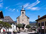
|
église St-Jean-Baptiste, clocher et cure avec inscriptions romaines | B | 46°14′34″N 6°59′22″E / 46.24265°N 6.98951°E | 6848 | ||
| Massongex | 
|
Mosaïque romaine (au Café du Caveau Romain) | B | 46°14′32″N 6°59′22″E / 46.24233°N 6.98944°E | 6849 | ||
Miège
| Location | Upload | Photo | Object | Cat. | Coordinates | KGS-Nr | |
|---|---|---|---|---|---|---|---|
| Miège | 
|
Pont voûté sur la Raspille | B | 46°18′50″N 7°33′35″E / 46.31377°N 7.55975°E | 6850 | ||
Mont-Noble
| Location | Upload | Photo | Object | Cat. | Coordinates | KGS-Nr | |
|---|---|---|---|---|---|---|---|
| Mont-Noble | 
|
église St-Maurice et St-Gothard (clocher et autels) | B | 46°13′43″N 7°25′40″E / 46.22852°N 7.42784°E | 6897 | ||
| Mont-Noble | 
|
Refuge du vallon de la Derotchia | B | 46°14′37″N 7°27′09″E / 46.24359°N 7.45237°E | 6898 | ||
Monthey
| Location | Upload | Photo | Object | Cat. | Coordinates | KGS-Nr | |
|---|---|---|---|---|---|---|---|
| Monthey | 
|
Musée du Vieux-Monthey | B | 46°15′09″N 6°56′45″E / 46.25238°N 6.94593°E | 10701 | ||
| Monthey | 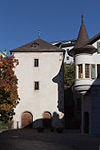
|
Ancien dépôt de sel puis arsenal | B | 46°15′07″N 6°56′44″E / 46.25203°N 6.94553°E | 6854 | ||
| Monthey | 
|
chapelle Notre-Dame du Pont | B | 46°15′04″N 6°56′46″E / 46.25114°N 6.94622°E | 6855 | ||
| Monthey | 
|
Château (avec musée et archives du Vieux-Monthey) | B | 46°15′09″N 6°56′46″E / 46.2524°N 6.946°E | 6856 | ||
| Monthey | 
|
Château-Vieux (site archéologique) | B | 46°15′01″N 6°56′46″E / 46.25033°N 6.94614°E | 6857 | ||
| Monthey | 
|
Choëx, église St-Sylvestre et cure | B | 46°14′37″N 6°57′39″E / 46.24363°N 6.96087°E | 6858 | ||
| Monthey | 
|
Choëx, site romain de Marendeux | B | 46°14′44″N 6°57′09″E / 46.24568°N 6.95241°E | 6859 | ||
| Monthey | 
|
Cure (1807) | B | 46°15′11″N 6°56′48″E / 46.25315°N 6.94679°E | 6860 | ||
| Monthey | 
|
église Notre-Dame de l'Immaculée Conception (1851) | B | 46°15′10″N 6°56′49″E / 46.25279°N 6.9469°E | 6861 | ||
| Monthey | 
|
Le Crochetan, maison Dufay (de Kalbermatten) | B | 46°15′15″N 6°56′53″E / 46.25412°N 6.94793°E | 6862 | ||
| Monthey | 
|
Maison Delacoste | B | 46°15′08″N 6°56′51″E / 46.25214°N 6.94743°E | 6863 | ||
| Monthey | 
|
Pont couvert sur la Vièze (1809) | B | 46°15′00″N 6°56′52″E / 46.24992°N 6.94777°E | 6864 | ||
Mörel-Filet
| Location | Upload | Photo | Object | Cat. | Coordinates | KGS-Nr | |
|---|---|---|---|---|---|---|---|
| Mörel-Filet | 
|
Pfarrarchiv / Zendenarchiv Mörel-Filet | B | 46°21′21″N 8°02′41″E / 46.3559°N 8.04463°E | 10599 | ||
| Mörel-Filet | 
|
Hohenflühen, Muttergotteskapelle | B | 46°20′40″N 8°01′36″E / 46.34456°N 8.02671°E | 6866 | ||
| Mörel-Filet | 
|
Kirche St. Hilarius und Haus de Sepibus | B | 46°21′21″N 8°02′40″E / 46.35588°N 8.0445°E | 6867 | ||
Mühlebach
| Location | Upload | Photo | Object | Cat. | Coordinates | KGS-Nr | |
|---|---|---|---|---|---|---|---|
| Mühlebach | 
|
Mühlebach VS | ISOS | 46°24′30″N 8°09′28″E / 46.408327°N 8.157769°E | |||
Münster-Geschinen
| Location | Upload | Photo | Object | Cat. | Coordinates | KGS-Nr | |
|---|---|---|---|---|---|---|---|
| Münster-Geschinen | 
|
Pfarreimuseum Münster | B | 46°29′13″N 8°15′53″E / 46.48708°N 8.26483°E | 9459 | ||
Naters
Nendaz
| Location | Upload | Photo | Object | Cat. | Coordinates | KGS-Nr | |
|---|---|---|---|---|---|---|---|
| Nendaz | 
|
Basse-Nendaz, Eglise St-Légier (fresques) et cure | B | 46°11′22″N 7°18′45″E / 46.18955°N 7.31255°E | 6899 | ||
| Nendaz | 
|
Haute Nendaz, chapelle St-Michel | B | 46°11′14″N 7°17′53″E / 46.18736°N 7.29798°E | 6900 | ||
| Nendaz | 
|
Ruine du château de Brignon (1260) | B | 46°11′17″N 7°19′21″E / 46.18802°N 7.32258°E | 6901 | ||
Niedergesteln
| Location | Upload | Photo | Object | Cat. | Coordinates | KGS-Nr | |
|---|---|---|---|---|---|---|---|
| Niedergesteln | 
|
Gestelnburg | A | 46°18′48″N 7°46′59″E / 46.31333°N 7.7831°E | 6903 | ||
| Niedergesteln | 
|
Häuserzeile Eischler-Haus | B | 46°18′52″N 7°46′56″E / 46.3144°N 7.78227°E | 6904 | ||
| Niedergesteln | 
|
Kirche St. Maria mit Beinhaus | B | 46°18′49″N 7°46′57″E / 46.31369°N 7.78254°E | 6905 | ||
| Niedergesteln | 
|
Pfarrhaus | B | 46°18′48″N 7°46′57″E / 46.31342°N 7.78239°E | 6906 | ||
| Niedergesteln | 
|
Niedergesteln | ISOS | 46°19′00″N 7°46′00″E / 46.316666666°N 7.766666666°E | |||
Oberems
| Location | Upload | Photo | Object | Cat. | Coordinates | KGS-Nr | |
|---|---|---|---|---|---|---|---|
| Oberems | 
|
Alte Kapelle | B | 46°16′53″N 7°41′42″E / 46.28143°N 7.69491°E | 6911 | ||
Obergoms
| Location | Upload | Photo | Object | Cat. | Coordinates | KGS-Nr | |
|---|---|---|---|---|---|---|---|
| Obergoms | 
|
Beinhaus (Fresken) | B | 46°30′53″N 8°19′29″E / 46.51477°N 8.32461°E | 6912 | ||
| Obergoms | 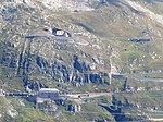
|
Festungsbatterie Galenhütten (Furka: 1890–1894) | B | 46°34′38″N 8°23′27″E / 46.57734°N 8.39097°E | 6914 | ||
| Obergoms | 
|
Kirche Hl. Kreuz | B | 46°32′04″N 8°20′54″E / 46.53454°N 8.34842°E | 6918 | ||
| Obergoms | 
|
Kirche St. Nikolaus (1894) | B | 46°30′23″N 8°18′13″E / 46.50651°N 8.30355°E | 7150 | ||
| Obergoms | 
|
Ladstegbrücke im Eginental | B | 46°28′39″N 8°22′05″E / 46.47744°N 8.36811°E | 7151 | ||
| Obergoms | 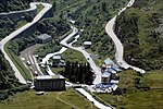
|
Oberwald, Gletsch, Hotelsiedlung Seiler Glacier du Rhône | B | 46°33′45″N 8°21′42″E / 46.56252°N 8.36176°E | 6916 | ||
| Obergoms | 
|
Unterwassern, Kapelle St. Christophorus (Altar) | B | 46°31′56″N 8°21′14″E / 46.53228°N 8.35386°E | 6919 | ||
| Obergoms | 
|
Zum Loch, Kapelle St. Anna | B | 46°30′16″N 8°19′06″E / 46.50438°N 8.31829°E | 7152 | ||
| Obergoms | 
|
Gletsch | ISOS | 46°33′49″N 8°21′45″E / 46.563604°N 8.362504°E | |||
| Obergoms | 
|
Ulrichen | ISOS | 46°30′N 8°18′E / 46.5°N 8.3°E | |||
| Obergoms | 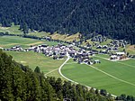
|
Obergesteln | ISOS | 46°30′00″N 8°19′00″E / 46.5°N 8.316666666°E | |||
| Obergoms | 
|
ligne sommitale de la Furka | A | 46°33′41″N 8°21′43″E / 46.561389°N 8.361944°E | 10362 | ||
Orsières
| Location | Upload | Photo | Object | Cat. | Coordinates | KGS-Nr | |
|---|---|---|---|---|---|---|---|
| Orsières | 
|
Archives bourgeoisiales et communales d'Orsières | B | 46°01′49″N 7°08′47″E / 46.03023°N 7.14625°E | 6920 | ||
| Orsières | Jardin botanique alpin Flore-Alpe | Jardin botanique alpin Flore-Alpe | A | 46°02′07″N 7°06′15″E / 46.03521°N 7.10423°E | 10447 | ||
| Orsières | 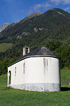
|
chapelle St-Eusèbe et site archéologique | B | 46°01′22″N 7°08′18″E / 46.02272°N 7.13841°E | 6921 | ||
| Orsières | 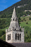
|
Clocher de l'église St-Nicolas | B | 46°01′52″N 7°08′46″E / 46.03114°N 7.1462°E | 6922 | ||
| Orsières | 
|
Ferret, chapelle de Notre-Dame des Neiges | B | 45°54′59″N 7°06′18″E / 45.91651°N 7.10491°E | 6924 | ||
| Orsières | 
|
Hôtel du Grand-Combin à Champex | B | 46°01′39″N 7°07′15″E / 46.0274°N 7.12072°E | 10577 | ||
| Orsières | 
|
Reppa, maison à cheminée (Chanton de Reppa) | B | 46°02′04″N 7°09′22″E / 46.03444°N 7.15616°E | 6926 | ||
| Orsières | 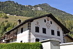
|
Som-la-Pro, 2 maisons peintes | B | 46°01′08″N 7°07′53″E / 46.01878°N 7.13127°E | 6927 | ||
| Orsières | 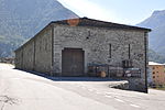
|
Souste | B | 46°01′40″N 7°08′49″E / 46.02786°N 7.14691°E | 6928 | ||
| Orsières | 
|
Commeire | ISOS | 46°01′26″N 7°10′14″E / 46.0238°N 7.1705°E | |||
Port-Valais
| Location | Upload | Photo | Object | Cat. | Coordinates | KGS-Nr | |
|---|---|---|---|---|---|---|---|
| Port-Valais | 
|
Bibliothèque des Bénédictins du Foyer St-Benoît | B | 46°23′09″N 6°50′59″E / 46.38589°N 6.84976°E | 6929 | ||
| Port-Valais | 
|
Bouveret, gare et débarcadère | B | 46°23′13″N 6°51′07″E / 46.38688°N 6.85187°E | 6930 | ||
| Port-Valais | 
|
Bouveret, Hôtel de la Tour (ancien dépôt de sel) | B | 46°23′11″N 6°51′06″E / 46.38642°N 6.85174°E | 6931 | ||
| Port-Valais | 
|
Site archéologique du promontoire | B | 46°22′20″N 6°52′19″E / 46.37215°N 6.872°E | 6932 | ||
Randa
| Location | Upload | Photo | Object | Cat. | Coordinates | KGS-Nr | |
|---|---|---|---|---|---|---|---|
| Randa | 
|
Kirche St. Sebastian | B | 46°06′04″N 7°47′04″E / 46.10115°N 7.78432°E | 6934 | ||
Rarogne
| Location | Upload | Photo | Object | Cat. | Coordinates | KGS-Nr | |
|---|---|---|---|---|---|---|---|
| Rarogne | 
|
Museum auf der Burg | B | 46°18′39″N 7°48′12″E / 46.31086°N 7.80336°E | 10702 | ||
| Rarogne | 
|
Heidnischbühl, site de hauteur préhistorique | A | 46°18′36″N 7°48′36″E / 46.30999°N 7.8099°E | 6940 | ||
| Rarogne | 
|
Kirche St. Roman mit altem Pfarrhaus | A | 46°18′38″N 7°48′12″E / 46.31067°N 7.80329°E | 6936 | ||
| Rarogne | 
|
Wohnturm der Viztume | A | 46°18′39″N 7°48′14″E / 46.31086°N 7.8038°E | 6939 | ||
| Rarogne | 
|
Bietschtal Viadukt BLS | B | 46°19′23″N 7°48′50″E / 46.32313°N 7.81389°E | 9073 | ||
| Rarogne | 
|
Haus von Ulrich Ruffiner (Haus Imboden) | B | 46°18′34″N 7°48′11″E / 46.30933°N 7.80311°E | 6938 | ||
| Rarogne | 
|
Maxenhaus | B | 46°18′43″N 7°48′01″E / 46.31185°N 7.80022°E | 6941 | ||
| Rarogne | 
|
Rarnerchumma, Kapelle Maria vom Guten Rat | B | 46°19′03″N 7°48′14″E / 46.31738°N 7.80385°E | 6937 | ||
| Rarogne | 
|
St. German, Kirche St. German | B | 46°18′44″N 7°49′15″E / 46.31234°N 7.82088°E | 6943 | ||
| Rarogne | 
|
St. German, Tscherggenhaus | B | 46°18′43″N 7°48′52″E / 46.31192°N 7.81448°E | 6944 | ||
| Rarogne | 
|
St. German, Vogelhaus | B | 46°18′43″N 7°48′53″E / 46.312°N 7.81461°E | 6945 | ||
| Rarogne | 
|
Zentriegenhaus | B | 46°18′43″N 7°48′03″E / 46.31208°N 7.80087°E | 6946 | ||
| Rarogne | 
|
Rarner Chumma | ISOS | 46°23′53″N 7°46′10″E / 46.39796°N 7.76958°E | |||
Raron
| Location | Upload | Photo | Object | Cat. | Coordinates | KGS-Nr | |
|---|---|---|---|---|---|---|---|
| Raron | 
|
Rarogne | ISOS | 46°19′N 7°48′E / 46.31°N 7.8°E | |||
Reckingen-Gluringen
| Location | Upload | Photo | Object | Cat. | Coordinates | KGS-Nr | |
|---|---|---|---|---|---|---|---|
| Reckingen-Gluringen | 
|
Pfarrkirche Geburt Mariens | A | 46°28′11″N 8°14′33″E / 46.46961°N 8.24252°E | 6948 | ||
| Reckingen-Gluringen | 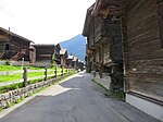
|
Nutzbauten «Uf der Stiege« | B | 46°28′15″N 8°14′31″E / 46.47094°N 8.24197°E | 13921 | ||
| Reckingen-Gluringen | 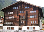
|
Taffinerhaus | B | 46°28′16″N 8°14′29″E / 46.47118°N 8.24126°E | 6954 | ||
Riddes
| Location | Upload | Photo | Object | Cat. | Coordinates | KGS-Nr | |
|---|---|---|---|---|---|---|---|
| Riddes | 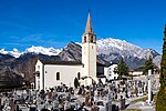
|
ancienne église St-Laurent | B | 46°10′07″N 7°13′13″E / 46.1686°N 7.22026°E | 6955 | ||
| Riddes | 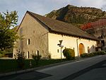
|
La Vidondée | B | 46°10′17″N 7°13′31″E / 46.17141°N 7.22531°E | 6956 | ||
Ried-Brig
| Location | Upload | Photo | Object | Cat. | Coordinates | KGS-Nr | |
|---|---|---|---|---|---|---|---|
| Ried-Brig | 
|
Burgspitz, Kapelle Mariä Verkündigung (1707), mit Kapellenweg | B | 46°19′09″N 8°01′47″E / 46.31903°N 8.02959°E | 6957 | ||
| Ried-Brig | 
|
pont du Ganter | B | 46°17′46″N 8°03′03″E / 46.296222222°N 8.050863888°E | 9077 | ||
Riederalp
| Location | Upload | Photo | Object | Cat. | Coordinates | KGS-Nr | |
|---|---|---|---|---|---|---|---|
| Riederalp | 
|
Goppisberg | ISOS | 46°22′22″N 8°03′06″E / 46.3728°N 8.0516°E | |||
| Riederalp | 
|
Greich | ISOS | 46°22′04″N 8°02′25″E / 46.3677°N 8.0404°E | |||
| Riederalp | 
|
Kapelle St. Agatha | B | 46°21′59″N 8°02′22″E / 46.36643°N 8.03936°E | 6759 | ||
| Riederalp | 
|
Kirche Maria-Lourdes (1911, Gaudy) | B | 46°21′24″N 8°02′00″E / 46.35665°N 8.03328°E | 6958 | ||
| Riederalp | 
|
Riederfurka, Villa Cassel | B | 46°22′36″N 8°00′58″E / 46.37659°N 8.01615°E | 6959 | ||
