Commons:Wiki Loves Monuments in Switzerland/Uri/A-M

From Wikimedia Commons, the free media repository
Jump to navigation Jump to search

Altdorf

Location Upload Photo Object Cat. Coordinates KGS-Nr
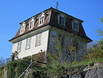
Altdorf Upload a file Haus im Eselmätteli
Haus im Eselmätteli A 46°52′58″N 8°38′24″E / 46.882655°N 8.640103°E / 46.882655; 8.640103 5789
Altdorf Upload a file Fremdenspital mit Kapelle
Fremdenspital mit Kapelle A 46°52′59″N 8°38′29″E / 46.883001°N 8.641436°E / 46.883001; 8.641436 5775
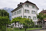
Altdorf Upload a file Haus Jauch
Haus Jauch A 46°52′50″N 8°38′47″E / 46.880636°N 8.646435°E / 46.880636; 8.646435 5776
Altdorf Upload a file Bannersammlung im Rathaus
Bannersammlung im Rathaus B 46°52′55″N 8°38′39″E / 46.882029°N 8.644086°E / 46.882029; 8.644086 11991
Altdorf Upload a file Grabmäler auf dem Friedhof gemäss Verzeichnis der Kirchgemeinde
Grabmäler auf dem Friedhof gemäss Verzeichnis der Kirchgemeinde B 46°52′59″N 8°38′31″E / 46.883166°N 8.641965°E / 46.883166; 8.641965 11296
Altdorf Upload a file Kapuzinerkloster Altdorf
Kapuzinerkloster Altdorf B 46°53′03″N 8°38′37″E / 46.88429°N 8.643735°E / 46.88429; 8.643735 5779
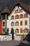
Altdorf Upload a file Rathaus
Rathaus B 46°52′55″N 8°38′39″E / 46.882037°N 8.644078°E / 46.882037; 8.644078 5782
Altdorf Upload a file Kapelle beim Suworowhaus
Kapelle beim Suworowhaus B 46°52′50″N 8°38′48″E / 46.880453°N 8.646706°E / 46.880453; 8.646706 11299
Altdorf Upload a file Josefsbrunnen beim Fremdenspital
Josefsbrunnen beim Fremdenspital B 46°52′59″N 8°38′29″E / 46.883054°N 8.641477°E / 46.883054; 8.641477 5777
Altdorf Upload a file Haus von Roll (früher UKB)
Haus von Roll (früher UKB) B 46°52′54″N 8°38′36″E / 46.881776°N 8.643285°E / 46.881776; 8.643285 5793
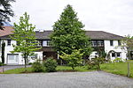
Altdorf Upload a file Haus Waldegg (mit Baumbestand)
Haus Waldegg (mit Baumbestand) B 46°53′04″N 8°38′34″E / 46.884543°N 8.642796°E / 46.884543; 8.642796 11339
Altdorf Upload a file Kantonales Zeughaus
Kantonales Zeughaus B 46°52′50″N 8°38′40″E / 46.880593°N 8.644571°E / 46.880593; 8.644571 5796
Altdorf Upload a file Kapelle St. Anna
Kapelle St. Anna A 46°52′59″N 8°38′32″E / 46.88305°N 8.64218°E / 46.88305; 8.64218 5772
Altdorf Upload a file Ankenwaage mit Hexenturm
Ankenwaage mit Hexenturm B 46°52′55″N 8°38′35″E / 46.882048°N 8.643029°E / 46.882048; 8.643029 5784
Altdorf Upload a file Haus Zieri
Haus Zieri B 46°52′56″N 8°38′38″E / 46.88229°N 8.643979°E / 46.88229; 8.643979 11297
Altdorf Upload a file Kapelle Unter-Heiligkreuz mit ehemaligem Schützenhaus und Haus Muheim beim Spital
Kapelle Unter-Heiligkreuz mit ehemaligem Schützenhaus und Haus Muheim beim Spital B 46°53′00″N 8°38′15″E / 46.883457°N 8.637418°E / 46.883457; 8.637418 5797
Altdorf Upload a file Tellspielhaus
Tellspielhaus B 46°52′51″N 8°38′40″E / 46.880952°N 8.644579°E / 46.880952; 8.644579 5803
Altdorf Upload a file Besslerbrunnen
Besslerbrunnen B 46°52′54″N 8°38′38″E / 46.881769°N 8.643941°E / 46.881769; 8.643941 5773
Altdorf Upload a file Besslerhaus (Dr. Christen)
Besslerhaus (Dr. Christen) B 46°53′00″N 8°38′18″E / 46.883421°N 8.638231°E / 46.883421; 8.638231 5785
Altdorf Upload a file Crivellihaus
Crivellihaus B 46°53′00″N 8°38′20″E / 46.883279°N 8.638923°E / 46.883279; 8.638923 11331
Altdorf Upload a file [[File:|150x150px|Dätwyler-Stiftung]]
Dätwyler-Stiftung A 46°52′40″N 8°38′49″E / 46.877834°N 8.646831°E / 46.877834; 8.646831 8582
Altdorf Upload a file Eidgenössisches Sackmagazin
Eidgenössisches Sackmagazin A 46°52′15″N 8°37′57″E / 46.870869°N 8.632415°E / 46.870869; 8.632415 9057
Altdorf Upload a file Eidgenössisches Getreidesilo Altdorf
Eidgenössisches Getreidesilo Altdorf A 46°52′12″N 8°37′58″E / 46.870119°N 8.632753°E / 46.870119; 8.632753 5786
Altdorf Upload a file Fabrikgebäude Dätwyler
Fabrikgebäude Dätwyler B 46°52′40″N 8°38′46″E / 46.87768°N 8.64615°E / 46.87768; 8.64615 5787
Altdorf Upload a file Haus Martin Gamma mit Oekonomiegebäude
Haus Martin Gamma mit Oekonomiegebäude B 46°52′58″N 8°38′27″E / 46.88288°N 8.640948°E / 46.88288; 8.640948 5792
Altdorf Upload a file Haus Dr. Hirzel
Haus Dr. Hirzel B 46°53′00″N 8°38′18″E / 46.883421°N 8.638231°E / 46.883421; 8.638231 11333
Altdorf Upload a file Haus Huon
Haus Huon B 46°52′36″N 8°38′23″E / 46.876623933°N 8.639726967°E / 46.876623933; 8.639726967 11336
Altdorf Upload a file Haus Blumenfeld mit Granitbrunnen
Haus Blumenfeld mit Granitbrunnen B 46°52′27″N 8°38′55″E / 46.8741°N 8.64861°E / 46.8741; 8.64861 11338
Altdorf Upload a file Haus oberer Vogelsang (mit Baumbestand)
Haus oberer Vogelsang (mit Baumbestand) B 46°53′05″N 8°38′27″E / 46.88476°N 8.640924°E / 46.88476; 8.640924 11341
Altdorf Upload a file Haus Walker-Kesselbach
Haus Walker-Kesselbach B 46°52′49″N 8°38′36″E / 46.880155°N 8.64338°E / 46.880155; 8.64338 5794
Altdorf Upload a file Haus Lusser an der Gotthardstrasse
Haus Lusser an der Gotthardstrasse B 46°52′46″N 8°38′39″E / 46.879427°N 8.644151°E / 46.879427; 8.644151 5791
Altdorf Upload a file Haus in der Stoffelmatte
Haus in der Stoffelmatte B 46°52′42″N 8°38′36″E / 46.878268°N 8.643207°E / 46.878268; 8.643207 5790
Altdorf Upload a file [[File:|150x150px|Historisches Museum]]
Historisches Museum B 46°52′40″N 8°38′42″E / 46.877835°N 8.644968°E / 46.877835; 8.644968 5795
Altdorf Upload a file Kirchenschatz-Museum St. Martin (Altdorf)
Kirchenschatz-Museum St. Martin (Altdorf) B 46°52′58″N 8°38′30″E / 46.882871°N 8.641735°E / 46.882871; 8.641735 8562
Altdorf Upload a file Kapuzinerinnenkloster St. Karl
Kapuzinerinnenkloster St. Karl B 46°52′44″N 8°38′37″E / 46.878985°N 8.643485°E / 46.878985; 8.643485 5798
Altdorf Upload a file Kollegium St. Karl Borromäus
Kollegium St. Karl Borromäus B 46°52′29″N 8°39′03″E / 46.87468°N 8.650735°E / 46.87468; 8.650735 5799
Altdorf Upload a file Haus Dr. F. Schmid (Korporationsarchiv Uri)
Haus Dr. F. Schmid (Korporationsarchiv Uri) B 46°52′48″N 8°38′37″E / 46.87999°N 8.64372°E / 46.87999; 8.64372 5788
Altdorf Upload a file [[File:|150x150px|Historisches Museum Uri]]
Historisches Museum Uri A 46°52′40″N 8°38′42″E / 46.877835°N 8.644968°E / 46.877835; 8.644968 8579
Altdorf Upload a file Oelberg-Kapelle bei der kath. Kirche
Oelberg-Kapelle bei der kath. Kirche B 46°53′01″N 8°38′31″E / 46.88356°N 8.64185°E / 46.88356; 8.64185 5781
Altdorf Upload a file Personalhaus der ehem. Draht- und Gummiwerke AG
Personalhaus der ehem. Draht- und Gummiwerke AG B 46°52′40″N 8°38′49″E / 46.877834°N 8.646831°E / 46.877834; 8.646831 9058
Altdorf Upload a file Katholische Kirche St. Martin
Katholische Kirche St. Martin A 46°53′00″N 8°38′32″E / 46.883299°N 8.642138°E / 46.883299; 8.642138 5778
Altdorf Upload a file Postgebäude
Postgebäude B 46°52′51″N 8°38′31″E / 46.880945234°N 8.642014689°E / 46.880945234; 8.642014689 5800
Altdorf Upload a file Staatsarchiv Uri
Staatsarchiv Uri A 46°52′51″N 8°38′29″E / 46.88096°N 8.64128°E / 46.88096; 8.64128 8791
Altdorf Upload a file Kantonale Kunst und Kulturgutsammlung Uri
Kantonale Kunst und Kulturgutsammlung Uri B 46°52′51″N 8°38′26″E / 46.880725°N 8.640506°E / 46.880725; 8.640506 8463
Altdorf Upload a file Telldenkmal und Türmli
Telldenkmal und Türmli A 46°52′54″N 8°38′39″E / 46.881666666°N 8.644166666°E / 46.881666666; 8.644166666 5783
Altdorf Upload a file Haus Winterberg
Haus Winterberg B 46°52′56″N 8°38′28″E / 46.882232°N 8.640986°E / 46.882232; 8.640986 11334
Altdorf Upload a file Altdorf
Altdorf ISOS 46°52′50″N 8°38′22″E / 46.880555555°N 8.639444444°E / 46.880555555; 8.639444444

Andermatt

Location Upload Photo Object Cat. Coordinates KGS-Nr
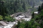
Andermatt Upload a file Teufelsbrücke
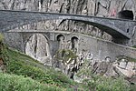
Teufelsbrücke A 46°38′51″N 8°35′25″E / 46.64737°N 8.59031°E / 46.64737; 8.59031 5804
Andermatt Upload a file Haus Babylon
Haus Babylon B 46°37′58″N 8°35′39″E / 46.632657°N 8.594268°E / 46.632657; 8.594268 5808
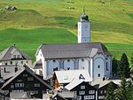
Andermatt Upload a file Katholische Kirche St. Peter und Paul
Katholische Kirche St. Peter und Paul B 46°38′02″N 8°35′41″E / 46.633976°N 8.594662°E / 46.633976; 8.594662 5810
Andermatt Upload a file Alte Kirche St. Kolumban
Alte Kirche St. Kolumban B 46°38′26″N 8°35′39″E / 46.640457°N 8.594278°E / 46.640457; 8.594278 5806
Andermatt Upload a file Kriegskaserne Büel
Kriegskaserne Büel B 46°38′38″N 8°35′25″E / 46.64384°N 8.59019°E / 46.64384; 8.59019 11354
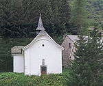
Andermatt Upload a file Kapelle Maria-Hilf
Kapelle Maria-Hilf B 46°38′00″N 8°35′54″E / 46.633309°N 8.598305°E / 46.633309; 8.598305 5811
Andermatt Upload a file Nosenhaus
Nosenhaus B 46°38′03″N 8°35′49″E / 46.634096°N 8.597042°E / 46.634096; 8.597042 11352
Andermatt Upload a file Rathaus mit Talarchiv und Dorfbrunnen
Rathaus mit Talarchiv und Dorfbrunnen B 46°37′59″N 8°35′43″E / 46.633117338°N 8.595301663°E / 46.633117338; 8.595301663 5812
Andermatt Upload a file Kapelle St. Wendelin, genannt Eiskapelle
Kapelle St. Wendelin, genannt Eiskapelle B 46°38′07″N 8°35′59″E / 46.635363°N 8.599851°E / 46.635363; 8.599851 11353
Andermatt Upload a file Wohnhaus (Talmuseum)
Wohnhaus (Talmuseum) A 46°37′58″N 8°35′43″E / 46.632729°N 8.59521°E / 46.632729; 8.59521 9748
Andermatt Upload a file Friedhof mit Grabmälern und Totenkapelle St. Michael
Friedhof mit Grabmälern und Totenkapelle St. Michael B 46°38′03″N 8°35′39″E / 46.634106°N 8.594221°E / 46.634106; 8.594221 11347
Andermatt Upload a file Gotthardpass
Gotthardpass A 46°33′33″N 8°33′42″E / 46.559166666°N 8.561666666°E / 46.559166666; 8.561666666 9056
Andermatt Upload a file Suworow-Denkmal
Suworow-Denkmal A 46°38′50″N 8°35′31″E / 46.647278°N 8.592083°E / 46.647278; 8.592083 5807
Andermatt Upload a file Andermatt
Andermatt ISOS 46°37′14″N 8°37′53″E / 46.62049°N 8.6314°E / 46.62049; 8.6314

Attinghausen

Location Upload Photo Object Cat. Coordinates KGS-Nr
Attinghausen Upload a file Burgruine Attinghausen
Burgruine Attinghausen A 46°51′44″N 8°37′47″E / 46.862179°N 8.629783°E / 46.862179; 8.629783 5813
Attinghausen Upload a file Haus Schweinsberg
Haus Schweinsberg A 46°51′51″N 8°37′34″E / 46.864186°N 8.626247°E / 46.864186; 8.626247 5814
Attinghausen Upload a file Katholische Kirche St. Andreas, Friedhofkapelle, Pfarrhaus und Beinhaus St. Ottilien
Katholische Kirche St. Andreas, Friedhofkapelle, Pfarrhaus und Beinhaus St. Ottilien B 46°51′49″N 8°37′47″E / 46.863655°N 8.629763°E / 46.863655; 8.629763 5815
Attinghausen Upload a file
Überreste des Kapuzinerinnenklosters Maria zu allen Engeln inklusive Kaplanenhaus B 46°51′47″N 8°37′31″E / 46.8631°N 8.625147°E / 46.8631; 8.625147 11357

Bauen

Location Upload Photo Object Cat. Coordinates KGS-Nr
Bauen Upload a file Haus im Oberen Baumgarten
Haus im Oberen Baumgarten B 46°56′05″N 8°34′39″E / 46.934626°N 8.57762°E / 46.934626; 8.57762 5818
Bauen Upload a file Kath. Kirche St. Ida
Kath. Kirche St. Ida B 46°56′11″N 8°34′47″E / 46.936406328°N 8.579767496°E / 46.936406328; 8.579767496 5819
Bauen Upload a file
Bauen ISOS 46°56′08″N 8°34′42″E / 46.93559°N 8.57836°E / 46.93559; 8.57836

Bürglen

Location Upload Photo Object Cat. Coordinates KGS-Nr
Bürglen Upload a file Brügg, Brücke am alten Klausenweg
Brügg, Brücke am alten Klausenweg B 46°52′37″N 8°40′51″E / 46.876878°N 8.680697°E / 46.876878; 8.680697 5825
Bürglen Upload a file Gasthaus zum Adler
Gasthaus zum Adler B 46°52′31″N 8°39′47″E / 46.875304°N 8.663068°E / 46.875304; 8.663068 10304
Bürglen Upload a file Loretokapelle St. Simon und Juda
Loretokapelle St. Simon und Juda B 46°52′37″N 8°40′41″E / 46.876906°N 8.678074°E / 46.876906; 8.678074 5826
Bürglen Upload a file Meierturm
Meierturm B 46°52′33″N 8°39′46″E / 46.875811°N 8.66283°E / 46.875811; 8.66283 5827
Bürglen Upload a file Tellskapelle
Tellskapelle B 46°52′31″N 8°39′45″E / 46.875365°N 8.662427°E / 46.875365; 8.662427 5823
Bürglen Upload a file Wattigwilerturm (Tellmuseum)
Wattigwilerturm (Tellmuseum) B 46°52′31″N 8°39′48″E / 46.875355°N 8.663345°E / 46.875355; 8.663345 5824
Bürglen Upload a file Katholische Pfarrkirche St. Peter und Paul mit Beinhaus und Ölbergkapelle
Katholische Pfarrkirche St. Peter und Paul mit Beinhaus und Ölbergkapelle A 46°52′30″N 8°39′45″E / 46.875113°N 8.66246°E / 46.875113; 8.66246 5822
Bürglen Upload a file Haus in der Spielmatt «Planzerhaus»
Haus in der Spielmatt «Planzerhaus» A 46°52′32″N 8°38′15″E / 46.875422°N 8.6376°E / 46.875422; 8.6376 5821
Bürglen Upload a file Riedertal, Wallfahrtskapelle U.L. Frau
Riedertal, Wallfahrtskapelle U.L. Frau B 46°52′02″N 8°41′32″E / 46.867126°N 8.692147°E / 46.867126; 8.692147 5828
Bürglen Upload a file
Wohnhaus, Hof B 46°52′21″N 8°39′31″E / 46.872617°N 8.65856°E / 46.872617; 8.65856 10306
Bürglen Upload a file
Pfarrhaus mit Resten eines ehemaligen Turmes B 46°52′32″N 8°39′47″E / 46.875537°N 8.663192°E / 46.875537; 8.663192 11359
Bürglen Upload a file
Haus zur Stiege an der Feldgasse B 46°52′28″N 8°39′46″E / 46.874461°N 8.662813°E / 46.874461; 8.662813 11360
Bürglen Upload a file
Haus in der Balmermatte ob St. Josef B 46°52′30″N 8°39′26″E / 46.874917°N 8.657221°E / 46.874917; 8.657221 11363
Bürglen Upload a file
Haus Sebastian samt altem Kornspeicher im Resämätteli B 46°52′37″N 8°40′22″E / 46.877007°N 8.672842°E / 46.877007; 8.672842 11366
Bürglen Upload a file
Tell-Museum B 46°52′31″N 8°39′48″E / 46.87533°N 8.66326°E / 46.87533; 8.66326 8580
Bürglen Upload a file Bürglen
Bürglen ISOS 46°52′30″N 8°39′46″E / 46.875°N 8.662777777°E / 46.875; 8.662777777

Erstfeld

Location Upload Photo Object Cat. Coordinates KGS-Nr
Erstfeld Upload a file Wohnhaus im Püntenermätteli
Wohnhaus im Püntenermätteli B 46°49′15″N 8°38′38″E / 46.8209°N 8.64393°E / 46.8209; 8.64393 11372
Erstfeld Upload a file Wohnhaus unterer Spätach mit Dörraum
Wohnhaus unterer Spätach mit Dörraum B 11369
Erstfeld Upload a file Wohnhaus, Talweg Nr. 14
Wohnhaus, Talweg Nr. 14 A 46°49′11″N 8°38′36″E / 46.819781°N 8.643327°E / 46.819781; 8.643327 10310
Erstfeld Upload a file Wallfahrtskapelle Jagdmatt
Wallfahrtskapelle Jagdmatt A 46°49′03″N 8°38′52″E / 46.817567°N 8.647707°E / 46.817567; 8.647707 5830
Erstfeld Upload a file Bahnhof Erstfeld
Bahnhof Erstfeld B 46°49′12″N 8°39′03″E / 46.82009°N 8.65071°E / 46.82009; 8.65071 5829
Erstfeld Upload a file Lokremise
Lokremise B 46°49′07″N 8°39′03″E / 46.81869°N 8.65077°E / 46.81869; 8.65077 10307
Erstfeld Upload a file
Stallscheune, Hinterwiler A 46°48′03″N 8°39′35″E / 46.800804°N 8.659724°E / 46.800804; 8.659724 10309
Erstfeld Upload a file Erstfeld
Erstfeld ISOS 46°48′45″N 8°35′58″E / 46.81237°N 8.59937°E / 46.81237; 8.59937

Flüelen

Location Upload Photo Object Cat. Coordinates KGS-Nr
Flüelen Upload a file Alte Kirche St. Georg und Nikolaus
Alte Kirche St. Georg und Nikolaus B 46°54′10″N 8°37′29″E / 46.90266°N 8.624852°E / 46.90266; 8.624852 5831
Flüelen Upload a file Pfarrkirche Herz Jesu samt Friedhof, Beinhaus und Pfarrhaus
Pfarrkirche Herz Jesu samt Friedhof, Beinhaus und Pfarrhaus B 46°54′20″N 8°37′34″E / 46.90553°N 8.62615°E / 46.90553; 8.62615 11374
Flüelen Upload a file Schlösschen Rudenz
Schlösschen Rudenz B 46°54′07″N 8°37′30″E / 46.90185°N 8.62489°E / 46.90185; 8.62489 5833
Flüelen Upload a file Bahnhof Flüelen
Bahnhof Flüelen A 46°54′06″N 8°37′28″E / 46.9017°N 8.62444°E / 46.9017; 8.62444 9063
Flüelen Upload a file Ziegelhütte
Ziegelhütte A 46°54′05″N 8°37′22″E / 46.901323°N 8.622735°E / 46.901323; 8.622735 5834
Flüelen Upload a file Flüelen
Flüelen ISOS 46°53′59″N 8°37′25″E / 46.899722222°N 8.623611111°E / 46.899722222; 8.623611111

Göschenen

Location Upload Photo Object Cat. Coordinates KGS-Nr
Göschenen Upload a file Fachwerkbahnbrücke
Fachwerkbahnbrücke B 46°40′02″N 8°35′22″E / 46.667317°N 8.589364°E / 46.667317; 8.589364 11376
Göschenen Upload a file Ehem. kath. Kirche im Unterdorf
Ehem. kath. Kirche im Unterdorf B 46°40′04″N 8°35′10″E / 46.667889°N 8.586109°E / 46.667889; 8.586109 5837
Göschenen Upload a file Bahnhof Göschenen
Bahnhof Göschenen B 46°39′55″N 8°35′18″E / 46.665348°N 8.588277°E / 46.665348; 8.588277 5836
Göschenen Upload a file Katholische Pfarrkirche Maria Himmelfahrt
Katholische Pfarrkirche Maria Himmelfahrt B 46°40′07″N 8°35′19″E / 46.668566°N 8.588554°E / 46.668566; 8.588554 11375
Göschenen Upload a file Zollbrücke mit Zolltor
Zollbrücke mit Zolltor B 46°40′03″N 8°35′08″E / 46.66753761°N 8.585545188°E / 46.66753761; 8.585545188 5838
Göschenen Upload a file Gotthardtunnel
Gotthardtunnel B 46°31′44″N 8°36′09″E / 46.529°N 8.6026°E / 46.529; 8.6026 11443
Göschenen Upload a file Reste der Häderlisbrücke (Sprenggibrücke) in der Schöllenen
Reste der Häderlisbrücke (Sprenggibrücke) in der Schöllenen B 46°39′31″N 8°35′03″E / 46.658552°N 8.584212°E / 46.658552; 8.584212 5835
Göschenen Upload a file
Göschenen ISOS 46°40′05″N 8°35′14″E / 46.66816°N 8.58709°E / 46.66816; 8.58709

Gurtnellen

Location Upload Photo Object Cat. Coordinates KGS-Nr
Gurtnellen Upload a file
Bergheimatschule (Grosshus) B 46°44′19″N 8°37′33″E / 46.738608°N 8.625942°E / 46.738608; 8.625942 11295
Gurtnellen Upload a file
Kapelle Maria Hilf in Richligen B 46°44′52″N 8°37′52″E / 46.747715°N 8.631043°E / 46.747715; 8.631043 11450
Gurtnellen Upload a file
Wiler, Kapelle St. Anna (mit Durchgang des Gotthardweges) B 46°43′35″N 8°37′18″E / 46.726452°N 8.621763°E / 46.726452; 8.621763 5839
Gurtnellen Upload a file
Wiler Gurtnellen, Altes Schulhaus B 46°43′43″N 8°37′20″E / 46.728605°N 8.622333°E / 46.728605; 8.622333 5841
Gurtnellen Upload a file
Gurtnellen-Wiler ISOS 46°43′42″N 8°37′17″E / 46.7283°N 8.6214°E / 46.7283; 8.6214

Hospental

Location Upload Photo Object Cat. Coordinates KGS-Nr
Hospental Upload a file Kapelle und Pfrundhaus St. Karl
Kapelle und Pfrundhaus St. Karl B 46°37′04″N 8°34′00″E / 46.617793°N 8.566636°E / 46.617793; 8.566636 5846
Hospental Upload a file Galgen
Galgen A 46°37′23″N 8°34′34″E / 46.623043°N 8.576147°E / 46.623043; 8.576147 10245
Hospental Upload a file Brücke über die Gotthardreuss in Hospental Dorf (Dorfbrücke)
Brücke über die Gotthardreuss in Hospental Dorf (Dorfbrücke) B 46°37′08″N 8°34′00″E / 46.618783°N 8.566657°E / 46.618783; 8.566657 10244
Hospental Upload a file Gasthaus St. Gotthard in Hospental-Dorf
Gasthaus St. Gotthard in Hospental-Dorf B 46°37′10″N 8°34′10″E / 46.619323°N 8.569319°E / 46.619323; 8.569319 11466
Hospental Upload a file Kath. Kirche Mariä Himmelfahrt
Kath. Kirche Mariä Himmelfahrt B 46°37′10″N 8°34′05″E / 46.619579°N 8.567979°E / 46.619579; 8.567979 5845
Hospental Upload a file Müllerhaus samt Ausstattung in Hospental-Dorf
Müllerhaus samt Ausstattung in Hospental-Dorf B 46°37′07″N 8°34′02″E / 46.618517°N 8.567174°E / 46.618517; 8.567174 11456
Hospental Upload a file Tennlenbrücke über die Furkareuss
Tennlenbrücke über die Furkareuss B 46°37′39″N 8°34′47″E / 46.627576°N 8.579834°E / 46.627576; 8.579834 11468
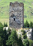
Hospental Upload a file Langobardenturm
Langobardenturm A 46°37′07″N 8°34′00″E / 46.618691°N 8.566786°E / 46.618691; 8.566786 5844
Hospental Upload a file Kapelle St. Nikolaus, Zumdorf
Kapelle St. Nikolaus, Zumdorf B 46°36′36″N 8°32′20″E / 46.609964°N 8.538808°E / 46.609964; 8.538808 5848
Hospental Upload a file
Ökonomie/Stallscheune, Steg A 46°37′29″N 8°34′37″E / 46.624788°N 8.577033°E / 46.624788; 8.577033 10246
Hospental Upload a file
Rossplatten, prähistorische Schlagplätze B 46°38′08″N 8°33′17″E / 46.63558°N 8.55474°E / 46.63558; 8.55474 9684
Hospental Upload a file Hospental
Hospental ISOS 46°37′14″N 8°34′12″E / 46.620555555°N 8.57°E / 46.620555555; 8.57

Isenthal

Location Upload Photo Object Cat. Coordinates KGS-Nr
Isenthal Upload a file Altes Pfarrhaus
Altes Pfarrhaus B 46°54′38″N 8°33′46″E / 46.910483°N 8.5628°E / 46.910483; 8.5628 5849
Isenthal Upload a file Kapelle St. Jakob
Kapelle St. Jakob B 46°54′15″N 8°31′19″E / 46.904129°N 8.521976°E / 46.904129; 8.521976 11475
Isenthal Upload a file Kath. Kirche St. Theodul und Agatha
Kath. Kirche St. Theodul und Agatha B 46°54′38″N 8°33′47″E / 46.91068°N 8.56315°E / 46.91068; 8.56315 5850
Isenthal Upload a file Wohnhaus, Ringli
Wohnhaus, Ringli A 46°54′38″N 8°34′05″E / 46.910623237°N 8.567956401°E / 46.910623237; 8.567956401 10247
Isenthal Upload a file
Haus Luss B 46°54′42″N 8°33′25″E / 46.911754°N 8.556984°E / 46.911754; 8.556984 11473