Commons:Wiki Loves Monuments in Switzerland/Schaffhausen/J-R

From Wikimedia Commons, the free media repository
Jump to navigation Jump to search

Kanton Thurgau

Location Upload Photo Object Cat. Coordinates KGS-Nr
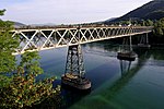
Kanton Thurgau Upload a file Rheinbrücke Hemishofen
Rheinbrücke Hemishofen B 47°40′21″N 8°50′03″E / 47.6725°N 8.83408°E / 47.6725; 8.83408 10888
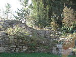
Kanton Thurgau Upload a file Tasgetium
Tasgetium A 47°39′23″N 8°51′31″E / 47.6565°N 8.85869°E / 47.6565; 8.85869 10554

Lohn

Location Upload Photo Object Cat. Coordinates KGS-Nr
Lohn Upload a file
Dorfbrunnen B 47°45′19″N 8°40′15″E / 47.755229°N 8.670843°E / 47.755229; 8.670843 14209
Lohn Upload a file
Dorfbrunnen B 47°45′24″N 8°40′16″E / 47.756666°N 8.671036°E / 47.756666; 8.671036 14210
Lohn Upload a file
Galgenbrunnen B 47°45′25″N 8°40′10″E / 47.757069°N 8.669525°E / 47.757069; 8.669525 14783
Lohn Upload a file
Kernbau der Ziegelei B 47°45′18″N 8°40′17″E / 47.754918°N 8.671369°E / 47.754918; 8.671369 10889
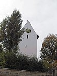
Lohn Upload a file Reformierte Kirche
Reformierte Kirche B 47°45′23″N 8°40′16″E / 47.756377°N 8.67119°E / 47.756377; 8.67119 4334
Lohn Upload a file
Vogtshaus B 47°45′23″N 8°40′12″E / 47.756308°N 8.670094°E / 47.756308; 8.670094 14213
Lohn Upload a file
Wohnhaus / Oekonomie B 47°45′24″N 8°40′18″E / 47.756786°N 8.671666°E / 47.756786; 8.671666 14211
Lohn Upload a file
Wohnhaus / Oekonomie B 47°45′25″N 8°40′17″E / 47.75687°N 8.671321°E / 47.75687; 8.671321 14212
Lohn Upload a file
Wohnhaus / Oekonomie B 47°45′22″N 8°40′15″E / 47.756138°N 8.670797°E / 47.756138; 8.670797 14214

Löhningen

Location Upload Photo Object Cat. Coordinates KGS-Nr
Löhningen Upload a file
Bahnhof, Stationsgebäude ehemalige Tramlinie B 47°42′04″N 8°33′06″E / 47.701207°N 8.551674°E / 47.701207; 8.551674 10156
Löhningen Upload a file
Frohsinn B 47°42′05″N 8°33′12″E / 47.701506°N 8.553319°E / 47.701506; 8.553319 14216
Löhningen Upload a file
Haus zum Engel B 47°42′04″N 8°33′02″E / 47.701216°N 8.550688°E / 47.701216; 8.550688 14223
Löhningen Upload a file
Haus zur Blume B 47°42′06″N 8°33′15″E / 47.70156°N 8.554212°E / 47.70156; 8.554212 14217
Löhningen Upload a file
Hofzeile B 47°41′58″N 8°33′10″E / 47.699469°N 8.552783°E / 47.699469; 8.552783 14218
Löhningen Upload a file
Hofzeile B 47°42′12″N 8°33′13″E / 47.703338°N 8.553544°E / 47.703338; 8.553544 14215
Löhningen Upload a file
Pfarrhaus B 47°41′57″N 8°33′11″E / 47.699242°N 8.552991°E / 47.699242; 8.552991 14219
Löhningen Upload a file Reformierte Kirche mit Kirchenumfriedung
Reformierte Kirche mit Kirchenumfriedung B 47°41′57″N 8°33′11″E / 47.69908°N 8.553041°E / 47.69908; 8.553041 14220
Löhningen Upload a file
Sonnenhof B 47°42′08″N 8°33′08″E / 47.702173°N 8.5522°E / 47.702173; 8.5522 14225
Löhningen Upload a file Steineggerscheune und Spitaltrotte
Steineggerscheune und Spitaltrotte B 47°42′01″N 8°33′09″E / 47.700381°N 8.552389°E / 47.700381; 8.552389 4336
Löhningen Upload a file
Storchen B 47°42′00″N 8°33′07″E / 47.700044°N 8.551889°E / 47.700044; 8.551889 14222
Löhningen Upload a file
Wohnhaus / Oekonomie B 47°42′06″N 8°33′07″E / 47.701781°N 8.551845°E / 47.701781; 8.551845 14224
Löhningen Upload a file
Wohnhaus / Oekonomie B 47°42′06″N 8°33′09″E / 47.701604°N 8.552455°E / 47.701604; 8.552455 14226

Merishausen

Location Upload Photo Object Cat. Coordinates KGS-Nr
Merishausen Upload a file Pfarrscheune
Pfarrscheune A 47°45′37″N 8°36′27″E / 47.760173°N 8.60752°E / 47.760173; 8.60752 9736
Merishausen Upload a file
Abtscheune (1704) B 47°44′34″N 8°37′11″E / 47.742773°N 8.619603°E / 47.742773; 8.619603 4338
Merishausen Upload a file Altes Schulhaus / Armenhaus / Bürgerheim
Altes Schulhaus / Armenhaus / Bürgerheim B 47°45′41″N 8°36′31″E / 47.761395°N 8.608507°E / 47.761395; 8.608507 14227
Merishausen Upload a file Doppel-Wohnhaus 16. Jh.
Doppel-Wohnhaus 16. Jh. B 47°45′39″N 8°36′36″E / 47.760742°N 8.609933°E / 47.760742; 8.609933 4342
Merishausen Upload a file Gemeindehaus (1595)
Gemeindehaus (1595) B 47°45′40″N 8°36′33″E / 47.761243°N 8.609278°E / 47.761243; 8.609278 4340
Merishausen Upload a file Reformierte Kirche, Pfarrhaus mit Nebengebäude und Friedhof
Reformierte Kirche, Pfarrhaus mit Nebengebäude und Friedhof B 47°45′37″N 8°34′49″E / 47.760263°N 8.580298°E / 47.760263; 8.580298 4331
Merishausen Upload a file Rössli
Rössli B 47°45′36″N 8°36′36″E / 47.759978°N 8.609916°E / 47.759978; 8.609916 4337
Merishausen Upload a file Vielzweckbauernhaus
Vielzweckbauernhaus B 47°45′44″N 8°36′26″E / 47.762173°N 8.607124°E / 47.762173; 8.607124 14230
Merishausen Upload a file
Wagner-Haus B 47°44′36″N 8°37′49″E / 47.743393°N 8.630285°E / 47.743393; 8.630285 14229
Merishausen Upload a file Wohnhaus
Wohnhaus B 47°45′39″N 8°36′36″E / 47.760813°N 8.610042°E / 47.760813; 8.610042 14233
Merishausen Upload a file Wohnhaus
Wohnhaus B 47°45′42″N 8°36′33″E / 47.761588°N 8.609032°E / 47.761588; 8.609032 14231
Merishausen Upload a file Wohnhaus (mit Scheune)
Wohnhaus (mit Scheune) B 47°45′32″N 8°36′37″E / 47.758815°N 8.610144°E / 47.758815; 8.610144 14228

Neuhausen am Rheinfall

Location Upload Photo Object Cat. Coordinates KGS-Nr
Neuhausen am Rheinfall Upload a file
Ruine Neuburg (Neuhausen am Rheinfall) B 47°40′36″N 8°36′30″E / 47.6767°N 8.60843°E / 47.6767; 8.60843 14234
Neuhausen am Rheinfall Upload a file Schlösschen Wörth
Schlösschen Wörth B 47°40′40″N 8°36′42″E / 47.6778°N 8.61177°E / 47.6778; 8.61177 4346
Neuhausen am Rheinfall Upload a file Villa Charlottenfels
Villa Charlottenfels A 47°41′26″N 8°37′17″E / 47.69049°N 8.62137°E / 47.69049; 8.62137 4345
Neuhausen am Rheinfall Upload a file
Aazheimerhof mit Scheune B 47°40′20″N 8°35′06″E / 47.672236°N 8.585009°E / 47.672236; 8.585009 4343
Neuhausen am Rheinfall Upload a file Alte Mühle am Rheinfall
Alte Mühle am Rheinfall B 47°40′44″N 8°36′55″E / 47.678886°N 8.615318°E / 47.678886; 8.615318 4344
Neuhausen am Rheinfall Upload a file
Badischer Bahnhof B 47°40′56″N 8°36′46″E / 47.682159°N 8.6127°E / 47.682159; 8.6127 10890
Neuhausen am Rheinfall Upload a file
Cinévox B 47°40′57″N 8°37′10″E / 47.682406°N 8.619418°E / 47.682406; 8.619418 10892
Neuhausen am Rheinfall Upload a file Katholische Kirche
Katholische Kirche B 47°40′55″N 8°37′03″E / 47.681842°N 8.617408°E / 47.681842; 8.617408 14232
Neuhausen am Rheinfall Upload a file
Langtrotte B 47°40′50″N 8°37′25″E / 47.680564°N 8.623679°E / 47.680564; 8.623679 14784
Neuhausen am Rheinfall Upload a file SIG Fabrik am Rheinfall (mit Mittelbau)
SIG Fabrik am Rheinfall (mit Mittelbau) B 47°40′45″N 8°37′04″E / 47.679159°N 8.617641°E / 47.679159; 8.617641 10891
Neuhausen am Rheinfall Upload a file
Spielkartenfabrik B 47°40′59″N 8°37′26″E / 47.683143°N 8.62387°E / 47.683143; 8.62387 14786
Neuhausen am Rheinfall Upload a file
Stadthäuser im Jugendstil B 47°40′58″N 8°37′20″E / 47.682773°N 8.622263°E / 47.682773; 8.622263 4347
Neuhausen am Rheinfall Upload a file
Villa Rabenfluh B 47°41′09″N 8°37′25″E / 47.685898°N 8.623598°E / 47.685898; 8.623598 4348

Neunkirch

Location Upload Photo Object Cat. Coordinates KGS-Nr
Neunkirch Upload a file
Gemeindearchiv Neunkirch B 47°41′21″N 8°29′47″E / 47.689301°N 8.496477°E / 47.689301; 8.496477 8955
Neunkirch Upload a file
Altstadt, mittelalterliche/neuzeitliche Stadt A 47°41′24″N 8°29′56″E / 47.69008°N 8.498877°E / 47.69008; 8.498877 9659
Neunkirch Upload a file Überhürst, neolithisches Grabenwerk
Überhürst, neolithisches Grabenwerk A 47°41′27″N 8°30′03″E / 47.690962°N 8.50076°E / 47.690962; 8.50076 10157
Neunkirch Upload a file
Alter Kindergarten (Backsteinbau) B 47°41′23″N 8°30′05″E / 47.689599°N 8.501318°E / 47.689599; 8.501318 14244
Neunkirch Upload a file
Baugruppe Im Winkel B 47°41′27″N 8°29′51″E / 47.69074°N 8.497465°E / 47.69074; 8.497465 14541
Neunkirch Upload a file
Baumgarten B 47°41′27″N 8°29′49″E / 47.690764°N 8.496853°E / 47.690764; 8.496853 14401
Neunkirch Upload a file
Gemeindearchiv, Altes Schulhaus B 47°41′26″N 8°29′54″E / 47.690624°N 8.498355°E / 47.690624; 8.498355 4350
Neunkirch Upload a file
Gemeindehaus B 47°41′25″N 8°29′56″E / 47.690384°N 8.499016°E / 47.690384; 8.499016 4351
Neunkirch Upload a file
Hirschen B 47°41′26″N 8°30′01″E / 47.690462°N 8.50039°E / 47.690462; 8.50039 14238
Neunkirch Upload a file Klettgauerhof (Stadtmantel und Zwinger)
Klettgauerhof (Stadtmantel und Zwinger) B 47°41′26″N 8°30′03″E / 47.690431°N 8.500816°E / 47.690431; 8.500816 14236
Neunkirch Upload a file
Krone B 47°41′26″N 8°30′08″E / 47.690507°N 8.502282°E / 47.690507; 8.502282 14402
Neunkirch Upload a file
Oberer Brunnen (1767) B 47°41′25″N 8°30′02″E / 47.690298°N 8.500586°E / 47.690298; 8.500586 4353
Neunkirch Upload a file Reformierte Bergkirche
Reformierte Bergkirche B 47°41′09″N 8°30′02″E / 47.685746°N 8.500655°E / 47.685746; 8.500655 4356
Neunkirch Upload a file Reformierte Stadtkirche
Reformierte Stadtkirche B 47°41′26″N 8°29′56″E / 47.690602°N 8.498781°E / 47.690602; 8.498781 14249
Neunkirch Upload a file
Rietmannsches Doppelhaus B 47°41′27″N 8°29′52″E / 47.690809°N 8.497826°E / 47.690809; 8.497826 4357
Neunkirch Upload a file
Schloss Oberhof B 47°41′28″N 8°30′03″E / 47.691007°N 8.500761°E / 47.691007; 8.500761 4354
Neunkirch Upload a file
Schmiede B 47°41′26″N 8°30′01″E / 47.690454°N 8.50023°E / 47.690454; 8.50023 14403
Neunkirch Upload a file
Schulhaus, Pfarrhaus B 47°41′27″N 8°29′54″E / 47.690886°N 8.49828°E / 47.690886; 8.49828 14400
Neunkirch Upload a file
Sidehof (Stadtmantel und Zwinger) B 47°41′23″N 8°29′52″E / 47.689749°N 8.497685°E / 47.689749; 8.497685 14237
Neunkirch Upload a file
Stadtmauer und Eckhaus B 47°41′24″N 8°30′03″E / 47.68998°N 8.500886°E / 47.68998; 8.500886 14787
Neunkirch Upload a file
Sternen B 47°41′23″N 8°30′05″E / 47.689599°N 8.501318°E / 47.689599; 8.501318 14245
Neunkirch Upload a file
Unterer Brunnen (1769) B 47°41′24″N 8°29′53″E / 47.690115°N 8.497959°E / 47.690115; 8.497959 4358
Neunkirch Upload a file
Wohnhaus B 47°41′26″N 8°30′00″E / 47.690691°N 8.499888°E / 47.690691; 8.499888 14250
Neunkirch Upload a file
Wohnhaus B 47°41′24″N 8°30′01″E / 47.689897°N 8.500205°E / 47.689897; 8.500205 14247
Neunkirch Upload a file
Wohnhaus B 47°41′25″N 8°29′53″E / 47.690331°N 8.497976°E / 47.690331; 8.497976 14248
Neunkirch Upload a file
Wohnhaus B 47°41′24″N 8°29′56″E / 47.690097°N 8.498971°E / 47.690097; 8.498971 10893
Neunkirch Upload a file
Wohnhaus (Stadtmantel und Zwinger) B 47°41′26″N 8°30′03″E / 47.690494°N 8.500764°E / 47.690494; 8.500764 14235
Neunkirch Upload a file
Wohnhaus / Oekonomie B 47°41′24″N 8°29′54″E / 47.690067°N 8.498277°E / 47.690067; 8.498277 14241
Neunkirch Upload a file
Wohnhaus mit Scheune B 47°41′26″N 8°29′54″E / 47.690589°N 8.498248°E / 47.690589; 8.498248 14240
Neunkirch Upload a file
Wohnhaus mit Scheune B 47°41′24″N 8°29′58″E / 47.690111°N 8.499357°E / 47.690111; 8.499357 14239
Neunkirch Upload a file
Wohnhäusergruppe mit Oekonomie (Stadtmantel und Zwinger) B 47°41′27″N 8°29′57″E / 47.690795°N 8.499291°E / 47.690795; 8.499291 4352
Neunkirch Upload a file
Zehntenscheune B 47°41′26″N 8°29′57″E / 47.690652°N 8.499208°E / 47.690652; 8.499208 14242
Neunkirch Upload a file
Zeilenbauernhäuser B 47°41′27″N 8°30′01″E / 47.690697°N 8.500182°E / 47.690697; 8.500182 14243
Neunkirch Upload a file
Zur Farb B 47°41′23″N 8°30′05″E / 47.689599°N 8.501318°E / 47.689599; 8.501318 14246

Oberhallau

Location Upload Photo Object Cat. Coordinates KGS-Nr
Oberhallau Upload a file Überhürst, neolithisches Grabenwerk
Überhürst, neolithisches Grabenwerk A 47°41′27″N 8°30′03″E / 47.690962°N 8.50076°E / 47.690962; 8.50076 9660
Oberhallau Upload a file
Berghof B 47°43′09″N 8°28′17″E / 47.719153°N 8.47143°E / 47.719153; 8.47143 14257
Oberhallau Upload a file
Fruchtspeicher B 47°42′15″N 8°28′38″E / 47.70428°N 8.47711°E / 47.70428; 8.47711 14254
Oberhallau Upload a file Kirche
Kirche B 47°42′18″N 8°28′43″E / 47.704879°N 8.478481°E / 47.704879; 8.478481 14251
Oberhallau Upload a file
Oekonomiegebäude mit Wohnanbau B 47°42′26″N 8°28′43″E / 47.707352°N 8.478582°E / 47.707352; 8.478582 14255
Oberhallau Upload a file
Pfarrhaus B 47°42′19″N 8°28′40″E / 47.705263°N 8.477862°E / 47.705263; 8.477862 14252
Oberhallau Upload a file
Vielzweckbau B 47°42′22″N 8°28′39″E / 47.706084°N 8.477518°E / 47.706084; 8.477518 14256
Oberhallau Upload a file
Wohnhaus B 47°42′11″N 8°28′28″E / 47.703008°N 8.47446°E / 47.703008; 8.47446 14253

Ramsen

Location Upload Photo Object Cat. Coordinates KGS-Nr
Ramsen Upload a file Katholische Kirche Ramsen
Katholische Kirche Ramsen B 47°42′30″N 8°48′37″E / 47.7083°N 8.81036°E / 47.7083; 8.81036 4366
Ramsen Upload a file
Bauernhaus B 47°42′23″N 8°48′36″E / 47.70648°N 8.809879°E / 47.70648; 8.809879 14263
Ramsen Upload a file Bauernhaus
Bauernhaus B 47°42′32″N 8°48′34″E / 47.709003°N 8.809491°E / 47.709003; 8.809491 14268
Ramsen Upload a file Bauernhaus
Bauernhaus B 47°42′25″N 8°48′38″E / 47.707082°N 8.81068°E / 47.707082; 8.81068 14261
Ramsen Upload a file Bauernhaus
Bauernhaus B 47°42′32″N 8°48′34″E / 47.708823°N 8.809513°E / 47.708823; 8.809513 14267
Ramsen Upload a file
Bauernhaus B 47°42′01″N 8°48′33″E / 47.700146°N 8.809248°E / 47.700146; 8.809248 14269
Ramsen Upload a file
Doppelhof Unterdorf Nr. 130 (Haus «Plüss«) B 47°42′23″N 8°48′36″E / 47.70648°N 8.809879°E / 47.70648; 8.809879 4364
Ramsen Upload a file Doppelwohnhofzeile mit Oekonomie
Doppelwohnhofzeile mit Oekonomie B 47°42′23″N 8°48′38″E / 47.706427°N 8.810557°E / 47.706427; 8.810557 14259
Ramsen Upload a file
Freihof B 47°42′25″N 8°48′45″E / 47.706853°N 8.81258°E / 47.706853; 8.81258 14272
Ramsen Upload a file Gemeindehaus
Gemeindehaus B 47°42′26″N 8°48′36″E / 47.707314°N 8.810113°E / 47.707314; 8.810113 14271
Ramsen Upload a file
Katholische Marienwallfahrtskapelle B 47°42′35″N 8°50′09″E / 47.709627°N 8.83572°E / 47.709627; 8.83572 14274
Ramsen Upload a file Katholisches Pfarrhaus
Katholisches Pfarrhaus B 47°42′29″N 8°48′38″E / 47.708118°N 8.810574°E / 47.708118; 8.810574 14270
Ramsen Upload a file
Krebsergut B 47°42′27″N 8°48′33″E / 47.707372°N 8.809049°E / 47.707372; 8.809049 14260
Ramsen Upload a file
Oekonomie B 47°42′27″N 8°48′34″E / 47.707458°N 8.809344°E / 47.707458; 8.809344 14265
Ramsen Upload a file Reformierte Kirche
Reformierte Kirche B 47°42′25″N 8°48′46″E / 47.706949°N 8.812862°E / 47.706949; 8.812862 14273
Ramsen Upload a file
Wiesholz, sog. Schloss B 47°42′31″N 8°50′10″E / 47.708578°N 8.836159°E / 47.708578; 8.836159 4367
Ramsen Upload a file
Wohnhaus B 47°42′26″N 8°48′31″E / 47.707323°N 8.808621°E / 47.707323; 8.808621 14264
Ramsen Upload a file Wohnhaus
Wohnhaus B 47°42′28″N 8°48′34″E / 47.707735°N 8.809498°E / 47.707735; 8.809498 14266
Ramsen Upload a file Zur Krone
Zur Krone B 47°42′27″N 8°48′35″E / 47.707398149°N 8.809684127°E / 47.707398149; 8.809684127 14258
Ramsen Upload a file Bibermühle (Ramsen)
Bibermühle (Ramsen) A+ISOS 47°40′47″N 8°48′15″E / 47.6797°N 8.80425°E / 47.6797; 8.80425 4363

Rüdlingen

Location Upload Photo Object Cat. Coordinates KGS-Nr
Rüdlingen Upload a file
Doppelhaus B 47°34′45″N 8°34′22″E / 47.57922°N 8.572673°E / 47.57922; 8.572673 14413
Rüdlingen Upload a file
Doppelhof B 47°34′35″N 8°34′21″E / 47.576433°N 8.572481°E / 47.576433; 8.572481 14405
Rüdlingen Upload a file Gasthof Rebstock
Gasthof Rebstock B 47°34′45″N 8°34′18″E / 47.579183°N 8.571782°E / 47.579183; 8.571782 14416
Rüdlingen Upload a file
Kleinbäuerliches Doppelhaus B 47°34′45″N 8°34′24″E / 47.579259°N 8.573286°E / 47.579259; 8.573286 14412
Rüdlingen Upload a file
Kleinbauernhofzeile B 47°34′36″N 8°34′20″E / 47.576671°N 8.572087°E / 47.576671; 8.572087 14406
Rüdlingen Upload a file
Oekonomie B 47°34′40″N 8°34′19″E / 47.577915°N 8.571848°E / 47.577915; 8.571848 14418
Rüdlingen Upload a file
Oekonomien Restaurant Stube B 47°34′36″N 8°34′18″E / 47.576665°N 8.571741°E / 47.576665; 8.571741 14425
Rüdlingen Upload a file
Rebhäuschen B 47°34′45″N 8°34′22″E / 47.57922°N 8.572673°E / 47.57922; 8.572673 14414
Rüdlingen Upload a file Reformierte Kirche Buchberg-Rüdlingen
Reformierte Kirche Buchberg-Rüdlingen B 47°34′30″N 8°34′01″E / 47.57504134°N 8.56691409°E / 47.57504134; 8.56691409 4322
Rüdlingen Upload a file
Restaurant Stube B 47°34′37″N 8°34′18″E / 47.576809°N 8.571798°E / 47.576809; 8.571798 14407
Rüdlingen Upload a file
Schulhaus B 47°34′39″N 8°34′18″E / 47.577547°N 8.571747°E / 47.577547; 8.571747 14420
Rüdlingen Upload a file
Wohnhaus B 47°34′42″N 8°34′19″E / 47.578317°N 8.572082°E / 47.578317; 8.572082 14410
Rüdlingen Upload a file
Wohnhaus B 47°34′52″N 8°33′47″E / 47.581228°N 8.563172°E / 47.581228; 8.563172 14424
Rüdlingen Upload a file
Wohnhaus B 47°34′44″N 8°34′20″E / 47.578989°N 8.572296°E / 47.578989; 8.572296 14411
Rüdlingen Upload a file
Wohnhaus (Anbau) B 47°34′36″N 8°34′17″E / 47.576632°N 8.571422°E / 47.576632; 8.571422 14422
Rüdlingen Upload a file
Wohnhaus mit Oekonomie B 47°34′35″N 8°34′21″E / 47.576326°N 8.572399°E / 47.576326; 8.572399 14404
Rüdlingen Upload a file
Wohnhaus mit Oekonomie B 47°34′41″N 8°34′20″E / 47.577975°N 8.572102°E / 47.577975; 8.572102 14409
Rüdlingen Upload a file
Wohnhaus mit Oekonomie B 47°34′39″N 8°34′16″E / 47.577381°N 8.571225°E / 47.577381; 8.571225 14421
Rüdlingen Upload a file
Wohnhaus mit Oekonomie B 47°34′34″N 8°34′20″E / 47.576202°N 8.57225°E / 47.576202; 8.57225 14423
Rüdlingen Upload a file
Wohnhaus mit Oekonomie B 47°34′40″N 8°34′17″E / 47.577657°N 8.571483°E / 47.577657; 8.571483 14419
Rüdlingen Upload a file
Wohnhaus mit Oekonomie B 47°34′33″N 8°34′19″E / 47.575936°N 8.571859°E / 47.575936; 8.571859 14415
Rüdlingen Upload a file
Wohnhaus mit Oekonomien B 47°34′42″N 8°34′19″E / 47.578383°N 8.571818°E / 47.578383; 8.571818 14417
Rüdlingen Upload a file
Wohnhaus mit Scheune B 47°34′42″N 8°34′19″E / 47.578407°N 8.572071°E / 47.578407; 8.572071 14408
Rüdlingen Upload a file
Wohnhaus mit Scheunen B 47°34′47″N 8°34′18″E / 47.579715°N 8.571727°E / 47.579715; 8.571727 14426