Commons:Wiki Loves Monuments in Switzerland/Graubünden/F-O
Jump to navigation
Jump to search
Falera
| Location | Upload | Photo | Object | Cat. | Coordinates | KGS-Nr | |
|---|---|---|---|---|---|---|---|
| Falera | 
|
Parc la Muota Falera | A | 46°48′00″N 9°14′08″E / 46.8°N 9.235555555°E | 9615 | ||
| Falera | 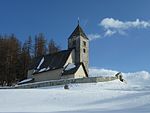
|
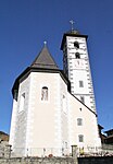
Remigiuskirche | A | 46°47′58″N 9°14′03″E / 46.799358°N 9.234155°E | 2998 | ||
| Falera | 
|
Steinsberg, ruina dal chastè, chaplutta e conturn | B | 2836 | |||
Farera
| Location | Upload | Photo | Object | Cat. | Coordinates | KGS-Nr | |
|---|---|---|---|---|---|---|---|
| Farera | 
|
Reformierte Kirche Cresta Ferrera | B | 46°33′43″N 9°26′52″E / 46.5619°N 9.44775°E | 12445 | ||
| Farera | 
|
Ruinen der Bergbausiedlung (19. Jh.) am Averser Rhein | B | 46°33′39″N 9°26′14″E / 46.560939°N 9.437314°E | 2852 | ||
Favugn
| Location | Upload | Photo | Object | Cat. | Coordinates | KGS-Nr | |
|---|---|---|---|---|---|---|---|
| Favugn | 
|
Reformierte Kirche Felsberg | B | 46°50′43″N 9°28′15″E / 46.84537°N 9.4707°E | 3001 | ||
| Favugn | 
|
Plansiedlung (Struktur) | B | 46°50′51″N 9°28′43″E / 46.84744°N 9.47865°E | 3002 | ||
| Favugn | 
|
Wohnhaus | B | 46°50′43″N 9°28′15″E / 46.84541°N 9.47096°E | 10738 | ||
Ferrera
| Location | Upload | Photo | Object | Cat. | Coordinates | KGS-Nr | |
|---|---|---|---|---|---|---|---|
| Ferrera | Landwasserviadukt | Landwasserviadukt | A | 46°40′51″N 9°40′33″E / 46.680833333°N 9.675833333°E | 10499 | ||
| Ferrera | 
|
Haus Alte Post | B | 46°41′16″N 9°40′20″E / 46.6877°N 9.67215°E | 10787 | ||
| Ferrera | 
|
Katholische Kirche Allerheiligen und Kapelle St. Luzius | B | 46°41′14″N 9°40′27″E / 46.6871°N 9.67423°E | 3247 | ||
Fideris
| Location | Upload | Photo | Object | Cat. | Coordinates | KGS-Nr | |
|---|---|---|---|---|---|---|---|
| Fideris | 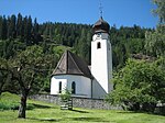
|
Reformierte Kirche | B | 46°54′50″N 9°44′25″E / 46.91387°N 9.7404°E | 3007 | ||
| Fideris | 
|
Türmlihaus | A | 46°54′55″N 9°44′33″E / 46.915333°N 9.742546°E | 3004 | ||
| Fideris | 
|
Wohnhaus Nr. 41 | A | 46°54′58″N 9°44′48″E / 46.916043°N 9.746583°E | 10401 | ||
| Fideris | 
|
Haus Valär (alte Post) | B | 46°54′54″N 9°44′31″E / 46.91497°N 9.74202°E | 3005 | ||
| Fideris | 
|
Haus von Planta (Badwirtschaft) | B | 46°54′53″N 9°44′27″E / 46.91475°N 9.74085°E | 3006 | ||
Filisur
| Location | Upload | Photo | Object | Cat. | Coordinates | KGS-Nr | |
|---|---|---|---|---|---|---|---|
| Filisur | Landwasserviadukt | Landwasserviadukt | A | 46°40′51″N 9°40′33″E / 46.680833333°N 9.675833333°E | 10499 | ||
| Filisur | 
|
Reformierte Kirche | B | 46°40′17″N 9°41′19″E / 46.67125°N 9.68873°E | 3010 | ||
| Filisur | Burg Greifenstein | Burg Greifenstein | A | 46°40′31″N 9°41′31″E / 46.675144°N 9.692035°E | 10488 | ||
| Filisur | 
|
Schmittentobel-Landwasserviadukt der Rhätischen Bahn | A | 46°40′51″N 9°40′34″E / 46.68086°N 9.67606°E | 3009 | ||
| Filisur | 
|
Wohnhaus Nr. 28 | B | 46°40′17″N 9°41′22″E / 46.67151°N 9.6894°E | 10739 | ||
| Filisur | 
|
Wohnhaus Nr. 84 | B | 46°40′23″N 9°41′14″E / 46.67299°N 9.68711°E | 10740 | ||
| Filisur | Bellaluna | Bellaluna | B | 46°39′13″N 9°42′50″E / 46.65369°N 9.71391°E | 12446 | ||
Fläsch
| Location | Upload | Photo | Object | Cat. | Coordinates | KGS-Nr | |
|---|---|---|---|---|---|---|---|
| Fläsch | 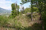
|
Burg Grafenberg | A | 47°02′46″N 9°30′48″E / 47.046035°N 9.513321°E | 10476 | ||
| Fläsch | 
|
Reformierte Kirche | B | 47°01′33″N 9°30′50″E / 47.02581°N 9.51385°E | 3013 | ||
| Fläsch | 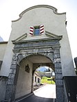
|
Festung Luziensteig | A | 47°02′17″N 9°31′39″E / 47.038082°N 9.527637°E | 3011 | ||
| Fläsch | 
|
Kleine Schanze, Schanze | A | 47°01′46″N 9°31′50″E / 47.029525°N 9.53058°E | 10477 | ||
| Fläsch | 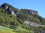
|
Matlusch-Kopf, prähistorische Siedlung | B | 47°01′36″N 9°31′26″E / 47.02668°N 9.52389°E | 3014 | ||
Flem
| Location | Upload | Photo | Object | Cat. | Coordinates | KGS-Nr | |
|---|---|---|---|---|---|---|---|
| Flem | 
|
Hotel Waldhaus | B | 46°49′38″N 9°17′04″E / 46.82722°N 9.28439°E | 3017 | ||
| Flem | 
|
Schlössli Flims | A | 46°50′10″N 9°17′06″E / 46.836178°N 9.284906°E | 3016 | ||
| Flem | 
|
Fidaz, Casa Martin pign | B | 46°50′35″N 9°18′51″E / 46.84297°N 9.31407°E | 10741 | ||
Furna
| Location | Upload | Photo | Object | Cat. | Coordinates | KGS-Nr | |
|---|---|---|---|---|---|---|---|
| Furna | 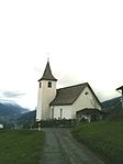
|
Reformierte Kirche | B | 46°56′13″N 9°40′44″E / 46.93696°N 9.67891°E | 10742 | ||
Fürstenau
| Location | Upload | Photo | Object | Cat. | Coordinates | KGS-Nr | |
|---|---|---|---|---|---|---|---|
| Fürstenau | 
|
Schloss Schauenstein | A | 46°43′17″N 9°26′47″E / 46.721263888°N 9.446277777°E | 10044 | ||
| Fürstenau | 
|
Haus Stoffel | A | 46°43′15″N 9°26′47″E / 46.72094°N 9.446396°E | 3020 | ||
| Fürstenau | 
|
Umfassungsmauer | B | 46°43′17″N 9°26′42″E / 46.721337°N 9.444958°E | 10045 | ||
| Fürstenau | 
|
Bischöfliches Schloss Fürstenau | A | 46°43′16″N 9°26′42″E / 46.721077777°N 9.445022222°E | 3019 | ||
Giuvaulta
| Location | Upload | Photo | Object | Cat. | Coordinates | KGS-Nr | |
|---|---|---|---|---|---|---|---|
| Giuvaulta | 
|
Burg Hochjuvalt | A | 46°46′40″N 9°25′15″E / 46.777777777°N 9.420833333°E | 10479 | ||
| Giuvaulta | 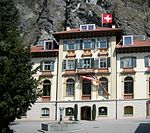
|
Ehemaliges Kurhaus | B | 46°46′12″N 9°25′34″E / 46.770076°N 9.426212°E | 10762 | ||
| Giuvaulta | 
|
Haus Tscharner | B | 46°46′08″N 9°25′36″E / 46.76899°N 9.426578°E | 3183 | ||
Glion
| Location | Upload | Photo | Object | Cat. | Coordinates | KGS-Nr | |
|---|---|---|---|---|---|---|---|
| Glion | 
|
Reformierte Kirche Ilanz | A | 46°46′24″N 9°12′11″E / 46.773198°N 9.203163°E | 3044 | ||
| Glion | 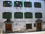
|
Casa Carniec (Museum Regiunal Surselva) | B | 46°46′25″N 9°12′13″E / 46.77373°N 9.20366°E | 3046 | ||
| Glion | 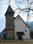
|
Martinskirche | A | 46°46′02″N 9°12′06″E / 46.767285°N 9.201529°E | 3045 | ||
Grono
| Location | Upload | Photo | Object | Cat. | Coordinates | KGS-Nr | |
|---|---|---|---|---|---|---|---|
| Grono | 
|
Torre Fiorenzana | A | 46°15′01″N 9°09′01″E / 46.25023°N 9.150185°E | 3026 | ||
| Grono | 
|
Cappella di S. Remigio | B | 46°15′41″N 9°10′16″E / 46.26145°N 9.17113°E | 3068 | ||
| Grono | 
|
Cappella di S. Rocco e dintorni | B | 46°14′51″N 9°08′42″E / 46.24745°N 9.14513°E | 3022 | ||
| Grono | 
|
Casa | B | 46°16′05″N 9°09′32″E / 46.26819°N 9.15881°E | 10838 | ||
| Grono | 
|
Casa a Marca | B | 46°15′47″N 9°09′49″E / 46.26296°N 9.16369°E | 10748 | ||
| Grono | 
|
Casa Rossa | B | 46°14′52″N 9°08′39″E / 46.24777°N 9.1443°E | 3023 | ||
| Grono | 
|
chiesa c. di S. Clemente e Ossario | B | 46°15′01″N 9°08′50″E / 46.2502°N 9.14716°E | 3025 | ||
| Grono | 
|
chiesa c. di S. Pietro | B | 46°16′06″N 9°09′28″E / 46.26822°N 9.15785°E | 3395 | ||
| Grono | 
|
chiesa p. di SS. Bernardo e Antonio | B | 46°15′45″N 9°09′49″E / 46.26255°N 9.16364°E | 3069 | ||
| Grono | 
|
Lostallo, stalle di Campagna | B | 46°18′12″N 9°11′05″E / 46.30326°N 9.18466°E | 3396 | ||
Grüsch
| Location | Upload | Photo | Object | Cat. | Coordinates | KGS-Nr | |
|---|---|---|---|---|---|---|---|
| Grüsch | 
|
Altes Rathaus | B | 46°58′56″N 9°38′53″E / 46.98212°N 9.64794°E | 3028 | ||
| Grüsch | 
|
Grosshaus | B | 46°58′52″N 9°38′56″E / 46.98122°N 9.64884°E | 12449 | ||
| Grüsch | 
|
Haus zum Rosengarten (Ott) mit Kultarchiv | B | 46°58′56″N 9°38′51″E / 46.98228°N 9.64754°E | 3027 | ||
| Grüsch | 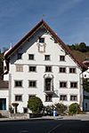
|
Hotel Krone | B | 46°58′55″N 9°38′52″E / 46.98186°N 9.64777°E | 12448 | ||
Guarda
| Location | Upload | Photo | Object | Cat. | Coordinates | KGS-Nr | |
|---|---|---|---|---|---|---|---|
| Guarda | 
|
Reformierte Kirche Giarsun | B | 46°46′11″N 10°08′41″E / 46.769861111°N 10.144861111°E | 10743 | ||
Haldenstein
| Location | Upload | Photo | Object | Cat. | Coordinates | KGS-Nr | |
|---|---|---|---|---|---|---|---|
| Haldenstein | 
|
Burg Grottenstein | B | 46°53′02″N 9°31′22″E / 46.883888888°N 9.522777777°E | 3031 | ||
| Haldenstein | 
|
Burg Haldenstein | A | 46°52′50″N 9°31′24″E / 46.880463°N 9.523337°E | 3032 | ||
| Haldenstein | 
|
Schloss Haldenstein | A | 46°52′42″N 9°31′37″E / 46.878333333°N 9.526944444°E | 3030 | ||
| Haldenstein | 
|
Reformierte Kirche Haldenstein | B | 46°52′44″N 9°31′33″E / 46.87896°N 9.52586°E | 13009 | ||
Ilanz/Glion
| Location | Upload | Photo | Object | Cat. | Coordinates | KGS-Nr | |
|---|---|---|---|---|---|---|---|
| Ilanz/Glion | 
|
Baselgia c. S. Andriu | B | 46°46′42″N 9°09′07″E / 46.77844°N 9.15186°E | 12474 | ||
| Ilanz/Glion | 
|
Baselgia c. S. Tumasch | B | 46°45′55″N 9°13′16″E / 46.76536°N 9.22124°E | 3264 | ||
| Ilanz/Glion | 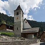
|
Baselgia c. S. Valentin | B | 46°48′32″N 9°07′01″E / 46.80882°N 9.11689°E | 3133 | ||
| Ilanz/Glion | Baselgia catolica Sogn Sein (St. Zeno) | Baselgia catolica Sogn Sein (St. Zeno) | B | 46°47′22″N 9°12′17″E / 46.78955°N 9.20475°E | 10745 | ||
| Ilanz/Glion | 
|
Caplutta S. Clau | B | 46°46′33″N 9°08′57″E / 46.77595°N 9.14915°E | 12475 | ||
| Ilanz/Glion | 
|
Caplutta Sogn Glieci | B | 46°47′24″N 9°10′00″E / 46.79002°N 9.16656°E | 10797 | ||
| Ilanz/Glion | 
|
Caplutta Sontg Maria dallas dolurs | B | 46°48′21″N 9°07′14″E / 46.80582°N 9.12048°E | 10755 | ||
| Ilanz/Glion | 
|
Casa Alva (Unteres Deflorinhaus) | B | 46°46′39″N 9°09′07″E / 46.77758°N 9.15183°E | 10771 | ||
| Ilanz/Glion | 
|
Casa Gronda cun pavillon e iert | B | 46°46′24″N 9°12′13″E / 46.77346°N 9.20356°E | 3047 | ||
| Ilanz/Glion | 
|
Casa Schmid cun porta sur | B | 46°46′21″N 9°12′12″E / 46.7726°N 9.20334°E | 3048 | ||
| Ilanz/Glion | 
|
Chasa Cadalbert | B | 46°45′34″N 9°14′03″E / 46.75932°N 9.23403°E | 3267 | ||
| Ilanz/Glion | Historische Werkstätte Gebrüder Giger (Pflugschmiede) | Historische Werkstätte Gebrüder Giger (Pflugschmiede) | B | 46°46′44″N 9°10′33″E / 46.77892°N 9.17592°E | 12469 | ||
| Ilanz/Glion | 
|
Kath. Pfarrkirche S. Florinus | B | 46°47′27″N 9°09′48″E / 46.7909°N 9.16339°E | 3268 | ||
Jenaz
| Location | Upload | Photo | Object | Cat. | Coordinates | KGS-Nr | |
|---|---|---|---|---|---|---|---|
| Jenaz | 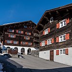
|
Häusergruppe am Platz | B | 46°55′43″N 9°42′51″E / 46.92866°N 9.7141°E | 12465 | ||
Jenins
| Location | Upload | Photo | Object | Cat. | Coordinates | KGS-Nr | |
|---|---|---|---|---|---|---|---|
| Jenins | 
|
Burg Neu-Aspermont | A | 47°00′11″N 9°33′55″E / 47.003055555°N 9.565277777°E | 3051 | ||
| Jenins | 
|
Oberes Haus von Sprecher, mit Garten | B | 47°00′07″N 9°33′31″E / 47.00193°N 9.55857°E | 12393 | ||
| Jenins | 
|
Salishaus | B | 47°00′04″N 9°33′25″E / 47.00108°N 9.55701°E | 12394 | ||
| Jenins | 
|
Unteres Haus von Sprecher, mit Umgebung | B | 47°00′04″N 9°33′24″E / 47.00106°N 9.55657°E | 3052 | ||
Kreis Calanca
| Location | Upload | Photo | Object | Cat. | Coordinates | KGS-Nr | |
|---|---|---|---|---|---|---|---|
| Kreis Calanca | 
|
Sta. Maria | ISOS | 46°15′59″N 9°09′00″E / 46.266388888°N 9.15°E | |||
Kreis Domleschg
| Location | Upload | Photo | Object | Cat. | Coordinates | KGS-Nr | |
|---|---|---|---|---|---|---|---|
| Kreis Domleschg | 
|
Scharons | ISOS | 46°43′05″N 9°27′32″E / 46.718°N 9.4589°E | |||
| Kreis Domleschg | 
|
Fürstenau | ISOS | 46°42′59″N 9°26′00″E / 46.716388888°N 9.433333333°E | |||
| Kreis Domleschg | 
|
Seglias | ISOS | 46°42′00″N 9°26′59″E / 46.7°N 9.449722222°E | |||
Kreis Fünf Dörfer
| Location | Upload | Photo | Object | Cat. | Coordinates | KGS-Nr | |
|---|---|---|---|---|---|---|---|
| Kreis Fünf Dörfer | 
|
Haldenstein | ISOS | 46°52′43″N 9°31′37″E / 46.878611111°N 9.526944444°E | |||
Kreis Ilanz
| Location | Upload | Photo | Object | Cat. | Coordinates | KGS-Nr | |
|---|---|---|---|---|---|---|---|
| Kreis Ilanz | 
|
Glion | ISOS | 46°45′59″N 9°12′00″E / 46.766388888°N 9.2°E | |||
| Kreis Ilanz | 
|
Castrisch | ISOS | 46°45′59″N 9°13′00″E / 46.766388888°N 9.216666666°E | |||
| Kreis Ilanz | 
|
Sagogn | ISOS | 46°47′32″N 9°15′21″E / 46.7922°N 9.2558°E | |||
| Kreis Ilanz | 
|
Luven | ISOS | 46°45′00″N 9°11′00″E / 46.75°N 9.183333333°E | |||
Kreis Jenaz
| Location | Upload | Photo | Object | Cat. | Coordinates | KGS-Nr | |
|---|---|---|---|---|---|---|---|
| Kreis Jenaz | 
|
Fideris | ISOS | 46°53′12″N 9°44′22″E / 46.88658°N 9.73945°E | |||
Kreis Lumnezia/Lugnez
| Location | Upload | Photo | Object | Cat. | Coordinates | KGS-Nr | |
|---|---|---|---|---|---|---|---|
| Kreis Lumnezia/Lugnez | 
|
Duin | ISOS | 46°42′59″N 9°13′00″E / 46.716388888°N 9.216666666°E | |||
Kreis Luzein
| Location | Upload | Photo | Object | Cat. | Coordinates | KGS-Nr | |
|---|---|---|---|---|---|---|---|
| Kreis Luzein | 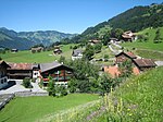
|
Luzein | ISOS | 46°55′11″N 9°46′00″E / 46.9197°N 9.7668°E | |||
Kreis Oberengadin
| Location | Upload | Photo | Object | Cat. | Coordinates | KGS-Nr | |
|---|---|---|---|---|---|---|---|
| Kreis Oberengadin | 
|
S-chanf | ISOS | 46°36′59″N 9°59′00″E / 46.616388888°N 9.983333333°E | |||
| Kreis Oberengadin | 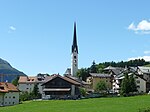
|
Zuoz | ISOS | 46°36′07″N 9°57′35″E / 46.602°N 9.9598°E | |||
| Kreis Oberengadin | 
|
Samedan | ISOS | 46°32′01″N 9°52′19″E / 46.533611111°N 9.871944444°E | |||
| Kreis Oberengadin | 
|
Bever | ISOS | 46°32′59″N 9°52′59″E / 46.549722222°N 9.883055555°E | |||
Kreis Rheinwald
| Location | Upload | Photo | Object | Cat. | Coordinates | KGS-Nr | |
|---|---|---|---|---|---|---|---|
| Kreis Rheinwald | 
|
Spleia | ISOS | 46°32′59″N 9°19′00″E / 46.549722222°N 9.316666666°E | |||
Kreis Roveredo
| Location | Upload | Photo | Object | Cat. | Coordinates | KGS-Nr | |
|---|---|---|---|---|---|---|---|
| Kreis Roveredo | 
|
Roveredo | ISOS | 46°14′05″N 9°07′33″E / 46.2348°N 9.1257°E | |||
| Kreis Roveredo | 
|
San Vittore | ISOS | 46°14′17″N 9°06′22″E / 46.238°N 9.1061°E | |||
| Kreis Roveredo | 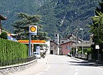
|
Grono | ISOS | 46°14′54″N 9°08′52″E / 46.2482°N 9.1477°E | |||
Kreis Ruis
| Location | Upload | Photo | Object | Cat. | Coordinates | KGS-Nr | |
|---|---|---|---|---|---|---|---|
| Kreis Ruis | 
|
Vuorz | ISOS | 46°46′35″N 9°07′00″E / 46.7764°N 9.1168°E | |||
Kreis Schams
| Location | Upload | Photo | Object | Cat. | Coordinates | KGS-Nr | |
|---|---|---|---|---|---|---|---|
| Kreis Schams | 
|
Andeer | ISOS | 46°36′11″N 9°25′35″E / 46.603°N 9.4264°E | |||
| Kreis Schams | 
|
Lon | ISOS | 46°39′05″N 9°25′39″E / 46.6514°N 9.4276°E | |||
Kreis Schiers
| Location | Upload | Photo | Object | Cat. | Coordinates | KGS-Nr | |
|---|---|---|---|---|---|---|---|
| Kreis Schiers | 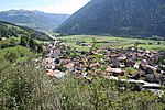
|
Grüsch | ISOS | 46°57′59″N 9°37′59″E / 46.966388888°N 9.633055555°E | |||
Kreis Seewis
| Location | Upload | Photo | Object | Cat. | Coordinates | KGS-Nr | |
|---|---|---|---|---|---|---|---|
| Kreis Seewis | 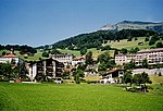
|
Seewis | ISOS | 46°59′25″N 9°38′15″E / 46.990277777°N 9.6375°E | |||
Kreis Trins
| Location | Upload | Photo | Object | Cat. | Coordinates | KGS-Nr | |
|---|---|---|---|---|---|---|---|
| Kreis Trins | 
|
Tumein | ISOS | 46°49′46″N 9°24′24″E / 46.8294°N 9.4066°E | |||
| Kreis Trins | 
|
Favugn | ISOS | 46°49′59″N 9°27′59″E / 46.833055555°N 9.466388888°E | |||
| Kreis Trins | 
|
Flem | ISOS | 46°49′59″N 9°16′59″E / 46.833055555°N 9.283055555°E | |||
Küblis
| Location | Upload | Photo | Object | Cat. | Coordinates | KGS-Nr | |
|---|---|---|---|---|---|---|---|
| Küblis | 
|
Reformierte Kirche Küblis | B | 46°54′51″N 9°46′37″E / 46.91417°N 9.77705°E | 3057 | ||
| Küblis | 
|
Zentrale Küblis der Bündner Kraftwerke | A | 46°54′49″N 9°46′55″E / 46.913662°N 9.781847°E | 9046 | ||
| Küblis | 
|
Schlössli | B | 46°54′53″N 9°46′37″E / 46.91461°N 9.77707°E | 10744 | ||
| Küblis | 
|
Kraftwerk Küblis | ISOS | 46°54′49″N 9°46′55″E / 46.91362°N 9.78201°E | |||
La Punt-Chamues-ch
| Location | Upload | Photo | Object | Cat. | Coordinates | KGS-Nr | |
|---|---|---|---|---|---|---|---|
| La Punt-Chamues-ch | 
|
Reformierte Kirche Chamues-ch | B | 46°34′26″N 9°56′08″E / 46.57394°N 9.93564°E | 3161 | ||
| La Punt-Chamues-ch | 
|
Reformierte Kirche La Punt | B | 46°34′42″N 9°55′28″E / 46.57843°N 9.92437°E | 3162 | ||
| La Punt-Chamues-ch | 
|
Albertini-Häuser Nr. 324/325 | A | 46°34′45″N 9°55′32″E / 46.579233°N 9.925525°E | 3164 | ||
| La Punt-Chamues-ch | 
|
Chesa Merleda | A | 46°34′45″N 9°55′35″E / 46.57924°N 9.926426°E | 3159 | ||
| La Punt-Chamues-ch | 
|
La Punt, Chesa Froriep | B | 46°34′44″N 9°55′31″E / 46.57894°N 9.92517°E | 12398 | ||
| La Punt-Chamues-ch | 
|
La Punt, Chesetta | B | 46°34′44″N 9°55′30″E / 46.57895°N 9.92491°E | 12399 | ||
| La Punt-Chamues-ch | 
|
La Punt, Ches'Ota | B | 46°34′44″N 9°55′29″E / 46.57886°N 9.92484°E | 12400 | ||
| La Punt-Chamues-ch | 
|
Val Chamuera, Acla Serlas | B | 46°32′13″N 9°59′24″E / 46.536824°N 9.990098°E | 13012 | ||
Laax
| Location | Upload | Photo | Object | Cat. | Coordinates | KGS-Nr | |
|---|---|---|---|---|---|---|---|
| Laax | 
|
Baselgia c. SS. Otmar e Giagl cun carner | B | 46°48′18″N 9°15′22″E / 46.80494°N 9.25623°E | 3058 | ||
Landquart
| Location | Upload | Photo | Object | Cat. | Coordinates | KGS-Nr | |
|---|---|---|---|---|---|---|---|
| Landquart | 
|
Reformierte Kirche Igis | B | 46°56′43″N 9°34′18″E / 46.94517°N 9.57157°E | 3043 | ||
| Landquart | 
|
Fabrikantenvilla | B | 46°57′05″N 9°34′03″E / 46.95137°N 9.56742°E | 3042 | ||
| Landquart | 
|
Güterschuppen RhB / SBB | B | 46°58′01″N 9°33′15″E / 46.967°N 9.55417°E | 3040 | ||
| Landquart | 
|
Historisches Rollmaterial der Rhätischen Bahn (15 Fahrzeuge) | B | 46°57′57″N 9°33′21″E / 46.96572°N 9.5557°E | 3038 | ||
| Landquart | 
|
Lokomotiv-Remise | B | 46°57′51″N 9°33′22″E / 46.96409°N 9.55603°E | 12392 | ||
| Landquart | 
|
Schloss Marschlins | A | 46°57′16″N 9°35′04″E / 46.954444444°N 9.584444444°E | 3039 | ||
Langwies
| Location | Upload | Photo | Object | Cat. | Coordinates | KGS-Nr | |
|---|---|---|---|---|---|---|---|
| Langwies | 
|
Langwieser Viadukt | A | 46°49′03″N 9°42′18″E / 46.8175°N 9.705°E | 9075 | ||
Lantsch
| Location | Upload | Photo | Object | Cat. | Coordinates | KGS-Nr | |
|---|---|---|---|---|---|---|---|
| Lantsch | 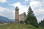
|
Kirche St. Maria | A | 46°40′58″N 9°33′31″E / 46.682713888°N 9.558577777°E | 3061 | ||
| Lantsch | 
|
Kapelle St. Cassian | B | 46°41′45″N 9°33′32″E / 46.69577°N 9.55889°E | 3062 | ||
| Lantsch | 
|
Bot da Loz, colonia preistorica - Eisenzeit | B | 46°40′41″N 9°33′49″E / 46.67815°N 9.56364°E | 3060 | ||
| Lantsch | 
|
Tgeasa La Tor | B | 46°40′59″N 9°33′42″E / 46.683°N 9.56167°E | 10747 | ||
| Lantsch | 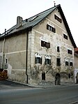
|
Tgesa Amilcar (ehem. Beeli v. Belfort) | B | 46°41′02″N 9°33′51″E / 46.6839°N 9.56415°E | 3063 | ||
| Lantsch | 
|
Antoniuskirche Lantsch/Lenz | B | 46°40′59″N 9°33′45″E / 46.682972222°N 9.562527777°E | 10746 | ||
Lavin
| Location | Upload | Photo | Object | Cat. | Coordinates | KGS-Nr | |
|---|---|---|---|---|---|---|---|
| Lavin | 
|
Gonda (Lavin) | A | 46°46′24″N 10°07′33″E / 46.77329°N 10.125944°E | 3067 | ||
| Lavin | 
|
Reformierte Kirche Lavin | B | 46°46′13″N 10°06′48″E / 46.77017°N 10.1132°E | 3064 | ||
Lon
| Location | Upload | Photo | Object | Cat. | Coordinates | KGS-Nr | |
|---|---|---|---|---|---|---|---|
| Lon | 
|
Reformierte Kirche Lohn | B | 46°39′03″N 9°25′37″E / 46.650833°N 9.426944°E | 3070 | ||
Lostallo
| Location | Upload | Photo | Object | Cat. | Coordinates | KGS-Nr | |
|---|---|---|---|---|---|---|---|
| Lostallo | 
|
Reformierte Kirche San Giorgio | B | 46°20′47″N 9°36′01″E / 46.3464°N 9.60014°E | 3072 | ||
| Lostallo | 
|
Cabbiolo, cappella di S. Nicolao e casa parrocchiale | B | 46°19′45″N 9°12′16″E / 46.32923°N 9.20433°E | 3071 | ||
Lumnezia
Luzein
| Location | Upload | Photo | Object | Cat. | Coordinates | KGS-Nr | |
|---|---|---|---|---|---|---|---|
| Luzein | 
|
Putz | ISOS | 46°55′32″N 9°44′38″E / 46.9255°N 9.7439°E | |||
| Luzein | 
|
Burg Castels | A | 46°55′29″N 9°44′42″E / 46.924713°N 9.745064°E | 10489 | ||
| Luzein | 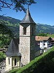
|
Reformierte Kirche Luzein | B | 46°55′09″N 9°46′03″E / 46.91922°N 9.76742°E | 3081 | ||
| Luzein | 
|
Haus mit Stallscheune | A | 46°57′39″N 9°48′38″E / 46.960822°N 9.81055°E | 10405 | ||
| Luzein | 
|
Sprecher-Haus | A | 46°55′16″N 9°45′52″E / 46.921173°N 9.764351°E | 3080 | ||
| Luzein | 
|
Dörrhaus | B | 46°55′17″N 9°45′48″E / 46.92146°N 9.76344°E | 12467 | ||
| Luzein | 
|
Grosshus | B | 46°55′17″N 9°45′49″E / 46.92125°N 9.76353°E | 12466 | ||
| Luzein | 
|
Putz, Haus Nebel | B | 46°55′32″N 9°44′27″E / 46.92559°N 9.74095°E | 13013 | ||
Madulain
| Location | Upload | Photo | Object | Cat. | Coordinates | KGS-Nr | |
|---|---|---|---|---|---|---|---|
| Madulain | 
|
Reformierte Kirche Madulain | B | 46°35′08″N 9°56′13″E / 46.58544°N 9.93683°E | 10750 | ||
| Madulain | 
|
Chesa Surova cun stalla e tablà | B | 46°35′08″N 9°56′10″E / 46.58545°N 9.93618°E | 10751 | ||
Maiavilla
| Location | Upload | Photo | Object | Cat. | Coordinates | KGS-Nr | |
|---|---|---|---|---|---|---|---|
| Maiavilla | 
|
Schloss Salenegg | A | 47°00′38″N 9°31′43″E / 47.010637°N 9.52862°E | 3085 | ||
| Maiavilla | 
|
Schloss Brandis | A | 47°00′23″N 9°31′51″E / 47.006394°N 9.530862°E | 3084 | ||
| Maiavilla | 
|
Marschall-Haus (Brügger-Salis) | B | 47°00′32″N 9°31′45″E / 47.00885°N 9.52925°E | 3087 | ||
| Maiavilla | 
|
Sprecher-Haus (ehem. Brügger) | B | 47°00′28″N 9°31′53″E / 47.00773°N 9.53144°E | 3089 | ||
| Maiavilla | St. Luzisteig, evang. Steigkirche mit Steighof und Suste | St. Luzisteig, evang. Steigkirche mit Steighof und Suste | B | 47°01′46″N 9°31′41″E / 47.02957°N 9.52795°E | 12451 | ||
| Maiavilla | 
|
Torkel Tobias Kuoni | B | 47°00′27″N 9°31′52″E / 47.00756°N 9.53104°E | 3091 | ||
| Maiavilla | 
|
Valentinshaus | B | 47°00′22″N 9°31′56″E / 47.0062°N 9.53235°E | 3092 | ||
| Maiavilla | 
|
Amanduskirche (Maienfeld) | B | 47°00′28″N 9°31′53″E / 47.00791°N 9.53145°E | 3088 | ||
Maienfeld
| Location | Upload | Photo | Object | Cat. | Coordinates | KGS-Nr | |
|---|---|---|---|---|---|---|---|
| Maienfeld | 
|
Festung St. Luzisteig | ISOS | 47°01′47″N 9°31′42″E / 47.0297°N 9.5282°E | |||
Maladers
| Location | Upload | Photo | Object | Cat. | Coordinates | KGS-Nr | |
|---|---|---|---|---|---|---|---|
| Maladers | 
|
Turm Bramberg, Haus Nr. 64 | B | 46°50′13″N 9°33′37″E / 46.83704°N 9.5604°E | 3093 | ||
Malans
| Location | Upload | Photo | Object | Cat. | Coordinates | KGS-Nr | |
|---|---|---|---|---|---|---|---|
| Malans | 
|
Reformierte Kirche Malans | B | 46°58′54″N 9°34′27″E / 46.98178°N 9.57425°E | 3097 | ||
| Malans | 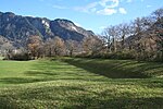
|
Rohanschanze | A | 46°58′31″N 9°33′30″E / 46.975158333°N 9.558383333°E | 10478 | ||
| Malans | 
|
Haus Studach | B | 46°58′53″N 9°34′29″E / 46.98148°N 9.57486°E | 12453 | ||
| Malans | 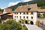
|
Haus von Moos | B | 46°58′58″N 9°34′38″E / 46.98286°N 9.57728°E | 12454 | ||
| Malans | 
|
Plantahaus (Heldstab) | B | 46°58′55″N 9°34′34″E / 46.98189°N 9.57612°E | 12452 | ||
| Malans | 
|
Turmhaus | B | 46°58′57″N 9°34′32″E / 46.9826°N 9.57543°E | 3098 | ||
| Malans | 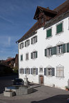
|
Unteres Plantahaus (Hartmann) | B | 46°58′54″N 9°34′35″E / 46.98162°N 9.57631°E | 3096 | ||
| Malans | 
|
Bothmar Castle | A | 46°59′08″N 9°34′33″E / 46.985444°N 9.575831°E | 3095 | ||
Malögia
| Location | Upload | Photo | Object | Cat. | Coordinates | KGS-Nr | |
|---|---|---|---|---|---|---|---|
| Malögia | 
|
Chapella | B | 46°37′45″N 10°00′26″E / 46.629166666°N 10.007222222°E | 3231 | ||
| Malögia | 
|
Maloja Palace | B | 46°24′22″N 9°42′01″E / 46.406111111°N 9.700277777°E | 3318 | ||
| Malögia | 
|
Pass dal Güglia | A | 46°28′20″N 9°43′41″E / 46.47222°N 9.72793°E | 2873 | ||
Masagn
| Location | Upload | Photo | Object | Cat. | Coordinates | KGS-Nr | |
|---|---|---|---|---|---|---|---|
| Masagn | 
|
Reformierte Kirche Masein | B | 46°42′18″N 9°25′37″E / 46.704943°N 9.426952°E | 3100 | ||
| Masagn | 
|
Schloss Tagstein mit Umgebung | B | 46°42′16″N 9°25′59″E / 46.704541°N 9.432954°E | 3101 | ||
Maton
| Location | Upload | Photo | Object | Cat. | Coordinates | KGS-Nr | |
|---|---|---|---|---|---|---|---|
| Maton | 
|
Reformierte Kirche Mathon | B | 46°38′10″N 9°24′55″E / 46.636189°N 9.415407°E | 3102 | ||
| Maton | 
|
Antoniuskirche | B | 46°38′10″N 9°25′02″E / 46.635979°N 9.417098°E | 3103 | ||
Medel/Lucmagn
| Location | Upload | Photo | Object | Cat. | Coordinates | KGS-Nr | |
|---|---|---|---|---|---|---|---|
| Medel/Lucmagn | 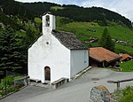
|
Kapelle St. Rochus Pardé | B | 46°39′07″N 8°51′01″E / 46.651836111°N 8.850141666°E | 3107 | ||
| Medel/Lucmagn | 
|
Casa cun picturas da preit | B | 46°40′28″N 8°51′28″E / 46.67433°N 8.85772°E | 3104 | ||
| Medel/Lucmagn | 
|
Chaplutta S. Giagl | B | 46°36′30″N 8°49′04″E / 46.60828°N 8.81787°E | 3105 | ||
| Medel/Lucmagn | 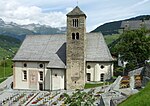
|
Platta, baselgia c. S. Martin | B | 46°39′30″N 8°51′15″E / 46.65822°N 8.85403°E | 3108 | ||
| Medel/Lucmagn | 
|
Curaglia | ISOS | 46°40′24″N 8°51′28″E / 46.6733°N 8.8577°E | |||
Mesocco
| Location | Upload | Photo | Object | Cat. | Coordinates | KGS-Nr | |
|---|---|---|---|---|---|---|---|
| Mesocco | 
|
Santa Maria del Castello | A | 46°22′52″N 9°13′59″E / 46.381°N 9.23302°E | 3110 | ||
| Mesocco | 
|
Casa a Marca di Sotto, mit Garten | B | 46°23′25″N 9°14′01″E / 46.39019°N 9.23349°E | 13014 | ||
| Mesocco | 
|
Case a Marca di Sopra, mit Garten | B | 46°23′25″N 9°13′59″E / 46.39015°N 9.23305°E | 3112 | ||
| Mesocco | 
|
chiesa cattolica di S. Pietro | B | 46°23′18″N 9°13′58″E / 46.38844°N 9.23278°E | 3113 | ||
| Mesocco | San Bernardino, Baltistero di San Bernardino (15 Jh.) | San Bernardino, Baltistero di San Bernardino (15 Jh.) | B | 46°27′48″N 9°11′32″E / 46.46323°N 9.19234°E | 3114 | ||
| Mesocco | San Bernardino, Chiesa Rotonda di San Bernardino (1867) | San Bernardino, Chiesa Rotonda di San Bernardino (1867) | B | 46°27′46″N 9°11′32″E / 46.46285°N 9.19236°E | 12456 | ||
| Mesocco | 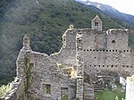
|
Castello di Mesocco | A | 46°22′50″N 9°13′59″E / 46.380512°N 9.233171°E | 3109 | ||
| Mesocco | 
|
Mesocco | ISOS | 46°23′35″N 9°13′58″E / 46.393°N 9.2328°E | |||
Mon
| Location | Upload | Photo | Object | Cat. | Coordinates | KGS-Nr | |
|---|---|---|---|---|---|---|---|
| Mon | 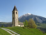
|
St. Cosmas e Damian | B | 46°39′03″N 9°34′04″E / 46.65081°N 9.56779°E | 3116 | ||
Murmarera
| Location | Upload | Photo | Object | Cat. | Coordinates | KGS-Nr | |
|---|---|---|---|---|---|---|---|
| Murmarera | Burg Marmels | Burg Marmels | B | 46°30′25″N 9°37′39″E / 46.50686°N 9.62742°E | 3099 | ||
Mustér
Mut
| Location | Upload | Photo | Object | Cat. | Coordinates | KGS-Nr | |
|---|---|---|---|---|---|---|---|
| Mut | 
|
Reformierte Kirche Obermutten | B | 46°40′19″N 9°29′01″E / 46.67206°N 9.48352°E | 10047 | ||
Mutten
| Location | Upload | Photo | Object | Cat. | Coordinates | KGS-Nr | |
|---|---|---|---|---|---|---|---|
| Mutten | 
|
Obermutten | ISOS | 46°40′20″N 9°29′02″E / 46.6723°N 9.48402°E | |||
Obersaxen Mundaun
| Location | Upload | Photo | Object | Cat. | Coordinates | KGS-Nr | |
|---|---|---|---|---|---|---|---|
| Obersaxen Mundaun | 
|
Baselgia catolica Sogn Gieri | B | 46°45′28″N 9°08′38″E / 46.75781°N 9.14401°E | 10815 | ||
