Commons:Wiki Loves Monuments in Switzerland/Fribourg/G-M
Jump to navigation
Jump to search
Gibloux
| Location | Upload | Photo | Object | Cat. | Coordinates | KGS-Nr | |
|---|---|---|---|---|---|---|---|
| Gibloux | 
|
église Saint-Vincent de Farvagny-le-Grand | A | 46°43′19″N 7°03′58″E / 46.721944444°N 7.066111111°E | 2061 | ||
| Gibloux | 
|
chapelle Notre-Dame des Ermites de Montban | B | 46°43′21″N 7°03′56″E / 46.722529°N 7.0655775°E | 13069 | ||
| Gibloux | 
|
chapelle Saint-Claude | B | 46°43′43″N 7°04′21″E / 46.728489°N 7.0726005°E | 13366 | ||
| Gibloux | 
|
Cure | B | 46°44′40″N 7°05′53″E / 46.7443234°N 7.0981389°E | 13035 | ||
| Gibloux | 
|
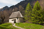
église Saint-Jean-l'Evangéliste | B | 46°42′28″N 7°03′12″E / 46.707807°N 7.053217°E | 13357 | ||
| Gibloux | 
|
Estavayer-le-Gibloux, Eglise Saint-Clément | B | 46°43′19″N 7°01′30″E / 46.72203°N 7.025136°E | 2030 | ||
| Gibloux | 
|
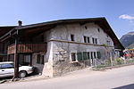
Ferme | B | 46°42′23″N 7°03′06″E / 46.706327°N 7.051724°E | 13359 | ||
| Gibloux | 
|
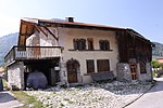
Ferme | B | 46°42′12″N 7°03′07″E / 46.703395°N 7.051876°E | 13360 | ||
| Gibloux | 
|
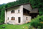
Ferme | B | 46°42′27″N 7°03′12″E / 46.707421°N 7.053416°E | 13358 | ||
| Gibloux | 
|
Praz Gady, habitation 33 (1592) | B | 46°42′38″N 7°03′28″E / 46.710494°N 7.057749°E | 2360 | ||
Giffers
| Location | Upload | Photo | Object | Cat. | Coordinates | KGS-Nr | |
|---|---|---|---|---|---|---|---|
| Giffers | 
|
Ferme | B | 46°44′37″N 7°14′16″E / 46.743527°N 7.237692°E | 13181 | ||
| Giffers | 
|
Ferme | B | 46°45′33″N 7°12′40″E / 46.75903°N 7.2110105°E | 13182 | ||
| Giffers | 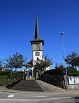
|
Pfarrkirche St. Tiburtius | B | 46°45′40″N 7°12′38″E / 46.760981°N 7.210662°E | 13183 | ||
Givisiez
| Location | Upload | Photo | Object | Cat. | Coordinates | KGS-Nr | |
|---|---|---|---|---|---|---|---|
| Givisiez | 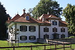
|
Manoir d'Affry et atelier de la sculptrice Marcello | A | 46°48′47″N 7°07′41″E / 46.812942°N 7.128171°E | 2179 | ||
| Givisiez | 
|
Bureau des autoroutes | B | 46°48′44″N 7°08′15″E / 46.812131°N 7.137635°E | 13184 | ||
| Givisiez | 
|
Château d'Affry (1539, 1644) | B | 46°48′46″N 7°07′41″E / 46.812852°N 7.128105°E | 2178 | ||
| Givisiez | 
|
église Saint-Laurent | B | 46°48′44″N 7°07′36″E / 46.812236°N 7.126537°E | 13185 | ||
| Givisiez | 
|
Manoir de Boccard | B | 46°48′44″N 7°07′32″E / 46.812206°N 7.1255675°E | 13186 | ||
| Givisiez | 
|
Pensionnat International de la Chassote | B | 46°48′40″N 7°08′16″E / 46.81124°N 7.137758°E | 13187 | ||
Gletterens
| Location | Upload | Photo | Object | Cat. | Coordinates | KGS-Nr | |
|---|---|---|---|---|---|---|---|
| Gletterens | 
|
Château | B | 46°53′50″N 6°56′05″E / 46.897116°N 6.934852°E | 13188 | ||
| Gletterens | 
|
Ferme | B | 46°53′50″N 6°56′05″E / 46.897258°N 6.9345885°E | 13189 | ||
Grandvillard
Granges
| Location | Upload | Photo | Object | Cat. | Coordinates | KGS-Nr | |
|---|---|---|---|---|---|---|---|
| Granges | 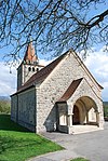
|
chapelle Saint-Nicolas | B | 46°31′29″N 6°49′52″E / 46.524675°N 6.831205°E | 13196 | ||
Granges-Paccot
| Location | Upload | Photo | Object | Cat. | Coordinates | KGS-Nr | |
|---|---|---|---|---|---|---|---|
| Granges-Paccot | 
|
viaduc de Grandfey | A | 46°49′35″N 7°10′05″E / 46.8265°N 7.168°E | 9076 | ||
| Granges-Paccot | 
|
Maison de campagne d'Epinay | B | 46°49′16″N 7°09′45″E / 46.821009°N 7.162549°E | 13197 | ||
| Granges-Paccot | 
|
Manoir de Reynold | B | 46°49′24″N 7°09′15″E / 46.823237°N 7.154125°E | 13198 | ||
Grangettes
| Location | Upload | Photo | Object | Cat. | Coordinates | KGS-Nr | |
|---|---|---|---|---|---|---|---|
| Grangettes | 
|
église St-Maurice | B | 46°40′35″N 6°57′53″E / 46.676448°N 6.964765°E | 2188 | ||
Greng
| Location | Upload | Photo | Object | Cat. | Coordinates | KGS-Nr | |
|---|---|---|---|---|---|---|---|
| Greng | 
|
Grengspitz, station lacustre | A | 9598 | |||
| Greng | 
|
Turmspeicher | A | 46°55′14″N 7°05′40″E / 46.920673°N 7.094568°E | 9970 | ||
| Greng | 
|
Herrenhaus (Greng) | B | 46°54′38″N 7°05′39″E / 46.910624°N 7.094121°E | 13199 | ||
Corbières
| Location | Upload | Photo | Object | Cat. | Coordinates | KGS-Nr | |
|---|---|---|---|---|---|---|---|
| Corbières | 
|
Corbières | ISOS | 46°40′00″N 7°06′00″E / 46.666666666°N 7.1°E | |||
Grolley
| Location | Upload | Photo | Object | Cat. | Coordinates | KGS-Nr | |
|---|---|---|---|---|---|---|---|
| Grolley | 
|
Ateliers du réparation, PAA | B | 46°49′48″N 7°03′07″E / 46.829891°N 7.051989°E | 9971 | ||
| Grolley | 
|
Maison de Campagne de Nicolas Kern à Rosière | B | 46°49′52″N 7°05′02″E / 46.831146°N 7.08396°E | 13200 | ||
| Grolley | 
|
Manoir de Chollet | B | 46°50′00″N 7°04′20″E / 46.833394°N 7.072241°E | 2190 | ||
| Grolley | 
|
Silo | B | 46°49′51″N 7°03′28″E / 46.830756°N 7.057684°E | 13201 | ||
Gruyères
| Location | Upload | Photo | Object | Cat. | Coordinates | KGS-Nr | |
|---|---|---|---|---|---|---|---|
| Gruyères | [[File:|150x150px|Château de Gruyères]] | Château de Gruyères | A | 46°35′05″N 7°05′03″E / 46.58466°N 7.08406°E | 8689 | ||
| Gruyères | 
|
Ancienne Chartreuse de la Part-Dieu | A | 46°35′49″N 7°01′01″E / 46.597005°N 7.016909°E | 2196 | ||
| Gruyères | 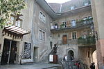
|
Château Saint-Germain | A | 46°35′03″N 7°04′57″E / 46.58405°N 7.082402°E | 2198 | ||
| Gruyères | 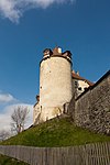
|
Fortifications (Murs de la ville, Tour Chupya-Bârba, Charrière des Morts, Belluard) | A | 46°34′59″N 7°04′52″E / 46.582967°N 7.081156°E | 2194 | ||
| Gruyères | 
|
Grange du Laviau | A | 46°34′49″N 7°04′59″E / 46.5804°N 7.083143°E | 9972 | ||
| Gruyères | 
|
Habitation Rue du Bourg 39 | A | 46°35′02″N 7°04′53″E / 46.583858°N 7.081438°E | 9477 | ||
| Gruyères | 
|
Habitation Rue du Bourg 7 | A | 46°35′00″N 7°04′50″E / 46.583271°N 7.080502°E | 9476 | ||
| Gruyères | 
|
Maison dite de Chalamala | A | 46°35′03″N 7°04′54″E / 46.584093°N 7.081723°E | 2193 | ||
| Gruyères | 
|
Alpage de La Chaux (1827) | B | 46°33′45″N 7°02′05″E / 46.562517°N 7.034638°E | 2195 | ||
| Gruyères | 
|
Anc. Institut des Sourds-Muets | B | 46°35′03″N 7°04′58″E / 46.584186°N 7.0826465°E | 13202 | ||
| Gruyères | 
|
Chalet d'alpage | B | 46°34′19″N 7°03′09″E / 46.571916°N 7.052439°E | 13204 | ||
| Gruyères | 
|
Chalet d'alpage | B | 46°35′34″N 7°09′22″E / 46.59275°N 7.156005°E | 13203 | ||
| Gruyères | 
|
Chalet des Enfants derrière la Fonjalla | B | 46°34′55″N 7°04′09″E / 46.58192°N 7.06917°E | 13205 | ||
| Gruyères | 
|
chapelle de la Salette de Bouleyres | B | 46°36′08″N 7°05′31″E / 46.60236°N 7.092002°E | 13206 | ||
| Gruyères | 
|
chapelle Saint-Anne, Epagny | B | 46°35′17″N 7°05′07″E / 46.588099°N 7.085361°E | 13207 | ||
| Gruyères | 
|
Château du Clos Muré | B | 46°35′01″N 7°04′28″E / 46.583701°N 7.074456°E | 13208 | ||
| Gruyères | 
|
Châtelet de Sparre | B | 46°34′50″N 7°05′56″E / 46.580548°N 7.099004°E | 13209 | ||
| Gruyères | 
|
Eglise Saint-Théodule | B | 46°35′01″N 7°05′00″E / 46.583559°N 7.083342°E | 9452 | ||
| Gruyères | 
|
Ferme de la Part-Dieu | B | 46°35′51″N 7°00′59″E / 46.597363°N 7.016277°E | 13024 | ||
| Gruyères | 
|
Pont-qui-Branle | B | 46°35′01″N 7°05′38″E / 46.583582°N 7.093845°E | 2201 | ||
| Gruyères | 
|
château de Gruyères | A | 46°35′05″N 7°05′02″E / 46.584819444°N 7.083988888°E | 2192 | ||
| Gruyères | 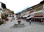
|
Greyerz | ISOS | 46°35′01″N 7°04′55″E / 46.583611°N 7.081944°E | |||
Guin
Haut-Intyamon
| Location | Upload | Photo | Object | Cat. | Coordinates | KGS-Nr | |
|---|---|---|---|---|---|---|---|
| Haut-Intyamon | 
|
Montbovon | ISOS | 46°29′14″N 7°02′34″E / 46.48722°N 7.04278°E | |||
| Haut-Intyamon | 
|
Neirivue | ISOS | 46°31′34″N 7°03′30″E / 46.52611°N 7.05833°E | |||
| Haut-Intyamon | 
|
Chalet d'alpage, Albeuve | A | 46°29′54″N 6°59′48″E / 46.498272°N 6.996534°E | 1929 | ||
| Haut-Intyamon | 
|
Ferme, Montbovon | A | 46°29′29″N 7°02′57″E / 46.491493°N 7.049133°E | 9976 | ||
| Haut-Intyamon | 
|
Fontaine, Lessoc | A | 46°30′17″N 7°03′44″E / 46.50485°N 7.06213°E | 2217 | ||
| Haut-Intyamon | 
|
Maison de François Fracheboud, Lessoc | A | 46°30′16″N 7°03′45″E / 46.50442°N 7.062511°E | 9977 | ||
| Haut-Intyamon | 
|
Montbovon, Ancienne Auberge de la Croix-Blanche | A | 46°29′17″N 7°02′42″E / 46.488096°N 7.044976°E | 2236 | ||
| Haut-Intyamon | 
|
Allières, pont en pierre sur l'Hongrin | B | 46°28′33″N 7°01′05″E / 46.475936°N 7.018111°E | 2235 | ||
| Haut-Intyamon | 
|
chapelle du Saint-Esprit aux Sciernes d'Albeuve | B | 46°29′49″N 7°02′07″E / 46.496815°N 7.035325°E | 13029 | ||
| Haut-Intyamon | 
|
chapelle Notre-Dame des Neiges au Buth | B | 46°30′21″N 7°03′46″E / 46.505779°N 7.062683°E | 2218 | ||
| Haut-Intyamon | 
|
église Notre-Dame de l'Assomption | B | 46°31′00″N 7°03′21″E / 46.516722°N 7.055923°E | 13030 | ||
| Haut-Intyamon | [[File:|150x150px|église Saint-Martin]] | église Saint-Martin | B | 46°30′20″N 7°03′45″E / 46.505661°N 7.062476°E | 9975 | ||
| Haut-Intyamon | 
|
Pont couvert (1667) sur la Sarine | B | 46°29′48″N 7°03′07″E / 46.49655°N 7.052079°E | 2219 | ||
| Haut-Intyamon | 
|
Pont en pierre sur l'Hongrin | B | 46°29′41″N 7°03′04″E / 46.49472°N 7.05113°E | 2238 | ||
| Haut-Intyamon | 
|
Préventorium et chapelle du Raosaire aux Sciernes d'Albeuve | B | 46°29′44″N 7°02′19″E / 46.495558°N 7.038604°E | 13211 | ||
| Haut-Intyamon | 
|
Vers-les-Morets (1651), maison no 38 | B | 46°29′03″N 7°02′20″E / 46.484053°N 7.038832°E | 2239 | ||
| Haut-Intyamon | 
|
Lessoc | ISOS | 46°30′17″N 7°03′44″E / 46.50484°N 7.06212°E | |||
Hauterive
| Location | Upload | Photo | Object | Cat. | Coordinates | KGS-Nr | |
|---|---|---|---|---|---|---|---|
| Hauterive | 
|
chapelle votive du Sacré-Coeur | A | 46°45′44″N 7°05′42″E / 46.762345°N 7.094886°E | 2275 | ||
| Hauterive | 
|
Châtillon-sur-Glâne, station de l'âge du fer | A | 46°46′59″N 7°07′38″E / 46.783164°N 7.127098°E | 2272 | ||
| Hauterive | 
|
Pont de la Glâne (cf. Villars-sur-Glâne/FR) | A | 46°47′06″N 7°07′35″E / 46.784924478°N 7.126262785°E | 10501 | ||
| Hauterive | 
|
pont et chapelle de Sainte-Apolline | A | 46°47′03″N 7°06′59″E / 46.784304°N 7.116497°E | 10500 | ||
| Hauterive | 
|
pont et chapelle de Sainte-Apolline | A | 46°47′03″N 7°06′59″E / 46.784304°N 7.116497°E | 2274 | ||
| Hauterive | 
|
Aérodrome Ecuvillens, Escadrille Oldtimers de l'Aérotique | B | 46°45′16″N 7°04′34″E / 46.754407°N 7.076089°E | 11112 | ||
| Hauterive | 
|
chapelle Notre-Dame Auxiliatrice | B | 46°46′30″N 7°05′52″E / 46.774912°N 7.097712°E | 13027 | ||
| Hauterive | 
|
Ferme | B | 46°45′38″N 7°05′45″E / 46.760666°N 7.095931°E | 13028 | ||
| Hauterive | 
|
Les Muéses, ferme 2 (env. 1800) et chapelle (1675) | B | 46°46′31″N 7°05′52″E / 46.775226°N 7.097671°E | 2276 | ||
| Hauterive | 
|
Hauterive | ISOS | 46°46′00″N 7°07′00″E / 46.766666666°N 7.116666666°E | |||
Hauteville
| Location | Upload | Photo | Object | Cat. | Coordinates | KGS-Nr | |
|---|---|---|---|---|---|---|---|
| Hauteville | 
|
Ferme | A | 46°40′13″N 7°06′17″E / 46.67017°N 7.104716°E | 9974 | ||
Heitenried
| Location | Upload | Photo | Object | Cat. | Coordinates | KGS-Nr | |
|---|---|---|---|---|---|---|---|
| Heitenried | 
|
Pfarrkirche St. Michael | A | 46°49′39″N 7°18′01″E / 46.827564°N 7.300186°E | 2204 | ||
| Heitenried | 
|
Kapelle St. Joseph | B | 46°49′55″N 7°19′31″E / 46.832037°N 7.325403°E | 13223 | ||
Jaun
Corbières
| Location | Upload | Photo | Object | Cat. | Coordinates | KGS-Nr | |
|---|---|---|---|---|---|---|---|
| Corbières | 
|
Villarvolard | ISOS | 46°39′N 7°06′E / 46.65°N 7.1°E | |||
Kerzers
| Location | Upload | Photo | Object | Cat. | Coordinates | KGS-Nr | |
|---|---|---|---|---|---|---|---|
| Kerzers | 
|
Kerzers | ISOS | 46°59′00″N 7°12′00″E / 46.983333333°N 7.2°E | |||
La Brillaz
| Location | Upload | Photo | Object | Cat. | Coordinates | KGS-Nr | |
|---|---|---|---|---|---|---|---|
| La Brillaz | 
|
église Saint-André | B | 46°46′33″N 7°02′22″E / 46.775865°N 7.039466°E | 13234 | ||
La Roche
| Location | Upload | Photo | Object | Cat. | Coordinates | KGS-Nr | |
|---|---|---|---|---|---|---|---|
| La Roche | 
|
Ferme | A | 46°42′12″N 7°08′54″E / 46.703394°N 7.148428°E | 2292 | ||
| La Roche | 
|
église Notre-Dame de l'Assomption | B | 46°41′42″N 7°08′05″E / 46.695118°N 7.134601°E | 2290 | ||
| La Roche | 
|
Scherwyl, ferme 25 (1662) | B | 46°41′47″N 7°08′21″E / 46.696389°N 7.139157°E | 2291 | ||
La Sonnaz
| Location | Upload | Photo | Object | Cat. | Coordinates | KGS-Nr | |
|---|---|---|---|---|---|---|---|
| La Sonnaz | 
|
Grenier | B | 46°50′05″N 7°08′04″E / 46.834836°N 7.134401°E | 13235 | ||
| La Sonnaz | 
|
Grenier | B | 46°50′19″N 7°06′54″E / 46.838722°N 7.114874°E | 13236 | ||
La Verrerie
| Location | Upload | Photo | Object | Cat. | Coordinates | KGS-Nr | |
|---|---|---|---|---|---|---|---|
| La Verrerie | 
|
Le Crêt, Église St-Loup | A | 46°36′32″N 6°54′36″E / 46.609026°N 6.909985°E | 2006 | ||
Le Mouret
Les Montets
| Location | Upload | Photo | Object | Cat. | Coordinates | KGS-Nr | |
|---|---|---|---|---|---|---|---|
| Les Montets | 
|
église paroissiale de la Sainte-Trinité, Montet | A | 46°48′58″N 6°52′07″E / 46.815997°N 6.868744°E | 2242 | ||
| Les Montets | 
|
Ferme | B | 13251 | |||
| Les Montets | 
|
Ferme | B | 46°47′45″N 6°50′48″E / 46.795825°N 6.846703°E | 13252 | ||
Marly
| Location | Upload | Photo | Object | Cat. | Coordinates | KGS-Nr | |
|---|---|---|---|---|---|---|---|
| Marly | 
|
Centre de recherches et laboratoires de la Ciba | B | 46°46′35″N 7°08′58″E / 46.776431°N 7.149396°E | 13254 | ||
| Marly | 
|
chapelle de la Sainte Famille | B | 46°46′45″N 7°08′46″E / 46.779265°N 7.146108°E | 13255 | ||
| Marly | 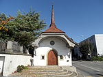
|
chapelle Saint-Sébastien | B | 46°46′36″N 7°09′41″E / 46.776785°N 7.161467°E | 2221 | ||
| Marly | 
|
Château du Petit-Marly, dit Maison Carry | B | 46°46′46″N 7°08′48″E / 46.779374°N 7.146578°E | 13256 | ||
| Marly | 
|
Cure | B | 46°46′30″N 7°09′34″E / 46.774909°N 7.15946°E | 13257 | ||
| Marly | 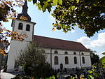
|
église Saints-Pierre-et-Paul | B | 46°46′30″N 7°09′31″E / 46.774979°N 7.1587°E | 13258 | ||
| Marly | 
|
Ferme du Pré aux Moines | B | 46°46′26″N 7°09′05″E / 46.773872°N 7.151269°E | 13259 | ||
| Marly | 
|
Manoir de Weck dit Château des Epinettes | B | 46°46′32″N 7°09′28″E / 46.775688°N 7.157911°E | 13260 | ||
Marsens
| Location | Upload | Photo | Object | Cat. | Coordinates | KGS-Nr | |
|---|---|---|---|---|---|---|---|
| Marsens | 
|
Vuippens | ISOS | 46°39′36″N 7°04′30″E / 46.66°N 7.075°E | |||
| Marsens | 
|
chapelle Saint-Ignace | A | 46°39′20″N 7°03′53″E / 46.655635°N 7.064799°E | 2223 | ||
| Marsens | 
|
Vuippens, Ferme Philiponna | A | 46°39′34″N 7°04′23″E / 46.659386°N 7.072939°E | 10007 | ||
| Marsens | 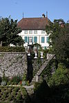
|
Château de Boccard (16e s.) | B | 46°39′30″N 7°04′41″E / 46.658323°N 7.078042°E | 2352 | ||
| Marsens | 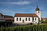
|
église Saint Sulpice (1791) | B | 46°39′32″N 7°04′22″E / 46.658864°N 7.072812°E | 2353 | ||
| Marsens | 
|
Etablissement hospitalier | B | 46°39′21″N 7°04′02″E / 46.655958°N 7.067109°E | 13263 | ||
| Marsens | 
|
Ferme | B | 46°39′18″N 7°03′39″E / 46.654992°N 7.060819°E | 13271 | ||
| Marsens | 
|
Château baillival de Vuippens | A | 46°39′30″N 7°04′41″E / 46.658341°N 7.078045°E | 2355 | ||
Massonnens
| Location | Upload | Photo | Object | Cat. | Coordinates | KGS-Nr | |
|---|---|---|---|---|---|---|---|
| Massonnens | 
|
église Saint-Maurice | A | 46°42′02″N 6°58′24″E / 46.700645°N 6.973234°E | 9983 | ||
Matran
| Location | Upload | Photo | Object | Cat. | Coordinates | KGS-Nr | |
|---|---|---|---|---|---|---|---|
| Matran | 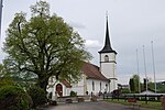
|
église Saint-Julien | B | 46°47′11″N 7°05′46″E / 46.78652°N 7.096172°E | 13272 | ||
| Matran | 
|
Gare | B | 46°47′20″N 7°05′47″E / 46.788967°N 7.096287°E | 9984 | ||
| Matran | 
|
Manoir de Weck | B | 46°47′07″N 7°06′19″E / 46.785315°N 7.10532°E | 13273 | ||
Ménières
| Location | Upload | Photo | Object | Cat. | Coordinates | KGS-Nr | |
|---|---|---|---|---|---|---|---|
| Ménières | 
|
Ferme | B | 13274 | |||
| Ménières | 
|
Ferme | B | 13275 | |||
Meyriez
| Location | Upload | Photo | Object | Cat. | Coordinates | KGS-Nr | |
|---|---|---|---|---|---|---|---|
| Meyriez | 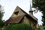
|
église paroissiale | B | 46°55′30″N 7°06′32″E / 46.92497°N 7.108944°E | 2225 | ||
| Meyriez | [[File:|150x150px|Maison de Tscharner (18e s.)]] | Maison de Tscharner (18e s.) | B | 46°55′30″N 7°06′30″E / 46.925086°N 7.108392°E | 2227 | ||
| Meyriez | 
|
Manoir de Chatoney | B | 46°55′32″N 7°06′31″E / 46.925563°N 7.108691°E | 2226 | ||
Mézières
| Location | Upload | Photo | Object | Cat. | Coordinates | KGS-Nr | |
|---|---|---|---|---|---|---|---|
| Mézières | 
|
Château | A | 46°40′46″N 6°55′36″E / 46.679413°N 6.926626°E | 2228 | ||
| Mézières | 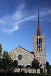
|
église Saint-Pierre-au-Liens | A | 46°40′45″N 6°55′35″E / 46.679205°N 6.926406°E | 2229 | ||
| Mézières | 
|
Berlens, Ancienne église N.-D.-de-l'Epine (1507) | B | 46°41′36″N 6°57′15″E / 46.693419°N 6.954067°E | 1953 | ||
| Mézières | 
|
Mézières | ISOS | 46°40′43″N 6°55′33″E / 46.6785°N 6.9258°E | |||
Misery-Courtion
| Location | Upload | Photo | Object | Cat. | Coordinates | KGS-Nr | |
|---|---|---|---|---|---|---|---|
| Misery-Courtion | 
|
chapelle Saint-Leger | B | 46°51′10″N 7°06′08″E / 46.852898°N 7.102148°E | 2002 | ||
| Misery-Courtion | 
|
Ferme du Manoir de Misery | B | 46°51′02″N 7°04′04″E / 46.850506°N 7.06785°E | 13276 | ||
| Misery-Courtion | 
|
Manoir de Misery | B | 46°51′04″N 7°04′08″E / 46.850978°N 7.068843°E | 9494 | ||
Mont-Vully
Montagny
| Location | Upload | Photo | Object | Cat. | Coordinates | KGS-Nr | |
|---|---|---|---|---|---|---|---|
| Montagny | 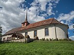
|
église Notre-Dame de Montagny-les-Monts | A | 46°48′38″N 6°59′32″E / 46.810673°N 6.992145°E | 2232 | ||
| Montagny | 
|
Hôtel de Ville (16e s.) | B | 46°48′40″N 6°59′32″E / 46.81116°N 6.99232°E | 2233 | ||
| Montagny | 
|
Ruines du château des sires de Montagny | B | 46°48′37″N 6°59′35″E / 46.810245°N 6.993144°E | 2234 | ||
| Montagny | 
|
Montagny-les-Monts | ISOS | 46°48′34″N 6°59′27″E / 46.8094°N 6.9907°E | |||
Montilier
| Location | Upload | Photo | Object | Cat. | Coordinates | KGS-Nr | |
|---|---|---|---|---|---|---|---|
| Montilier | 
|
Herrenhaus von Ernst | A | 46°56′07″N 7°07′26″E / 46.935339°N 7.123943°E | 2246 | ||
| Montilier | 
|
Platzbünden, Dorf, Fischergässli, Seeweg, Strandweg, Dorfmatte, Fasnacht-Rohr, prähististorische Seeufersiedlungen | A | 46°56′11″N 7°07′27″E / 46.936392°N 7.124108°E | 9599 | ||
| Montilier | 
|
Schlossspeicher | B | 46°56′09″N 7°07′29″E / 46.935863°N 7.124636°E | 13277 | ||
Morat
Morlon
| Location | Upload | Photo | Object | Cat. | Coordinates | KGS-Nr | |
|---|---|---|---|---|---|---|---|
| Morlon | 
|
église paroissiale Saint-Grat | B | 46°37′41″N 7°05′16″E / 46.627939°N 7.087711°E | 11262 | ||
Muntelier
| Location | Upload | Photo | Object | Cat. | Coordinates | KGS-Nr | |
|---|---|---|---|---|---|---|---|
| Muntelier | 
|
Muntelier | ISOS | 46°56′00″N 7°07′00″E / 46.933333333°N 7.116666666°E | |||
Murist
| Location | Upload | Photo | Object | Cat. | Coordinates | KGS-Nr | |
|---|---|---|---|---|---|---|---|
| Murist | 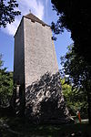
|
Tour de la Molière | A | 46°47′53″N 6°49′19″E / 46.797934°N 6.821936°E | 2247 | ||
Murten
| Location | Upload | Photo | Object | Cat. | Coordinates | KGS-Nr | |
|---|---|---|---|---|---|---|---|
| Murten | 
|
Murten | ISOS | 46°55′41″N 7°07′01″E / 46.928055555°N 7.116944444°E | |||
| Murten | 
|
Lurtigen | ISOS | 46°56′00″N 7°10′00″E / 46.933333333°N 7.166666666°E | |||
| Murten | 
|
Salvenach | ISOS | 46°55′00″N 7°09′00″E / 46.916666666°N 7.15°E | |||

