| Location
|
Upload
|
Photo
|
Object
|
Cat.
|
Coordinates
|
KGS-Nr
|
| Herisau
|

|
yes
|


|
Herisau
|
ISOS
|
47°23′06″N 9°16′43″E / 47.3851°N 9.2786°E / 47.3851; 9.2786
|
|
| Herisau
|

|

|


|
Staatsarchiv Appenzell Ausserrhoden
|
A
|
47°23′08″N 9°16′50″E / 47.3856°N 9.28055°E / 47.3856; 9.28055
|
8787
|
| Herisau
|

|
yes
|


|
«Altes Rathaus» Schwänberg
|
A
|
47°23′39″N 9°14′23″E / 47.3942°N 9.2396°E / 47.3942; 9.2396
|
10418
|
| Herisau
|

|
yes
|


|
Eisenbahnbrücke Bodensee-Toggenburgbahn, SOB (vgl. St.Gallen/SG)
|
A
|
47°24′02″N 9°19′31″E / 47.400672222°N 9.325161111°E / 47.400672222; 9.325161111
|
460
|
| Herisau
|

|
yes
|


|
Museum Herisau
|
A
|
47°23′08″N 9°16′44″E / 47.3856°N 9.27888°E / 47.3856; 9.27888
|
8500
|
| Herisau
|

|
yes
|


|
Kantonales Regierungsgebäude
|
A
|
47°23′07″N 9°16′47″E / 47.3854°N 9.27982°E / 47.3854; 9.27982
|
435
|
| Herisau
|

|
yes
|


|
Rutenkaminhaus
|
A
|
47°23′36″N 9°14′21″E / 47.3934°N 9.23907°E / 47.3934; 9.23907
|
11802
|
| Herisau
|

|
yes
|


|
Schwarzes Haus
|
A
|
47°23′10″N 9°16′25″E / 47.386°N 9.27352°E / 47.386; 9.27352
|
9037
|
| Herisau
|

|
yes
|


|
Urnäschbrücke im Kubel
|
A
|
47°24′00″N 9°19′36″E / 47.3999°N 9.3266°E / 47.3999; 9.3266
|
459
|
| Herisau
|

|
yes
|


|
Walsersches Doppelhaus
|
A
|
47°23′10″N 9°16′44″E / 47.3861°N 9.27898°E / 47.3861; 9.27898
|
445
|
| Herisau
|

|
yes
|


|
Wetterhaus
|
A
|
47°23′09″N 9°16′43″E / 47.3857°N 9.2787°E / 47.3857; 9.2787
|
432
|
| Herisau
|

|
yes
|


|
Zeughaus Ebnet
|
A
|
47°23′18″N 9°16′51″E / 47.3883°N 9.28088°E / 47.3883; 9.28088
|
9094
|
| Herisau
|

|
yes
|


|
Reformierte Kirche Herisau
|
A
|
47°23′09″N 9°16′45″E / 47.38584°N 9.27928°E / 47.38584; 9.27928
|
434
|
| Herisau
|

|
yes
|


|
Rosenburg
|
A
|
47°23′18″N 9°15′16″E / 47.38844°N 9.25441°E / 47.38844; 9.25441
|
443
|
| Herisau
|

|
yes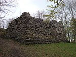
|


|
Ruine Rosenberg
|
B
|
47°23′47″N 9°16′55″E / 47.3964°N 9.2819°E / 47.3964; 9.2819
|
442
|
| Herisau
|

|

|


|
Bauernhaus
|
B
|
47°22′15″N 9°16′02″E / 47.3709°N 9.26734°E / 47.3709; 9.26734
|
14858
|
| Herisau
|

|

|


|
Bauernhaus
|
B
|
47°22′11″N 9°15′57″E / 47.3698°N 9.26594°E / 47.3698; 9.26594
|
14859
|
| Herisau
|

|

|


|
Bauernhaus
|
B
|
47°23′52″N 9°15′05″E / 47.39786°N 9.2515°E / 47.39786; 9.2515
|
14861
|
| Herisau
|

|

|


|
Bauernhaus
|
B
|
47°22′11″N 9°15′56″E / 47.36977°N 9.26542°E / 47.36977; 9.26542
|
11543
|
| Herisau
|

|
yes
|


|
Bauernhaus
|
B
|
47°23′52″N 9°19′21″E / 47.39766°N 9.32255°E / 47.39766; 9.32255
|
11552
|
| Herisau
|

|
yes
|


|
Bauernhaus
|
B
|
47°22′18″N 9°18′40″E / 47.3718°N 9.31103°E / 47.3718; 9.31103
|
14860
|
| Herisau
|

|

|


|
Bauernhaus
|
B
|
47°21′56″N 9°15′31″E / 47.36552°N 9.25863°E / 47.36552; 9.25863
|
14862
|
| Herisau
|

|

|


|
Bauernhaus
|
B
|
47°21′43″N 9°15′35″E / 47.36208°N 9.25959°E / 47.36208; 9.25959
|
11487
|
| Herisau
|

|

|


|
Bauernhaus
|
B
|
47°22′56″N 9°13′32″E / 47.38227°N 9.22565°E / 47.38227; 9.22565
|
11490
|
| Herisau
|

|
yes
|


|
Bauernhaus
|
B
|
47°23′29″N 9°18′33″E / 47.39128°N 9.3091°E / 47.39128; 9.3091
|
11541
|
| Herisau
|

|
yes
|


|
Bauernhaus
|
B
|
47°23′41″N 9°18′55″E / 47.3948°N 9.31516°E / 47.3948; 9.31516
|
11545
|
| Herisau
|

|
yes
|


|
Bauernhaus
|
B
|
47°22′41″N 9°18′59″E / 47.37801°N 9.31627°E / 47.37801; 9.31627
|
11546
|
| Herisau
|

|

|


|
Bauernhaus
|
B
|
47°23′48″N 9°14′53″E / 47.39654°N 9.24798°E / 47.39654; 9.24798
|
11548
|
| Herisau
|

|

|


|
Bauernhaus
|
B
|
47°23′55″N 9°15′59″E / 47.39867°N 9.26648°E / 47.39867; 9.26648
|
11549
|
| Herisau
|

|

|


|
Burgruine Urstein (13. Jh.)
|
B
|
47°23′07″N 9°19′28″E / 47.38516°N 9.32438°E / 47.38516; 9.32438
|
444
|
| Herisau
|

|

|


|
Ehemalige Mühle
|
B
|
47°23′55″N 9°15′28″E / 47.39864°N 9.25791°E / 47.39864; 9.25791
|
11553
|
| Herisau
|

|
yes
|


|
Ehemalige Villa Buff am Nieschberg (1907/08)
|
B
|
47°22′22″N 9°16′34″E / 47.37271°N 9.27616°E / 47.37271; 9.27616
|
448
|
| Herisau
|

|
yes
|


|
Gasthaus mit Bäckerei
|
B
|
47°22′57″N 9°18′41″E / 47.3825°N 9.31146°E / 47.3825; 9.31146
|
14863
|
| Herisau
|

|

|


|
Turbinenhäuschen
|
B
|
47°23′30″N 9°13′58″E / 47.39158°N 9.23264°E / 47.39158; 9.23264
|
14864
|
| Herisau
|

|
yes
|


|
Wirtshaus Bären (1789)
|
B
|
47°23′45″N 9°19′16″E / 47.39594°N 9.32109°E / 47.39594; 9.32109
|
440
|
| Herisau
|

|
yes
|


|
Schwänbergbrücke
|
B
|
47°23′30″N 9°13′57″E / 47.391756°N 9.232461°E / 47.391756; 9.232461
|
461
|
| Herisau
|

|

|


|
Wohnhaus
|
B
|
47°23′55″N 9°16′02″E / 47.39872°N 9.26712°E / 47.39872; 9.26712
|
14867
|
| Herisau
|

|

|


|
Wohnhaus
|
B
|
47°22′51″N 9°18′54″E / 47.3808°N 9.31502°E / 47.3808; 9.31502
|
14865
|
| Herisau
|

|

|


|
Wohnhaus
|
B
|
47°23′48″N 9°14′51″E / 47.39667°N 9.2474°E / 47.39667; 9.2474
|
14866
|
| Herisau
|

|

|


|
Wohnheim
|
B
|
47°23′01″N 9°13′37″E / 47.38362°N 9.22702°E / 47.38362; 9.22702
|
14868
|
| Herisau
|

|

|


|
Schwänberg
|
ISOS
|
47°23′37″N 9°14′26″E / 47.39356°N 9.2406°E / 47.39356; 9.2406
|
|
| Herisau
|

|
yes
|


|
Kubelbrücke
|
A
|
47°24′00″N 9°19′35″E / 47.3999°N 9.3265°E / 47.3999; 9.3265
|
10513
|


