Commons:Wiki Loves Monuments in Switzerland/Aargau/C-K
Jump to navigation
Jump to search
Densbüren
| Location | Upload | Photo | Object | Cat. | Coordinates | KGS-Nr | |
|---|---|---|---|---|---|---|---|
| Densbüren | 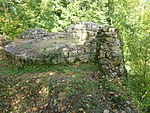
|
Ruine Urgiz, Burgruine / Hochwacht | A | 47°27′39″N 8°03′06″E / 47.46071465°N 8.051736748°E | 100 | ||
| Densbüren | 
|
Evangelisch -reformierte Pfarrkirche | B | 47°27′10″N 8°03′17″E / 47.45276°N 8.0547°E | 15332 | ||
| Densbüren | 
|
Evangelisch-reformiertes Pfarrhaus | B | 47°27′10″N 8°03′15″E / 47.45289°N 8.05417°E | 15333 | ||
| Densbüren | 
|
Säge | B | 47°27′37″N 8°02′55″E / 47.46014°N 8.04854°E | 15334 | ||
Dietwil
| Location | Upload | Photo | Object | Cat. | Coordinates | KGS-Nr | |
|---|---|---|---|---|---|---|---|
| Dietwil | 
|
Römisch-katholische Pfarrkirche | A | 47°08′51″N 8°23′34″E / 47.1475066°N 8.392792405°E | 101 | ||
| Dietwil | 
|
Pfarrhaus (Dietwil) | B | 47°08′50″N 8°23′34″E / 47.1473°N 8.39285°E | 15335 | ||
| Dietwil | 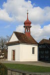
|
Beinhauskapelle (Dietwil) | B | 47°08′52″N 8°23′33″E / 47.1477°N 8.39261°E | 15336 | ||
Dottikon
| Location | Upload | Photo | Object | Cat. | Coordinates | KGS-Nr | |
|---|---|---|---|---|---|---|---|
| Dottikon | 
|
Tieffurtmühle | B | 47°22′58″N 8°14′00″E / 47.38272°N 8.23335°E | 15337 | ||
Döttingen
| Location | Upload | Photo | Object | Cat. | Coordinates | KGS-Nr | |
|---|---|---|---|---|---|---|---|
| Döttingen | 
|
Surbbrücke | B | 47°34′05″N 8°15′33″E / 47.567924575°N 8.259154644°E | 15338 | ||
Dürrenäsch
| Location | Upload | Photo | Object | Cat. | Coordinates | KGS-Nr | |
|---|---|---|---|---|---|---|---|
| Dürrenäsch | 
|
Ölmühle | B | 47°19′18″N 8°08′47″E / 47.32173°N 8.14642°E | 15340 | ||
| Dürrenäsch | 
|
Speicher | B | 47°19′15″N 8°09′18″E / 47.3208°N 8.15502°E | 15341 | ||
| Dürrenäsch | 
|
Walti Haus | B | 47°19′15″N 8°09′20″E / 47.32076°N 8.15558°E | 15342 | ||
Effingen
| Location | Upload | Photo | Object | Cat. | Coordinates | KGS-Nr | |
|---|---|---|---|---|---|---|---|
| Effingen | 
|
Laur-Haus | B | 47°29′24″N 8°06′05″E / 47.490046674°N 8.101351955°E | 15343 | ||
Eggenwil
| Location | Upload | Photo | Object | Cat. | Coordinates | KGS-Nr | |
|---|---|---|---|---|---|---|---|
| Eggenwil | 
|
Ehemaliges Waschhaus Rebhaus | B | 47°22′11″N 8°20′21″E / 47.36986°N 8.33915°E | 15344 | ||
| Eggenwil | 
|
Römisch-katholische Pfarrkirche mit Friedhofmauer | B | 47°22′11″N 8°20′20″E / 47.36962°N 8.33901°E | 15346 | ||
| Eggenwil | 
|
Römisch-katholisches Pfarrhaus | B | 47°22′11″N 8°20′20″E / 47.36977°N 8.33889°E | 15345 | ||
Egliswil
| Location | Upload | Photo | Object | Cat. | Coordinates | KGS-Nr | |
|---|---|---|---|---|---|---|---|
| Egliswil | 
|
Evangelisch-reformierte Pfarrkirche | B | 47°20′59″N 8°11′09″E / 47.34971°N 8.18573°E | 15353 | ||
| Egliswil | 
|
Haus: Zum Sonnenberg | B | 47°21′03″N 8°11′18″E / 47.35094°N 8.18842°E | 15354 | ||
Ehrendingen
| Location | Upload | Photo | Object | Cat. | Coordinates | KGS-Nr | |
|---|---|---|---|---|---|---|---|
| Ehrendingen | 
|
Altes Pfarrhaus | B | 47°29′42″N 8°20′30″E / 47.494942°N 8.341598°E | 15348 | ||
| Ehrendingen | 
|
Ehemalige Gipsmühle | B | 47°30′23″N 8°20′44″E / 47.506479°N 8.345444°E | 15351 | ||
| Ehrendingen | 
|
Ehemaliges Vogthaus | B | 47°29′41″N 8°20′30″E / 47.494816°N 8.341556°E | 15347 | ||
| Ehrendingen | 
|
Haus | B | 47°30′05″N 8°20′59″E / 47.501309°N 8.349789°E | 15352 | ||
| Ehrendingen | 
|
Römisch-katholische Pfarrkirche | B | 47°29′42″N 8°20′29″E / 47.495087°N 8.341494°E | 15349 | ||
| Ehrendingen | 
|
St. Agatha-Kapelle | B | 47°30′05″N 8°20′56″E / 47.501524°N 8.348758°E | 15350 | ||
Elfingen
| Location | Upload | Photo | Object | Cat. | Coordinates | KGS-Nr | |
|---|---|---|---|---|---|---|---|
| Elfingen | 
|
Elfingen | ISOS | 47°30′30″N 8°06′00″E / 47.508333333°N 8.1°E | |||
Endingen
| Location | Upload | Photo | Object | Cat. | Coordinates | KGS-Nr | |
|---|---|---|---|---|---|---|---|
| Endingen | 
|
Judenfriedhof | A | 47°31′58″N 8°18′33″E / 47.53290947°N 8.309147291°E | 103 | ||
| Endingen | 
|
Jüdisches Badehaus | B | 47°32′11″N 8°17′29″E / 47.53643°N 8.29139°E | 15356 | ||
| Endingen | 
|
Römisch-katholische Pfarrkirche | B | 47°32′51″N 8°17′30″E / 47.547488922°N 8.291598704°E | 15841 | ||
| Endingen | 
|
Untere Surbbrücke | B | 47°32′18″N 8°17′27″E / 47.538307°N 8.290697°E | 15358 | ||
| Endingen | 
|
Wohnhaus (ehemalige Hufschmiede) | B | 47°32′19″N 8°17′26″E / 47.5385909°N 8.2906317°E | 15359 | ||
| Endingen | 
|
Synagoge | A | 47°32′13″N 8°17′23″E / 47.53682224°N 8.289740455°E | 104 | ||
Ennetbaden
| Location | Upload | Photo | Object | Cat. | Coordinates | KGS-Nr | |
|---|---|---|---|---|---|---|---|
| Ennetbaden | 
|
Oederlintrotte | B | 47°28′58″N 8°18′40″E / 47.482764098°N 8.311019324°E | 105 | ||
| Ennetbaden | 
|
Römisch-katholische Pfarrkirche St. Michael mit Altar und Michaelfigur | B | 47°28′43″N 8°19′03″E / 47.478716°N 8.317554°E | 15364 | ||
| Ennetbaden | 
|
Schwanen | B | 47°28′49″N 8°18′54″E / 47.480215°N 8.315012°E | 15362 | ||
| Ennetbaden | 
|
Sog. Schlössli | B | 47°28′37″N 8°18′46″E / 47.477048°N 8.31281°E | 106 | ||
| Ennetbaden | 
|
Spitaltrotte | B | 47°28′52″N 8°19′00″E / 47.481053°N 8.316535°E | 15361 | ||
Erlinsbach
| Location | Upload | Photo | Object | Cat. | Coordinates | KGS-Nr | |
|---|---|---|---|---|---|---|---|
| Erlinsbach | 
|
Evangelisch-reformierte Pfarrkirche | B | 47°24′26″N 8°00′35″E / 47.40727°N 8.00977°E | 15366 | ||
| Erlinsbach | 
|
Evangelisch-reformiertes Pfarrhaus | B | 47°24′26″N 8°00′36″E / 47.40716°N 8.01011°E | 15367 | ||
Fahrwangen
| Location | Upload | Photo | Object | Cat. | Coordinates | KGS-Nr | |
|---|---|---|---|---|---|---|---|
| Fahrwangen | 
|
Brunnenanlage | B | 47°17′28″N 8°14′28″E / 47.29112°N 8.24105°E | 15370 | ||
| Fahrwangen | 
|
Hallwilgedenkstein | B | 47°17′40″N 8°15′22″E / 47.29433°N 8.256097°E | 15369 | ||
| Fahrwangen | 
|
Hallwilgedenkstein | B | 47°17′27″N 8°14′28″E / 47.290855°N 8.241118°E | 15368 | ||
| Fischbach-Göslikon | 
|
Katholische Pfarrkirche Maria Himmelfahrt | A | 47°22′27″N 8°18′15″E / 47.37423606°N 8.304293215°E | 107 | ||
Fischbach-Göslikon
| Location | Upload | Photo | Object | Cat. | Coordinates | KGS-Nr | |
|---|---|---|---|---|---|---|---|
| Fischbach-Göslikon | 
|
Haus: Zum Rittersaal | B | 47°22′10″N 8°18′38″E / 47.3695°N 8.31065°E | 15373 | ||
| Fischbach-Göslikon | 
|
Kapelle in Nesselnbach (Architekt Gübelin) | B | 47°23′15″N 8°17′18″E / 47.38748°N 8.28845°E | 15374 | ||
| Fischbach-Göslikon | 
|
Rochuskapelle | B | 47°22′27″N 8°18′15″E / 47.3741°N 8.30429°E | 15375 | ||
| Fischbach-Göslikon | 
|
Römisch-katholisches Pfarrhaus | B | 47°22′27″N 8°18′16″E / 47.37407°N 8.30447°E | 15376 | ||
Fisibach
| Location | Upload | Photo | Object | Cat. | Coordinates | KGS-Nr | |
|---|---|---|---|---|---|---|---|
| Fisibach | 
|
Bleiche, Teil der spätrömischen Rheinbefestigung | A | 47°34′25″N 8°24′25″E / 47.57350893°N 8.40683619°E | 11658 | ||
| Fisibach | 
|
Bauernhaus | B | 47°33′42″N 8°24′24″E / 47.56159°N 8.40653°E | 15379 | ||
| Fisibach | 
|
Gasthaus «Zum Rössli« | B | 47°33′50″N 8°24′24″E / 47.563916978°N 8.406611316°E | 15378 | ||
| Fisibach | 
|
Mühle | B | 47°34′07″N 8°24′23″E / 47.56858°N 8.40648°E | 15381 | ||
| Fisibach | 
|
St. Agatha Kapelle | B | 47°33′44″N 8°24′29″E / 47.562161146°N 8.407921445°E | 15377 | ||
Fislisbach
| Location | Upload | Photo | Object | Cat. | Coordinates | KGS-Nr | |
|---|---|---|---|---|---|---|---|
| Fislisbach | 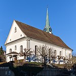
|
Katholische Kirche St. Agatha | B | 47°26′12″N 8°17′37″E / 47.436564°N 8.293492°E | 108 | ||
Frick
| Location | Upload | Photo | Object | Cat. | Coordinates | KGS-Nr | |
|---|---|---|---|---|---|---|---|
| Frick | 
|
Katholische Kirche St. Peter und Paul, sowie Beinhaus | A | 47°30′16″N 8°01′21″E / 47.50445175°N 8.022508924°E | 109 | ||
| Frick | Sauriermuseum Frick | Sauriermuseum Frick | B | 47°30′19″N 8°01′07″E / 47.50537°N 8.0185°E | 8602 | ||
| Frick | 
|
Altes Schulhaus | B | 47°30′16″N 102°00′00″E / 47.50435°N 8022°E | 15383 | ||
| Frick | 
|
Ehemalige Schaffnerei der Kommende Beuggen | B | 47°30′33″N 8°01′05″E / 47.50919°N 8.01807°E | 15386 | ||
| Frick | 
|
Kaplanei | B | 47°30′17″N 8°01′20″E / 47.50464°N 8.02228°E | 15385 | ||
| Frick | 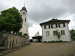
|
Kirchhügel; spätrömische Befestigung, Vorängerkirche und frühmittelalterliches Gräberfeld | B | 47°30′16″N 8°01′21″E / 47.50458°N 8.02238°E | 15388 | ||
| Frick | 
|
Römisch-katholisches Pfarrhaus | B | 47°30′17″N 8°01′21″E / 47.50475°N 8.02257°E | 15384 | ||
| Frick | 
|
Frick | ISOS | 47°30′29″N 8°01′20″E / 47.508055555°N 8.022222222°E | |||
Full-Reuenthal
| Location | Upload | Photo | Object | Cat. | Coordinates | KGS-Nr | |
|---|---|---|---|---|---|---|---|
| Full-Reuenthal | 
|
Jüppe, Teil der spätrömischen Rheinbefestigung | A | 47°37′09″N 8°12′46″E / 47.61903714°N 8.21278861°E | 11660 | ||
| Full-Reuenthal | 
|
Artilleriefestung | B | 47°36′14″N 8°12′07″E / 47.60378°N 8.20201°E | 15391 | ||
| Full-Reuenthal | 
|
Nepomuk-Kapelle | B | 47°37′00″N 8°11′58″E / 47.616594336°N 8.199424905°E | 15390 | ||
| Full-Reuenthal | 
|
Schlösschen oder sog. Minnesängerhaus | B | 47°36′11″N 8°12′08″E / 47.6031°N 8.20218°E | 15393 | ||
Gansingen
| Location | Upload | Photo | Object | Cat. | Coordinates | KGS-Nr | |
|---|---|---|---|---|---|---|---|
| Gansingen | 
|
Ehemaliges Pfarrhaus | B | 47°32′39″N 8°08′04″E / 47.544051928°N 8.134411187°E | 15394 | ||
Gebenstorf
| Location | Upload | Photo | Object | Cat. | Coordinates | KGS-Nr | |
|---|---|---|---|---|---|---|---|
| Gebenstorf | 
|
Reformierte Kirche Gebenstorf | B | 47°28′56″N 8°14′31″E / 47.482352777°N 8.241847222°E | 110 | ||
| Gebenstorf | 
|
Gebensstorfer Horn, Wallanlage (Zeitstellung nicht bekannt) | B | 47°29′10″N 8°14′58″E / 47.486127°N 8.249346°E | 15395 | ||
| Gebenstorf | 
|
Vogelsang, Gehling; römisches Gräberfeld (Gräberfeld zu Vindonissa) | B | 47°29′28″N 8°14′22″E / 47.491233°N 8.239471°E | 15396 | ||
Geltwil
| Location | Upload | Photo | Object | Cat. | Coordinates | KGS-Nr | |
|---|---|---|---|---|---|---|---|
| Geltwil | 
|
Wohnhaus Isenbergschwilerstrasse | A | 47°14′42″N 8°20′17″E / 47.24495249°N 8.33814171°E | 111 | ||
| Geltwil | 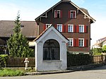
|
Wegkapelle | B | 47°14′58″N 8°19′25″E / 47.24952°N 8.32355°E | 15398 | ||
Gipf-Oberfrick
| Location | Upload | Photo | Object | Cat. | Coordinates | KGS-Nr | |
|---|---|---|---|---|---|---|---|
| Gipf-Oberfrick | 
|
Burgruine Alt-Thierstein | A | 47°29′49″N 7°58′22″E / 47.49690338°N 7.972659195°E | 112 | ||
| Gipf-Oberfrick | 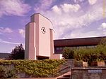
|
Römisch-katholische Pfarrkirche mit Plastik Hl. Anna Selbdritt | B | 47°29′50″N 8°00′12″E / 47.49711°N 8.00343°E | 15403 | ||
| Gipf-Oberfrick | 
|
Trottgasse 1 | B | 47°30′08″N 8°00′20″E / 47.502320235°N 8.005567898°E | 15400 | ||
Gontenschwil
| Location | Upload | Photo | Object | Cat. | Coordinates | KGS-Nr | |
|---|---|---|---|---|---|---|---|
| Gontenschwil | 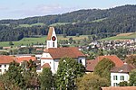
|
Reformierte Kirche Gontenschwil | B | 47°16′18″N 8°08′43″E / 47.2718°N 8.14515°E | 15409 | ||
| Gontenschwil | 
|
Haus «Fischerhübel» | A | 47°16′07″N 8°08′44″E / 47.26859249°N 8.145655648°E | 9856 | ||
| Gontenschwil | 
|
Bauernhaus | B | 47°16′46″N 8°08′34″E / 47.27956°N 8.14272°E | 15405 | ||
| Gontenschwil | 
|
Bauernhaus | B | 47°16′47″N 8°08′32″E / 47.27972°N 8.14216°E | 15406 | ||
| Gontenschwil | 
|
Ehemaliges Pfarrhaus | B | 47°16′18″N 8°08′44″E / 47.27166°N 8.14546°E | 15407 | ||
| Gontenschwil | 
|
Ehemaliges Ratsherrenhaus | B | 47°15′51″N 8°09′04″E / 47.26423°N 8.15115°E | 15408 | ||
| Gontenschwil | 
|
Gasthof Löwen | B | 47°16′47″N 8°08′35″E / 47.27977°N 8.14293°E | 113 | ||
| Gontenschwil | 
|
Speicher | B | 47°15′41″N 8°08′50″E / 47.26142°N 8.14709°E | 15410 | ||
| Gontenschwil | 
|
Vielzweckbau Kirchrain | B | 47°16′18″N 8°08′44″E / 47.271711°N 8.145492°E | 15404 | ||
Gränichen
| Location | Upload | Photo | Object | Cat. | Coordinates | KGS-Nr | |
|---|---|---|---|---|---|---|---|
| Gränichen | 
|
Untervogthaus | A | 47°21′29″N 8°05′50″E / 47.35817925°N 8.097231307°E | 116 | ||
| Gränichen | 
|
Schloss Liebegg | B | 47°20′11″N 8°07′04″E / 47.3363°N 8.1177°E | 115 | ||
| Gränichen | 
|
Reformierte Kirche | A | 47°21′23″N 8°06′08″E / 47.35650486°N 8.102187522°E | 114 | ||
| Gränichen | 
|
Ehemaliges Beinhaus | B | 47°21′29″N 8°06′13″E / 47.35817°N 8.10352°E | 15412 | ||
| Gränichen | 
|
Evangelisch-reformiertes Pfarrhaus | B | 47°21′30″N 8°06′15″E / 47.35821°N 8.10403°E | 15411 | ||
| Gränichen | 
|
Speicher bei der Landwirtschaftlichen Schule | B | 47°20′12″N 8°07′14″E / 47.33665°N 8.1206°E | 15414 | ||
| Gränichen | 
|
Speicher beim Rütihof | B | 47°20′21″N 8°04′51″E / 47.33928°N 8.08082°E | 15413 | ||
| Gränichen | 
|
Umfassungsmauer, Vorzeichen Pfarrkirche | B | 47°21′23″N 8°06′09″E / 47.3564°N 8.10258°E | 15415 | ||
Habsburg
| Location | Upload | Photo | Object | Cat. | Coordinates | KGS-Nr | |
|---|---|---|---|---|---|---|---|
| Habsburg | 
|
Schloss | A | 47°27′45″N 8°10′50″E / 47.46252375°N 8.18059223°E | 117 | ||
Hägglingen
| Location | Upload | Photo | Object | Cat. | Coordinates | KGS-Nr | |
|---|---|---|---|---|---|---|---|
| Hägglingen | 
|
Katholische Kirche St. Michael (Fresken) | B | 47°23′15″N 8°15′15″E / 47.38755°N 8.25404°E | 118 | ||
| Hägglingen | 
|
Römisch-katholisches Pfarrhaus | B | 47°23′16″N 8°15′14″E / 47.38785°N 8.25392°E | 15416 | ||
Hallwil
| Location | Upload | Photo | Object | Cat. | Coordinates | KGS-Nr | |
|---|---|---|---|---|---|---|---|
| Hallwil | 
|
Haus Herti | B | 47°19′42″N 8°10′38″E / 47.32828°N 8.17724°E | 15417 | ||
| Hallwil | 
|
Schulhaus | B | 47°19′44″N 257°00′00″E / 47.32882°N 8177°E | 15418 | ||
Hellikon
| Location | Upload | Photo | Object | Cat. | Coordinates | KGS-Nr | |
|---|---|---|---|---|---|---|---|
| Hellikon | 
|
Wendelinskapelle | B | 47°30′24″N 7°55′39″E / 47.50654°N 7.92752°E | 15423 | ||
| Hellikon | 
|
Mühle | B | 47°30′21″N 7°55′37″E / 47.50582°N 7.92689°E | 15421 | ||
| Hellikon | 
|
Sebastians-Kapelle | B | 47°30′33″N 7°55′10″E / 47.50925°N 7.91954°E | 15422 | ||
| Hellikon | 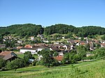
|
Hellikon | ISOS | 47°30′35″N 7°55′22″E / 47.5097°N 7.9229°E | |||
Hendschiken
| Location | Upload | Photo | Object | Cat. | Coordinates | KGS-Nr | |
|---|---|---|---|---|---|---|---|
| Hendschiken | 
|
Strohdachhaus | A | 47°22′43″N 8°12′42″E / 47.37850868°N 8.211680916°E | 9857 | ||
Herznach
| Location | Upload | Photo | Object | Cat. | Coordinates | KGS-Nr | |
|---|---|---|---|---|---|---|---|
| Herznach | 
|
Pfarrhof mit kaholischer Kirche St. Nikolaus | A | 47°28′21″N 8°02′59″E / 47.47259796°N 8.049684835°E | 120 | ||
| Herznach | 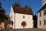
|
Beinhaus | B | 47°28′21″N 8°02′58″E / 47.4725°N 8.04947°E | 15424 | ||
| Herznach | 
|
Kirchenschatz der Katholischen Kirche St. Nikolaus | B | 47°28′22″N 8°02′59″E / 47.47271°N 8.04974°E | 10610 | ||
| Herznach | 
|
Römisch-katholisches Pfarrhaus | B | 47°28′22″N 8°02′59″E / 47.47286°N 8.04969°E | 15425 | ||
Hilfikon
| Location | Upload | Photo | Object | Cat. | Coordinates | KGS-Nr | |
|---|---|---|---|---|---|---|---|
| Hilfikon | 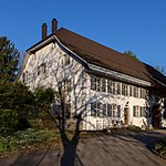
|
Ehemaliges Gasthaus: zum Elefant | B | 47°19′47″N 8°14′52″E / 47.329854956°N 8.247856988°E | 15427 | ||
| Hilfikon | 
|
Speicher von 1762 | B | 47°19′46″N 8°14′43″E / 47.32944161°N 8.245231155°E | 15428 | ||
| Hilfikon | 
|
Speicher von 1773 | B | 47°19′52″N 8°14′52″E / 47.331221934°N 8.247890964°E | 15429 | ||
Holderbank
| Location | Upload | Photo | Object | Cat. | Coordinates | KGS-Nr | |
|---|---|---|---|---|---|---|---|
| Holderbank | 
|
Reformierte Kirche Holderbank | B | 47°25′53″N 8°10′03″E / 47.43151°N 8.16743°E | 9859 | ||
| Holderbank | 
|
Evangelisch-reformiertes Pfarrhaus | B | 47°25′54″N 8°10′03″E / 47.43175°N 8.16761°E | 15430 | ||
Hornussen
| Location | Upload | Photo | Object | Cat. | Coordinates | KGS-Nr | |
|---|---|---|---|---|---|---|---|
| Hornussen | 
|
Ehemaliges Säckinger Amtshaus | A | 47°30′01″N 8°03′47″E / 47.50019294°N 8.063048154°E | 9480 | ||
| Hornussen | 
|
Haus Hauptstrasse 112 | B | 47°30′00″N 8°03′46″E / 47.500038504°N 8.06268133°E | 15434 | ||
| Hornussen | 
|
Haus Hauptstrasse 46 | B | 47°30′00″N 8°03′49″E / 47.500123074°N 8.063677755°E | 15436 | ||
| Hornussen | 
|
Haus Hauptstrasse 70 | B | 47°29′58″N 8°03′53″E / 47.499497283°N 8.064639272°E | 15433 | ||
| Hornussen | 
|
Haus mit Saal mit Stuckdecke | B | 47°30′00″N 8°03′48″E / 47.499864192°N 8.063316356°E | 15435 | ||
| Hornussen | 
|
Römisch-katholische Pfarrkirche | B | 47°29′55″N 8°03′47″E / 47.498588244°N 8.063089007°E | 16004 | ||
| Hornussen | 
|
Scheune Hauptstrasse 114 | B | 47°30′01″N 8°03′44″E / 47.500139649°N 8.062271072°E | 15432 | ||
| Hornussen | 
|
Hornussen | ISOS | 47°30′04″N 8°03′50″E / 47.501111111°N 8.063888888°E | |||
Hottwil
| Location | Upload | Photo | Object | Cat. | Coordinates | KGS-Nr | |
|---|---|---|---|---|---|---|---|
| Hottwil | 
|
Haus Hauptstrasse 43 «im Spittel« | B | 47°32′48″N 8°09′37″E / 47.54675°N 8.16028°E | 15437 | ||
Hünenberg
| Location | Upload | Photo | Object | Cat. | Coordinates | KGS-Nr | |
|---|---|---|---|---|---|---|---|
| Hünenberg | 
|
Reussbrücke Sins–Hünenberg | B | 47°11′12″N 8°24′02″E / 47.18655°N 8.40045°E | 7268 | ||
| Hünenberg | 
|
Reussbrücke Sins–Hünenberg | B | 47°11′12″N 8°24′02″E / 47.18655°N 8.40045°E | 9895 | ||
Jonen
| Location | Upload | Photo | Object | Cat. | Coordinates | KGS-Nr | |
|---|---|---|---|---|---|---|---|
| Hunzenschwil | 
|
Ziegelmatte/Zotzelacker, römische Ziegelei | A | 47°23′28″N 8°07′38″E / 47.39112176°N 8.127360039°E | 9535 | ||
| Jonen | 
|
Wallfahrtskapelle | A | 47°18′04″N 8°24′41″E / 47.30101948°N 8.41128457°E | 125 | ||
| Jonen | 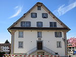
|
Ehemalige Taverne: Zur Mutter Gottes | B | 47°17′46″N 8°23′43″E / 47.29612547°N 8.395223263°E | 15438 | ||
| Jonen | 
|
Römisch-katholische Pfarrkirche | B | 47°17′45″N 8°23′44″E / 47.29578996°N 8.395547801°E | 15439 | ||
| Jonen | 
|
St. Niklaus-Kapelle | B | 47°18′01″N 8°23′38″E / 47.30016621°N 8.393907239°E | 15440 | ||
| Jonen | 
|
Obschlagen | ISOS | 47°18′08″N 8°24′08″E / 47.30214°N 8.40211°E | |||
| Jonen | 
|
Obschlagen | ISOS | 47°18′08″N 8°24′08″E / 47.30214°N 8.40211°E | |||
| Jonen | 
|
Litzi | ISOS | 47°18′07″N 8°24′14″E / 47.30204°N 8.40379°E | |||
| Jonen | 
|
Litzi | ISOS | 47°18′07″N 8°24′14″E / 47.30204°N 8.40379°E | |||
| Jonen | 
|
Jonen | ISOS | 47°17′54″N 8°23′50″E / 47.298333333°N 8.397222222°E | |||
Kaiseraugst
| Location | Upload | Photo | Object | Cat. | Coordinates | KGS-Nr | |
|---|---|---|---|---|---|---|---|
| Kaiseraugst | 
|
Kirche St. Gallus | B | 47°32′28″N 7°43′28″E / 47.5412°N 7.72445°E | 130 | ||
| Kaiseraugst | 
|
Augusta Raurica | A | 47°31′59″N 7°43′20″E / 47.53319°N 7.72229°E | 1391 | ||
| Kaiseraugst | 
|
Kaiseraugst | ISOS | 47°32′29″N 7°43′40″E / 47.541388888°N 7.727777777°E | |||
Kaiserstuhl
Kaisten
| Location | Upload | Photo | Object | Cat. | Coordinates | KGS-Nr | |
|---|---|---|---|---|---|---|---|
| Kaisten | 
|
Ehemalige Stiftsmühle Kloster Säckingen | B | 47°32′33″N 8°02′31″E / 47.542466271°N 8.041886796°E | 15454 | ||
| Kaisten | 
|
Fasnachtsberg; Ruine einer mittelalterlichen Burg, prähistorische Fundstelle | B | 47°32′32″N 8°02′59″E / 47.54221°N 8.04962°E | 15456 | ||
| Kaisten | 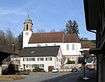
|
Römisch-katholische Pfarrkirche | B | 47°32′24″N 8°02′46″E / 47.53999°N 8.04617°E | 15459 | ||
| Kaisten | 
|
St. Wendelinskapelle | B | 47°32′54″N 8°03′05″E / 47.548226313°N 8.051450578°E | 15455 | ||
| Kaisten | 
|
Ittenthal | ISOS | 47°31′09″N 8°03′45″E / 47.519166666°N 8.0625°E | |||
Kallern
| Location | Upload | Photo | Object | Cat. | Coordinates | KGS-Nr | |
|---|---|---|---|---|---|---|---|
| Kallern | 
|
Bauernhaus Unterniesenberg | A | 47°18′15″N 8°17′18″E / 47.3041131°N 8.288359041°E | 9861 | ||
| Kallern | 
|
Muttergottes Kapelle | B | 47°18′01″N 8°16′53″E / 47.30034°N 8.28142°E | 9862 | ||
Killwangen
| Location | Upload | Photo | Object | Cat. | Coordinates | KGS-Nr | |
|---|---|---|---|---|---|---|---|
| Killwangen | 
|
Chlaimättli; Erdburg mit Abschnittsgraben, mittelalterlich? | B | 47°25′30″N 8°20′22″E / 47.425068°N 8.339438°E | 15460 | ||
Kirchleerau
| Location | Upload | Photo | Object | Cat. | Coordinates | KGS-Nr | |
|---|---|---|---|---|---|---|---|
| Kirchleerau | 
|
Ehemalige Untervogtei | B | 47°16′32″N 8°04′06″E / 47.27561°N 8.06842°E | 15462 | ||
| Kirchleerau | 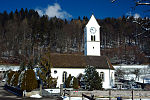
|
Evangelisch-reformierte Pfarrkirche | B | 47°16′35″N 8°04′05″E / 47.27633°N 8.06807°E | 15461 | ||
Klingnau
Koblenz
| Location | Upload | Photo | Object | Cat. | Coordinates | KGS-Nr | |
|---|---|---|---|---|---|---|---|
| Koblenz | 
|
Eisenbahnviadukt Koblenz-Felsenau | A | 47°35′52″N 8°13′16″E / 47.59763897°N 8.221053146°E | 10514 | ||
| Koblenz | 
|
Eisenbahnviadukt Koblenz-Felsenau | A | 47°35′52″N 8°13′16″E / 47.59763897°N 8.221053146°E | 9875 | ||
| Koblenz | 
|
Kleiner Laufen, Teil der spätrömischen Rheinbefestigung | A | 47°36′51″N 8°15′18″E / 47.61416094°N 8.255014265°E | 142 | ||
| Koblenz | 
|
Eisenbahnviadukt Koblenz-Waldshut | A | 47°36′33″N 8°14′03″E / 47.60908901°N 8.234188912°E | 9072 | ||
| Koblenz | 
|
Lokremise | B | 47°36′11″N 8°13′45″E / 47.60306°N 8.22916°E | 15479 | ||
| Koblenz | 
|
Rütenen | B | 47°36′41″N 8°14′45″E / 47.61144°N 8.24593°E | 11751 | ||
| Koblenz | 
|
Schloss | B | 47°36′31″N 8°14′10″E / 47.608585927°N 8.236123672°E | 15476 | ||
| Koblenz | 
|
Verenastatue | B | 47°36′28″N 8°14′19″E / 47.607769052°N 8.238505309°E | 15477 | ||
| Koblenz | 
|
Bahnhof Koblenz | B | 47°36′01″N 8°13′37″E / 47.6003°N 8.22706°E | 15478 | ||
Kölliken
| Location | Upload | Photo | Object | Cat. | Coordinates | KGS-Nr | |
|---|---|---|---|---|---|---|---|
| Kölliken | 
|
Strohdachhaus Dorfmuseum | A | 47°20′04″N 8°01′28″E / 47.33453703°N 8.024579824°E | 9864 | ||
| Kölliken | 
|
Strohdachhaus Schönenwerderstrasse | A | 47°20′16″N 8°01′25″E / 47.33789714°N 8.023571413°E | 143 | ||
| Kölliken | 
|
Reformierte Kirche Kölliken | B | 176°00′00″N 8°01′31″E / 47336°N 8.02528°E | 15486 | ||
| Kölliken | 
|
Evangelisch-reformiertes Pfarrhaus | B | 47°20′10″N 8°01′33″E / 47.33618°N 8.02586°E | 15483 | ||
| Kölliken | 
|
Gasthof «zum Bären« | B | 47°20′13″N 8°01′28″E / 47.33689°N 8.02443°E | 15485 | ||
| Kölliken | 
|
Landhaus Bindschedler | B | 47°19′50″N 8°01′18″E / 47.33051°N 8.02157°E | 15481 | ||
| Kölliken | 
|
Speicher | B | 47°20′16″N 8°01′24″E / 47.33778°N 8.02337°E | 15482 | ||
| Kölliken | 
|
Strohdachhaus Hauptstrasse | B | 47°19′56″N 8°01′28″E / 47.3321°N 8.0245°E | 15480 | ||
| Kölliken | 
|
Villa Matter (1903/04, Pfleghard & Haefeli) | B | 47°20′05″N 8°01′19″E / 47.33485°N 8.02193°E | 15487 | ||
Künten
| Location | Upload | Photo | Object | Cat. | Coordinates | KGS-Nr | |
|---|---|---|---|---|---|---|---|
| Künten | 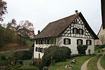
|
Mühle | A | 47°23′18″N 8°19′45″E / 47.38843782°N 8.329291409°E | 9865 | ||
Küttigen
| Location | Upload | Photo | Object | Cat. | Coordinates | KGS-Nr | |
|---|---|---|---|---|---|---|---|
| Küttigen | 
|
Ruine Königstein | B | 47°25′29″N 8°02′00″E / 47.4246°N 8.03339°E | 144 | ||
| Küttigen | [[File:|150x150px|Ruine Horen]] | Ruine Horen | B | 47°24′49″N 8°03′28″E / 47.413611111°N 8.057777777°E | 15493 | ||
| Küttigen | 
|
Ehemalige Mühle | B | 47°24′53″N 8°02′56″E / 47.414693°N 8.048788°E | 15489 | ||
| Küttigen | 
|
Ehemalige Papiermühle Sauerländer | B | 47°25′22″N 8°02′17″E / 47.42272°N 8.03793°E | 145 | ||
| Küttigen | 
|
Ehemaliges Zollhaus | B | 47°25′05″N 8°02′50″E / 47.41813°N 8.04716°E | 15491 | ||
| Küttigen | 
|
Evangelisch-reformierte Pfarrkirche | B | 47°24′38″N 8°03′48″E / 47.41068°N 8.06327°E | 15492 | ||
| Küttigen | 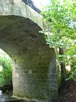
|
Schellenbrücke | B | 47°25′26″N 8°03′15″E / 47.423875°N 8.054234°E | 15490 | ||
| Küttigen | 
|
Trottbaum vom Schlössli Aarau | B | 47°25′10″N 8°02′37″E / 47.419398°N 8.043594°E | 15488 | ||


