namn ID
inom det administrativa området plats geografiska koordinater bild
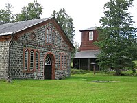
Anola Manor (herrgårdshus )
104
. . Nakkila
61°23′16″N 22°00′07″E / 61.387724°N 22.001925°E / 61.387724; 22.001925
Anttilan ja Voiluodon kylät (kulturmiljö
1991
. . Raumo
61°03′32″N 21°27′41″E / 61.058809326°N 21.461398173°E / 61.058809326; 21.461398173 Upload an image of this heritage site
Björneborgs gamla begravningsplats (begravningsplats )
4575
. Bärnäs Björneborg
61°29′07″N 21°46′42″E / 61.485277777778°N 21.778333333333°E / 61.485277777778; 21.778333333333
Bärnäs (stadsdel i Björneborg stad
4792
. . Björneborg
61°29′08″N 21°46′08″E / 61.4855°N 21.7689°E / 61.4855; 21.7689
Emil Cedercreutz-museet (konstmuseum museum )
3927
1 Museotie Harjavalta
61°17′40″N 22°11′16″E / 61.294444°N 22.187778°E / 61.294444; 22.187778
Euran kirkkoympäristö (kyrkplats
269
. Eura kyrkoby Eura
Upload an image of this heritage site
Gamla Raumo (historiskt stadscentrum stadslandskap )
1513
. . Raumo
61°07′42″N 21°30′48″E / 61.128269°N 21.513215°E / 61.128269; 21.513215
Gördböle (by
1985
. . Sastmola
61°46′31″N 21°31′27″E / 61.775410271°N 21.524127056°E / 61.775410271; 21.524127056 Upload an image of this heritage site
Hinnerjoki kyrkoby (kyrkby by tätort i Finland
1974
. . Eura
60°59′38″N 21°59′28″E / 60.99385°N 21.991026°E / 60.99385; 21.991026 Upload an image of this heritage site
Huittisten kirkko ja sen ympäristö (kyrkplats
1486
. . Vittis
Upload an image of this heritage site
Huovinrinne (garnison
4966
. . Säkylä
61°02′25″N 22°25′41″E / 61.0402°N 22.428°E / 61.0402; 22.428 Upload an image of this heritage site
Huovintie (historisk väg
1597
. . Ulvsby Säkylä Kumo Harjavalta Kjulo Nakkila
61°16′05″N 22°10′12″E / 61.26793°N 22.17°E / 61.26793; 22.17
Hämeenkankaan- ja Kyrönkankaantie (historisk väg
4050
. . Kankaanpää Jämijärvi Karvia
Upload an image of this heritage site
Irjanne (by tätort i Finland
271
. . Euraåminne
61°14′30″N 21°47′06″E / 61.24166666666667°N 21.785°E / 61.24166666666667; 21.785 Upload an image of this heritage site
J.W. Suomisen nahkatehdas ja Koskilinna (industriminne
4936
. . Nakkila
61°21′59″N 21°59′38″E / 61.366317452°N 21.993940891°E / 61.366317452; 21.993940891 Upload an image of this heritage site
Juseliuksen mausoleumi ja Käppärän hautausmaa (begravningsplats )
1491
. . Björneborg
Upload an image of this heritage site
Kaddin kalastusmajat (kulturlandskap
4035
. . Sastmola
61°49′30″N 21°21′57″E / 61.824896842°N 21.36578007°E / 61.824896842; 21.36578007 Upload an image of this heritage site
Karviankylä (by
1977
. . Karvia
62°12′49″N 22°39′31″E / 62.213542751°N 22.658492036°E / 62.213542751; 22.658492036 Upload an image of this heritage site
Kauttua ironworks and mill community (industrilandskap
912
. . Eura
61°06′39″N 22°09′31″E / 61.110942°N 22.158718°E / 61.110942; 22.158718 Upload an image of this heritage site
Kauvatsan kirkonseutu (kyrkplats
1979
. Kauvatsa Kumo
Upload an image of this heritage site
Kellahden kartanomaisema (gårdsmiljö
2089
. . Björneborg
Upload an image of this heritage site
Kokemäen kirkonseutu (kyrkplats
1487
. . Kumo
Upload an image of this heritage site
Kokemäenjoen luodot (skär )
4070
. . Björneborg
Upload an image of this heritage site
Kokemäenkartanon historiallinen maisema (gårdsmiljö
3992
. . Kumo
Upload an image of this heritage site
Kraftmanin härkätalli ja navetta (jordbruksmiljö
3926
. . Björneborg
Upload an image of this heritage site
Kumo järnvägsstation (järnvägsstation junction station
4230
. Peipohja Kumo
61°15′16″N 22°18′12″E / 61.254444444444°N 22.303333333333°E / 61.254444444444; 22.303333333333
Köyliönjokilaakson ympäryskylät (rural environment
1978
. . Eura
Upload an image of this heritage site
Köyliönsaaren Vanhakartanon ja kirkon historiallinen maisema (gårdsmiljö
87
. . Kjulo
Upload an image of this heritage site
Lammaistenlahden kulttuurimaisema (kulturlandskap
1613
. . Harjavalta Nakkila
Upload an image of this heritage site
Lapinjokilaakson kylä- ja viljelymaisema (rural environment
1980
. . Eura Raumo
61°02′03″N 21°57′42″E / 61.034267478°N 21.96172987°E / 61.034267478; 21.96172987 Upload an image of this heritage site
Lavian kirkonkylä (kyrkby
1981
. Lavia Björneborg
Upload an image of this heritage site
Leineberg (by i Finland industriminne bruk
927
. . Ulvsby
61°26′36″N 22°05′38″E / 61.443402°N 22.093855°E / 61.443402; 22.093855
Luvia kyrkoby (by kyrkby tätort i Finland
4052
. . Euraåminne
Luvian saariston kalastajatilat (fiskeläge
4124
. . Luvia
Upload an image of this heritage site
Långfors (by
95
. . Sastmola
61°48′46″N 21°39′36″E / 61.812667°N 21.659932°E / 61.812667; 21.659932 Upload an image of this heritage site
Mäntyluotos lots- och hamnmiljö (water traffic site
2928
. . Björneborg
Upload an image of this heritage site
Nakkilan kirkko ympäristöineen (kyrkplats
1488
. . Nakkila
Upload an image of this heritage site
Nanhia (by kulturminnesplats
1975
. . Vittis Lauttakylä
61°11′51″N 22°43′02″E / 61.197510677°N 22.717167232°E / 61.197510677; 22.717167232 Upload an image of this heritage site
Nedre byn (by kulturminnesplats
1984
. . Sastmola
61°50′30″N 21°31′22″E / 61.84160609°N 21.522861269°E / 61.84160609; 21.522861269 Upload an image of this heritage site
Niinisalo garrison (garnison
1437
. Niinisalo . Kankaanpää
61°50′10″N 22°28′10″E / 61.836111111111°N 22.469444444444°E / 61.836111111111; 22.469444444444
Norrmarks järnbruk och Ahlström företagens fastigheter (industriminne
907
. . Björneborg
Upload an image of this heritage site
Nuoranteen talot (kulturlandskap
1973
. . Eura
Upload an image of this heritage site
Panelia (tätort i Finland by i Finland
1612
. Kiukais Eura
61°13′28″N 21°58′30″E / 61.224325°N 21.975°E / 61.224325; 21.975
Peränkylä (by i Finland
1983
. . Luvia
61°19′20″N 21°39′55″E / 61.32219444444444°N 21.665377777777778°E / 61.32219444444444; 21.665377777777778 Upload an image of this heritage site
Pihlavan saha ja asuinalueet (industriminne
350
. Svinhamn . Björneborg
Upload an image of this heritage site
Porin teollisuusmaisema (industriminne
1498
. . Björneborg
Upload an image of this heritage site
Punkalaitumenjoen kylä- ja viljelymaisema (jokikylä
4542
. . Vittis
Upload an image of this heritage site
Pyhän Henrikin saarnahuone ja sen historiallinen ympäristö (kyrkplats
960
. Ylistaro Kumo
Påmark kyrkoby (kyrkby tätort i Finland
1528
. . Påmark
Upload an image of this heritage site
Raijalan kylä (by
1976
. . Vittis
61°10′42″N 22°34′53″E / 61.17821099°N 22.581353632°E / 61.17821099; 22.581353632 Upload an image of this heritage site
Rauma old railway station (stationsbyggnad
4232
. Category:Rauma Railway Station . Raumo
61°07′56″N 21°29′33″E / 61.132222°N 21.4925°E / 61.132222; 21.4925
Q30560303 (lärarseminarium utbildningsinstitution
1525
. . Raumo
Rauman asuinalueet (bostadsområde )
5172
. . Raumo
Upload an image of this heritage site
Riihikedon aravatalot (bostadsområde )
4571
. Mellanriorna Björneborg
61°28′44″N 21°47′49″E / 61.478881204°N 21.796826129°E / 61.478881204; 21.796826129 Upload an image of this heritage site
Riihikedon koulukorttelit (utbildningsinstitution
4574
. . Björneborg
Upload an image of this heritage site
Ruokojärven kulttuurimaisema (kulturlandskap
4051
. . Kankaanpää
Upload an image of this heritage site
Räfsö (by ö stadsdel
1497
. . Björneborg
61°36′47″N 21°26′45″E / 61.613172222222°N 21.445741666667°E / 61.613172222222; 21.445741666667
Sandskärs båk (dagmärke )
2930
. . Raumo
61°06′31″N 21°16′57″E / 61.108527777778°N 21.282472222222°E / 61.108527777778; 21.282472222222
Q18661880 (sjukhusbyggnad sjukhus )
2227
. . Harjavalta
61°20′37″N 22°05′22″E / 61.343511°N 22.08933°E / 61.343511; 22.08933
Siikaisten talonpoikaisarkkitehtuuri (jordbruksmiljö
1993
. . Siikais
Upload an image of this heritage site
Sorkka (by i Finland
1992
. . Raumo
61°10′49″N 21°33′27″E / 61.18020937°N 21.557577546°E / 61.18020937; 21.557577546 Upload an image of this heritage site
Sten-Björneborg (bostadsområde )
1512
. . Björneborg
61°29′21″N 21°47′41″E / 61.489294°N 21.794697°E / 61.489294; 21.794697
Suosmeri (by
2019
. . Ulvsby
61°27′54″N 21°54′17″E / 61.464930588°N 21.904788776°E / 61.464930588; 21.904788776 Upload an image of this heritage site
Svinhamns villaområde (villaområde
5180
. . Björneborg
61°34′16″N 21°35′25″E / 61.571158°N 21.590281°E / 61.571158; 21.590281 Upload an image of this heritage site
Säkylä kyrka (kyrka )
3945
. . Säkylä
61°02′45″N 22°20′45″E / 61.0458°N 22.3458°E / 61.0458; 22.3458 61°02′53″N 22°20′15″E / 61.04796995°N 22.33752259°E / 61.04796995; 22.33752259
Säpi lighthouse community and pilot station (skärgårdsbosättning
4992
. . Luvia
Upload an image of this heritage site
Södermark (by i Finland
1989
. . Björneborg
61°34′01″N 21°48′58″E / 61.566985°N 21.81623°E / 61.566985; 21.81623 Upload an image of this heritage site
Trolls by och stengärdsgårdar (by
1986
. . Sastmola
61°55′45″N 21°26′45″E / 61.929231898°N 21.445889746°E / 61.929231898; 21.445889746 Upload an image of this heritage site
Ulvila Church and surroundings (kyrkplats kulturminnesplats
379
. Gammelby Ulvsby
Upload an image of this heritage site
Unaja (by i Finland
1990
. . Raumo
61°04′33″N 21°30′41″E / 61.075774996°N 21.511320943°E / 61.075774996; 21.511320943
Vittisbofjärds kyrkoby (kyrkby
1529
. . Björneborg
61°40′33″N 21°37′13″E / 61.67583333°N 21.62027778°E / 61.67583333; 21.62027778
Vuojoki gård (kulturlandskap herrgårdshus )
38
. . Euraåminne
61°13′04″N 21°40′23″E / 61.217778°N 21.673056°E / 61.217778; 21.673056 61°13′05″N 21°40′21″E / 61.2181182°N 21.6726322°E / 61.2181182; 21.6726322
museibro ()
4845
. . Euraåminne


