Commons:WikiMiniAtlas/ru
Jump to navigation
Jump to search
| Please help translating the WikiMiniAtlas interface to the many languages used on commons at Commons:WikiMiniAtlas/Translations. |

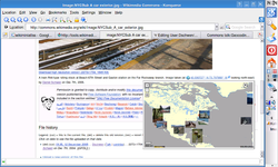
WikiMiniAtlas is JavaScript plugin to display a draggable, zoomable, and clickable worldmap on geocoded image pages, such as this one. The map contains thumbnails of all other geocoded images on Commons and can be magnified down to approximate 100m resolution worldwide. While it looks similar to GoogleMaps it is our own software and free data.
Stand alone version


A stand-alone version can be found here
News
- July 5th, 2007
- Thanks the en:User:TheDJ who suggested a patch, the WikiMiniAtlas now works in Safari.
- June 19th, 2007
- The new base map generated from VMAP0 data is now live for about a week. Today I had to create a workaround for yet another IE bug (location headers on image request replies seem to get ignored).
- May 30th, 2007
- The new database dump adds over 3300 new images to the map, that's almost a 120% increase. Geocoding is really taking off now. The display of the images can now be switched for labels from seven different wikipedias. The WikiMikiAtlas userinterface has been translated into 25 different languages so far. Thanks guys!
- May 16th, 2007
- The WikiMiniAtlas is enabled globally on Commons. A couple of enhancements are planned. The display of either thumbnails or Links to Wikipedia articles in various languages wil be switchable soon.
Ошибки
- Thumbnails partially occluded by map tiles (IE only)
- The thumbs are child elements of the maptiles and therefore the z-index mechanism does not work between thumbs and neighbouring maptiles in the Internet Explorer. Links: [1]
See also: Commons project Geocoding