Commons:Wiki4Alps/Werdenberg

From Wikimedia Commons, the free media repository
Jump to navigation Jump to search

<< Wiki4Alps << St. Gallen

List of the cultural heritage of the district of Werdenberg in the Canton St. Gallen

[edit]
Map of Werdenberg
Map of Werdenberg

List of Monuments in the district of Werdenberg in the Canton St. Gallen.

Update: 15 April 2014

List

[edit]
KGS-Nr Upload Foto   Object Other Cov. Cat. Type Address Town Coordinates
8110 Upload a file Gasthaus Traube Gasthaus Traube No images B G St. Gallerstrasse 7 Buchs
47° 26′ 06.57″ N, 9° 28′ 46.89″ E Kartographer map based on OpenStreetMap.View all coordinates using: OpenStreetMapinfo


14012 Upload a file Katholische Kirche Herz Jesu Katholische Kirche Herz Jesu No images B G Pfrundgutstrasse 5 Buchs
47° 09′ 50.19″ N, 9° 28′ 14.58″ E Kartographer map based on OpenStreetMap.View all coordinates using: OpenStreetMapinfo


14029 Upload a file Alte Mühle Alte Mühle No images B G Müliweg 5 Gams
47° 12′ 15.45″ N, 9° 26′ 26.41″ E Kartographer map based on OpenStreetMap.View all coordinates using: OpenStreetMapinfo


8137 Upload a file Katholische Kirche St. Michael (1868) Katholische Kirche St. Michael (1868) No images B G Michaelsberg Gams
47° 12′ 12.74″ N, 9° 26′ 24.31″ E Kartographer map based on OpenStreetMap.View all coordinates using: OpenStreetMapinfo


11773 Upload a file Doppelhaus Doppelhaus No images A G Städtli 24/25, Werdenberg Grabs
47° 10′ 05.85″ N, 9° 27′ 46.44″ E Kartographer map based on OpenStreetMap.View all coordinates using: OpenStreetMapinfo


11771 Upload a file Haus Haus No images A G Städtli 16, Werdenberg Grabs
47° 10′ 03.48″ N, 9° 27′ 44.45″ E Kartographer map based on OpenStreetMap.View all coordinates using: OpenStreetMapinfo


11772 Upload a file Haus Haus No images A G Städtli 23, Werdenberg Grabs
47° 10′ 05.05″ N, 9° 27′ 45.74″ E Kartographer map based on OpenStreetMap.View all coordinates using: OpenStreetMapinfo


11760 Upload a file Häuser, Mittelalterliche Ständerbaureihe Häuser, Mittelalterliche Ständerbaureihe No images A G Städtli 2–7, Werdenberg Grabs
47° 10′ 05.16″ N, 9° 27′ 46.79″ E Kartographer map based on OpenStreetMap.View all coordinates using: OpenStreetMapinfo


8151 Upload a file Mühle, Säge, Wollwäscherei und Hammerschmitte No images A G Glockenweg, Grabs Grabs
47° 10′ 49.28″ N, 9° 26′ 17.86″ E Kartographer map based on OpenStreetMap.View all coordinates using: OpenStreetMapinfo


10127 Upload a file Schlangenhaus Schlangenhaus No images A G Städtli 14, Werdenberg Grabs
47° 10′ 03.22″ N, 9° 27′ 45.05″ E Kartographer map based on OpenStreetMap.View all coordinates using: OpenStreetMapinfo


10126 Upload a file Stadtbefestigung (Stadtmauer, Torturm, Doktorhaus) Stadtbefestigung (Stadtmauer, Torturm, Doktorhaus) No images A G Werdenberg Grabs
47° 10′ 05.93″ N, 9° 27′ 46.96″ E Kartographer map based on OpenStreetMap.View all coordinates using: OpenStreetMapinfo


8149 Upload a file Schloss Werdenberg Schloss Werdenberg No images A G Städtli, Werdenberg Grabs
47° 10′ 06.51″ N, 9° 27′ 42.04″ E Kartographer map based on OpenStreetMap.View all coordinates using: OpenStreetMapinfo


8287 Upload a file Burgruine Forstegg mit Zeughaus (17. Jh.) Burgruine Forstegg mit Zeughaus (17. Jh.) No images B F/G Schloss Forstegg, Salez Sennwald
47° 14′ 44.66″ N, 9° 29′ 45.98″ E Kartographer map based on OpenStreetMap.View all coordinates using: OpenStreetMapinfo


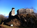
8288 Upload a file Burgruine Hohensax Burgruine Hohensax No images B F Sax Sennwald
47° 13′ 49.35″ N, 9° 26′ 37.92″ E Kartographer map based on OpenStreetMap.View all coordinates using: OpenStreetMapinfo


8291 Upload a file Hammerschmiede (19. Jh.) No images B G In Bächen, Sennwald Sennwald
47° 15′ 23.52″ N, 9° 30′ 05.08″ E Kartographer map based on OpenStreetMap.View all coordinates using: OpenStreetMapinfo


8290 Upload a file Reformierte Kirche Sax (um 1500) No images B G Kirchgasse, Sax Sennwald
47° 13′ 55.51″ N, 9° 27′ 33.31″ E Kartographer map based on OpenStreetMap.View all coordinates using: OpenStreetMapinfo


14059 Upload a file Reformierte Kirche Sennwald Reformierte Kirche Sennwald No images B G Anna Göldi-Weg, Sennwald Sennwald
47° 15′ 56.13″ N, 9° 30′ 28.61″ E Kartographer map based on OpenStreetMap.View all coordinates using: OpenStreetMapinfo


8293 Upload a file Reformierte Kirche (um 1500, 20. Jh.) mit Pfarrhaus (16./19. Jh.) und Beinhauskapelle No images B G Chirchgass Sevelen
47° 07′ 17.32″ N, 9° 29′ 09.66″ E Kartographer map based on OpenStreetMap.View all coordinates using: OpenStreetMapinfo


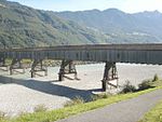
8292 Upload a file Rheinbrücke Sevelen-Vaduz Rheinbrücke Sevelen-Vaduz No images B G Rheinstrasse Sevelen
47° 07′ 57.12″ N, 9° 30′ 42.94″ E Kartographer map based on OpenStreetMap.View all coordinates using: OpenStreetMapinfo


8396 Upload a file Gretschins-Herrenfeld/Ochsenberg (prähistorische Siedlung/Opferplatz/mittelalterliche Burg, Ruine) No images A F Burghalde, Gretschins Wartau
47° 05′ 54.44″ N, 9° 29′ 25.61″ E Kartographer map based on OpenStreetMap.View all coordinates using: OpenStreetMapinfo


8397 Upload a file Walser Rathaus auf Palfries No images A G Palfries Wartau
47° 05′ 48.33″ N, 9° 24′ 03.96″ E Kartographer map based on OpenStreetMap.View all coordinates using: OpenStreetMapinfo


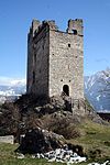
8400 Upload a file Burgruine Wartau (13. Jh.) Burgruine Wartau (13. Jh.) No images B F Burghalde, Gretschins Wartau
47° 05′ 54.94″ N, 9° 29′ 26.34″ E Kartographer map based on OpenStreetMap.View all coordinates using: OpenStreetMapinfo


8401 Upload a file Burgstelle (13. Jh.), Brocha Burg No images B F Burgweg Wartau
47° 06′ 13.21″ N, 9° 29′ 26.33″ E Kartographer map based on OpenStreetMap.View all coordinates using: OpenStreetMapinfo


8398 Upload a file Moos, mesolithische Station No images B F Oberschan Wartau
47° 06′ 42.54″ N, 9° 27′ 45.44″ E Kartographer map based on OpenStreetMap.View all coordinates using: OpenStreetMapinfo


14090 Upload a file Rathaus Azmoos No images B G Poststrasse 51, Azmoos Wartau
47° 04′ 47.78″ N, 9° 28′ 36.35″ E Kartographer map based on OpenStreetMap.View all coordinates using: OpenStreetMapinfo


14089 Upload a file Reformierte Kirche St. Martin Reformierte Kirche St. Martin No images B G Kirchweg, Gretschins Wartau
47° 05′ 50.31″ N, 9° 29′ 10.32″ E Kartographer map based on OpenStreetMap.View all coordinates using: OpenStreetMapinfo


9656 Upload a file Altweesen (spätrömisches Kastell/ mittelalterliche Wüstung) No images A F Bahnhofstrasse / Ziegelbrückstrasse Weesen
47° 07′ 57.77″ N, 9° 05′ 33.6″ E Kartographer map based on OpenStreetMap.View all coordinates using: OpenStreetMapinfo


8408 Upload a file Dominikanerinnenkloster Maria Zuflucht (Ende 17. Jh.) mit Klosterarchiv No images B G/S Im Städtli 29 Weesen
47° 08′ 07.46″ N, 9° 05′ 47.19″ E Kartographer map based on OpenStreetMap.View all coordinates using: OpenStreetMapinfo


8409 Upload a file Katholische Bühlkirche Heilig Kreuz (Ortsgemeindearchiv), mit Kaplanei Katholische Bühlkirche Heilig Kreuz (Ortsgemeindearchiv), mit Kaplanei No images B G Büelstrasse Weesen
47° 08′ 03.04″ N, 9° 05′ 38.99″ E Kartographer map based on OpenStreetMap.View all coordinates using: OpenStreetMapinfo


14096 Upload a file Reformierte Bühlkirche (Zwinglikirche) Reformierte Bühlkirche (Zwinglikirche) No images B G Büelstrasse Weesen
47° 08′ 03.63″ N, 9° 05′ 36.63″ E Kartographer map based on OpenStreetMap.View all coordinates using: OpenStreetMapinfo


14095 Upload a file Villa Kurfürst No images B G Hauptstrasse 10 Weesen
47° 08′ 00.74″ N, 9° 05′ 43.66″ E Kartographer map based on OpenStreetMap.View all coordinates using: OpenStreetMapinfo