Commons:Wiki4Alps/Visp

From Wikimedia Commons, the free media repository
Jump to navigation Jump to search

<< Wiki4Alps << Valais

List of the cultural heritage of the district of Visp in the Canton Valais

[edit]
Map of Visp
Map of Visp

List of Monuments in the district of Visp in the Canton Valais.

Update: 15 April 2014

List

[edit]
KGS-Nr Upload Foto   Object Other Cov. Cat. Type Address Town Coordinates
6618 Upload a file Muttergotteskapelle Muttergotteskapelle No images B G Dorfplatz Baltschieder
46° 18′ 33.62″ N, 7° 51′ 53.24″ E Kartographer map based on OpenStreetMap.View all coordinates using: OpenStreetMapinfo


6934 Upload a file Kirche St.Sebastian Kirche St.Sebastian No images B G Kirchplatz Randa
46° 06′ 04.14″ N, 7° 47′ 03.55″ E Kartographer map based on OpenStreetMap.View all coordinates using: OpenStreetMapinfo


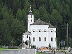
6967 Upload a file Rundkirche Mariä Himmelfahrt Rundkirche Mariä Himmelfahrt No images A G Lehn Saas-Balen
46° 09′ 12.6″ N, 7° 55′ 36.34″ E Kartographer map based on OpenStreetMap.View all coordinates using: OpenStreetMapinfo


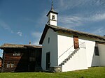
6969 Upload a file Kapelle St.Antonius Kapelle St.Antonius No images B G Tamatten Saas-Balen
46° 08′ 18.2″ N, 7° 55′ 52″ E Kartographer map based on OpenStreetMap.View all coordinates using: OpenStreetMapinfo


6970 Upload a file Kapelle zur Hohen Stiege, mit Kapellenweg No images B G Saas-Fee
46° 06′ 36.94″ N, 7° 56′ 02.36″ E Kartographer map based on OpenStreetMap.View all coordinates using: OpenStreetMapinfo


6971 Upload a file Gebäude mit wassergetriebenen Anlagen No images B G Saas-Grund
46° 07′ 54.91″ N, 7° 56′ 14.71″ E Kartographer map based on OpenStreetMap.View all coordinates using: OpenStreetMapinfo


6972 Upload a file Kapelle Heilige Dreifaltigkeit No images B G Saas-Grund
46° 07′ 52.21″ N, 7° 56′ 09.85″ E Kartographer map based on OpenStreetMap.View all coordinates using: OpenStreetMapinfo


6973 Upload a file Kirche St.Bartholomäus (Ausstattung) No images B G Saas-Grund
46° 07′ 25.86″ N, 7° 56′ 12.26″ E Kartographer map based on OpenStreetMap.View all coordinates using: OpenStreetMapinfo


6974 Upload a file Rippenhelm des ehemaligen Kirchturms No images B G Saas-Grund
46° 07′ 23.52″ N, 7° 56′ 14.89″ E Kartographer map based on OpenStreetMap.View all coordinates using: OpenStreetMapinfo


7081 Upload a file Alter Kirchturm Alter Kirchturm No images B G Dorfstrasse St.Niklaus
46° 10′ 39.86″ N, 7° 48′ 11.02″ E Kartographer map based on OpenStreetMap.View all coordinates using: OpenStreetMapinfo


7082 Upload a file Kapelle St.Jakob Kapelle St.Jakob No images B G Gasenried St.Niklaus
46° 10′ 42.74″ N, 7° 49′ 28.67″ E Kartographer map based on OpenStreetMap.View all coordinates using: OpenStreetMapinfo


7084 Upload a file Meierturm No images B G Dorfstrasse 36 St.Niklaus
46° 10′ 32.59″ N, 7° 48′ 05.76″ E Kartographer map based on OpenStreetMap.View all coordinates using: OpenStreetMapinfo


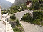
7086 Upload a file Kinbrücke über die Mattervispa mit Bildstock Kinbrücke über die Mattervispa mit Bildstock No images A G Chinegga Stalden
46° 13′ 46.31″ N, 7° 52′ 16.25″ E Kartographer map based on OpenStreetMap.View all coordinates using: OpenStreetMapinfo


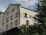
7088 Upload a file Embdaturm No images B G Hofen Stalden
46° 14′ 00.74″ N, 7° 52′ 10.45″ E Kartographer map based on OpenStreetMap.View all coordinates using: OpenStreetMapinfo


7089 Upload a file Kapelle und Brücke zur Niwu Briggu Kapelle und Brücke zur Niwu Briggu No images B G Neubrück Stalden
46° 15′ 06.66″ N, 7° 52′ 38.86″ E Kartographer map based on OpenStreetMap.View all coordinates using: OpenStreetMapinfo


7090 Upload a file Kirche St.Michael No images B G Unterdorf Stalden
46° 14′ 03.73″ N, 7° 52′ 16.97″ E Kartographer map based on OpenStreetMap.View all coordinates using: OpenStreetMapinfo


7091 Upload a file Meierhaus No images B G Stalden
46° 13′ 59.88″ N, 7° 52′ 29.89″ E Kartographer map based on OpenStreetMap.View all coordinates using: OpenStreetMapinfo


7092 Upload a file Merjenbrücke No images B G Stahlen Stalden
46° 13′ 37.16″ N, 7° 51′ 48.64″ E Kartographer map based on OpenStreetMap.View all coordinates using: OpenStreetMapinfo


7093 Upload a file Kapelle St.Anna Kapelle St.Anna No images B G Gspon Staldenried
46° 13′ 28.63″ N, 7° 54′ 10.69″ E Kartographer map based on OpenStreetMap.View all coordinates using: OpenStreetMapinfo


7134 Upload a file Mühle und Walke Mühle und Walke No images A G Törbel
46° 14′ 21.19″ N, 7° 50′ 34.12″ E Kartographer map based on OpenStreetMap.View all coordinates using: OpenStreetMapinfo


7133 Upload a file Kirche St.Theodor (Altäre) No images B G Zen Stapfen Törbel
46° 14′ 12.91″ N, 7° 51′ 09.58″ E Kartographer map based on OpenStreetMap.View all coordinates using: OpenStreetMapinfo


7130 Upload a file Schutzengelkapelle No images B G Im Feld Törbel
46° 13′ 56.14″ N, 7° 51′ 04.9″ E Kartographer map based on OpenStreetMap.View all coordinates using: OpenStreetMapinfo


7183 Upload a file Altes Spittel (16. und 18. Jh.) No images B G Spittelgasse 4 Visp
46° 17′ 23.24″ N, 7° 52′ 52″ E Kartographer map based on OpenStreetMap.View all coordinates using: OpenStreetMapinfo


7185 Upload a file Burgerhaus (mit Pergola) No images B G Grundacherstrasse 19, Eyholz Visp
46° 17′ 38.33″ N, 7° 54′ 42.23″ E Kartographer map based on OpenStreetMap.View all coordinates using: OpenStreetMapinfo


7184 Upload a file Burgerkirche Heilige Drei Könige mit Burgerarchiv Burgerkirche Heilige Drei Könige mit Burgerarchiv No images B G Kaplaneigasse Visp
46° 17′ 25.01″ N, 7° 52′ 51.89″ E Kartographer map based on OpenStreetMap.View all coordinates using: OpenStreetMapinfo


7188 Upload a file Haus Burgener (1699) No images B G St. Martiniplatz 5 Visp
46° 17′ 22.81″ N, 7° 52′ 53.08″ E Kartographer map based on OpenStreetMap.View all coordinates using: OpenStreetMapinfo


7189 Upload a file Haus Cricer (1577) Haus Cricer (1577) No images B G Gräfibielgasse 3 Visp
46° 17′ 26.16″ N, 7° 52′ 51.31″ E Kartographer map based on OpenStreetMap.View all coordinates using: OpenStreetMapinfo


7190 Upload a file Haus In-Albon (16. Jh.) Haus In-Albon (16. Jh.) No images B G Gräfibielgasse 6 Visp
46° 17′ 25.84″ N, 7° 52′ 50.59″ E Kartographer map based on OpenStreetMap.View all coordinates using: OpenStreetMapinfo


7191 Upload a file Haus Zuber (15. Jh.) Haus Zuber (15. Jh.) No images B G St. Martinistrasse 4a Visp
46° 17′ 25.51″ N, 7° 52′ 53.47″ E Kartographer map based on OpenStreetMap.View all coordinates using: OpenStreetMapinfo


7186 Upload a file Kapelle Mariä Himmelfahrt Kapelle Mariä Himmelfahrt No images B G Kantonsstrasse, Eyholz Visp
46° 17′ 46.28″ N, 7° 55′ 08.83″ E Kartographer map based on OpenStreetMap.View all coordinates using: OpenStreetMapinfo


7182 Upload a file Kapelle St.Sebastian (1688) Kapelle St.Sebastian (1688) No images B G Albenried Visp
46° 17′ 28.86″ N, 7° 49′ 54.7″ E Kartographer map based on OpenStreetMap.View all coordinates using: OpenStreetMapinfo


7187 Upload a file Kaplaneihaus (1673) Kaplaneihaus (1673) No images B G Kantonsstrasse 76, Eyholz Visp
46° 17′ 45.74″ N, 7° 55′ 08.11″ E Kartographer map based on OpenStreetMap.View all coordinates using: OpenStreetMapinfo


7192 Upload a file Kirche St.Martin Kirche St.Martin No images B G St. Martiniplatz Visp
46° 17′ 20.76″ N, 7° 52′ 52″ E Kartographer map based on OpenStreetMap.View all coordinates using: OpenStreetMapinfo


7193 Upload a file Lochmatterturm (um 1200) Lochmatterturm (um 1200) No images B G Treichweg 6 Visp
46° 17′ 18.02″ N, 7° 52′ 51.67″ E Kartographer map based on OpenStreetMap.View all coordinates using: OpenStreetMapinfo


7195 Upload a file Pflanzetta Pflanzetta No images B G St. Jodernstrasse 7 Visp
46° 17′ 15.54″ N, 7° 52′ 56.6″ E Kartographer map based on OpenStreetMap.View all coordinates using: OpenStreetMapinfo


7196 Upload a file Schützenlaube (1664) Schützenlaube (1664) No images B G Schulhausplatz Visp
46° 17′ 26.95″ N, 7° 52′ 49.55″ E Kartographer map based on OpenStreetMap.View all coordinates using: OpenStreetMapinfo


9705 Upload a file Bronzezeitliche/mittelalterliche Siedlung No images A G Oberstalden Visperterminen
46° 16′ 18.84″ N, 7° 53′ 42.9″ E Kartographer map based on OpenStreetMap.View all coordinates using: OpenStreetMapinfo


7197 Upload a file Altäre der Kirche St.Theodul No images B G Kirchstrasse Visperterminen
46° 15′ 29.16″ N, 7° 54′ 02.99″ E Kartographer map based on OpenStreetMap.View all coordinates using: OpenStreetMapinfo


7203 Upload a file Waldkapelle mit Kapellenweg No images B G Visperterminen
46° 15′ 22.86″ N, 7° 54′ 43.74″ E Kartographer map based on OpenStreetMap.View all coordinates using: OpenStreetMapinfo


7220 Upload a file Kastel, bronzezeitliche Höhensiedlung No images B F Zeneggen
46° 16′ 19.38″ N, 7° 51′ 27.5″ E Kartographer map based on OpenStreetMap.View all coordinates using: OpenStreetMapinfo


7221 Upload a file Nothelferkapelle auf dem Biel No images B G Zeneggen
46° 16′ 25.36″ N, 7° 51′ 50.22″ E Kartographer map based on OpenStreetMap.View all coordinates using: OpenStreetMapinfo


9706 Upload a file Felszeichnungen/prähistorische Schalensteine No images A F Hubelwäng Zermatt
46° 00′ 41.69″ N, 7° 43′ 44.83″ E Kartographer map based on OpenStreetMap.View all coordinates using: OpenStreetMapinfo


7226 Upload a file Kapelle der Heiligen Familie No images B G Wichjeweg, Winkelmatten Zermatt
46° 00′ 47.09″ N, 7° 44′ 43.04″ E Kartographer map based on OpenStreetMap.View all coordinates using: OpenStreetMapinfo


7223 Upload a file Kapelle St.Jakob Kapelle St.Jakob No images B G Findelen Zermatt
46° 00′ 40.25″ N, 7° 45′ 55.01″ E Kartographer map based on OpenStreetMap.View all coordinates using: OpenStreetMapinfo


7225 Upload a file Kirche St.Mauritius (Altäre mit Taufstein) Kirche St.Mauritius (Altäre mit Taufstein) No images B G Kirchtrasse Zermatt
46° 01′ 10.09″ N, 7° 44′ 47.65″ E Kartographer map based on OpenStreetMap.View all coordinates using: OpenStreetMapinfo