Commons:Wiki4Alps/Obersimmental-Saanen

From Wikimedia Commons, the free media repository
Jump to navigation Jump to search

<< Wiki4Alps << Bern

List of the cultural heritage of the district of Obersimmental-Saanen in the Canton Bern

[edit]
Map of Obersimmental-Saanen

List of Monuments in the district of Obersimmental-Saanen in the Canton Bern.

Update: 15 April 2014

List

[edit]
KGS-Nr Upload Foto   Object Other Cov. Cat. Type Address Town Coordinates
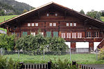
9202 Upload a file Bauernhaus Bauernhaus No images A G Adlemsried 85, 86 Boltigen
46° 38′ 20.84″ N, 7° 23′ 49.77″ E Kartographer map based on OpenStreetMap.View all coordinates using: OpenStreetMapinfo


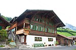
9770 Upload a file Bauernhaus Bauernhaus No images A G Weissenbach 543 Boltigen
46° 36′ 23.61″ N, 7° 22′ 29.23″ E Kartographer map based on OpenStreetMap.View all coordinates using: OpenStreetMapinfo


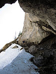
9555 Upload a file Ranggiloch (mesolithischer Abri) Ranggiloch (mesolithischer Abri) No images A F Boltigen
46° 38′ 07.89″ N, 7° 20′ 20.61″ E Kartographer map based on OpenStreetMap.View all coordinates using: OpenStreetMapinfo


795 Upload a file Burgruine Geristein No images B G Boltigen
46° 59′ 26.27″ N, 7° 31′ 25.75″ E Kartographer map based on OpenStreetMap.View all coordinates using: OpenStreetMapinfo


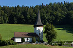
803 Upload a file Reformierte Kirche Reformierte Kirche No images B G Boltigen
46° 37′ 49.4″ N, 7° 23′ 39.4″ E Kartographer map based on OpenStreetMap.View all coordinates using: OpenStreetMapinfo


9220 Upload a file Bauernhaus No images A G Saali 594 Gsteig bei Gstaad
46° 24′ 02.15″ N, 7° 16′ 15.71″ E Kartographer map based on OpenStreetMap.View all coordinates using: OpenStreetMapinfo


9771 Upload a file Bauernhaus Feutersoey No images A G Zelg 408 Gsteig bei Gstaad
46° 24′ 43.45″ N, 7° 16′ 04.44″ E Kartographer map based on OpenStreetMap.View all coordinates using: OpenStreetMapinfo


924 Upload a file Gasthof Bären No images B G Dorf Gsteig bei Gstaad
46° 23′ 06.66″ N, 7° 16′ 01.61″ E Kartographer map based on OpenStreetMap.View all coordinates using: OpenStreetMapinfo


925 Upload a file Reformierte Kirche mit Pfarrhaus Reformierte Kirche mit Pfarrhaus No images B G Dorf Gsteig bei Gstaad
46° 23′ 04.72″ N, 7° 16′ 02.08″ E Kartographer map based on OpenStreetMap.View all coordinates using: OpenStreetMapinfo


1021 Upload a file Ehemaliges Bauernhaus mit Mühle No images A G Dorf 247 Lauenen
46° 25′ 28″ N, 7° 19′ 21.13″ E Kartographer map based on OpenStreetMap.View all coordinates using: OpenStreetMapinfo


1020 Upload a file Jägerhaus No images B G Auf der Schüpfe 514 Lauenen
46° 24′ 58.66″ N, 7° 19′ 46.94″ E Kartographer map based on OpenStreetMap.View all coordinates using: OpenStreetMapinfo


1022 Upload a file Reformierte Kirche Reformierte Kirche No images B G Im Dorf Lauenen
46° 25′ 28.91″ N, 7° 19′ 15.74″ E Kartographer map based on OpenStreetMap.View all coordinates using: OpenStreetMapinfo


1198 Upload a file Alte Kastlanei No images A G Davidsmatte 231 Saanen
46° 29′ 22.09″ N, 7° 16′ 06.23″ E Kartographer map based on OpenStreetMap.View all coordinates using: OpenStreetMapinfo


1200 Upload a file Kirche Saanen Kirche Saanen No images A G Pfruendmatte 74 Saanen
46° 29′ 25.01″ N, 7° 15′ 30.4″ E Kartographer map based on OpenStreetMap.View all coordinates using: OpenStreetMapinfo


1197 Upload a file Palace-Hotel Palace-Hotel No images B G Gstaad Saanen
46° 28′ 23.33″ N, 7° 17′ 22.63″ E Kartographer map based on OpenStreetMap.View all coordinates using: OpenStreetMapinfo


1201 Upload a file Reformierte St. Anna-Kapelle und Pfarrhaus Reformierte St. Anna-Kapelle und Pfarrhaus No images B G Saanen
46° 29′ 25.02″ N, 7° 15′ 31.81″ E Kartographer map based on OpenStreetMap.View all coordinates using: OpenStreetMapinfo


1240 Upload a file Haus Perren-Gobeli Nr. 311 No images B G Grodey St. Stephan
46° 30′ 35.46″ N, 7° 23′ 56.03″ E Kartographer map based on OpenStreetMap.View all coordinates using: OpenStreetMapinfo


1241 Upload a file Reformierte Kirche No images B G Ried St. Stephan
46° 31′ 09.44″ N, 7° 23′ 03.23″ E Kartographer map based on OpenStreetMap.View all coordinates using: OpenStreetMapinfo


1369 Upload a file Burgruine Oberer Mannenberg Burgruine Oberer Mannenberg No images A G Zweisimmen
46° 34′ 17.9″ N, 7° 22′ 54.83″ E Kartographer map based on OpenStreetMap.View all coordinates using: OpenStreetMapinfo


11720 Upload a file Unterer Mannenberg Unterer Mannenberg No images A G Zweisimmen
46° 34′ 13.36″ N, 7° 22′ 46.85″ E Kartographer map based on OpenStreetMap.View all coordinates using: OpenStreetMapinfo


1367 Upload a file Reformierte Kirche mit Pfarrhaus Reformierte Kirche mit Pfarrhaus No images A G Kirchgasse 231 Zweisimmen
46° 33′ 06.83″ N, 7° 22′ 18.47″ E Kartographer map based on OpenStreetMap.View all coordinates using: OpenStreetMapinfo


1370 Upload a file Schloss Blankenburg, mit Schlossscheune Schloss Blankenburg, mit Schlossscheune No images B G Blankenburg Zweisimmen
46° 32′ 20.7″ N, 7° 23′ 16.06″ E Kartographer map based on OpenStreetMap.View all coordinates using: OpenStreetMapinfo