Commons:Wiki4Alps/Hinwil

From Wikimedia Commons, the free media repository
Jump to navigation Jump to search

<< Wiki4Alps << Zürich

List of the cultural heritage of the district of Hinwil in the Canton Zürich

[edit]
Map of Zürich
Map of Zürich

List of Monuments in the district of Hinwil in the Canton Zürich.

Update: 15 April 2014

List

[edit]
KGS-Nr Upload Foto   Object Other Cov. Cat. Type Address Town Coordinates
7455 Upload a file Bauernhaus Roswiesli (18. Jh.) Bauernhaus Roswiesli (18. Jh.) No images B G Roswiesli 280, Steg Fischenthal
47° 21′ 00.96″ N, 8° 56′ 15.09″ E Kartographer map based on OpenStreetMap.View all coordinates using: OpenStreetMapinfo


7456 Upload a file Drechslerei im Kleintal (1860) Drechslerei im Kleintal (1860) No images B G Chlital 3, Steg Fischenthal
47° 20′ 56.3″ N, 8° 57′ 09.33″ E Kartographer map based on OpenStreetMap.View all coordinates using: OpenStreetMapinfo


12558 Upload a file Fabrikantenvilla Waldheim Fabrikantenvilla Waldheim No images B G Bahnhofstrasse 19, Steg Fischenthal
47° 21′ 11.84″ N, 8° 56′ 00.72″ E Kartographer map based on OpenStreetMap.View all coordinates using: OpenStreetMapinfo


7454 Upload a file Flarzhaus Ennerlänzen (17./18. Jh.) Flarzhaus Ennerlänzen (17./18. Jh.) No images B G Ennerlenzen 1–4 Fischenthal
47° 21′ 26.11″ N, 8° 55′ 31.52″ E Kartographer map based on OpenStreetMap.View all coordinates using: OpenStreetMapinfo


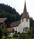
12559 Upload a file Reformierte Kirche Reformierte Kirche No images B G Kirchstrasse 2 Fischenthal
47° 19′ 53.16″ N, 8° 55′ 08.97″ E Kartographer map based on OpenStreetMap.View all coordinates using: OpenStreetMapinfo


11661 Upload a file Primarschulhaus Binzholz Primarschulhaus Binzholz No images A G Schulhausstrasse 6 Wald
47° 16′ 45.24″ N, 8° 54′ 37.49″ E Kartographer map based on OpenStreetMap.View all coordinates using: OpenStreetMapinfo


7722 Upload a file Bauernhaus Bauernhaus No images B G Tonacher Wald
47° 16′ 11.59″ N, 8° 54′ 01.88″ E Kartographer map based on OpenStreetMap.View all coordinates using: OpenStreetMapinfo


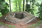
7723 Upload a file Burgruine Baliken Burgruine Baliken No images B G Blattenbach, Baliken Wald
47° 16′ 26.85″ N, 8° 53′ 50.83″ E Kartographer map based on OpenStreetMap.View all coordinates using: OpenStreetMapinfo


7724 Upload a file Ehemalige Pilgerherberge zum Roten Schwert Ehemalige Pilgerherberge zum Roten Schwert No images B G Blattenbach 1142 Wald
47° 16′ 33.93″ N, 8° 53′ 51.5″ E Kartographer map based on OpenStreetMap.View all coordinates using: OpenStreetMapinfo


7726 Upload a file Ehemalige Spinnerei und Weberei Honegger (Baugruppe) Ehemalige Spinnerei und Weberei Honegger (Baugruppe) No images B G Lindenhofstrasse / Jonastrasse Wald
47° 16′ 26.34″ N, 8° 54′ 31.78″ E Kartographer map based on OpenStreetMap.View all coordinates using: OpenStreetMapinfo


7727 Upload a file Feinweberei Elmer (Baugruppe) Feinweberei Elmer (Baugruppe) No images B G Hüblistrasse 35 Wald
47° 16′ 47.33″ N, 8° 55′ 01.86″ E Kartographer map based on OpenStreetMap.View all coordinates using: OpenStreetMapinfo


7728 Upload a file Herrensitz Windegg (17. Jh. über Burgstelle um 1270) mit Ökonomiegebäude Herrensitz Windegg (17. Jh. über Burgstelle um 1270) mit Ökonomiegebäude No images B G Windeggstrasse 2 Wald
47° 16′ 34.94″ N, 8° 55′ 08.14″ E Kartographer map based on OpenStreetMap.View all coordinates using: OpenStreetMapinfo


7729 Upload a file Reformierte Kirche Reformierte Kirche No images B G Kirchplatz Wald
47° 16′ 37.08″ N, 8° 54′ 57.06″ E Kartographer map based on OpenStreetMap.View all coordinates using: OpenStreetMapinfo


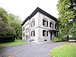
12714 Upload a file Villa Clarida Villa Clarida No images B G Rütistrasse 18 Wald
47° 16′ 29.19″ N, 8° 54′ 48.71″ E Kartographer map based on OpenStreetMap.View all coordinates using: OpenStreetMapinfo


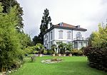
12715 Upload a file Villa Flora Villa Flora No images B G Rütistrasse 15 Wald
47° 16′ 29.94″ N, 8° 54′ 51.16″ E Kartographer map based on OpenStreetMap.View all coordinates using: OpenStreetMapinfo