Commons:Wiki4Alps/Brig

From Wikimedia Commons, the free media repository
Jump to navigation Jump to search

<< Wiki4Alps << Valais

List of the cultural heritage of the district of Brig in the Canton Valais

[edit]
Map of Brig
Map of Brig

List of Monuments in the district of Brig in the Canton Valais.

Update: 15 April 2014

List

[edit]
KGS-Nr Upload Foto   Object Other Cov. Cat. Type Address Town Coordinates
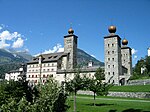
6661 Upload a file Alter und neuer Stockalperpalast Alter und neuer Stockalperpalast No images A G Alte Simplonstrasse 28 Brig-Glis
46° 18′ 54.72″ N, 7° 59′ 26.52″ E Kartographer map based on OpenStreetMap.View all coordinates using: OpenStreetMapinfo


6659 Upload a file Gamsenmauer (Talsperre) No images A F Sandweg Brig-Glis
46° 18′ 08.1″ N, 7° 56′ 52.62″ E Kartographer map based on OpenStreetMap.View all coordinates using: OpenStreetMapinfo


6660 Upload a file Kirche Mariä Himmelfahrt mit Beinhaus Kirche Mariä Himmelfahrt mit Beinhaus No images A G Dorfplatz Brig-Glis
46° 18′ 38.38″ N, 7° 58′ 40.91″ E Kartographer map based on OpenStreetMap.View all coordinates using: OpenStreetMapinfo


6663 Upload a file Bahnhof (1906) Bahnhof (1906) No images B G Bahnhofplatz 1 Brig-Glis
46° 19′ 09.3″ N, 7° 59′ 17.7″ E Kartographer map based on OpenStreetMap.View all coordinates using: OpenStreetMapinfo


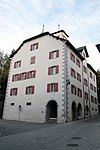
6667 Upload a file Haus Fernanda von Stockalper (1727) Haus Fernanda von Stockalper (1727) No images B G Alte Simplonstrasse 39 Brig-Glis
46° 18′ 55.37″ N, 7° 59′ 27.92″ E Kartographer map based on OpenStreetMap.View all coordinates using: OpenStreetMapinfo


6666 Upload a file Jungsteinzeitliches Gräberfeld No images B F Grundbiel Brig-Glis
46° 18′ 33.77″ N, 7° 57′ 51.73″ E Kartographer map based on OpenStreetMap.View all coordinates using: OpenStreetMapinfo


6668 Upload a file Kapelle St.Antonius Eremita Kapelle St.Antonius Eremita No images B G Alte Simplonstrasse Brig-Glis
46° 18′ 52.09″ N, 7° 59′ 31.31″ E Kartographer map based on OpenStreetMap.View all coordinates using: OpenStreetMapinfo


6669 Upload a file Kapelle St.Sebastian Kapelle St.Sebastian No images B G Sebastiansplatz Brig-Glis
46° 18′ 58.57″ N, 7° 59′ 16.48″ E Kartographer map based on OpenStreetMap.View all coordinates using: OpenStreetMapinfo


6670 Upload a file Kollegiumskirche Spiritus Sanctus mit altem Kollegium Kollegiumskirche Spiritus Sanctus mit altem Kollegium No images B G Kollegiumsplatz Brig-Glis
46° 18′ 55.66″ N, 7° 59′ 32.42″ E Kartographer map based on OpenStreetMap.View all coordinates using: OpenStreetMapinfo


13912 Upload a file Museum Stockalperschloss No images B S Alte Simplonstrasse 39 Brig-Glis
46° 18′ 54.94″ N, 7° 59′ 26.34″ E Kartographer map based on OpenStreetMap.View all coordinates using: OpenStreetMapinfo


6671 Upload a file Ringmauer und Scheune No images B G Furkaweg Brig-Glis
46° 18′ 56.81″ N, 7° 59′ 37.46″ E Kartographer map based on OpenStreetMap.View all coordinates using: OpenStreetMapinfo


6672 Upload a file Sammlung Arnold Perren (Ethnografie) No images B S Sebastiansplatz Brig-Glis
46° 18′ 59.62″ N, 7° 59′ 16.58″ E Kartographer map based on OpenStreetMap.View all coordinates using: OpenStreetMapinfo


10598 Upload a file Stockalperarchiv Brig und Archiv des Geschichtsforschenden Vereins Oberwallis No images B S Alte Simplonstrasse 28 Brig-Glis
46° 18′ 54.83″ N, 7° 59′ 26.2″ E Kartographer map based on OpenStreetMap.View all coordinates using: OpenStreetMapinfo


6888 Upload a file Beinhaus Beinhaus No images A G Beinhausweg Naters
46° 19′ 31.87″ N, 7° 59′ 17.56″ E Kartographer map based on OpenStreetMap.View all coordinates using: OpenStreetMapinfo


6887 Upload a file Kirche St.Mauritius Kirche St.Mauritius No images A G Kirchstrasse Naters
46° 19′ 32.2″ N, 7° 59′ 16.3″ E Kartographer map based on OpenStreetMap.View all coordinates using: OpenStreetMapinfo


6874 Upload a file Burgerhaus mit Triel No images B G Mund Naters
46° 18′ 58.46″ N, 7° 56′ 31.13″ E Kartographer map based on OpenStreetMap.View all coordinates using: OpenStreetMapinfo


6889 Upload a file Burgruine Supersaxo No images B F/G Schlossweg Naters
46° 19′ 40.4″ N, 7° 59′ 15.11″ E Kartographer map based on OpenStreetMap.View all coordinates using: OpenStreetMapinfo


6890 Upload a file Junkerhof Junkerhof No images B G Kirchstrasse 3 Naters
46° 19′ 31.33″ N, 7° 59′ 15″ E Kartographer map based on OpenStreetMap.View all coordinates using: OpenStreetMapinfo


6891 Upload a file Kapelle St.Antonius im Klosi No images B G Klosiweg Naters
46° 19′ 42.06″ N, 7° 59′ 07.19″ E Kartographer map based on OpenStreetMap.View all coordinates using: OpenStreetMapinfo


6637 Upload a file Kapelle St.Johannes der Täufer mit spätgotischem Kruzifix und Barockaltar No images B G Birgisch Naters
46° 18′ 59.83″ N, 7° 57′ 25.13″ E Kartographer map based on OpenStreetMap.View all coordinates using: OpenStreetMapinfo


10574 Upload a file Kapelle St.Nikolaus No images B G Färchu, Mund Naters
46° 18′ 50.4″ N, 7° 56′ 02.51″ E Kartographer map based on OpenStreetMap.View all coordinates using: OpenStreetMapinfo


6876 Upload a file Kirche St.Jakob (Turm und Ausstattung) Kirche St.Jakob (Turm und Ausstattung) No images B G Kantonsstrasse 35, Mund Naters
46° 18′ 55.12″ N, 7° 56′ 31.49″ E Kartographer map based on OpenStreetMap.View all coordinates using: OpenStreetMapinfo


6885 Upload a file Kirche St.Theodul Kirche St.Theodul No images B G Blatten Naters
46° 21′ 28.37″ N, 7° 58′ 59.99″ E Kartographer map based on OpenStreetMap.View all coordinates using: OpenStreetMapinfo


6893 Upload a file Lergienhaus (ob Pfarrhaus) No images B G Schulhausstrasse 1/3 Naters
46° 19′ 33.96″ N, 7° 59′ 12.73″ E Kartographer map based on OpenStreetMap.View all coordinates using: OpenStreetMapinfo


6894 Upload a file Ornavasso-Turm Ornavasso-Turm No images B G Schulhausstrasse 6 Naters
46° 19′ 37.52″ N, 7° 59′ 09.92″ E Kartographer map based on OpenStreetMap.View all coordinates using: OpenStreetMapinfo


6895 Upload a file Pfarrhaus mit Archiv Pfarrhaus mit Archiv No images B G Judengasse 44 Naters
46° 19′ 33.1″ N, 7° 59′ 13.99″ E Kartographer map based on OpenStreetMap.View all coordinates using: OpenStreetMapinfo


6896 Upload a file Spycher Michel Supersaxo Spycher Michel Supersaxo No images B G Schlossweg 2 Naters
46° 19′ 37.02″ N, 7° 59′ 17.92″ E Kartographer map based on OpenStreetMap.View all coordinates using: OpenStreetMapinfo


6877 Upload a file Wohnturm No images B G Brunnu 5, Mund Naters
46° 18′ 58.43″ N, 7° 56′ 35.34″ E Kartographer map based on OpenStreetMap.View all coordinates using: OpenStreetMapinfo


9077 Upload a file Ganterbrücke Ganterbrücke No images B G Simplonstrasse Ried-Brig
46° 17′ 47.47″ N, 8° 03′ 02.63″ E Kartographer map based on OpenStreetMap.View all coordinates using: OpenStreetMapinfo


6957 Upload a file Kapelle Mariä Verkündigung (1707) mit Kapellenweg No images B G Burgspitz Ried-Brig
46° 19′ 08.51″ N, 8° 01′ 46.52″ E Kartographer map based on OpenStreetMap.View all coordinates using: OpenStreetMapinfo


7030 Upload a file Altes Hospiz Altes Hospiz No images A G beim Simplonpass Simplon
46° 14′ 06.65″ N, 8° 00′ 55.62″ E Kartographer map based on OpenStreetMap.View all coordinates using: OpenStreetMapinfo


7021 Upload a file Alpe Hopsche No images B G Simplon
46° 15′ 03.89″ N, 8° 01′ 15.13″ E Kartographer map based on OpenStreetMap.View all coordinates using: OpenStreetMapinfo


7024 Upload a file Alter Sustbau No images B G Engi Simplon
46° 13′ 14.95″ N, 8° 01′ 56.89″ E Kartographer map based on OpenStreetMap.View all coordinates using: OpenStreetMapinfo


14952 Upload a file Hospiz auf dem Simplonpass No images B G Simplon
46° 14′ 47.22″ N, 8° 01′ 45.3″ E Kartographer map based on OpenStreetMap.View all coordinates using: OpenStreetMapinfo


7031 Upload a file Kirche St.Gotthard Kirche St.Gotthard No images B G Dorfplatz Simplon
46° 11′ 44.95″ N, 8° 03′ 22.32″ E Kartographer map based on OpenStreetMap.View all coordinates using: OpenStreetMapinfo


7032 Upload a file Napoleonskaserne in der Gondoschlucht (Alte Kaserne) Napoleonskaserne in der Gondoschlucht (Alte Kaserne) No images B G Gondoschlucht Simplon
46° 11′ 10.54″ N, 8° 05′ 29.87″ E Kartographer map based on OpenStreetMap.View all coordinates using: OpenStreetMapinfo


14954 Upload a file Haus Trigon No images B G Termen


7229 Upload a file Siedlungsruinen des Goldbergwerks Gondo No images A X Hof Zwischbergen
46° 11′ 16.4″ N, 8° 08′ 24″ E Kartographer map based on OpenStreetMap.View all coordinates using: OpenStreetMapinfo


7230 Upload a file Kirche St.Markus Kirche St.Markus No images B G Simplonstrasse, Gondon Zwischbergen
46° 11′ 44.56″ N, 8° 08′ 27.1″ E Kartographer map based on OpenStreetMap.View all coordinates using: OpenStreetMapinfo


7231 Upload a file Sust von Stockalper Sust von Stockalper No images B G Simplonstrasse, Gondo Zwischbergen
46° 11′ 45.06″ N, 8° 08′ 25.3″ E Kartographer map based on OpenStreetMap.View all coordinates using: OpenStreetMapinfo