Category:Zürcher Oberland
Jump to navigation
Jump to search


Deutsch: Das Zürcher Oberland (schweizerdeutsch Züri-Oberland) bezeichnet das hügelige Hinterland des Kantons Zürich und das Tössbergland. Es umfasst die Zürcher Bezirke Hinwil, Uster, Pfäffikon und das Mittlere Tösstal im Bezirk Winterthur. Das Zürcher Oberland ist durch seine Wander- und Mountainbikerouten bekannt, mit vielen abgelegenen, ruhigen Plätzen, um sich vom täglichen Stress zu erholen. So bieten sich von den Bergen Schneebelhorn, Hörnli, Sitzberg und vom Bachtel mit seinem Aussichtsturm herrliche Rundblicke von den Alpen, über den Zürichsee, das Zürcher Unterland, bis gegen den Bodensee und zum Säntis.
Das Oberland umfasst folgende Gemeinden: Bäretswil - Bauma - Bubikon - Dürnten - Egg - Fällanden - Fehraltorf - Fischenthal - Gossau - Greifensee - Grüningen - Hinwil - Hittnau - Illnau-Effretikon - Kyburg - Maur - Mönchaltorf - Pfäffikon - Russikon - Rüti - Schlatt - Seegräben - Sternenberg - Turbenthal - Uster - Volketswil - Wald - Weisslingen - Wetzikon - Wila - Wildberg und Zell.
Das Oberland umfasst folgende Gemeinden: Bäretswil - Bauma - Bubikon - Dürnten - Egg - Fällanden - Fehraltorf - Fischenthal - Gossau - Greifensee - Grüningen - Hinwil - Hittnau - Illnau-Effretikon - Kyburg - Maur - Mönchaltorf - Pfäffikon - Russikon - Rüti - Schlatt - Seegräben - Sternenberg - Turbenthal - Uster - Volketswil - Wald - Weisslingen - Wetzikon - Wila - Wildberg und Zell.
English: The Zürcher Oberland (Zürich highlands) is the hilly south-eastern part of the Canton of Zürich in Switzerland, bordering on the Toggenburg, including the districts of Uster, Hinwil, Pfäffikon as well as the Tösstal as far as the district of Winterthur. The territory gradually fell under the control of the city of Zürich from 1408 to 1452. In the 18th century, the jurisdiction lay with the reeve of Grüningen for the southern part, and with the reeve of Kyburg for the northern part together with most of the Zürcher Unterland.
Français : L'Oberland zurichois, appelé en allemand Zürcher Oberland et en alémanique Züri-Oberland, est une région de Suisse.
Highlands in Switzerland | |||||
| Upload media | |||||
| Instance of | |||||
|---|---|---|---|---|---|
| Location | Canton of Zürich, Switzerland | ||||
| |||||
Subcategories
This category has the following 57 subcategories, out of 57 total.
A
B
D
E
F
- Flarz (10 F)
G
H
I
J
K
- Kastell Irgenhausen (109 F)
M
P
S
- Schnebelhorn (18 F)
- Sternenberg (19 F)
T
- Täuferhöhle (7 F)
- Tössstock (9 F)
U
V
W
Z
Media in category "Zürcher Oberland"
The following 48 files are in this category, out of 48 total.
-
Adlisberg - Zürcher Oberland - Loorenchop IMG 4235.JPG 4,288 × 2,848; 6.21 MB
-
Alfred A.Fassbind - der Biograf von Joseph Schmidt.jpg 6,000 × 4,005; 3.06 MB
-
Aussenanlage.JPG 6,000 × 4,000; 15.98 MB
-
Bachtel - Ritterhaus - Bubikon Büelhölzli IMG 4927.JPG 4,176 × 2,772; 2.77 MB
-
Barfussweg.JPG 6,000 × 4,000; 16.64 MB
-
Detail Ringspinnmaschine 43 - Teilansicht.jpg 5,414 × 3,614; 3.28 MB
-
Dürnten - Tann - Tösstal - Ritterhaus - Bubikon Büelhölzli 2010-11-09 15-12-38.JPG 4,288 × 2,848; 6.29 MB
-
Egg - Pfannenstiel Aussichtsturm IMG 4814.JPG 4,288 × 2,848; 6.29 MB
-
Farm in Züricher Oberland.JPG 5,184 × 3,456; 5.81 MB
-
Hörnli 20 Dezember 2009 009.jpg 1,280 × 960; 367 KB
-
Karte Bezirk Hinwil 2007 blank.png 2,066 × 1,450; 619 KB
-
Karte Bezirk Hinwil 2007.png 2,066 × 1,450; 745 KB
-
Karte Bezirk Hinwil.png 826 × 1,001; 244 KB
-
Karte Bezirk Pfäffikon 2007 blank.png 2,066 × 1,277; 557 KB
-
Karte Bezirk Pfäffikon 2007.png 2,066 × 1,277; 681 KB
-
Karte Bezirk Pfäffikon 2015 blank.png 2,066 × 1,276; 551 KB
-
Karte Bezirk Pfäffikon 2015.png 2,066 × 1,276; 666 KB
-
Karte Bezirk Pfäffikon 2016 blank.png 2,066 × 1,276; 544 KB
-
Karte Bezirk Pfäffikon 2016.png 2,066 × 1,276; 658 KB
-
Karte Bezirk Pfäffikon.png 826 × 1,001; 250 KB
-
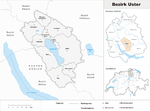
Karte Bezirk Uster.png 826 × 1,001; 247 KB
-
Naehmaschinenmuseum0wd.jpg 1,600 × 1,200; 389 KB
-
Naturstation Silberweide Bild 2.JPG 1,772 × 1,181; 931 KB
-
Oberuster - Schloss-Plateau - Turm 2015-09-20 16-05-35.JPG 6,000 × 4,000; 17 MB
-
Pfannenstiel - Hochwacht IMG 4789.JPG 4,288 × 2,848; 3.08 MB
-
Pfannenstiel Hochwacht-Okenshöhe - Pfannenstiel Aussichtsturm IMG 4819.JPG 4,288 × 2,848; 6.87 MB
-
Pfäffikersee.JPG 1,280 × 960; 491 KB
-
S-Bahn Zürich Drumlinlandschaft.jpg 4,032 × 3,024; 2.45 MB
-
Schotterbank Sennwald.jpg 1,598 × 1,068; 703 KB
-
Seedamm rapperswil.jpg 1,399 × 1,866; 2.45 MB
-
Spielplatz Wasserlauf.jpg 4,000 × 6,000; 6.3 MB
-
Storch4.JPG 6,000 × 4,000; 10.37 MB
-
ZH Oberland Winter12.jpg 2,826 × 1,883; 1.65 MB
-
Zürcher Oberland - Pfannenstiel Aussichtsturm 2010-10-01 16-32-10.jpg 4,176 × 2,772; 2.15 MB
-
Zürcher Oberland - Pfannenstiel Aussichtsturm IMG 4816.JPG 3,264 × 2,448; 1.6 MB
-
Zürcher Oberland - Pfannenstiel Hochwacht IMG 4830.JPG 4,074 × 2,704; 1.95 MB
-
Zürcher Oberland - Pfannenstiel Hochwacht IMG 4831.JPG 4,074 × 2,704; 2.27 MB
-
Zürcher Oberland.jpg 3,345 × 2,104; 1.85 MB
-
Zürcher Oberland2.jpg 3,456 × 2,304; 2.01 MB


