Category:Ystrad Mynach
Jump to navigation
Jump to search
town in the County Borough of Caerphilly, within the ancient county of Glamorgan, Wales  | |||||
| Upload media | |||||
| Instance of | |||||
|---|---|---|---|---|---|
| Location |
| ||||
 | |||||
Cymraeg: Mae Ystrad Mynach yn dref ym mwrdeistref sirol Caerffili. Saif ar y briffordd A472. Mae ganddi boblogaeth o tua 10,000.
English: Ystrad Mynach is a town in the County Borough of Caerphilly, previously within the ancient traditional county of Glamorgan, Wales, and is 5 miles north of Caerphilly town. It has a population of around 10,000 and stands in the Rhymney Valley [1]. Before the Industrial Revolution and the coming of coal mining in the South Wales coalfield the valley was rural and farmed [2]. It lies in the community of Gelligaer.
Norsk bokmål: Ystrad Mynach er en by i grevskapsdistriktet Caerphilly i Wales, omkring 8 km nord for Caerphilly.
Subcategories
This category has the following 2 subcategories, out of 2 total.
P
- Parc Penallta (18 F)
Y
- Ystrad Mynach railway station (28 F)
Media in category "Ystrad Mynach"
The following 200 files are in this category, out of 403 total.
(previous page) (next page)-

-
 37411 near Ystrad Mynach - geograph.org.uk - 343182.jpg 640 × 439; 96 KB
-

-
 A472 at Tredomen - geograph.org.uk - 5755629.jpg 640 × 481; 55 KB
-
 A472 towards Ystrad Mynach railway station - geograph.org.uk - 6153762.jpg 1,024 × 779; 234 KB
-
 Access road to Forge Mill, Ystrad Mynach - geograph.org.uk - 6171269.jpg 1,471 × 1,600; 845 KB
-
 Adorable Paws in Ystrad Mynach town centre - geograph.org.uk - 5997187.jpg 1,024 × 875; 185 KB
-

-
 Ashburne, Penallta Road, Ystrad Mynach - geograph.org.uk - 5997219.jpg 1,024 × 677; 122 KB
-

-
 Barclays Ystrad Mynach - geograph.org.uk - 5992725.jpg 1,600 × 1,468; 535 KB
-
 Bargoed train in Ystrad Mynach railway station - geograph.org.uk - 5988054.jpg 1,024 × 837; 268 KB
-
 Bark Avenue Boutique in Ystrad Mynach - geograph.org.uk - 6171332.jpg 1,600 × 1,173; 337 KB
-
 Bedwlwyn Road houses, Ystrad Mynach - geograph.org.uk - 5997277.jpg 1,024 × 838; 195 KB
-
 Bedwlwyn Street, Ystrad Mynach - geograph.org.uk - 5994449.jpg 1,024 × 886; 195 KB
-
 Beech Tree Fish Bar, Ystrad Mynach - geograph.org.uk - 5997834.jpg 1,024 × 802; 155 KB
-

-
 Bethania Chapel, Twyn Road, Ystrad Mynach - geograph.org.uk - 6171479.jpg 1,600 × 1,366; 411 KB
-
-

-
 Bethany, Lisburn Road, Ystrad Mynach - geograph.org.uk - 5994333.jpg 1,024 × 873; 166 KB
-

-
 Bilingual direction sign, Caerphilly Road, Ystrad Mynach - geograph.org.uk - 6172328.jpg 1,011 × 1,024; 242 KB
-

-

-
 Blue frontage, Penallta Road, Ystrad Mynach - geograph.org.uk - 5986677.jpg 906 × 1,024; 225 KB
-
 Blue house, Penallta Road, Ystrad Mynach - geograph.org.uk - 6017196.jpg 1,024 × 1,016; 168 KB
-
 Bookmakers at Valley Greyhound Stadium.jpg 2,600 × 1,733; 1.25 MB
-

-
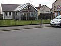
 Bryn Seion Baptist Chapel, Ystrad Mynach - geograph.org.uk - 5997810.jpg 1,024 × 681; 180 KB
-
 Bryn Seion Chapel, Ystrad Mynach - geograph.org.uk - 5514141.jpg 4,608 × 3,456; 3.86 MB
-
 Brynmynach Avenue, Tredomen - geograph.org.uk - 5987150.jpg 1,024 × 949; 167 KB
-
 Brynmynach Avenue, Ystrad Mynach - geograph.org.uk - 2064376.jpg 640 × 483; 75 KB
-
 Bungalow on a Tredomen corner - geograph.org.uk - 5987151.jpg 1,024 × 908; 160 KB
-
 Bungalows, The Avenue, Ystrad Mynach - geograph.org.uk - 2036146.jpg 640 × 424; 61 KB
-
 Bus lane near Ystrad Mynach railway station - geograph.org.uk - 6153824.jpg 1,600 × 1,175; 453 KB
-
 Bus stop alongside the A472, Ystrad Mynach - geograph.org.uk - 6153759.jpg 1,024 × 808; 268 KB
-
 Byron Spear Motors, Ystrad Mynach - geograph.org.uk - 5995511.jpg 1,024 × 698; 141 KB
-

-
 Car-lined Station Road, Ystrad Mynach - geograph.org.uk - 6153766.jpg 1,024 × 712; 192 KB
-
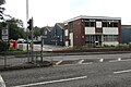
 CCB Centre for Sporting Excellence Main Building front entrance.jpg 800 × 532; 43 KB
-
 CCB Centre for Sporting Excellence Night 2.jpg 800 × 532; 45 KB
-
 Cefn Hengoed Youth Centre - geograph.org.uk - 411099.jpg 550 × 480; 34 KB
-
 Central Street, Ystrad Mynach - geograph.org.uk - 5993571.jpg 1,024 × 767; 142 KB
-
 Centre For Sporting Excellence in Ystrad Mynach - geograph.org.uk - 6172165.jpg 1,600 × 984; 255 KB
-
 Centre for Sporting Excellence reception area.jpg 800 × 533; 43 KB
-

-
 Change of house type, Heathlands, Ystrad Mynach - geograph.org.uk - 5988729.jpg 1,024 × 906; 174 KB
-
 Chicken ^ Pizza Land, Ystrad Mynach - geograph.org.uk - 5993191.jpg 1,024 × 963; 170 KB
-
 Children's playground on an Ystrad Mynach corner - geograph.org.uk - 5988584.jpg 1,024 × 932; 296 KB
-
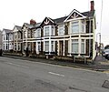 Church Street houses, Ystrad Mynach - geograph.org.uk - 5993305.jpg 1,024 × 859; 185 KB
-
 Church Street, Ystrad Mynach - geograph.org.uk - 2038327.jpg 640 × 465; 76 KB
-
 Class 37 at Ystrad Mynach - geograph.org.uk - 6247258.jpg 5,184 × 3,888; 6.34 MB
-
 Class 37 near Ystrad Mynach - geograph.org.uk - 6213488.jpg 5,067 × 3,800; 6.22 MB
-
 Class 66 at Ystrad Mynach - geograph.org.uk - 6247272.jpg 3,198 × 4,265; 5.15 MB
-
 Commercial Street bus stop and shelter, Ystrad Mynach - geograph.org.uk - 5993186.jpg 1,024 × 1,012; 202 KB
-
 Commercial Street, Ystrad Mynach - geograph.org.uk - 5995506.jpg 940 × 1,024; 184 KB
-
 Conspicuous house in Ystrad Mynach - geograph.org.uk - 5988766.jpg 1,024 × 698; 137 KB
-
 Contented sheep - geograph.org.uk - 736998.jpg 638 × 475; 88 KB
-
 Coopers Arms name sign, Ystrad Mynach - geograph.org.uk - 6171298.jpg 1,826 × 1,708; 900 KB
-
 Coopers Court business names sign, Ystrad Mynach - geograph.org.uk - 6171308.jpg 1,024 × 784; 153 KB
-
 Coopers Terrace, Ystrad Mynach - geograph.org.uk - 2037213.jpg 640 × 411; 62 KB
-
 Coopers Terrace, Ystrad Mynach - geograph.org.uk - 6172008.jpg 924 × 1,024; 247 KB
-
 Country Lane, Llanfabon - geograph.org.uk - 447156.jpg 640 × 480; 114 KB
-
 Cows at Llanbradach Fawr - geograph.org.uk - 736606.jpg 638 × 475; 76 KB
-
 Curve in a freight-only line, Tredomen - geograph.org.uk - 6303826.jpg 1,600 × 1,252; 457 KB
-
 Cwm Bakery, Ystrad Mynach - geograph.org.uk - 5997766.jpg 1,024 × 1,007; 213 KB
-
 Cycle route crosses Penallta Road - geograph.org.uk - 5718846.jpg 5,179 × 3,451; 5.33 MB
-
 Cycle route crossing Penallta Road - geograph.org.uk - 5718852.jpg 5,179 × 3,451; 5.56 MB
-
 Cycle route zigzags up into Penallta Park - geograph.org.uk - 5718888.jpg 5,179 × 3,451; 6.14 MB
-
 Cylla Sidings, Ystrad Mynach - geograph.org.uk - 6018265.jpg 1,024 × 671; 150 KB
-
 Dark green cabinet on an Ystrad Mynach corner - geograph.org.uk - 6153832.jpg 1,024 × 869; 252 KB
-
 Dark green cabinets on an Ystrad Mynach corner - geograph.org.uk - 5993300.jpg 741 × 1,024; 182 KB
-
 David Lucas Bookmakers, Ystrad Mynach - geograph.org.uk - 5993189.jpg 1,024 × 1,003; 202 KB
-

-

-
 Derelict premises, Penallta Road, Ystrad Mynach - geograph.org.uk - 6017427.jpg 1,024 × 689; 146 KB
-
 Diamonds in Ystrad Mynach - geograph.org.uk - 5992742.jpg 857 × 1,024; 214 KB
-
 Dilwyn Avenue houses, Ystrad Mynach - geograph.org.uk - 5997878.jpg 1,017 × 1,024; 195 KB
-
 Direction signs alongside the A472, Tredomen - geograph.org.uk - 5987161.jpg 1,012 × 1,024; 202 KB
-

-
 Do not trespass on the railway, Ystrad Mynach - geograph.org.uk - 5988058.jpg 1,600 × 1,492; 749 KB
-
 Donations bin, Commercial Street, Ystrad Mynach - geograph.org.uk - 5993188.jpg 1,024 × 925; 273 KB
-
 Down Bedwlwyn Street, Ystrad Mynach - geograph.org.uk - 5997255.jpg 1,600 × 1,023; 320 KB
-
 Down Penallta Link Road, Tredomen - geograph.org.uk - 6303848.jpg 1,600 × 1,584; 450 KB
-
 Downstream along Nant Caeach, Ystrad Mynach - geograph.org.uk - 6153748.jpg 1,600 × 1,020; 634 KB
-

-
 Dry Stone wall - geograph.org.uk - 421967.jpg 640 × 480; 151 KB
-
 East along Lisburn Road, Ystrad Mynach - geograph.org.uk - 5994349.jpg 1,024 × 859; 162 KB
-
 East along Pantycelyn Street, Ystrad Mynach - geograph.org.uk - 5988409.jpg 1,024 × 850; 158 KB
-
 East along Pengam Road, Ystrad Mynach - geograph.org.uk - 5997341.jpg 1,024 × 847; 167 KB
-

-
 East side of Penallta House, Tredomen - geograph.org.uk - 6303873.jpg 1,600 × 1,097; 315 KB
-
 East side of Pierhead Buildings, Ystrad Mynach - geograph.org.uk - 5994280.jpg 1,024 × 931; 186 KB
-
 East side of Station Road, Ystrad Mynach - geograph.org.uk - 5988386.jpg 1,024 × 951; 232 KB
-
 East side of the Beech Tree, Ystrad Mynach - geograph.org.uk - 5997844.jpg 1,024 × 853; 225 KB
-
 Eastern entrance to Ystrad Mynach Primary School - geograph.org.uk - 5994577.jpg 758 × 1,024; 172 KB
-
 Ecclesiastical Architecture, Llanfabon - geograph.org.uk - 447148.jpg 640 × 480; 101 KB
-
 Educ8 premises in Ystrad Mynach - geograph.org.uk - 5994245.jpg 1,024 × 820; 232 KB
-
 Edward Street, Ystrad Mynach - geograph.org.uk - 6171446.jpg 1,600 × 1,205; 348 KB
-
 Electricity and gas near a hospital, Ystrad Mynach - geograph.org.uk - 6172059.jpg 1,600 × 1,226; 423 KB
-
 English Baptist Mission, Central Street, Ystrad Mynach - geograph.org.uk - 5993393.jpg 1,600 × 1,135; 316 KB
-
 English Baptist Mission, Ystrad Mynach (geograph 5514130).jpg 4,608 × 3,456; 3.89 MB
-
 Entrance to Bryn Compost and Quarry - geograph.org.uk - 429654.jpg 640 × 455; 63 KB
-
 Entrance to Lewis Girls' School, Ystrad Mynach - geograph.org.uk - 5992790.jpg 1,024 × 828; 172 KB
-

-

-
 Erroneous bilingual street name sign in Ystrad Mynach - geograph.org.uk - 6017357.jpg 2,984 × 1,731; 1.51 MB
-
 Evening racing at the Valley Greyhound Stadium 01.jpg 772 × 515; 293 KB
-
 Evening racing at the Valley Greyhound Stadium 02.jpg 1,292 × 861; 618 KB
-
 Evening racing at the Valley Greyhound Stadium 03.jpg 937 × 625; 444 KB
-
 Evening racing at the Valley Greyhound Stadium 04.jpg 1,032 × 688; 539 KB
-
 Evening racing at the Valley Greyhound Stadium 05.jpg 770 × 513; 265 KB
-
 Everson Sports ^ Trophies shop in Ystrad Mynach - geograph.org.uk - 5997851.jpg 926 × 1,024; 189 KB
-
 Exit from Ystrad Mynach Campus - geograph.org.uk - 6171638.jpg 1,024 × 749; 193 KB
-
 Fab Fabrics in Ystrad Mynach - geograph.org.uk - 5994371.jpg 838 × 1,024; 214 KB
-
 Fallen leaves on a side road in Ystrad Mynach - geograph.org.uk - 5988657.jpg 1,024 × 963; 416 KB
-
 Fenced-off site, Penallta Road, Ystrad Mynach - geograph.org.uk - 6018307.jpg 1,024 × 688; 155 KB
-
 Finishing Touches in Ystrad Mynach - geograph.org.uk - 5993192.jpg 766 × 1,024; 167 KB
-
 First World War silhouettes and bench in Ystrad Mynach (geograph 6172159).jpg 2,449 × 2,311; 1.43 MB
-
 Flavours of India in Ystrad Mynach - geograph.org.uk - 5997798.jpg 1,600 × 1,518; 462 KB
-
 Footbridge beyond Hengoed railway station - geograph.org.uk - 6246214.jpg 1,024 × 651; 259 KB
-

-
 Footbridge over a brook, Ystrad Mynach - geograph.org.uk - 6171659.jpg 1,600 × 1,200; 576 KB
-
 Footpath and cycleway, Ystrad Mynach - geograph.org.uk - 6042352.jpg 891 × 1,024; 253 KB
-

-
 Former Nancy's Cafe, Nelson Road, Ystrad Mynach - geograph.org.uk - 5986741.jpg 1,024 × 836; 226 KB
-
 Former Natwest, Bedwlwyn Road, Ystrad Mynach - geograph.org.uk - 5994296.jpg 867 × 1,024; 197 KB
-

-

-
 Fortuna Bingo hall, Bedwlwyn Road, Ystrad Mynach - geograph.org.uk - 5997867.jpg 1,024 × 828; 172 KB
-
 From 20 to 30, Penallta Road, Ystrad Mynach - geograph.org.uk - 5986635.jpg 1,014 × 1,024; 259 KB
-
 From 30 to 40 on Penallta Link Road, Tredomen - geograph.org.uk - 5987218.jpg 1,022 × 1,024; 274 KB
-
 From 40 to 30 on Penallta Link Road, Tredomen - geograph.org.uk - 5987207.jpg 1,024 × 926; 250 KB
-
 Gaffaccino's Coffee Shop in Ystrad Mynach - geograph.org.uk - 5994410.jpg 814 × 1,024; 210 KB
-
 Gaffalicious corner shop in Ystrad Mynach - geograph.org.uk - 5986627.jpg 1,024 × 1,013; 188 KB
-
 Gas installation west of Coopers Terrace, Ystrad Mynach - geograph.org.uk - 6172033.jpg 1,600 × 1,223; 400 KB
-
 Gates to Penallta Marsh LNR - geograph.org.uk - 5719609.jpg 5,179 × 3,451; 6.03 MB
-

-
 George Street, Ystrad Mynach - geograph.org.uk - 6017230.jpg 1,024 × 789; 140 KB
-

-
 Glenview, Ystrad Mynach - geograph.org.uk - 6017176.jpg 1,024 × 952; 165 KB
-
 Golden Gate, Penallta Road, Ystrad Mynach - geograph.org.uk - 5994366.jpg 1,024 × 975; 229 KB
-
 Graig Road electricity substation, Hengoed - geograph.org.uk - 6246095.jpg 1,600 × 1,261; 569 KB
-
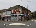
 Grassy roundabout in the south of Ystrad Mynach - geograph.org.uk - 6171272.jpg 1,024 × 725; 271 KB
-
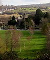
 Graveyard, Holy Trinity Church, Ystrad Mynach - geograph.org.uk - 5637081.jpg 5,179 × 3,451; 6.23 MB
-
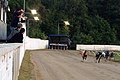
 Greyhound racing at the Valley Greyhound Stadium in Ystrad Mynach.jpg 2,843 × 1,895; 297 KB
-
 Greyhound racing at the Valley Greyhound Stadium, Ystrad Mynach.jpg 2,488 × 1,659; 361 KB
-
 Griffiths Street, Ystrad Mynach - geograph.org.uk - 5988430.jpg 1,024 × 597; 136 KB
-
 Grove Dental Practice, Ystrad Mynach - geograph.org.uk - 5986642.jpg 873 × 1,024; 203 KB
-
 Heathlands bungalows, Ystrad Mynach - geograph.org.uk - 5988705.jpg 1,024 × 688; 142 KB
-

-

-
 High Street public toilets, Ystrad Mynach - geograph.org.uk - 5994455.jpg 1,024 × 852; 300 KB
-
 Holy Trinity Church - geograph.org.uk - 6791001.jpg 2,048 × 1,536; 1.19 MB
-
 Holy Trinity, Ystrad Mynach - geograph.org.uk - 5988056.jpg 861 × 1,024; 209 KB
-
 Hospital car park entrance, Ystrad Mynach - geograph.org.uk - 6172208.jpg 1,200 × 1,600; 438 KB
-
 Hospital chimneys, Ystrad Mynach - geograph.org.uk - 6172185.jpg 910 × 1,024; 179 KB
-
 Houses on the east side of Edward Street, Ystrad Mynach - geograph.org.uk - 6172019.jpg 1,451 × 1,600; 365 KB
-

-

-
 Houses opposite Ystrad Mynach railway station - geograph.org.uk - 6153828.jpg 1,600 × 1,009; 471 KB
-
 Housing variety, Heathlands, Ystrad Mynach - geograph.org.uk - 5988740.jpg 1,024 × 740; 145 KB
-
 Ildiwch-Give Way, Davies Street, Ystrad Mynach - geograph.org.uk - 5997333.jpg 1,024 × 807; 203 KB
-
 Industrial Units - geograph.org.uk - 6790997.jpg 2,048 × 1,536; 969 KB
-

-

-

-

-

-
 Ironmongers on an Ystrad Mynach corner - geograph.org.uk - 5994471.jpg 1,002 × 1,024; 237 KB
-
 Jat Stores, Ystrad Mynach - geograph.org.uk - 5993428.jpg 1,012 × 1,024; 188 KB
-

-

-
 Junction of Twyn Road and Caerphilly Road, Ystrad Mynach - geograph.org.uk - 6171339.jpg 1,600 × 1,169; 424 KB
-
 Kids Fun name sign, Coopers Court, Ystrad Mynach - geograph.org.uk - 6171357.jpg 1,061 × 2,008; 476 KB
-
 Kids Fun play centre ^ party venue, Ystrad Mynach - geograph.org.uk - 6171352.jpg 1,600 × 1,063; 356 KB
-

-

-
 Lawrence ^ Harris - Eye care for life, Ystrad Mynach - geograph.org.uk - 5997803.jpg 1,019 × 1,024; 242 KB
-
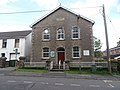
 Lewis Street Methodist Church, Ystrad Mynach - geograph.org.uk - 5986581.jpg 1,024 × 768; 156 KB
-
 Lewis Street traffic calming, Ystrad Mynach - geograph.org.uk - 5986691.jpg 1,001 × 1,024; 185 KB
-
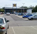 Lidl, Ystrad Mynach - geograph.org.uk - 2035555.jpg 640 × 605; 87 KB
-
 Lloyds Bank Ystrad Mynach - geograph.org.uk - 5992732.jpg 906 × 1,024; 173 KB
-
 Lloyds Pharmacy in Ystrad Mynach - geograph.org.uk - 5997784.jpg 1,024 × 912; 200 KB
-

-

-
 Lucas Estates ^ Rentals office in Ystrad Mynach - geograph.org.uk - 5986618.jpg 1,024 × 955; 202 KB
-
 Lucky Valley in Ystrad Mynach - geograph.org.uk - 5993420.jpg 1,024 × 754; 141 KB
-

-
 M ^ R Barbers, Ystrad Mynach - geograph.org.uk - 5994359.jpg 924 × 1,024; 214 KB
-
 Main building of CCB Centre for Sporting Excellence at night.jpg 800 × 533; 48 KB
-
 Manic in Ystrad Mynach town centre - geograph.org.uk - 5997177.jpg 960 × 1,024; 346 KB
-
 Marmaris Barber Shop ^2, Ystrad Mynach - geograph.org.uk - 5997248.jpg 783 × 1,024; 290 KB
-
 Meeting the dogs at the Valley Greyhound Stadium, Ystrad Mynach.jpg 3,155 × 2,103; 393 KB
-

-

-
 Mineral Line in Tredomen - geograph.org.uk - 6303862.jpg 1,600 × 1,283; 651 KB
-

-
 Mini-roundabout at crossroads in Ystrad Mynach - geograph.org.uk - 5994493.jpg 1,024 × 839; 163 KB


.jpg)


.jpg)


