Category:Yeovil
Jump to navigation
Jump to search
town in Somerset, England, UK | |||||
| Upload media | |||||
| Instance of | |||||
|---|---|---|---|---|---|
| Location | South Somerset, Somerset, South West England, England | ||||
| Population |
| ||||
| official website | |||||
 | |||||
Subcategories
This category has the following 9 subcategories, out of 9 total.
Media in category "Yeovil"
The following 200 files are in this category, out of 656 total.
(previous page) (next page)-
"The Bucket", seen from Wyndham Hill - geograph.org.uk - 3391950.jpg 640 × 480; 100 KB
-
'An eloquent man' - geograph.org.uk - 3534897.jpg 1,704 × 2,304; 1.1 MB
-
'Introspection' - geograph.org.uk - 3530093.jpg 1,704 × 2,304; 2.06 MB
-
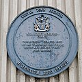
2 Henford Millennium 2000 Blue Plaque.jpg 2,674 × 2,676; 2.49 MB
-
89 Sherborne Road, Yeovil - geograph.org.uk - 5299436.jpg 640 × 480; 54 KB
-
89 Sherborne Road, Yeovil - geograph.org.uk - 5967896.jpg 1,024 × 684; 205 KB
-
A door with a message - geograph.org.uk - 3528609.jpg 1,704 × 2,304; 2.04 MB
-
A face in the open air - geograph.org.uk - 3530080.jpg 1,704 × 2,304; 2.29 MB
-
A little TLC - geograph.org.uk - 3528646.jpg 1,704 × 2,304; 1.81 MB
-
A mix of styles - geograph.org.uk - 3528625.jpg 2,304 × 1,704; 1.73 MB
-
A moved building, Yeovil - geograph.org.uk - 5967483.jpg 1,024 × 768; 338 KB
-
A run-down station and train - geograph.org.uk - 3438384.jpg 640 × 480; 123 KB
-
A30 entering Yeovil - geograph.org.uk - 3421483.jpg 640 × 455; 89 KB
-
A30 footbridge - geograph.org.uk - 4410497.jpg 640 × 351; 41 KB
-
A30, footbridge - geograph.org.uk - 4410337.jpg 640 × 409; 40 KB
-
A30, footbridge - geograph.org.uk - 4410341.jpg 640 × 434; 44 KB
-
A30, roundabout - geograph.org.uk - 4410331.jpg 640 × 346; 48 KB
-
A37 approaching Quicksilver Roundabout, Yeovil - geograph.org.uk - 5967468.jpg 1,024 × 684; 278 KB
-
A37 northbound - geograph.org.uk - 3003800.jpg 640 × 480; 83 KB
-
A37 northbound - geograph.org.uk - 3003826.jpg 640 × 454; 74 KB
-
A37 northbound - geograph.org.uk - 4410276.jpg 640 × 532; 68 KB
-
A37 northbound - geograph.org.uk - 4410285.jpg 640 × 494; 63 KB
-
A37 northbound - geograph.org.uk - 4410295.jpg 640 × 483; 71 KB
-
A37 northbound - geograph.org.uk - 4410500.jpg 640 × 522; 72 KB
-
A37 northbound - geograph.org.uk - 4410505.jpg 640 × 476; 57 KB
-
Above Nine Springs - geograph.org.uk - 1768076.jpg 640 × 480; 91 KB
-
Agusta Westland Works - geograph.org.uk - 1209367.jpg 640 × 439; 50 KB
-
AgustaWestlands Leisure Complex - geograph.org.uk - 2499716.jpg 640 × 480; 135 KB
-
Aldon cross-country - geograph.org.uk - 1276241.jpg 640 × 480; 87 KB
-
Aldon. - geograph.org.uk - 93829.jpg 640 × 480; 112 KB
-
Allotments, Yeovil - geograph.org.uk - 660432.jpg 640 × 480; 105 KB
-
Altar window - geograph.org.uk - 3534880.jpg 1,704 × 2,304; 1.59 MB
-
Animal pens at Yeovil Market - geograph.org.uk - 734402.jpg 640 × 480; 125 KB
-
Another new name for an old face - geograph.org.uk - 3533213.jpg 1,704 × 2,304; 1.58 MB
-
Approaching Yeovil on the A37 Dorchester Road - geograph.org.uk - 2464150.jpg 1,600 × 1,067; 604 KB
-
Arch Ruins at Ninesprings Country Park.jpg 4,032 × 3,024; 6.04 MB
-
Army Reserve Centre, Yeovil - geograph.org.uk - 5967779.jpg 1,024 × 768; 326 KB
-
Autumn colour in Preston Road, Yeovil - geograph.org.uk - 4193642.jpg 1,600 × 1,200; 1.49 MB
-
Back Gardens, Yeovil - geograph.org.uk - 1139716.jpg 640 × 428; 103 KB
-
Balidon House - geograph.org.uk - 2831585.jpg 640 × 480; 371 KB
-
Balidon House Bow Window - geograph.org.uk - 1139700.jpg 640 × 367; 81 KB
-
Baptist Chapel Millennium 2000 Blue Plaque.jpg 2,936 × 2,937; 1.9 MB
-
Barclays Bank, King George Street, Yeovil - geograph.org.uk - 2464010.jpg 1,067 × 1,600; 354 KB
-
Beales department store - geograph.org.uk - 3530030.jpg 1,704 × 2,304; 1.5 MB
-
Beats a barn - geograph.org.uk - 3533157.jpg 2,304 × 1,704; 1.3 MB
-
Benchmark on Pen Mill Railway Station - geograph.org.uk - 2285694.jpg 600 × 800; 203 KB
-
Benchmark on the Pen Mill Hotel - geograph.org.uk - 2284902.jpg 600 × 800; 180 KB
-
Benchmark on the side of ^27 The Park - geograph.org.uk - 2286975.jpg 600 × 800; 207 KB
-
Benchmark on Yeovil Centre - geograph.org.uk - 4545535.jpg 640 × 480; 84 KB
-
Benchmark on ^132 Gold Croft - geograph.org.uk - 2287244.jpg 600 × 800; 166 KB
-
Benchmark on ^15 Hendford - geograph.org.uk - 2286152.jpg 600 × 800; 191 KB
-
Benchmark on ^170 Gold Croft - geograph.org.uk - 2287212.jpg 600 × 800; 163 KB
-
Benchmark on ^18 High Street - geograph.org.uk - 2286136.jpg 600 × 800; 155 KB
-
Benchmark on ^56 Mitchelmore Road - geograph.org.uk - 2287169.jpg 600 × 800; 155 KB
-
Benchmark on ^8 Eastville - geograph.org.uk - 2285626.jpg 600 × 800; 132 KB
-
Black Horse - geograph.org.uk - 3264970.jpg 640 × 480; 95 KB
-
Black Horse public house, Yeovil - geograph.org.uk - 5654162.jpg 640 × 480; 96 KB
-
Blossom at Nine Springs - geograph.org.uk - 3896013.jpg 800 × 731; 95 KB
-
BM superstore, Lysander Road, Yeovil - geograph.org.uk - 4830718.jpg 1,600 × 1,200; 228 KB
-
Bob Hannam Memorial Bench.jpg 4,032 × 3,024; 3.66 MB
-
Bowling next to grazing - geograph.org.uk - 1411520.jpg 640 × 480; 141 KB
-
Bridge over former railway line, Yeovil - geograph.org.uk - 5967635.jpg 1,024 × 768; 336 KB
-
Bridge over former railway, Yeovil - geograph.org.uk - 5247331.jpg 640 × 480; 87 KB
-
Bridge, Yeovil Town Station - geograph.org.uk - 4219061.jpg 640 × 480; 87 KB
-
Builder's Yard - geograph.org.uk - 6871969.jpg 4,032 × 3,024; 4.51 MB
-
Buildings on Silver Street, Yeovil - geograph.org.uk - 5967730.jpg 1,024 × 768; 305 KB
-
Bungalows on Sandhurst Road - geograph.org.uk - 6004347.jpg 1,024 × 759; 136 KB
-
Cafe culture, Yeovil High Street - geograph.org.uk - 1126371.jpg 640 × 480; 212 KB
-
Camborne Grove houses, Yeovil - geograph.org.uk - 4655761.jpg 800 × 518; 151 KB
-
Camborne Grove, Yeovil - geograph.org.uk - 4655594.jpg 800 × 568; 122 KB
-
Camborne Grove, Yeovil - geograph.org.uk - 4657175.jpg 800 × 644; 153 KB
-
Camborne Place, Yeovil - geograph.org.uk - 4655752.jpg 649 × 800; 109 KB
-
Camborne Place, Yeovil - geograph.org.uk - 4657108.jpg 799 × 800; 143 KB
-
Camborne Street, Yeovil - geograph.org.uk - 4657122.jpg 800 × 608; 131 KB
-
Car park and apartments, Yeovil - geograph.org.uk - 5547788.jpg 1,024 × 768; 126 KB
-
Carpark murals (2) - Yeovil - geograph.org.uk - 1765448.jpg 640 × 480; 56 KB
-
Carpark murals - Yeovil - geograph.org.uk - 1765425.jpg 640 × 480; 95 KB
-
Church Cottage, Preston Rd, Preston Plucknett - geograph.org.uk - 2398478.jpg 4,000 × 3,000; 2.1 MB
-
Church Green, Yeovil - geograph.org.uk - 3624078.jpg 1,024 × 768; 1,024 KB
-
Church House (7836606206).jpg 4,000 × 3,000; 3.92 MB
-
Church of St John the Baptist - geograph.org.uk - 7073409.jpg 1,600 × 1,197; 389 KB
-
Church of St John the Baptist, Yeovil - geograph.org.uk - 5967741.jpg 1,024 × 684; 327 KB
-
Church of the Holy Ghost , Yeovil - geograph.org.uk - 1556567.jpg 480 × 640; 88 KB
-
Church sign board, Lysander Road - geograph.org.uk - 6312384.jpg 4,288 × 2,848; 1.27 MB
-
Church Terrace Yeovil - geograph.org.uk - 908896.jpg 640 × 480; 83 KB
-
Church Terrace, Yeovil - geograph.org.uk - 5967677.jpg 1,024 × 684; 265 KB
-
Cineworld and restaurants, Yeovil - geograph.org.uk - 5653318.jpg 640 × 480; 99 KB
-
Clock tower of St Michael's Hall - geograph.org.uk - 1435927.jpg 480 × 640; 191 KB
-
Column marking the Millennium, Yeovil - geograph.org.uk - 2909795.jpg 1,064 × 1,600; 356 KB
-
Column marking the Millennium, Yeovil - geograph.org.uk - 2909800.jpg 1,600 × 1,064; 382 KB
-
Converted building, Yeovil - geograph.org.uk - 4195311.jpg 1,600 × 1,200; 1.18 MB
-
Court Ash, Yeovil - geograph.org.uk - 1569094.jpg 640 × 446; 92 KB
-
Covered animal pens at Yeovil market - geograph.org.uk - 734412.jpg 640 × 480; 100 KB
-
D L Crease Ltd, Yeovil - geograph.org.uk - 4655256.jpg 800 × 796; 157 KB
-
Demolished site, Goldcroft - geograph.org.uk - 3264962.jpg 640 × 480; 60 KB
-
Direction sign, Lyde Road, Yeovil - geograph.org.uk - 4655208.jpg 715 × 800; 138 KB
-
Disused dairy, Yeovil - geograph.org.uk - 5299429.jpg 640 × 480; 88 KB
-
Dodham Brook joining River Yeo - geograph.org.uk - 1554841.jpg 640 × 471; 133 KB
-
East Coker Road - Yeovil - geograph.org.uk - 1228924.jpg 480 × 640; 121 KB
-
Electrical contractor, Lyde Road - geograph.org.uk - 6618976.jpg 1,024 × 738; 158 KB
-
Emergency Gate ^ Beacon - geograph.org.uk - 2493536.jpg 640 × 480; 137 KB
-
Entrance to Abbey Manor Business Centre, Yeovil - geograph.org.uk - 4193627.jpg 1,600 × 1,200; 1.48 MB
-
Esso filling station and car dealer, Yeovil - geograph.org.uk - 4040148.jpg 1,536 × 1,152; 963 KB
-
Filling station, Morrisons, Yeovil - geograph.org.uk - 4830622.jpg 1,600 × 1,200; 441 KB
-
Fire and Ambulance Stations - geograph.org.uk - 1411514.jpg 640 × 480; 105 KB
-
Five Ways Roundabout, Yeovil - geograph.org.uk - 2979099.jpg 640 × 480; 58 KB
-
Flats and Houses at Windermere Rd - geograph.org.uk - 1139676.jpg 640 × 428; 51 KB
-
Flowers in Princes Street - geograph.org.uk - 3028490.jpg 554 × 800; 119 KB
-
Footpath and Cycleway - geograph.org.uk - 2493516.jpg 640 × 480; 159 KB
-
Forest Hill, Yeovil - geograph.org.uk - 2789279.jpg 640 × 480; 80 KB
-
Former Arts Centre South Street - geograph.org.uk - 878251.jpg 640 × 474; 71 KB
-
Former Cinema - geograph.org.uk - 2979144.jpg 640 × 480; 69 KB
-
Former cinema - Yeovil - geograph.org.uk - 5653323.jpg 640 × 480; 63 KB
-
Former creamery, Yeovil - geograph.org.uk - 5248254.jpg 640 × 480; 79 KB
-
Former Elephant ^ Castle, Yeovil - geograph.org.uk - 5967751.jpg 1,024 × 768; 228 KB
-
Former glove factory, Yeovil - geograph.org.uk - 5247273.jpg 640 × 480; 72 KB
-
Former glove factory, Yeovil - geograph.org.uk - 5967482.jpg 1,024 × 684; 222 KB
-
Former Goldcroft Post Office - geograph.org.uk - 1406028.jpg 640 × 480; 132 KB
-
Former Hall - geograph.org.uk - 1439371.jpg 640 × 480; 152 KB
-
Former industry - Yeovil - geograph.org.uk - 5242293.jpg 640 × 480; 99 KB
-
Former Kings Arms. Yeovil - geograph.org.uk - 5967737.jpg 1,024 × 768; 321 KB
-
Former leather works, Yeovil - geograph.org.uk - 5248252.jpg 640 × 480; 74 KB
-
Forum carpark - Yeovil - geograph.org.uk - 1731066.jpg 640 × 480; 107 KB
-
Foundry House development - Yeovil - geograph.org.uk - 2121699.jpg 640 × 480; 73 KB
-
Foundry House, Old Station Way, Yeovil - site of former Glove Factory (7166833984).jpg 3,648 × 2,736; 2.21 MB
-
Four Lime trees Wyndham Hill - geograph.org.uk - 1288238.jpg 640 × 480; 124 KB
-
Fruit and Vedge Shop Lower Middle Street - geograph.org.uk - 928406.jpg 640 × 448; 103 KB
-
G.W.R.S.A Club, Yeovil - geograph.org.uk - 4655019.jpg 800 × 710; 248 KB
-
Gardens in Central Yeovil - geograph.org.uk - 3028458.jpg 800 × 600; 176 KB
-
GeoTrinity Yeovil.ogg 0.8 s; 18 KB
-
Glenthorne Avenue, Yeovil - geograph.org.uk - 5967484.jpg 1,024 × 684; 232 KB
-
Goar Knapp Allotments - geograph.org.uk - 1439377.jpg 640 × 480; 175 KB
-
Goldcroft Awareness Centre - geograph.org.uk - 1406055.jpg 640 × 480; 174 KB
-
Goldcroft Post Office - geograph.org.uk - 1434230.jpg 640 × 512; 120 KB
-
Goldenstones Leisure Centre - Yeovil - geograph.org.uk - 1398102.jpg 640 × 482; 88 KB
-
Goldfinches feeding in Yeovil - geograph.org.uk - 2542663.jpg 1,600 × 851; 267 KB
-
Graffiti and greenery - geograph.org.uk - 980614.jpg 640 × 419; 100 KB
-
Great Western pub name sign, Yeovil - geograph.org.uk - 4655790.jpg 505 × 640; 85 KB
-
Great Western pub, Yeovil - geograph.org.uk - 4655624.jpg 800 × 502; 91 KB
-
Great Western pub, Yeovil - geograph.org.uk - 4657096.jpg 800 × 720; 171 KB
-
Grey Day at Lidl Yeovil - geograph.org.uk - 1702577.jpg 640 × 480; 45 KB
-
Grove Avenue, Yeovil - geograph.org.uk - 6257890.jpg 1,600 × 1,067; 650 KB
-
Growing taller with every year - geograph.org.uk - 3528639.jpg 1,704 × 2,304; 1.7 MB
-
GWR service departing Yeovil Pen Mill - geograph.org.uk - 6953549.jpg 1,024 × 768; 289 KB
-
Halfords on the A30, Yeovil - geograph.org.uk - 3490605.jpg 800 × 600; 157 KB
-
Harbin Close, Yeovil - geograph.org.uk - 4655391.jpg 800 × 567; 111 KB
-
Hart Mobility shop in Yeovil - geograph.org.uk - 4655460.jpg 800 × 653; 121 KB
-
Haynes Butchers Princes St Yeovil - geograph.org.uk - 1558974.jpg 640 × 480; 86 KB
-
Haynes Butchers, Princes St Yeovil - geograph.org.uk - 1558973.jpg 640 × 485; 120 KB
-
Hendford Hill - geograph.org.uk - 4410325.jpg 640 × 494; 77 KB
-
Hendford Hill, A30 - geograph.org.uk - 4410326.jpg 640 × 470; 82 KB
-
Hendford Hill, Yeovil - geograph.org.uk - 5967475.jpg 1,024 × 684; 227 KB
-
Hendford, Yeovil - geograph.org.uk - 1554769.jpg 640 × 480; 59 KB
-
Hendford, Yeovil - geograph.org.uk - 1569112.jpg 640 × 458; 74 KB
-
Hidden Cottage - geograph.org.uk - 2493478.jpg 640 × 480; 179 KB
-
High Street Henford Corner Millennium 2000 Blue Plaque.jpg 2,691 × 2,693; 1.87 MB
-
High Street, Yeovil - geograph.org.uk - 3624051.jpg 1,024 × 683; 758 KB
-
Hilbourne Gardens, Yeovil - geograph.org.uk - 4626767.jpg 1,024 × 768; 139 KB
-
Holy Trinity Church, Yeovil - geograph.org.uk - 6312374.jpg 4,288 × 2,848; 1.05 MB
-
Home Drive Yeovil - geograph.org.uk - 1159943.jpg 640 × 428; 65 KB
-
Hospital Roundabout - Yeovil - geograph.org.uk - 4566329.jpg 1,024 × 752; 120 KB


