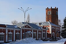
Category:Yelets
Jump to navigation
Jump to search
| Object location | | View all coordinates using: OpenStreetMap |
|---|
city in Lipetsk Oblast, Russia | |||||
| Upload media | |||||
| Instance of | |||||
|---|---|---|---|---|---|
| Location |
| ||||
| Head of government |
| ||||
| Population |
| ||||
| Area |
| ||||
| Elevation above sea level |
| ||||
| official website | |||||
 | |||||
Subcategories
This category has the following 11 subcategories, out of 11 total.
Media in category "Yelets"
The following 50 files are in this category, out of 50 total.
-
Coat of Arms of Elets (Lipetsk oblast).png 174 × 223; 10 KB
-
Flag of Elets (Lipetsk oblast).png 200 × 133; 8 KB
-
20190925 Старинный почтовый ящик.jpg 2,560 × 1,536; 1.35 MB
-
Coat of arms of Elets (2004).gif 174 × 221; 9 KB
-
Coat of Arms of Elets (Lipetsk oblast) (1967).png 175 × 230; 9 KB
-
Coat of arms of Yelets.svg 120 × 149; 23 KB
-
Coat of arms Yelets.svg 408 × 507; 25 KB
-
Flag of Yelets.svg 1,501 × 1,000; 34 KB
-
Location of Yelets (Lipetsk Oblast).svg 512 × 497; 132 KB
-
RR5514-0075R.png 1,024 × 1,024; 1.79 MB
-
Yelets - panoramio - Andris Malygin (72).jpg 1,600 × 1,170; 510 KB
-
Yelets - panoramio - Andris Malygin (73).jpg 1,600 × 998; 339 KB
-
Yelets - panoramio - Andris Malygin (74).jpg 1,600 × 1,137; 591 KB
-
Yelets - panoramio - Andris Malygin (75).jpg 1,562 × 1,200; 399 KB
-
Yelets - panoramio - Andris Malygin (76).jpg 1,600 × 1,075; 366 KB
-
Yelets - panoramio - Andris Malygin (77).jpg 1,600 × 1,161; 558 KB
-
Yelets - panoramio - Andris Malygin (78).jpg 1,600 × 1,061; 662 KB
-
Yelets - panoramio - Andris Malygin (79).jpg 786 × 1,200; 258 KB
-
Yelets - panoramio - Andris Malygin (80).jpg 833 × 1,200; 233 KB
-
Yelets - panoramio - Andris Malygin (81).jpg 894 × 1,200; 271 KB
-
Yelets - panoramio - Andris Malygin (82).jpg 1,595 × 1,200; 382 KB
-
Yelets - panoramio - Andris Malygin (83).jpg 1,600 × 1,041; 384 KB
-
Yelets - panoramio - Andris Malygin (84).jpg 1,600 × 1,098; 464 KB
-
Yelets - panoramio - Andris Malygin (85).jpg 862 × 1,200; 266 KB
-
Yelets - panoramio - Andris Malygin (86).jpg 1,600 × 1,067; 618 KB
-
Yelets - panoramio - Andris Malygin (87).jpg 1,520 × 1,200; 566 KB
-
Yelets - panoramio - Andris Malygin (88).jpg 1,600 × 1,123; 595 KB
-
Yelets - panoramio - Andris Malygin (89).jpg 1,310 × 1,200; 442 KB
-
Yelets - panoramio - Andris Malygin (90).jpg 1,418 × 1,200; 577 KB
-
Yelets - panoramio - Andris Malygin (91).jpg 1,600 × 1,067; 338 KB
-
Yelets - panoramio - Andris Malygin (92).jpg 1,600 × 1,067; 360 KB
-
Yelets - panoramio - Andris Malygin (94).jpg 1,600 × 1,067; 303 KB
-
Yelets - panoramio - Andris Malygin (95).jpg 1,600 × 1,162; 360 KB
-
Yelets - panoramio - Andris Malygin (96).jpg 578 × 1,200; 136 KB
-
Yelets - panoramio - Andris Malygin (97).jpg 1,600 × 1,048; 316 KB
-
Yelets COA (Oryol Governorate) (1781).png 174 × 202; 12 KB
-
Yelets P1040931 2200.jpg 3,300 × 2,200; 1.94 MB
-
Yelets P1040932 2200.jpg 4,070 × 2,200; 3.05 MB
-
Yelets P1040949 2200.jpg 3,300 × 2,200; 2.65 MB
-
Yelets, Lipetsk Oblast, Russia - panoramio - Andris Malygin (5).jpg 1,600 × 1,176; 384 KB
-
Yelets- panoramio - Andris Malygin (70).jpg 1,600 × 1,190; 320 KB
-
Вечерний Елец - panoramio.jpg 2,048 × 1,536; 254 KB
-
Вид от дома-музея Т. Хлебникова. Елец. 2013.jpg 1,704 × 2,272; 579 KB
-
Воргольские скалы в зелени.jpg 3,024 × 3,780; 6.69 MB
-
Гербы города ельца.webp 768 × 410; 39 KB
-
Елец - panoramio (2).jpg 2,048 × 1,536; 623 KB
-
Елец - panoramio (4).jpg 4,912 × 3,264; 6.14 MB
-
Елец памятник архитектуры Вознесенский собор значок.jpg 2,024 × 2,930; 701 KB
-
Камни. Воргольские скалы.jpg 3,024 × 3,780; 5.12 MB
-
Панорама Ельца.jpg 9,881 × 1,472; 859 KB


