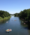
Category:Yakima River
Jump to navigation
Jump to search
tributary to the Columbia River in Washington state, United States of America | |||||
| Upload media | |||||
| Instance of | |||||
|---|---|---|---|---|---|
| Location |
| ||||
| Length |
| ||||
| Elevation above sea level |
| ||||
| Origin of the watercourse | |||||
| Mouth of the watercourse | |||||
| Drainage basin | |||||
| Tributary |
| ||||
 | |||||
Subcategories
This category has the following 18 subcategories, out of 18 total.
B
- Big Pines Recreation Site (25 F)
C
- Yakima River Canyon (7 F)
E
- Easton Diversion Dam (1 F)
K
L
N
P
- Prosser Diversion Dam (2 F)
R
- Roza Dam (2 F)
- Roza Recreational Area (17 F)
S
- Sunnyside Canal (4 F)
- Sunnyside Diversion Dam (3 F)
T
- Teanaway River (5 F)
V
- Van Giesen Street Bridge (8 F)
W
- Wapato Diversion Dam (8 F)
Y
Media in category "Yakima River"
The following 57 files are in this category, out of 57 total.
-
YakimaRiverWatersjed.png 841 × 596; 25 KB
-
A bend in the river beside the Yakima Greenway, in Union Gap, Washington - panoramio.jpg 2,592 × 1,552; 616 KB
-
A convention of hotair balloonists, a party in the sky.jpg 4,288 × 2,848; 1.06 MB
-
Cle Elum River mouth.jpg 4,032 × 3,024; 3.11 MB
-
Footbridge 3984.JPG 4,272 × 2,848; 6.81 MB
-
Hot air balloon event in Prosser, Washington.jpg 4,288 × 2,848; 5.77 MB
-
Osprey 7994.jpg 4,000 × 6,000; 8.13 MB
-
Osprey 7995.jpg 6,000 × 4,000; 6.21 MB
-
Osprey 7996.jpg 1,283 × 1,926; 1.06 MB
-
Osprey 7997.jpg 6,000 × 4,000; 6.16 MB
-
Osprey 7999.jpg 6,000 × 4,000; 6.15 MB
-
Osprey 8000.jpg 6,000 × 4,000; 5.99 MB
-
Osprey 8001.jpg 6,000 × 4,000; 6.06 MB
-
Rafters enjoying a summer day on the Yakima below Horn Rapids (1).png 2,247 × 2,614; 8.01 MB
-
Rafters enjoying a summer day on the Yakima below Horn Rapids.JPG 2,247 × 2,614; 1.82 MB
-
Sarg Hubbard Park - panoramio (2).jpg 9,110 × 1,993; 13.08 MB
-
Sarg Hubbard Park - panoramio (4).jpg 3,264 × 2,448; 1.72 MB
-
Sarg Hubbard Park - panoramio (5).jpg 2,981 × 1,076; 646 KB
-
Sarg Hubbard Park - panoramio (7).jpg 10,961 × 2,089; 16.04 MB
-
The Yakima River.jpg 1,200 × 800; 1.17 MB
-
Upper Yakima River from Highway 10, between Cle Elum and Thorp, Washington.jpg 3,264 × 2,448; 3.22 MB
-
View south from Umptanum Ridge into Yakima Canyon 0961.jpg 1,501 × 949; 355 KB
-
WA 821.jpg 5,184 × 3,456; 7.31 MB
-
Wannawish Dam.jpg 1,000 × 534; 127 KB
-
WASR10 YakimaRiver.jpg 1,638 × 1,200; 405 KB
-
Yakama Indian Reservation in Washington state (Openstreetmap).png 1,778 × 1,212; 993 KB
-
Yakima Delta Habitat Management Unit.jpeg 4,032 × 3,024; 2.35 MB
-
Yakima Greenway - panoramio (11).jpg 1,552 × 2,592; 652 KB
-
Yakima Greenway - panoramio (29).jpg 5,438 × 1,972; 6.94 MB
-
Yakima Greenway - panoramio (30).jpg 4,258 × 2,052; 6.26 MB
-
Yakima Greenway - panoramio (31).jpg 3,354 × 1,209; 3.08 MB
-
Yakima Greenway - panoramio (32).jpg 3,264 × 2,448; 1.83 MB
-
Yakima Greenway - panoramio (33).jpg 3,264 × 1,143; 878 KB
-
Yakima Greenway - panoramio (36).jpg 3,264 × 2,448; 2.01 MB
-
Yakima Greenway - panoramio (37).jpg 3,264 × 2,448; 1.64 MB
-
Yakima Greenway - panoramio (39).jpg 3,264 × 2,448; 1.69 MB
-
Yakima Greenway - panoramio (44).jpg 5,464 × 2,005; 7.5 MB
-
Yakima Greenway - panoramio (8).jpg 3,648 × 2,736; 3.54 MB
-
Yakima River at Prosser.jpeg 3,024 × 4,032; 3.69 MB
-
Yakima River Canyon (1).webm 15 s, 1,920 × 1,080; 31.82 MB
-
Yakima River Canyon (3).webm 5.2 s, 1,920 × 1,080; 13.71 MB
-
Yakima River Canyon (30692979635).jpg 2,550 × 3,300; 2.06 MB
-
Yakima River Canyon - 26718232170.jpg 8,838 × 2,968; 16.33 MB
-
Yakima River Canyon 20160512.webm 17 s, 1,920 × 1,080; 25.87 MB
-
Yakima River Canyon.webm 5.2 s, 1,920 × 1,080; 13.71 MB
-
Yakima River Delta.jpeg 4,032 × 3,024; 1.8 MB
-
Yakima river from Prosser.jpg 2,592 × 1,936; 1.62 MB
-
Yakima River running through Prosser with the Horse Heaven Hills.jpg 2,592 × 1,936; 1.59 MB
-
Yakima River south of Union Gap.jpg 1,000 × 456; 281 KB
-
Yakima Sportsman State Park.jpg 8,000 × 6,000; 19.49 MB
-
Yakima Valley open prairie, ca 1910s (INDOCC 1359).jpg 768 × 616; 95 KB
-
Yakima Valley.jpg 1,024 × 681; 143 KB
-
Yakimarivermap.jpg 666 × 676; 599 KB


