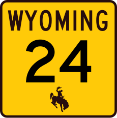
Category:Wyoming Highway 24
Jump to navigation
Jump to search
 | number: | (twenty-four) |
|---|---|---|
| State highways in Wyoming: | 14 · 22 · 24 · 28 · 31 · 34 |
state highway in Crook County, Wyoming, United States | |||||
| Upload media | |||||
| Instance of | |||||
|---|---|---|---|---|---|
| Location | Crook County, Wyoming | ||||
| Transport network | |||||
| Owned by | |||||
| Maintained by | |||||
| Inception |
| ||||
| Length |
| ||||
| Terminus | |||||
| |||||
English: Media related to Wyoming Highway 24 (Bear Lodge Highway), a 46.72-mile (75.19 km) state highway in Crook County, Wyoming, United States, that connects U.S. Route 14 at South Dakota Highway 34 at the South Dakota border.
Subcategories
This category has only the following subcategory.
Media in category "Wyoming Highway 24"
The following 7 files are in this category, out of 7 total.
-
Devils Tower under a giant cumulonimbus, seen from Wyoming Highway 24, 2009.jpg 2,868 × 1,907; 2.57 MB
-
Hulett, Wyoming.jpg 3,904 × 2,928; 3.49 MB
-
View from Wyoming State Highway 24, Devils Tower, WY - 53767689384.jpg 4,032 × 3,024; 5.06 MB
-
Wy crook2.jpg 1,536 × 1,024; 402 KB
-
WY-24.svg 391 × 393; 12 KB
-
WYO 24 and Devils Tower, Southeast view 20110821 1 (cropped).jpg 4,144 × 592; 813 KB
-
WYO 24 and Devils Tower, Southeast view 20110821 1.jpg 4,928 × 3,264; 5.85 MB


