Category:Wisconsin State Historical Marker Program
Jump to navigation
Jump to search
standardized historical markers of Wisconsin by the Wisconsin Historical Society | |||||
| Upload media | |||||
| Instance of | |||||
|---|---|---|---|---|---|
| Part of | |||||
| Location |
| ||||
| Applies to jurisdiction | |||||
| official website | |||||
| |||||
Note: these markers are managed by the Wisconsin Historical Society, a unit of the State of Wisconsin, and are in the public domain.[1]
Media in category "Wisconsin State Historical Marker Program"
The following 41 files are in this category, out of 41 total.
-
22-08-007-pigeon.jpg 1,643 × 2,048; 1.87 MB
-
22-08-010-black-river.jpg 1,672 × 2,048; 1.87 MB
-
About Iowa County Courthouse - panoramio.jpg 4,896 × 3,672; 6.86 MB
-
Aztalan State Park Entrance Sign.jpg 3,456 × 2,304; 3.73 MB
-
Brigham County Park.jpg 6,000 × 4,000; 7.3 MB
-
CentraliaPulpAndPaperMillRHPSign.jpg 2,304 × 1,728; 850 KB
-
Charles T. and Gertrude Rietz House 2.jpg 4,032 × 3,024; 8.91 MB
-
Cooksville, Wisconsin - plaque.jpg 2,136 × 2,850; 4.13 MB
-
Covered Bridge, Cedarburg, Wisconsin - sign.JPG 480 × 640; 247 KB
-
Delavan’s Historic Brick Street Historical Marker (3538414891).jpg 1,328 × 1,600; 918 KB
-
East Park Historic District, Stoughton, Wisconsin.jpg 3,496 × 2,695; 5.79 MB
-
ElkhartLakeRoadRaceCircuits.jpg 1,728 × 2,304; 766 KB
-
FatherCasperRehrlMarker.jpg 1,728 × 2,304; 793 KB
-
First Kindergarten 5.jpg 3,264 × 1,840; 740 KB
-
Fort Winnebago site and historical marker.jpg 6,000 × 4,000; 6.17 MB
-
Ft defiance.jpg 640 × 480; 34 KB
-
GK.SPsign.jpg 649 × 600; 517 KB
-
Great River Road - Beef Slough Sign at Wayside - NARA - 7718865.jpg 3,008 × 2,000; 2.91 MB
-
Great River Road - Bow and Arrow Historic Marker - NARA - 7718851.jpg 3,008 × 2,000; 4.62 MB
-
Great River Road - Bow and Arrow State Historical Marker - NARA - 7718966.jpg 2,647 × 1,746; 917 KB
-
Janesville Armory 1.JPG 2,912 × 5,184; 7.21 MB
-
John-mccaffary-burial.jpg 780 × 519; 89 KB
-
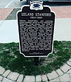
Leland Stanford Plaque Port Washington, WI.jpg 925 × 1,071; 170 KB
-
Merrimac Ferry ^ Sign - panoramio.jpg 4,896 × 3,672; 7.52 MB
-
Mineral Point, WI - 043.jpg 1,785 × 3,209; 2.3 MB
-
Mineral Point, WI - 047.jpg 3,024 × 4,032; 4.66 MB
-
OshkoshPublicMuseumRHPSign.jpg 2,304 × 1,728; 794 KB
-
PECATONICA BATTLEFIELD 1832 Marker Side 1 (picture 2020).jpg 4,608 × 3,456; 2.92 MB
-
PECATONICA BATTLEFIELD 1832 Marker Side 2 (picture 2020).jpg 4,608 × 3,456; 3.02 MB
-
Raube Road Site Marker.jpg 1,936 × 1,288; 1.48 MB
-
Rib Lake Historic Marker.jpg 640 × 480; 65 KB
-
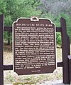
Roche-A-CriRHPSign.jpg 1,630 × 1,945; 2.35 MB
-
Rockbridge Historical Marker Friday 2019June07 914am.jpg 5,312 × 2,988; 5.57 MB
-
Superior Stockade.jpg 4,000 × 6,000; 8.97 MB
-
Tompkins-Brindler Mound Group.jpg 3,872 × 2,592; 6.7 MB
-
UWOshkoshRHPmarker.jpg 1,194 × 1,581; 1.27 MB
-
Washington Avenue Plaque 2.jpg 1,024 × 768; 312 KB
-
Wind Point - Wind Point Light - 20220510103717.jpg 3,024 × 4,032; 2.44 MB
-
Wisconsin Historical Marker ice cream sundae.jpg 2,048 × 1,536; 880 KB
-
Wisconsin’s First School for the Deaf Historical Marker (3538418425).jpg 1,067 × 1,600; 805 KB


