Category:Winkleigh
Jump to navigation
Jump to search
English: Winkleigh is a small village in Devon, England. It is best known outside Devon as the birthplace of Inch's Cider. Inch's Cider was bought by Bulmer's, who then closed the plant down. However some of those involved in the original enterprise now run Winkleigh Cider on the Hatherleigh Road.
Norsk bokmål: Winkleigh er en liten landsby i Devon, England. Den er best kjent som fødested for Inch Cider. Fabrikken stengte for noen år siden og flyttet til North Tawton. Inch's Cider ble kjøpt av Bulmer's, som så stengte bryggeriet. Noen av de ansatte driver imidlertid fremdeles Winkleigh Cider på Hatherleigh Road.
village and civil parish in Devon, United Kingdom | |||||
| Upload media | |||||
| Instance of | |||||
|---|---|---|---|---|---|
| Location | Torridge, Devon, South West England, England | ||||
| Population |
| ||||
 | |||||
Subcategories
This category has only the following subcategory.
A
Media in category "Winkleigh"
The following 200 files are in this category, out of 452 total.
(previous page) (next page)-
A 3124 south of Coulson Cross - geograph.org.uk - 3921905.jpg 1,600 × 1,063; 274 KB
-
A fine farm gate - geograph.org.uk - 3927965.jpg 4,912 × 3,264; 6.41 MB
-
A light frost on Hole Moor - geograph.org.uk - 3927879.jpg 4,912 × 3,264; 5.13 MB
-
A narrow road with a wide verge at Lane End Cross - geograph.org.uk - 5129712.jpg 1,600 × 1,201; 759 KB
-
A plain bus shelter at Winkleigh - geograph.org.uk - 3533066.jpg 768 × 1,024; 119 KB
-
A3124 at Whitehouse Lane - geograph.org.uk - 3430177.jpg 640 × 396; 54 KB
-
A3124 crosses a stream - geograph.org.uk - 5482305.jpg 2,176 × 1,476; 1.06 MB
-
A3124 junction to Hollocombe - geograph.org.uk - 5483179.jpg 2,112 × 1,388; 1.91 MB
-
A3124 junction with Elms Meadow, Winkleigh - geograph.org.uk - 5483204.jpg 2,177 × 1,444; 1.98 MB
-
A3124 near Hollocombe Moor - geograph.org.uk - 5481808.jpg 2,112 × 1,436; 1.16 MB
-
A3124 near Venton Farm - geograph.org.uk - 3430170.jpg 640 × 480; 98 KB
-
A3124 north-west of Winkleigh, Devon - geograph.org.uk - 4560284.jpg 1,024 × 692; 430 KB
-
A3124 north-west of Winkleigh, Devon - geograph.org.uk - 4560289.jpg 1,024 × 768; 523 KB
-
A3124 north-west of Winkleigh, Devon - geograph.org.uk - 4560293.jpg 1,024 × 609; 353 KB
-
A3124 runs past Summers Moor - geograph.org.uk - 5483229.jpg 1,952 × 1,404; 1.38 MB
-
A3124 towards Cock's Bridge - geograph.org.uk - 5482325.jpg 2,176 × 1,476; 1.31 MB
-
A3124 towards Coulson Cross - geograph.org.uk - 5483796.jpg 1,024 × 715; 268 KB
-
A3124, Cadditon Cross - geograph.org.uk - 2768713.jpg 640 × 474; 58 KB
-
A3214 approaching Winkleigh - geograph.org.uk - 5483188.jpg 2,184 × 1,496; 1.51 MB
-
Access road and bungalows in west Winkleigh - geograph.org.uk - 3626366.jpg 1,024 × 768; 99 KB
-
Access Road to Bryony Hill farm - geograph.org.uk - 2811845.jpg 800 × 600; 297 KB
-
Access to fields on Hole Moor - geograph.org.uk - 3927884.jpg 4,912 × 3,264; 5.16 MB
-
All Saints' Church, Winkleigh - geograph.org.uk - 6996411.jpg 3,024 × 4,032; 3.39 MB
-
All Saints' Church, Winkleigh - geograph.org.uk - 6996415.jpg 3,024 × 4,032; 2.69 MB
-
Allotment gardens, Winkleigh - geograph.org.uk - 3401892.jpg 640 × 480; 64 KB
-
Approach to Lane End junction - geograph.org.uk - 3934545.jpg 4,912 × 3,264; 6.97 MB
-
Approach to Lane End junction - geograph.org.uk - 3934595.jpg 4,912 × 3,264; 6.72 MB
-
Approach to Tinker's Cross - geograph.org.uk - 3927921.jpg 4,912 × 3,264; 6.03 MB
-
Approach to Tinker's Cross - geograph.org.uk - 3927954.jpg 4,912 × 3,264; 6.53 MB
-
Approaching Berner's Cross - geograph.org.uk - 480156.jpg 640 × 480; 142 KB
-
Approaching Tawgreen Cottages - geograph.org.uk - 3920953.jpg 1,600 × 1,027; 302 KB
-
Approaching the junction with the B3220 - geograph.org.uk - 7130602.jpg 1,024 × 768; 302 KB
-
Ashley House Farm - geograph.org.uk - 3935352.jpg 4,808 × 3,022; 5.4 MB
-
Autumn colours in Hollocombe - geograph.org.uk - 282970.jpg 480 × 640; 214 KB
-
B3220 approaching Brookland Bridge - geograph.org.uk - 3533091.jpg 768 × 1,024; 176 KB
-
B3220 at Gray's Bridge - geograph.org.uk - 3533074.jpg 1,024 × 768; 218 KB
-
Barley on Bude Hill - geograph.org.uk - 482501.jpg 640 × 480; 155 KB
-
Barn and fields, Riddistone - geograph.org.uk - 2769936.jpg 640 × 400; 44 KB
-
Barn at Gray's Bridge Farm - geograph.org.uk - 479572.jpg 640 × 472; 112 KB
-
Beare Lane - geograph.org.uk - 2769261.jpg 640 × 430; 88 KB
-
Beare Lane - geograph.org.uk - 2769280.jpg 640 × 480; 99 KB
-
Bransgrove Lane - geograph.org.uk - 5129719.jpg 1,600 × 1,200; 750 KB
-
Brick building, Court Castle, Winkleigh - geograph.org.uk - 2818538.jpg 640 × 480; 126 KB
-
Bridge on Venton Moor - geograph.org.uk - 3453834.jpg 1,024 × 672; 240 KB
-
Bridge over Hollocombe Water - geograph.org.uk - 2822022.jpg 640 × 505; 112 KB
-
Bridleway to Bransgrove - geograph.org.uk - 2281373.jpg 640 × 480; 59 KB
-
Bridleway to Narracott - geograph.org.uk - 2281409.jpg 640 × 480; 72 KB
-
Brookland Bridge on B3220 - geograph.org.uk - 3533094.jpg 1,024 × 768; 170 KB
-
Brookland Bridge seen from Stabdon Lane - geograph.org.uk - 3534679.jpg 768 × 1,024; 198 KB
-
Bude Hill (road) skirting Winkleigh Wood - geograph.org.uk - 3924013.jpg 4,608 × 3,027; 4.41 MB
-
Bude Hill (road) skirting Winkleigh Wood - geograph.org.uk - 3924014.jpg 1,600 × 1,019; 402 KB
-
Bude Hill (road) skirting Winkleigh Wood - geograph.org.uk - 3924016.jpg 4,488 × 2,889; 4.43 MB
-
Bude Hill - geograph.org.uk - 3424251.jpg 480 × 640; 77 KB
-
Bude Hill by Ward Farm - geograph.org.uk - 3923930.jpg 4,575 × 2,933; 4.2 MB
-
Bude Hill by Ward Farm - geograph.org.uk - 3923932.jpg 4,171 × 2,440; 2.35 MB
-
Bude Hill by Ward Farm - geograph.org.uk - 3923939.jpg 4,803 × 3,116; 5.9 MB
-
Bude Hill near Barton Farm - geograph.org.uk - 3924019.jpg 1,600 × 1,052; 396 KB
-
Bude Hill near Barton Farm - geograph.org.uk - 3924025.jpg 1,600 × 1,047; 352 KB
-
Buildings at Hollocombe Barton - geograph.org.uk - 2822069.jpg 640 × 450; 84 KB
-
Built for 'Geograph' - geograph.org.uk - 3934542.jpg 4,912 × 3,264; 5.72 MB
-
Bullow Brook valley - geograph.org.uk - 480101.jpg 640 × 480; 140 KB
-
Bullowbrook Bridge - geograph.org.uk - 6559660.jpg 1,600 × 1,201; 1.18 MB
-
Cactus nursery display bed near Winkleigh, Devon - geograph.org.uk - 4560508.jpg 932 × 1,024; 806 KB
-
Cadditon - geograph.org.uk - 2769930.jpg 640 × 334; 43 KB
-
Cadditon - geograph.org.uk - 2770033.jpg 640 × 393; 61 KB
-
Cadditon Cross - geograph.org.uk - 2769923.jpg 640 × 391; 73 KB
-
Car wash on edge of Winkleigh - geograph.org.uk - 6556237.jpg 1,600 × 1,143; 814 KB
-
Centre of Stable Green - geograph.org.uk - 3934683.jpg 4,912 × 3,264; 5.72 MB
-
Chapel at Hollocombe - geograph.org.uk - 283494.jpg 640 × 480; 128 KB
-
Chapel at Stable Green - geograph.org.uk - 2822006.jpg 640 × 396; 46 KB
-
Chapel at Stable Green - geograph.org.uk - 5128722.jpg 1,600 × 1,200; 817 KB
-
Chittlehampton Farm, near Hollocombe - geograph.org.uk - 146022.jpg 640 × 426; 119 KB
-
Chittlehampton to Stable Green - geograph.org.uk - 3935399.jpg 4,912 × 3,264; 6.22 MB
-
Church steps, Winkleigh - geograph.org.uk - 3401846.jpg 640 × 480; 97 KB
-
Clapper Cross - geograph.org.uk - 3536329.jpg 1,024 × 768; 275 KB
-
Clapper Cross from the woodland by the Taw - geograph.org.uk - 3536339.jpg 1,024 × 768; 293 KB
-
Clotworthy House in Winkleigh - geograph.org.uk - 2811926.jpg 600 × 800; 314 KB
-
Cock's Bridge - geograph.org.uk - 3453852.jpg 1,024 × 683; 195 KB
-
Cock's Bridge - geograph.org.uk - 480187.jpg 640 × 480; 150 KB
-
Cock's Bridge at Riddiford - geograph.org.uk - 2741446.jpg 800 × 600; 380 KB
-
Colour in Coulson - geograph.org.uk - 3921036.jpg 4,681 × 2,806; 3.66 MB
-
Constructing poultry pens - geograph.org.uk - 3888251.jpg 4,912 × 3,264; 7.41 MB
-
Construction site, Winkleigh - geograph.org.uk - 3401865.jpg 640 × 480; 84 KB
-
Coopers Hill, Winkleigh - geograph.org.uk - 4452540.jpg 800 × 600; 121 KB
-
Cottage at Tinker's Cross - geograph.org.uk - 453661.jpg 640 × 480; 104 KB
-
Coulson Cross (A 3124) - geograph.org.uk - 3921040.jpg 1,600 × 1,063; 269 KB
-
Do online deliveries come here^ - geograph.org.uk - 3920982.jpg 1,600 × 996; 197 KB
-
East Park Close, Winkleigh - geograph.org.uk - 3401832.jpg 640 × 480; 56 KB
-
Eggesford Road arriving in Winkleigh - geograph.org.uk - 3924029.jpg 4,703 × 2,933; 4.43 MB
-
Eggesford Road arriving in Winkleigh - geograph.org.uk - 3924033.jpg 4,436 × 2,845; 3.41 MB
-
Eggesford Road in Winkleigh - geograph.org.uk - 3924035.jpg 4,488 × 2,950; 4.1 MB
-
Eggesford Road, Winkleigh - geograph.org.uk - 3401839.jpg 640 × 480; 78 KB
-
Elms Meadow, Winkleigh - geograph.org.uk - 482580.jpg 640 × 364; 72 KB
-
Elms Meadow, Winkleigh - geograph.org.uk - 482646.jpg 640 × 425; 88 KB
-
Entrance to Surf Bay Leisure Park - geograph.org.uk - 1880090.jpg 640 × 480; 57 KB
-
Entrance to Winkleigh Wood - geograph.org.uk - 3424268.jpg 640 × 480; 114 KB
-
Erecting new poultry sheds - geograph.org.uk - 3935396.jpg 4,829 × 3,127; 5.35 MB
-
Evidence of wet weather - geograph.org.uk - 3888239.jpg 4,912 × 3,264; 4.44 MB
-
Exeter Road - Winkleigh - geograph.org.uk - 3924039.jpg 4,532 × 3,038; 3.55 MB
-
Exeter Road - Winkleigh - geograph.org.uk - 3924040.jpg 4,620 × 2,883; 3.02 MB
-
Farm access road to Collacott Barton - geograph.org.uk - 3533085.jpg 1,024 × 768; 100 KB
-
Farm land east of Stable Green - geograph.org.uk - 3888229.jpg 4,912 × 3,264; 5.56 MB
-
Farm land east of Stable Green - geograph.org.uk - 3888232.jpg 4,912 × 3,264; 5.78 MB
-
Farm road to Collacutt Barton - geograph.org.uk - 2741412.jpg 800 × 601; 231 KB
-
Farm road to Durdon - geograph.org.uk - 480169.jpg 640 × 480; 129 KB
-
Farm road to Luxton Barton - geograph.org.uk - 2768700.jpg 640 × 412; 73 KB
-
Farm Shop - Higher Puncherdon - geograph.org.uk - 3910970.jpg 4,421 × 2,994; 2.55 MB
-
Farm track to Graysbridge Farm - geograph.org.uk - 2809527.jpg 800 × 600; 392 KB
-
Farming related buildings - Hole Moor - geograph.org.uk - 3927910.jpg 4,912 × 3,264; 4.69 MB
-
Farmland near Bidbeare Farm - geograph.org.uk - 83472.jpg 640 × 480; 34 KB
-
Farmland near Taw Green - geograph.org.uk - 83474.jpg 640 × 480; 28 KB
-
Farmland near Tinker's Cross - geograph.org.uk - 3927970.jpg 4,912 × 3,264; 6.97 MB
-
Farmland north of Lane End - geograph.org.uk - 3935351.jpg 4,912 × 3,264; 7.03 MB
-
Farmland north of Lower Narracott Farm - geograph.org.uk - 283134.jpg 640 × 480; 133 KB
-
Farmland north of Tinkers' Cross - geograph.org.uk - 3935313.jpg 4,825 × 3,071; 5.63 MB
-
Farmland north of Tinkers' Cross - geograph.org.uk - 3935317.jpg 4,912 × 3,264; 6.78 MB
-
Farmland on Great Moor - geograph.org.uk - 3929951.jpg 4,912 × 3,264; 7.16 MB
-
Farmland on Great Moor - geograph.org.uk - 3929953.jpg 4,912 × 3,264; 7.34 MB
-
Farmland on Great Moor - geograph.org.uk - 3929956.jpg 4,912 × 3,264; 7.69 MB
-
Field above Luxton Moor - geograph.org.uk - 482805.jpg 640 × 480; 106 KB
-
Field and trees near Penson Cross - geograph.org.uk - 2769870.jpg 640 × 443; 84 KB
-
Field at a bend in the road at Taw Green - geograph.org.uk - 3536300.jpg 1,024 × 768; 113 KB
-
Field at Riddiford - geograph.org.uk - 2818771.jpg 640 × 425; 68 KB
-
Field entrance on Berry Hill - geograph.org.uk - 2769429.jpg 640 × 480; 65 KB
-
Field near Coulson - geograph.org.uk - 2769904.jpg 640 × 418; 65 KB
-
Field near Coulson - geograph.org.uk - 2769910.jpg 640 × 359; 48 KB
-
Field near Penson Cross - geograph.org.uk - 2769874.jpg 640 × 436; 87 KB
-
Field north of Berner's Cross - geograph.org.uk - 3888646.jpg 4,912 × 3,264; 3.84 MB
-
Field west of Venton Moor - geograph.org.uk - 2810062.jpg 800 × 600; 436 KB
-
Fields at Bude Hill - geograph.org.uk - 7117258.jpg 1,600 × 900; 371 KB
-
Fields behind Wheatland Farm - geograph.org.uk - 3960626.jpg 1,600 × 1,063; 564 KB
-
Fields behind Wheatland Farm - geograph.org.uk - 3960628.jpg 4,912 × 3,264; 6.69 MB
-
Fields near Winkleigh - geograph.org.uk - 2818716.jpg 640 × 423; 55 KB
-
Fields north of Winkleigh - geograph.org.uk - 3401872.jpg 640 × 480; 76 KB
-
Fishmongers in Castle Street - geograph.org.uk - 2809556.jpg 800 × 600; 309 KB
-
Flowering cacti near Winkleigh, Devon - geograph.org.uk - 4560521.jpg 1,024 × 1,024; 750 KB
-
Footbridge at Horry Mill - geograph.org.uk - 146018.jpg 640 × 426; 155 KB
-
Footpath and stream near Winkleigh - geograph.org.uk - 3626395.jpg 768 × 1,024; 277 KB
-
Footpath junction, Hollocombe - geograph.org.uk - 281783.jpg 640 × 480; 201 KB
-
Footpath south-west of Winkleigh - geograph.org.uk - 3626400.jpg 1,024 × 768; 182 KB
-
Footpath to Heath Farm - geograph.org.uk - 3423467.jpg 640 × 464; 58 KB
-
Footpath to Heath Farm - geograph.org.uk - 3423515.jpg 640 × 480; 98 KB
-
Ford at Whitehouse - geograph.org.uk - 4188121.jpg 3,872 × 2,592; 5.02 MB
-
Fore Street - geograph.org.uk - 3892828.jpg 4,912 × 3,264; 3.15 MB
-
Frosty field - Lane End - geograph.org.uk - 3929957.jpg 4,912 × 3,264; 5.25 MB
-
Frosty field - Lane End - geograph.org.uk - 3929967.jpg 4,912 × 3,264; 6.44 MB
-
Frosty field - Lane End - geograph.org.uk - 3934582.jpg 4,912 × 3,264; 7.13 MB
-
Frosty field - Lane End - geograph.org.uk - 3934588.jpg 4,912 × 3,264; 5.06 MB
-
Frosty field ^ long shadows - geograph.org.uk - 3935345.jpg 4,912 × 3,264; 5.75 MB
-
Frosty fields - geograph.org.uk - 3935327.jpg 4,808 × 3,071; 6.03 MB
-
Frosty fields - Stable Green - geograph.org.uk - 3935329.jpg 4,912 × 3,264; 6.34 MB
-
Garage in Winkleigh - geograph.org.uk - 3626359.jpg 1,024 × 768; 124 KB
-
Gate and field by Heath Lane - geograph.org.uk - 3423454.jpg 640 × 468; 72 KB
-
Gate, Loosedon Barton - geograph.org.uk - 2818261.jpg 640 × 440; 60 KB
-
Gateway near Punchardon - geograph.org.uk - 3424039.jpg 480 × 640; 73 KB
-
Gray's Bridge on B3220 - geograph.org.uk - 2741422.jpg 800 × 600; 433 KB
-
Gray's Cross - geograph.org.uk - 2741416.jpg 800 × 600; 348 KB
-
Grazing near Chittlehampton - geograph.org.uk - 3935401.jpg 4,912 × 3,264; 5.19 MB
-
Great Plantation near Winkleigh - geograph.org.uk - 3626403.jpg 1,024 × 768; 135 KB
-
Great Punchardon - geograph.org.uk - 3424216.jpg 640 × 396; 49 KB
-
Great Punchardon farm stead - geograph.org.uk - 3927865.jpg 4,912 × 3,264; 5.28 MB
-
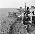
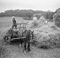
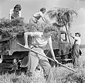
Harvesting at Mount Barton, Devon, England, 1942 D10307.jpg 1,843 × 1,772; 1,002 KB
-
Harvesting at Mount Barton, Devon, England, 1942 D10311.jpg 800 × 774; 112 KB
-
Harvesting at Mount Barton, Devon, England, 1942 D10313.jpg 800 × 774; 111 KB
-
Harvesting at Mount Barton, Devon, England, 1942 D10315.jpg 800 × 780; 105 KB
-
Harvesting at Mount Barton, Devon, England, 1942 D10317.jpg 800 × 773; 110 KB
-
Harvesting at Mount Barton, Devon, England, 1942 D10325.jpg 800 × 780; 108 KB
-
Harvesting at Mount Barton, Devon, England, 1942 D10329.jpg 800 × 774; 89 KB
-
Harvesting at Mount Barton, Devon, England, 1942 D10334.jpg 1,823 × 1,772; 1,005 KB
-
Harvesting at Mount Barton, Devon, England, 1942 D10339.jpg 800 × 773; 97 KB
-
Harvesting at Mount Barton, Devon, England, 1942 D10344.jpg 800 × 776; 137 KB
-
Heading down Bude Hill - geograph.org.uk - 3923921.jpg 4,443 × 2,988; 3.43 MB
-
Heading down Bude Hill - geograph.org.uk - 3923924.jpg 4,912 × 3,264; 6.59 MB
-
Heading south from Stable Green - geograph.org.uk - 3934692.jpg 4,912 × 3,264; 6.22 MB
-
Heading west of Penson Cross - geograph.org.uk - 3920993.jpg 1,600 × 1,038; 261 KB
-
Heart of Stable Green - geograph.org.uk - 3934685.jpg 4,912 × 3,264; 6.06 MB
-
Henacroft Cross - geograph.org.uk - 2811635.jpg 800 × 600; 442 KB
-
High Street, Winkleigh - geograph.org.uk - 2818512.jpg 478 × 640; 68 KB
-
Higher Minicleave Wood, Hollocombe - geograph.org.uk - 283495.jpg 640 × 480; 140 KB
-
Hogweed - geograph.org.uk - 482784.jpg 480 × 640; 100 KB
-
Hollocombe Corner - geograph.org.uk - 2281416.jpg 640 × 480; 37 KB
-
Hollocombe Corner - geograph.org.uk - 480165.jpg 640 × 480; 108 KB
-
Hollocombe Moor - geograph.org.uk - 282254.jpg 640 × 480; 147 KB
-
Hollocombe Moor Cross - geograph.org.uk - 2818782.jpg 640 × 452; 87 KB
-
Hollocombe Moor Head - geograph.org.uk - 2821383.jpg 640 × 408; 62 KB
-
Hollocombe Water - geograph.org.uk - 2821966.jpg 472 × 640; 107 KB
-
Hollocombe Water - geograph.org.uk - 483095.jpg 640 × 480; 143 KB
-
Hollocombe Water - geograph.org.uk - 483109.jpg 640 × 480; 145 KB
-
Hollocombe water viewed from Leach Bridge - geograph.org.uk - 282963.jpg 480 × 640; 182 KB
-
Hollocombe Wood - geograph.org.uk - 2822074.jpg 640 × 480; 147 KB
-
Horry Mill Ford - geograph.org.uk - 6829270.jpg 4,032 × 3,024; 5.83 MB
-
House south of Stable Green - geograph.org.uk - 3934689.jpg 4,912 × 3,264; 5.69 MB
-
Inns in Winkleigh - geograph.org.uk - 2809544.jpg 800 × 600; 284 KB
-
Lane approaching Riddistone Cross - geograph.org.uk - 3921004.jpg 1,024 × 638; 117 KB
-
Lane at Coulson - geograph.org.uk - 482795.jpg 640 × 480; 136 KB
-
Lane between Taw Green and Penson Cross - geograph.org.uk - 2768715.jpg 640 × 480; 119 KB
-
Lane by Great Punchardon - geograph.org.uk - 3892824.jpg 4,912 × 3,264; 6.56 MB
-
Lane by Plover's Barrow - geograph.org.uk - 3927873.jpg 4,912 × 3,264; 5.53 MB
-
Lane End - geograph.org.uk - 453658.jpg 640 × 480; 96 KB


