Category:Wincanton
Jump to navigation
Jump to search
English: Wincanton is a town in Somerset, England
town in Somerset, England  | |||||
| Upload media | |||||
| Instance of | |||||
|---|---|---|---|---|---|
| Location | Wincanton, South Somerset, Somerset, South West England, England | ||||
| Different from | |||||
 | |||||
Subcategories
This category has the following 4 subcategories, out of 4 total.
W
- Wincanton Town Hall (4 F)
- Wincanton War Memorial Hall (1 F)
Media in category "Wincanton"
The following 198 files are in this category, out of 198 total.
-
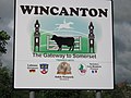 "Wincanton" sign - geograph.org.uk - 451858.jpg 640 × 480; 70 KB
-
 'The Market Garden', Wincanton - geograph.org.uk - 3442622.jpg 1,600 × 878; 371 KB
-
 1 and 3, High Street.jpg 4,608 × 3,456; 3.67 MB
-
 1, Church Street.jpg 4,608 × 3,456; 4.56 MB
-
 10, Market Place 2.jpg 4,608 × 3,456; 3.73 MB
-
 10, North Street 2.jpg 4,608 × 3,456; 6.16 MB
-
 11, 13, 15 And 17, North Street.jpg 4,608 × 3,456; 4.06 MB
-
 11, Market Place.jpg 4,608 × 3,456; 3.87 MB
-
 11, Mill Street.jpg 4,608 × 3,456; 5.37 MB
-
 12, High Street.jpg 4,608 × 3,456; 3.38 MB
-
 13, Market Place 2.jpg 3,456 × 4,608; 3.74 MB
-
 14, High Street 2.jpg 4,608 × 3,456; 3.51 MB
-
 15 North Street.jpg 4,608 × 3,456; 2.72 MB
-
 15, Mill Street 2.jpg 4,608 × 3,456; 4.76 MB
-
 15, Mill Street.jpg 4,608 × 3,456; 4.64 MB
-
 16 And 17, Market Place.jpg 4,608 × 3,456; 3.76 MB
-
 16, High Street.jpg 4,608 × 3,456; 4.32 MB
-
 17 And 19, Mill Street.jpg 4,608 × 3,456; 5.62 MB
-
 17 North Street.jpg 4,608 × 3,456; 3.83 MB
-
 17, High Street 2.jpg 4,608 × 3,456; 4.19 MB
-
 18, High Street 2.jpg 4,608 × 3,456; 4.53 MB
-
 19, High Street 2.jpg 4,608 × 3,456; 3.65 MB
-
 2, High Street 2.jpg 4,608 × 3,456; 4.15 MB
-
 2, Mill Street.jpg 4,608 × 3,456; 2.81 MB
-
 21 And 23, High Street.jpg 4,608 × 3,456; 3.47 MB
-
 22, High Street 2.jpg 4,608 × 3,456; 4.93 MB
-
 24, High Street 2.jpg 4,608 × 3,456; 4.47 MB
-
 25 And 27, Mill Street.jpg 4,608 × 3,456; 3 MB
-
 3 and 5, Church Street.jpg 4,608 × 3,456; 4.21 MB
-
 30 And 32, High Street.jpg 4,608 × 3,456; 5.2 MB
-
 4, Market Place 2.jpg 4,608 × 3,456; 4.06 MB
-
 41, High Street 2.jpg 4,608 × 3,456; 3.58 MB
-
 46, High Street 2.jpg 3,456 × 4,608; 4.2 MB
-
 5, High Street.jpg 4,608 × 3,456; 3.85 MB
-
 56 And 58, High Street.jpg 4,608 × 3,456; 4.64 MB
-
 6, High Street 2.jpg 4,608 × 3,456; 4.62 MB
-
 6, Mill Street.jpg 4,608 × 3,456; 5.03 MB
-
 7 And 8, Market Place 2.jpg 4,608 × 3,456; 3.85 MB
-
 7, High Street.jpg 4,608 × 3,456; 3.95 MB
-
 71, High Street.jpg 3,456 × 4,608; 4.87 MB
-
 8, High Street.jpg 4,608 × 3,456; 4.5 MB
-
 9, Market Place 2.jpg 4,608 × 3,456; 3.82 MB
-
 A bold statement - geograph.org.uk - 4104649.jpg 4,912 × 3,264; 5.03 MB
-
 A303 approaches Common Road overbridge - geograph.org.uk - 3845025.jpg 3,331 × 2,621; 1.19 MB
-
 A303 approaching Common Road Bridge - geograph.org.uk - 3024473.jpg 640 × 391; 46 KB
-
 A303 approaching exit for Wincanton - geograph.org.uk - 3773301.jpg 2,023 × 1,303; 1.24 MB
-
 A303 at the Wincanton Interchange - geograph.org.uk - 3845034.jpg 3,648 × 2,736; 1.32 MB
-
 A303 cutting on Bayford Hill - geograph.org.uk - 4116135.jpg 1,600 × 1,066; 1.01 MB
-
 A303 heading west - geograph.org.uk - 6260593.jpg 1,024 × 684; 217 KB
-
 A303 heading west - geograph.org.uk - 6260671.jpg 1,024 × 684; 185 KB
-
 A303 heading west - geograph.org.uk - 6260679.jpg 1,024 × 684; 193 KB
-
 A303 heading west - geograph.org.uk - 6260691.jpg 1,024 × 684; 169 KB
-
 A303 junction south of Wincanton - geograph.org.uk - 2903977.jpg 800 × 600; 304 KB
-
 A303 south of Wincanton - geograph.org.uk - 3773311.jpg 1,923 × 1,239; 1.21 MB
-
 A303, eastbound - geograph.org.uk - 4780115.jpg 640 × 340; 45 KB
-
 A303, westbound - geograph.org.uk - 5297490.jpg 640 × 426; 56 KB
-
 A303, Wincanton bypass - geograph.org.uk - 5297484.jpg 640 × 426; 53 KB
-
 A371 turning, A303 - geograph.org.uk - 5297489.jpg 640 × 402; 52 KB
-
 An interesting looking shop - geograph.org.uk - 4104645.jpg 4,707 × 3,225; 3.32 MB
-
 Arch Containing Spring And Washing Place.jpg 4,608 × 3,456; 5.5 MB
-
 Ash House.jpg 4,608 × 3,456; 4.72 MB
-

-
 Benchmark on ^83 High Street, Wincanton - geograph.org.uk - 4644310.jpg 640 × 480; 104 KB
-
 Bridge over A303 south-east of Wincanton - geograph.org.uk - 2903984.jpg 800 × 533; 283 KB
-
 Bridge over the A303, A371 turning - geograph.org.uk - 3024478.jpg 640 × 430; 42 KB
-
 British Geological Survey Sheet 297 Wincanton Solid and Drift, Published 1972.jpg 13,955 × 9,936; 50 MB
-
 Canton Cafe.jpg 4,608 × 3,456; 4.49 MB
-
 Common Road Bridge, A303 - geograph.org.uk - 4780120.jpg 640 × 336; 44 KB
-
 Cottages along Wincanton High Street - geograph.org.uk - 4104629.jpg 4,665 × 3,060; 3.29 MB
-
 Cottages in South Street - geograph.org.uk - 4112102.jpg 1,600 × 1,063; 424 KB
-
 Dental Surgery Priors House.jpg 4,608 × 3,456; 4.03 MB
-
 Did they run out of paint^ - geograph.org.uk - 4112111.jpg 1,600 × 1,063; 427 KB
-
 Direction Sign - Signpost at Brain's Corner, Wincanton - geograph.org.uk - 6051182.jpg 1,836 × 1,178; 384 KB
-

-
 Discworld Emporium Wincanton.jpg 2,587 × 2,342; 1.32 MB
-
 Dolphin Hotel 2.jpg 4,608 × 3,456; 4.62 MB
-
 Dolphin Hotel 3.jpg 4,608 × 3,456; 4.79 MB
-
 Early on a Sunday morning - geograph.org.uk - 5925856.jpg 1,024 × 768; 159 KB
-
 Entrance Gates And Return Railings To Western Corner Of Cash's Park.jpg 4,608 × 3,456; 5.74 MB
-
 Field boundary near River Cale - geograph.org.uk - 3474359.jpg 640 × 290; 38 KB
-
 Flush Bracket OSBM S0374 - geograph.org.uk - 6076989.jpg 480 × 640; 99 KB
-
 Footpath to Shalford - geograph.org.uk - 165797.jpg 426 × 640; 165 KB
-
 Former Police Station 2.jpg 4,608 × 3,456; 4.83 MB
-
 Former Post Office.jpg 4,608 × 3,456; 4.79 MB
-
 Free parking - Wincanton - geograph.org.uk - 4112344.jpg 4,912 × 3,264; 5.44 MB
-
 Front Boundary Wall, Railings And Gate, 6 Metres East Of St Audrey's.jpg 4,608 × 3,456; 4.01 MB
-
 Hidden pub garden - geograph.org.uk - 4112114.jpg 1,600 × 1,063; 535 KB
-
 Hiding the new - geograph.org.uk - 4104644.jpg 4,912 × 3,264; 6.47 MB
-
 High Street approaching The Bear Inn - geograph.org.uk - 3417977.jpg 640 × 480; 80 KB
-
 High Street Wincanton - geograph.org.uk - 4105009.jpg 640 × 393; 63 KB
-
 Horwood, Sutor Farm - geograph.org.uk - 6120825.jpg 6,544 × 4,362; 6.63 MB
-
 In need of some TLC - geograph.org.uk - 4112100.jpg 680 × 1,024; 181 KB
-
 Jewell's House.jpg 4,608 × 3,456; 5.72 MB
-
 Lane to Hook Valley Farm, Wincanton - geograph.org.uk - 5978294.jpg 1,920 × 1,280; 1.55 MB
-
 Lawrence Hill KFC - geograph.org.uk - 5925891.jpg 1,024 × 768; 108 KB
-
 Lawrence Hill, Wincanton - geograph.org.uk - 5978293.jpg 1,868 × 1,198; 929 KB
-
 Lay-by on A303 Wincanton bypass - geograph.org.uk - 4116134.jpg 1,600 × 1,200; 1.41 MB
-
 Lay-by on A303 Wincanton bypass - geograph.org.uk - 5957017.jpg 1,920 × 1,280; 748 KB
-
 Lay-by on A303 Wincanton bypass - geograph.org.uk - 5957019.jpg 1,920 × 1,280; 775 KB
-
 Layby on A303 at Wincanton - geograph.org.uk - 4045221.jpg 640 × 362; 52 KB
-
 Lidl supermarket car park, Wincanton - geograph.org.uk - 6223263.jpg 1,600 × 1,200; 666 KB
-
 Little Poland^ - geograph.org.uk - 4112107.jpg 1,600 × 1,044; 377 KB
-
 Lower end of Wincanton High Street - geograph.org.uk - 4112083.jpg 1,600 × 1,063; 362 KB
-
 Lower end of Wincanton High Street - geograph.org.uk - 4112084.jpg 1,197 × 1,600; 375 KB
-
 Midland Bank 5.jpg 4,608 × 3,456; 4.42 MB
-
 Millers Inn.jpg 4,608 × 3,456; 3.45 MB
-
 Morrisons petrol station - geograph.org.uk - 5925871.jpg 1,024 × 768; 171 KB
-
 Morrisons superstore Wincanton - geograph.org.uk - 3417985.jpg 640 × 480; 80 KB
-
 New builds - Wincanton bus station - geograph.org.uk - 4112121.jpg 1,600 × 1,063; 447 KB
-
 Nippy Bus bus Optare Solo in Wincanton, Somerset 23 June 2007.jpg 640 × 360; 156 KB
-
 No 2 (Incorporating No 5 Market Place) No 5 (Incorporating No 2 Church Street).jpg 4,608 × 3,456; 4.4 MB
-

-
 Not bright enough - geograph.org.uk - 4112099.jpg 532 × 800; 108 KB
-
 Oil tanker parked by the A303 - geograph.org.uk - 5297486.jpg 640 × 309; 65 KB
-
 Old Direction Sign - Signpost by Common Road, Wincanton - geograph.org.uk - 6045033.jpg 1,192 × 1,736; 482 KB
-

-
 Old passageway off Wincanton High Street - geograph.org.uk - 4112115.jpg 680 × 1,024; 191 KB
-
 Old Toll House, Wincanton (geograph 6114740).jpg 640 × 574; 154 KB
-
 Ordnance Survey Cut Mark - geograph.org.uk - 3925068.jpg 4,000 × 3,000; 4.44 MB
-
 Ordnance Survey Drawings - Wincanton (OSD 51).jpg 4,000 × 2,873; 4.32 MB
-
 Ordnance Survey Flush Bracket G3898 - geograph.org.uk - 3925062.jpg 4,000 × 3,000; 3.91 MB
-
 Ordnance Survey Flush Bracket S0374 - geograph.org.uk - 3925051.jpg 4,000 × 3,000; 4.04 MB
-
 Our Lady Convent Va Primary School Tout Hill House.jpg 4,608 × 3,456; 5.04 MB
-
 Our Lady of Mount Carmel Catholic Primary School, Wincanton.jpg 4,608 × 3,456; 5.06 MB
-
 P627 CGM 46727 step Dennis Dart- Plaxton Pointer, Wincanton (8549181787).jpg 4,272 × 2,848; 3.39 MB
-
 P627 CGM 46727 step Dennis Dart- Plaxton Pointer, Wincanton (8549188725).jpg 4,272 × 2,848; 4.72 MB
-
 Red Lion Public House 2.jpg 4,608 × 3,456; 4.91 MB
-
 River Cale at Wincanton - geograph.org.uk - 451900.jpg 480 × 640; 127 KB
-
 River Cale below Hawker's Bridge - geograph.org.uk - 6223281.jpg 1,200 × 1,600; 1.02 MB
-
 Roman Catholic Church and Presbytery of St Luke and St Teresa.jpg 4,608 × 3,456; 4.58 MB
-
 Roundabout at Wincanton - geograph.org.uk - 2162562.jpg 640 × 480; 285 KB
-
 Roundabout on Lawrence Hill, Wincanton - geograph.org.uk - 5949273.jpg 1,920 × 1,280; 731 KB
-
 Row of shops, Wincanton. - geograph.org.uk - 3442624.jpg 640 × 561; 82 KB
-
 Sign for Hawker's Bridge over River Cale, Wincanton - geograph.org.uk - 6223279.jpg 1,600 × 1,200; 821 KB
-
 South Somerset , The A303 - geograph.org.uk - 3104461.jpg 4,288 × 2,848; 4.74 MB
-
 South Somerset , The A303 - geograph.org.uk - 3104496.jpg 4,288 × 2,848; 5.05 MB
-
 South Somerset , The A303 - geograph.org.uk - 3104507.jpg 2,848 × 4,288; 5.17 MB
-
 St Audrey's.jpg 4,608 × 3,456; 4.19 MB
-
 Stoke Trister, The River Cale at Battispool Bridge - geograph.org.uk - 6120998.jpg 5,102 × 3,399; 7.02 MB
-
 Stone house by Hawker's Bridge, Wincanton - geograph.org.uk - 6223284.jpg 1,600 × 1,200; 796 KB
-
 The Bear Inn 2.jpg 4,608 × 3,456; 3.92 MB
-
 The George Inn 3.jpg 4,608 × 3,456; 4.68 MB
-
 The Nog Inn.jpg 4,608 × 3,456; 3.54 MB
-
 The north side of Wincanton Lidl supermarket - geograph.org.uk - 6223271.jpg 1,600 × 1,200; 660 KB
-

-

-

-

-

-

-

-

-
 The Parish Office - geograph.org.uk - 4104648.jpg 4,912 × 3,264; 3.84 MB
-

-
 The Stables Etc, 30 Metres East Of Tout Hill House.jpg 4,608 × 3,456; 5.06 MB
-
 The West Boundary Wall And Entrance Gateway, 8 Metres Fron Tout Hill House.jpg 4,608 × 3,456; 4.48 MB
-

-
 Uncle Tom's Cabin - geograph.org.uk - 4104635.jpg 4,912 × 3,264; 6.06 MB
-
 Uncle Tom's Cabin Public House.jpg 4,608 × 3,456; 4.94 MB
-
 View along Wincanton High Street - geograph.org.uk - 4104642.jpg 4,912 × 3,264; 5.69 MB
-
 Water trough in cow field. - geograph.org.uk - 450982.jpg 640 × 480; 100 KB
-
 Will look great when finished - geograph.org.uk - 4112082.jpg 1,600 × 1,063; 429 KB
-
 'Furzewood' - house on West Hill, Wincanton, Somerset.jpg 640 × 480; 77 KB
-
 Wincanton (8573572574).jpg 3,296 × 2,472; 5.37 MB
-
 Wincanton , A303 - geograph.org.uk - 6620938.jpg 3,108 × 2,331; 1.83 MB
-
 Wincanton , A303 - geograph.org.uk - 6620939.jpg 3,333 × 2,500; 2.28 MB
-
 Wincanton - South West Coaches' Solo and First Hampshire Dart.jpg 4,272 × 2,848; 4.42 MB
-
 Wincanton banner.jpg 4,009 × 583; 651 KB
-
 Wincanton bus station - geograph.org.uk - 4104650.jpg 4,912 × 3,264; 5.97 MB
-
 Wincanton Bus Station - geograph.org.uk - 4112123.jpg 1,600 × 1,063; 514 KB
-
 Wincanton fire station.jpg 640 × 427; 171 KB
-
 Wincanton high street.jpg 640 × 446; 113 KB
-
 Wincanton Memorial Hall - geograph.org.uk - 475456.jpg 640 × 480; 89 KB
-
 Wincanton Museum.JPG 1,724 × 2,976; 2.29 MB
-
 Wincanton Primary School.jpg 4,608 × 3,456; 5.06 MB
-
 Wincanton Roundabout - geograph.org.uk - 3113356.jpg 1,600 × 1,067; 252 KB
-
 Wincanton t (8572485163).jpg 2,635 × 1,973; 2.94 MB
-
 Wincanton t 2 (8573575830).jpg 3,296 × 2,472; 4.36 MB
-
 Wincanton town (8573581250).jpg 3,296 × 2,472; 4.89 MB
-
 Wincanton Town Football Club - geograph.org.uk - 1372886.jpg 640 × 480; 41 KB
-
 Wincanton Travelodge - geograph.org.uk - 3742832.jpg 1,024 × 768; 125 KB
-
 Wincanton Wholefoods - geograph.org.uk - 4104640.jpg 4,912 × 3,264; 5.69 MB
-
 Wincanton, Somerset and Dorset Animal Rescue - geograph.org.uk - 6120962.jpg 4,331 × 2,887; 3.19 MB
-
 Wincanton, Somerset, St Peter ^ St Paul - geograph.org.uk - 5914654.jpg 4,608 × 3,456; 5.4 MB
-
 YJ56 AUK Nippybus + T828 AFX 42828 First, Wincanton (8550274504).jpg 4,272 × 2,848; 4.61 MB
-
 YJ56 AUK Nippybus Optare Solo in Wincanton on the 667, 9-3-13 (8803872088).jpg 4,272 × 2,848; 5.35 MB
-
 Bayford Hill Wincanton - geograph.org.uk - 327741.jpg 480 × 640; 124 KB
-

-
 Farmland near Stileway Farm - geograph.org.uk - 496173.jpg 640 × 480; 66 KB
-
 House on Verrington Lane - geograph.org.uk - 450989.jpg 640 × 480; 83 KB
-
 Moorhayes Farm - geograph.org.uk - 398306.jpg 640 × 480; 178 KB
-

-
 Stileway Farm - geograph.org.uk - 495662.jpg 640 × 480; 67 KB
-
 Track leading to Westleaze Farm - geograph.org.uk - 450972.jpg 640 × 480; 84 KB
-
 Wincanton to Buckhorn Weston Road - geograph.org.uk - 327585.jpg 640 × 480; 136 KB
-
 Wincanton to Buckhorn Weston Road - geograph.org.uk - 327610.jpg 640 × 480; 131 KB
-
 Wincanton to Buckhorn Weston Road - geograph.org.uk - 327615.jpg 640 × 480; 166 KB
-
 Wincanton Transport Depot - geograph.org.uk - 451909.jpg 640 × 480; 64 KB


_No_5_(Incorporating_No_2_Church_Street).jpg)
,_With_Walls_Enclosing_Garden_To_North_East_Rockhill_House,_With_Walls_Enclosing_Garden_To_North_East.jpg)


.jpg)

.jpg)


.jpg)
.jpg)


_-_geograph.org.uk_-_3158322.jpg)
_-_geograph.org.uk_-_3158329.jpg)
_-_geograph.org.uk_-_3158345.jpg)
_-_geograph.org.uk_-_3158353.jpg)
_-_geograph.org.uk_-_3158364.jpg)
_-_geograph.org.uk_-_3158382.jpg)
_-_geograph.org.uk_-_3158389.jpg)
_-_geograph.org.uk_-_3158400.jpg)


.jpg)


.jpg)
.jpg)
.jpg)


.jpg)
.jpg)


