Category:Wigtown Bay
Jump to navigation
Jump to search
English: Wigtown Bay is a large inlet of the Irish Sea on the coast of Galloway in southwest Scotland. Its coastline falls entirely within the modern administrative area of Dumfries and Galloway and shared between the historical counties of Wigtownshire and Kirkcudbrightshire.
Media in category "Wigtown Bay"
The following 39 files are in this category, out of 39 total.
-
 Inversion over Wigtown Bay - geograph.org.uk - 2957363.jpg 572 × 640; 123 KB
-
 Old posts in Wigtown Bay - geograph.org.uk - 1922059.jpg 1,998 × 1,465; 603 KB
-
 River Bladnoch at Wigtown Bay - geograph.org.uk - 3354335.jpg 2,272 × 1,704; 722 KB
-
 South of Sliddery Point - geograph.org.uk - 2993682.jpg 479 × 640; 114 KB
-
 The Solway coast at Wigtown Bay - geograph.org.uk - 6205773.jpg 3,264 × 2,448; 3.46 MB
-
 View from Sliddery Point - geograph.org.uk - 2993190.jpg 640 × 481; 81 KB
-
 View to Wigtown Bay - geograph.org.uk - 2894251.jpg 480 × 640; 62 KB
-
 Viewpoint over Wigtown Bay - geograph.org.uk - 3711005.jpg 4,000 × 3,000; 3.31 MB
-
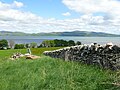
 Watching Wigtown Bay - geograph.org.uk - 2995318.jpg 511 × 640; 98 KB
-
 Wetlands at Wigtown Bay - geograph.org.uk - 3354438.jpg 2,272 × 1,704; 691 KB
-
 Wigtown Bay - geograph.org.uk - 1887602.jpg 3,648 × 2,736; 4.52 MB
-
 Wigtown Bay - geograph.org.uk - 1887735.jpg 3,648 × 2,736; 4.36 MB
-
 Wigtown Bay - geograph.org.uk - 2141883.jpg 3,588 × 2,616; 723 KB
-
 Wigtown Bay - geograph.org.uk - 2559608.jpg 640 × 480; 51 KB
-
 Wigtown Bay - geograph.org.uk - 2842241.jpg 640 × 480; 72 KB
-
 Wigtown Bay - geograph.org.uk - 4331297.jpg 1,920 × 1,280; 1.53 MB
-
 Wigtown Bay - geograph.org.uk - 4332768.jpg 1,920 × 1,280; 2.12 MB
-
 Wigtown Bay - geograph.org.uk - 4332769.jpg 1,920 × 1,280; 1.36 MB
-
 Wigtown Bay - geograph.org.uk - 4857492.jpg 1,920 × 1,280; 1.8 MB
-
 Wigtown Bay - geograph.org.uk - 4857496.jpg 1,920 × 1,280; 1.94 MB
-
 Wigtown Bay - geograph.org.uk - 4858423.jpg 1,920 × 1,280; 1.2 MB
-
 Wigtown Bay - geograph.org.uk - 4858426.jpg 1,920 × 1,280; 1.64 MB
-
 Wigtown Bay - geograph.org.uk - 4858467.jpg 1,920 × 1,280; 1.84 MB
-
 Wigtown Bay - geograph.org.uk - 4858542.jpg 1,920 × 1,280; 1.5 MB
-
 Wigtown Bay - geograph.org.uk - 4858717.jpg 1,920 × 1,280; 1.46 MB
-
 Wigtown Bay - geograph.org.uk - 4858796.jpg 1,920 × 1,280; 727 KB
-
 Wigtown Bay - geograph.org.uk - 4882647.jpg 1,879 × 1,204; 428 KB
-
 Wigtown Bay - geograph.org.uk - 4882653.jpg 1,920 × 1,280; 1.12 MB
-
 Wigtown Bay - geograph.org.uk - 4882680.jpg 1,920 × 1,280; 1.18 MB
-
 Wigtown Bay - geograph.org.uk - 5531581.jpg 2,592 × 1,728; 1.43 MB
-
 Wigtown Bay - geograph.org.uk - 5694208.jpg 2,976 × 1,984; 2.66 MB
-
 Wigtown Bay - geograph.org.uk - 6615080.jpg 2,976 × 1,984; 2.3 MB
-
 Wigtown Bay - geograph.org.uk - 6615093.jpg 2,976 × 1,984; 2.21 MB
-
 Wigtown Bay at low tide - geograph.org.uk - 1864461.jpg 3,016 × 2,226; 916 KB
-
 Wigtown Bay Information Board - geograph.org.uk - 3354367.jpg 2,272 × 1,704; 684 KB
-
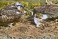 Wigtown Bay Ospreys - geograph.org.uk - 2508324.jpg 640 × 426; 101 KB
-
 Wigtown Bay, East Channel - geograph.org.uk - 3937755.jpg 1,920 × 1,280; 1.87 MB
-
 Woodland at Wigtown Bay - geograph.org.uk - 3937678.jpg 1,920 × 1,280; 2.42 MB
-
 Woodland at Wigtown Bay - geograph.org.uk - 3937720.jpg 1,920 × 1,280; 2.36 MB


