Category:Whitkirk
Jump to navigation
Jump to search
suburb in Leeds, West Yorkshire, England, UK  | |||||
| Upload media | |||||
| Instance of | |||||
|---|---|---|---|---|---|
| Part of | |||||
| Location | Leeds, West Yorkshire, Yorkshire and the Humber, England | ||||
 | |||||
Subcategories
This category has the following 5 subcategories, out of 5 total.
Media in category "Whitkirk"
The following 47 files are in this category, out of 47 total.
-
 Almshouses - Wetherby Road, Roundhay - geograph.org.uk - 552584.jpg 640 × 403; 40 KB
-
 Bridge HUL 4 30 - Selby Road - geograph.org.uk - 564075.jpg 640 × 489; 45 KB
-
 Chapel Court - Chapel Street - geograph.org.uk - 569150.jpg 640 × 414; 35 KB
-
 Chestnut tree, Temple Newsam Park, Colton - geograph.org.uk - 259436.jpg 640 × 480; 124 KB
-
 Colton Road in Whitkirk, Leeds.JPG 4,608 × 3,456; 3.81 MB
-

-
 Dawlish Row - Skelton Terrace - geograph.org.uk - 1238312.jpg 640 × 480; 226 KB
-
 Dawlish Street - York Road - geograph.org.uk - 683792.jpg 640 × 434; 53 KB
-
 Dawlish Terrace - Ivy Avenue - geograph.org.uk - 1238443.jpg 640 × 454; 169 KB
-
 East Leeds Clinic - Harehills Lane - geograph.org.uk - 683779.jpg 640 × 406; 38 KB
-
 Easterly Road, Oakwood. - geograph.org.uk - 250828.jpg 640 × 478; 70 KB
-

-
 Footbridge over York Road - geograph.org.uk - 683804.jpg 640 × 381; 39 KB
-
 Gate at the end of Park Road, Colton - geograph.org.uk - 259451.jpg 640 × 480; 124 KB
-
 Green lane, Temple Newsam Park - geograph.org.uk - 263650.jpg 640 × 480; 101 KB
-
 Houses on Colton Road, Whitkirk, Leeds, West Yorkshire.jpg 4,608 × 3,456; 3.98 MB
-

-
 Lidl Supermarket - Selby Road - geograph.org.uk - 569167.jpg 640 × 360; 17 KB
-
 Premier Inn - Hollyshaw Lane, Whitkirk - geograph.org.uk - 961997.jpg 640 × 429; 200 KB
-
 Primrose Lane - geograph.org.uk - 569141.jpg 640 × 433; 27 KB
-
 St Alban Road - geograph.org.uk - 563178.jpg 640 × 396; 32 KB
-
 Temple Newsam Golf Course, Colton - geograph.org.uk - 263636.jpg 640 × 480; 99 KB
-
 Temple-newsam-war-memorial.jpg 1,200 × 769; 959 KB
-
 Templenewsam Road - geograph.org.uk - 569171.jpg 640 × 378; 23 KB
-
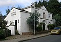
 The Catholic Centre - Selby Road - geograph.org.uk - 569162.jpg 640 × 383; 18 KB
-
 The Coach House - Colton Road, Whitkirk - geograph.org.uk - 961993.jpg 640 × 444; 217 KB
-
 Whitkirk-Colton-Sunrinse-Leeds.jpg 604 × 453; 44 KB
-

-
 Chapel Street - geograph.org.uk - 569151.jpg 640 × 389; 28 KB
-
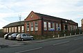
 Chapel Street Social Club - Halton - geograph.org.uk - 569155.jpg 640 × 439; 24 KB
-

-
 Field End Crescent - geograph.org.uk - 569163.jpg 640 × 379; 24 KB
-
 Field End Gardens - geograph.org.uk - 569161.jpg 640 × 414; 26 KB
-
 Field End Road - geograph.org.uk - 569160.jpg 640 × 493; 31 KB
-

-
 Halton Moor Avenue - geograph.org.uk - 569191.jpg 640 × 389; 30 KB
-
 Hawkhill Avenue - geograph.org.uk - 564028.jpg 640 × 444; 54 KB
-
 Levita Place - geograph.org.uk - 569183.jpg 640 × 364; 23 KB
-
 Lyme Chase - geograph.org.uk - 563145.jpg 640 × 428; 69 KB
-
 Oak Crescent - geograph.org.uk - 569170.jpg 640 × 379; 21 KB
-
 Pinfold Lane - geograph.org.uk - 569149.jpg 640 × 430; 49 KB
-
 Play Area - Sutton Estate - geograph.org.uk - 569187.jpg 640 × 480; 49 KB
-
 Primrose Drive - geograph.org.uk - 569147.jpg 640 × 400; 24 KB
-
 Primrose Road - geograph.org.uk - 569146.jpg 640 × 397; 30 KB
-
 Selby Avenue - geograph.org.uk - 569203.jpg 640 × 358; 22 KB
-
 Temple Court - geograph.org.uk - 569166.jpg 640 × 424; 24 KB
-
 The Travellers - Selby Road - geograph.org.uk - 569164.jpg 640 × 412; 25 KB


