Category:White Pine County, Nevada
Jump to navigation
Jump to search
Counties of Nevada: Churchill · Clark · Douglas · Elko · Esmeralda · Eureka · Humboldt · Lander · Lincoln · Lyon · Mineral · Nye · Pershing · Storey · Washoe · White Pine ·Independent city: Carson City
county in Nevada, United States | |||||
| Upload media | |||||
| Instance of | |||||
|---|---|---|---|---|---|
| Named after | |||||
| Location | Nevada | ||||
| Capital | |||||
| Inception |
| ||||
| Population |
| ||||
| Area |
| ||||
| official website | |||||
 | |||||
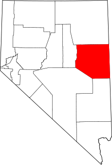
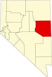
English: Media related to White Pine County, Nevada, a county in eastern Nevada, United States.
Subcategories
This category has the following 15 subcategories, out of 15 total.
Media in category "White Pine County, Nevada"
The following 57 files are in this category, out of 57 total.
-
18-1470.JPG 3,872 × 2,592; 2.29 MB
-
2013-07-14 19 53 39 Rainbow while descending Nevada State Route 488.jpg 3,264 × 2,448; 1.72 MB
-
Aurum Ghost Town, Nevada (15615438356).jpg 600 × 450; 38 KB
-
Baker, Rd50 - panoramio.jpg 858 × 643; 575 KB
-
Belmont Mill - panoramio.jpg 1,500 × 1,000; 503 KB
-
Belmont Mine and upper tram terminus, Looking N-NE, White Pine County, NV - panoramio.jpg 2,304 × 1,728; 1.81 MB
-
BLM sign - panoramio.jpg 4,992 × 3,328; 2.25 MB
-
Cured Cheat Grass in White Pine County, NV.JPG 4,272 × 2,848; 4.59 MB
-
CurrantBristleCone.jpg 831 × 600; 126 KB
-
Draft environmental impact statement for the White Pine energy station project (IA draftenvironment01neso).pdf 1,362 × 1,883, 690 pages; 131.33 MB
-
East View from GRBA - panoramio.jpg 1,600 × 1,200; 409 KB
-
Final environmental impact statement for the White Pine energy station project (IA finalenvironment01neva).pdf 1,689 × 2,177, 452 pages; 136.29 MB
-
Floatilla - panoramio.jpg 4,000 × 3,000; 3.18 MB
-
GrandTouring-Mercedes-Wagon-SSC.jpg 308 × 218; 106 KB
-
Hamilton Nevada.jpg 600 × 400; 31 KB
-
Info sign - panoramio - harley photo.jpg 3,328 × 4,992; 2.44 MB
-
Lages Wildfire in White Pine County, Nevada.JPG 4,272 × 2,848; 2.55 MB
-
Liberty Pit.jpg 3,872 × 2,592; 2.6 MB
-
Massif - panoramio (1).jpg 4,000 × 3,000; 4.24 MB
-
Moorman Ridge in Shellback Wilderness Nevada.jpg 2,400 × 3,600; 4.32 MB
-
National Forest Development Road 448, Baker, United States (Unsplash).jpg 5,472 × 3,648; 1.59 MB
-
NewarkValleyLightning (19356330624).jpg 3,332 × 2,207; 3.05 MB
-
NSchellPk.jpg 899 × 586; 168 KB
-
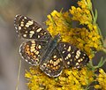
Phyciodes pulchella P1510007a.jpg 1,931 × 1,638; 509 KB
-
Rhodes cabin Nevada.tif 4,821 × 3,792; 174 KB
-
Riepetown, Nevada (circa 1905).jpg 950 × 605; 263 KB
-
Robinson Mine in the winter.jpg 4,000 × 3,000; 1.21 MB
-
RobinsonMineElyNV.jpg 625 × 451; 41 KB
-
Sacramento Pass, view South from Highway 6-50 - panoramio.jpg 2,848 × 2,134; 1.18 MB
-
Scenic Overlook in Great Basin National Park dyeclan.com - panoramio.jpg 3,264 × 2,448; 3.92 MB
-
SchellCreekRangefromCaveLakeSP.JPG 3,264 × 2,448; 2.68 MB
-
SchellCrRange.jpg 600 × 900; 265 KB
-
Shellback Wilderness and US Route 50 Aerial.jpg 3,600 × 2,400; 3.77 MB
-
Snake Range-Sacramento Pass, Nevada - panoramio.jpg 2,842 × 1,736; 2.95 MB
-
USA White Pine County, Nevada age pyramid.svg 520 × 600; 8 KB
-
Ward Mountain and Hamels Peak Aerial.jpg 2,400 × 3,600; 4.61 MB
-
West side of Sacramento Pass - panoramio.jpg 2,848 × 2,134; 3.63 MB
-
White Pine County, NV, USA - panoramio.jpg 3,000 × 4,000; 6.83 MB


