Category:Whitchurch, Hampshire
Jump to navigation
Jump to search
town and civil parish in Basingstoke and Deane, Hampshire, England  | |||||
| Upload media | |||||
| Instance of | |||||
|---|---|---|---|---|---|
| Location | Basingstoke and Deane, Hampshire, South East England, England | ||||
| Population |
| ||||
| official website | |||||
 | |||||
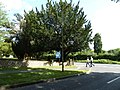
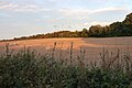
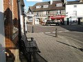
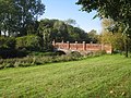
English: Whitchurch is a town in Hampshire, England. It is on the River Test, miles from Basingstoke. Much of the town is a Conservation Area. Because of the amount of wildlife in and near the river, parts of the town are designated as Site of Special Scientific Interest.
Subcategories
This category has the following 13 subcategories, out of 13 total.
A
- A34 road at Whitchurch (27 F)
C
- Cole Henley (24 F)
G
- Gill Nethercott Centre (4 F)
P
R
- River Test in Whitchurch (38 F)
W
- Whitchurch Cycle Trail (4 F)
- Whitchurch Silk Mill (39 F)
- Whitchurch Town Hall (10 F)
Media in category "Whitchurch, Hampshire"
The following 200 files are in this category, out of 933 total.
(previous page) (next page)-
-
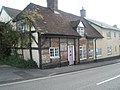
 24 Winchester Street - geograph.org.uk - 5363578.jpg 1,024 × 739; 154 KB
-

-

-
 A Green Valley - geograph.org.uk - 5147597.jpg 1,600 × 1,200; 765 KB
-
 A long footpath to Whitchurch - geograph.org.uk - 4290576.jpg 1,600 × 1,062; 716 KB
-
 A meeting of lanes - geograph.org.uk - 6721448.jpg 1,024 × 768; 328 KB
-
 A new field boundary - geograph.org.uk - 3404757.jpg 640 × 425; 86 KB
-
 A welcome sight - geograph.org.uk - 3395648.jpg 640 × 425; 115 KB
-
 A34 - is this its precursor - geograph.org.uk - 3142412.jpg 3,516 × 2,425; 1.33 MB
-
 A34 - Larks Barrow Hill - geograph.org.uk - 2734826.jpg 640 × 480; 73 KB
-
 A34 footbridge north of Whitchurch - geograph.org.uk - 2692807.jpg 3,648 × 2,270; 1.49 MB
-
 A34 near Whitchurch - geograph.org.uk - 881366.jpg 640 × 427; 71 KB
-
 A34 north of Whitchurch - geograph.org.uk - 4238149.jpg 640 × 480; 51 KB
-
 A34 northbound at Bradley Wood - geograph.org.uk - 4238166.jpg 640 × 481; 61 KB
-
 A34 northbound at Harrow Way Bridge - geograph.org.uk - 4646951.jpg 1,600 × 1,194; 681 KB
-
 A34 northbound at Manor Farm - geograph.org.uk - 4238145.jpg 640 × 481; 61 KB
-
 A34 northbound towards Newbury - geograph.org.uk - 4646942.jpg 1,600 × 1,200; 519 KB
-
 A34 Road Bridge - geograph.org.uk - 881740.jpg 640 × 480; 112 KB
-
 A34 roadbridge carries Harrow Way - geograph.org.uk - 2692385.jpg 3,340 × 2,188; 1.14 MB
-
 A34 southwest of Whitchurch - geograph.org.uk - 2692920.jpg 640 × 480; 68 KB
-
 A34 west of Whitchurch - geograph.org.uk - 2692902.jpg 3,024 × 1,970; 914 KB
-
 A34, North of Whitchurch - geograph.org.uk - 3287515.jpg 640 × 480; 394 KB
-
 Access to New Barn - geograph.org.uk - 4307093.jpg 2,869 × 1,901; 2.42 MB
-
 Albright, Ardglen Road - geograph.org.uk - 5150715.jpg 3,523 × 2,030; 1.42 MB
-
 Albright, Unit G - geograph.org.uk - 5150717.jpg 2,882 × 1,402; 875 KB
-
 Allison Way, Whitchurch - geograph.org.uk - 5236097.jpg 1,600 × 1,324; 502 KB
-
 Allotments off Test Road - geograph.org.uk - 5363618.jpg 1,024 × 768; 263 KB
-
 Allotments, Whitchurch - geograph.org.uk - 2018052.jpg 640 × 480; 81 KB
-
 Along side the River Test - geograph.org.uk - 2024794.jpg 426 × 640; 225 KB
-
 Ancient farm track - geograph.org.uk - 4290154.jpg 3,568 × 2,368; 7.38 MB
-
 Ancient track - geograph.org.uk - 3980036.jpg 4,648 × 3,071; 5.07 MB
-

-
 Approaching Peak House Farm - geograph.org.uk - 2702244.jpg 640 × 473; 50 KB
-
-
 Approaching train - geograph.org.uk - 2702225.jpg 640 × 480; 109 KB
-
 Arable land at Ridgeway Farm - geograph.org.uk - 2415222.jpg 640 × 480; 100 KB
-
 Arable land at Whitnal Farm - geograph.org.uk - 2415226.jpg 640 × 477; 101 KB
-
 ARH20100421-0937-43691.JPG 2,581 × 2,063; 2.44 MB
-
 Ash Bed Plantation - geograph.org.uk - 5988024.jpg 1,920 × 1,280; 1.22 MB
-
 At Whitchurch, Hants - geograph.org.uk - 84539.jpg 640 × 480; 51 KB
-

-
 Autumn colours - geograph.org.uk - 3182333.jpg 480 × 640; 161 KB
-
 Autumn colours - geograph.org.uk - 3182337.jpg 640 × 480; 162 KB
-
 B3400 - London Road - geograph.org.uk - 5341079.jpg 640 × 467; 93 KB
-
 B3400 at Whitchurch village boundary - geograph.org.uk - 3106815.jpg 640 × 481; 97 KB
-
 B3400 Church Street - geograph.org.uk - 3107625.jpg 640 × 480; 70 KB
-
 B3400 near Hurstbourne Park - geograph.org.uk - 3107642.jpg 640 × 480; 61 KB
-
 Barn at Whitchurch - geograph.org.uk - 135153.jpg 640 × 480; 93 KB
-
 Barn at Whitnal Farm - geograph.org.uk - 2415236.jpg 640 × 400; 90 KB
-
 Barn at Wooldings Farm - geograph.org.uk - 2404697.jpg 640 × 480; 110 KB
-
 Barn at Wooldings Farm - geograph.org.uk - 2404702.jpg 640 × 438; 105 KB
-
 Behind the shelter belt - geograph.org.uk - 4294131.jpg 1,600 × 1,062; 571 KB
-
 Bell Street, Whitchurch - geograph.org.uk - 604190.jpg 640 × 480; 71 KB
-
 Bench at the five roads junction - geograph.org.uk - 603767.jpg 640 × 480; 87 KB
-
 Bend in the track - geograph.org.uk - 2406387.jpg 640 × 477; 104 KB
-
 Bere Hill - geograph.org.uk - 2340598.jpg 640 × 297; 141 KB
-
 Bere Hill, Whitchurch - geograph.org.uk - 2024756.jpg 640 × 428; 188 KB
-
 Bere Mill - geograph.org.uk - 2645343.jpg 1,024 × 768; 237 KB
-
 Black sheep at Bere Mill - geograph.org.uk - 2340625.jpg 640 × 426; 176 KB
-
 Blacksmith's Barn - geograph.org.uk - 4427162.jpg 640 × 480; 99 KB
-
 Block on the byway - geograph.org.uk - 4084861.jpg 1,024 × 675; 292 KB
-
 Bridge by Bere Mill - geograph.org.uk - 2628981.jpg 640 × 480; 119 KB
-
 Bridge carrying the Harrow Way across A34 - geograph.org.uk - 6371808.jpg 1,024 × 768; 91 KB
-
 Bridge over A34 for Harrow Way - geograph.org.uk - 6558757.jpg 1,024 × 768; 125 KB
-
 Bridleway and trees by Harrow Way - geograph.org.uk - 3187774.jpg 480 × 640; 114 KB
-
 Bridleway bridge over A34 - geograph.org.uk - 3039744.jpg 1,000 × 750; 477 KB
-
 Bridleway to Down Farm - geograph.org.uk - 3187782.jpg 640 × 443; 70 KB
-
 Bridleway to New Barn - geograph.org.uk - 4448810.jpg 1,600 × 1,062; 431 KB
-
 Bridleway towards Egbury - geograph.org.uk - 3388720.jpg 800 × 531; 113 KB
-
 Bright when the sun shines - geograph.org.uk - 4084865.jpg 1,024 × 667; 275 KB
-
-
 Broad field boundary - geograph.org.uk - 4084867.jpg 1,024 × 680; 301 KB
-
 Brow of the hill - geograph.org.uk - 4293556.jpg 1,600 × 1,062; 761 KB
-
 Building in Bell Street, Whitchurch - geograph.org.uk - 881449.jpg 640 × 424; 81 KB
-
 Building site, Whitchurch - geograph.org.uk - 5282074.jpg 640 × 480; 152 KB
-
 Bungalow on Winchester Street, Whitchurch - geograph.org.uk - 5931589.jpg 1,920 × 1,280; 1.4 MB
-
 Burnaby Stores on Winchester Road, Whitchurch - geograph.org.uk - 5935440.jpg 1,920 × 1,280; 916 KB
-
 Burning straw by Twinley Lane - geograph.org.uk - 5928396.jpg 1,920 × 1,280; 688 KB
-
 Burning straw by Twinley Lane - geograph.org.uk - 5928397.jpg 1,920 × 1,280; 691 KB
-
 Burning straw by Twinley Lane - geograph.org.uk - 5928398.jpg 1,920 × 1,280; 636 KB
-
 Byway east of Twinley Lane - geograph.org.uk - 2640365.jpg 1,024 × 768; 199 KB
-
 Byway junction north of Laverstoke - geograph.org.uk - 2640866.jpg 1,024 × 768; 332 KB
-
 Byway junction on Harrow Way - geograph.org.uk - 3185534.jpg 640 × 480; 111 KB
-
 Byway meets public footpath - geograph.org.uk - 4290561.jpg 1,600 × 1,062; 780 KB
-
 Byway meets The Harrow Way - geograph.org.uk - 6719425.jpg 1,600 × 1,200; 878 KB
-
 Byway north of Down Farm - geograph.org.uk - 3389157.jpg 640 × 425; 114 KB
-
 Byway off The Harrow Way - geograph.org.uk - 6721419.jpg 800 × 600; 215 KB
-
 Byway off Twinley Lane - geograph.org.uk - 5988025.jpg 1,920 × 1,280; 1.69 MB
-
 Byway south of Bradley Wood - geograph.org.uk - 3395949.jpg 640 × 425; 169 KB
-
 Byway south of Brickkiln Wood - geograph.org.uk - 4290556.jpg 1,600 × 1,062; 620 KB
-
 Byway south of Brickkiln Wood - geograph.org.uk - 4290566.jpg 1,600 × 1,062; 598 KB
-
 Byway to Brickkiln - geograph.org.uk - 2340758.jpg 640 × 432; 237 KB
-
 Byway to Brickkiln Hassock - geograph.org.uk - 2340878.jpg 640 × 403; 208 KB
-
 Byway to Cooper's in the Wood farm - geograph.org.uk - 3389204.jpg 640 × 425; 114 KB
-
 Byway to Cooper's in the Wood farm - geograph.org.uk - 3389206.jpg 640 × 425; 114 KB
-
 Byway to Cooper's in the Wood Farm - geograph.org.uk - 3404697.jpg 640 × 425; 136 KB
-
 Byway to Egbury - geograph.org.uk - 3404731.jpg 640 × 425; 102 KB
-
 Byway to Egbury - geograph.org.uk - 3404766.jpg 640 × 425; 72 KB
-
 Byway to Tufton Warren farm - geograph.org.uk - 2340750.jpg 640 × 427; 202 KB
-
 Byway to Twinley Lane - geograph.org.uk - 4084918.jpg 1,024 × 700; 359 KB
-
 Byway towards Harrow Way - geograph.org.uk - 4084894.jpg 1,024 × 680; 304 KB
-
 Byway towards Hogdigging Copse - geograph.org.uk - 3388723.jpg 800 × 531; 177 KB
-
 Byway towards Hogdigging Copse - geograph.org.uk - 3404713.jpg 640 × 425; 123 KB
-
 Byway towards New Barn - geograph.org.uk - 2415369.jpg 640 × 462; 106 KB
-
 Byway towards Watch Lane - geograph.org.uk - 6721429.jpg 800 × 600; 198 KB
-
 Byway towards Whitnal - geograph.org.uk - 4084852.jpg 1,024 × 673; 369 KB
-
 Byway towards Whitnal - geograph.org.uk - 4084870.jpg 1,024 × 680; 304 KB
-
 Byway towards Whitnal - geograph.org.uk - 4084879.jpg 1,024 × 731; 340 KB
-
 Byway towards Whitnal - geograph.org.uk - 4084887.jpg 1,024 × 667; 338 KB
-
 Byway towards Whitnal - geograph.org.uk - 4084923.jpg 1,024 × 674; 343 KB
-
 Byway towards Whitnal - geograph.org.uk - 4084937.jpg 1,024 × 680; 240 KB
-
 Byway towards Whitnal - geograph.org.uk - 4084943.jpg 1,024 × 680; 290 KB
-
 Byway towards Whitnal - geograph.org.uk - 4084947.jpg 1,024 × 680; 226 KB
-
 Byway towards Whitnal - geograph.org.uk - 6721437.jpg 1,024 × 768; 318 KB
-
 Byway ^ farm track - geograph.org.uk - 3404759.jpg 640 × 425; 125 KB
-
 Byway ^ farm track - geograph.org.uk - 3404761.jpg 640 × 425; 125 KB
-
 Caesar's Belt - geograph.org.uk - 2706110.jpg 640 × 480; 115 KB
-
 Caesar's Belt - geograph.org.uk - 3182356.jpg 640 × 480; 95 KB
-
 Camp on the Harrow Way - geograph.org.uk - 2415460.jpg 640 × 477; 111 KB
-

-
 Cattle by Down Copse - geograph.org.uk - 3187112.jpg 640 × 447; 72 KB
-
 Cattle in field - geograph.org.uk - 1171375.jpg 640 × 480; 121 KB
-
-
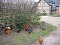 Chickens at Whitnal Barn - geograph.org.uk - 2415251.jpg 640 × 477; 98 KB
-
 Church Street passes under the A34 - geograph.org.uk - 3107630.jpg 640 × 480; 107 KB
-
 Church Street, Whitchurch - geograph.org.uk - 4469566.jpg 2,560 × 1,920; 2.01 MB
-
 Church Street, Whitchurch - geograph.org.uk - 4471303.jpg 2,560 × 1,920; 1.97 MB
-
 Circular seat by Whitchurch Town Hall - geograph.org.uk - 602785.jpg 640 × 480; 71 KB
-
 Clock Barn at Tufton Warren Farm - geograph.org.uk - 332431.jpg 442 × 640; 132 KB
-
 Close up of a pheasant feeder - geograph.org.uk - 4294136.jpg 1,600 × 1,062; 791 KB
-
 Colour along Twinley Lane - geograph.org.uk - 5371368.jpg 640 × 479; 98 KB
-
 Colour by Square Oaks - geograph.org.uk - 5371367.jpg 640 × 480; 124 KB
-
 Coloured Bollards by the White Hart - geograph.org.uk - 5150788.jpg 3,267 × 2,993; 2.32 MB
-
 Combatting rural disrespect - geograph.org.uk - 4093952.jpg 640 × 416; 122 KB
-
 Cones in Micheldever Road - geograph.org.uk - 2782091.jpg 640 × 480; 50 KB
-
 Cooper's in the Wood Copse - geograph.org.uk - 3404702.jpg 640 × 425; 91 KB
-
 Cooper's in the Wood Copse - geograph.org.uk - 3404706.jpg 640 × 425; 98 KB
-
 Cooper's in the Wood Copse - geograph.org.uk - 3404743.jpg 640 × 425; 108 KB
-
 Cottage at Whitchurch - geograph.org.uk - 602766.jpg 640 × 480; 87 KB
-
 Cottage garden, Whitchurch, Hampshire - geograph.org.uk - 4542110.jpg 2,667 × 3,429; 2.86 MB
-
 Cottages in Bell Street - geograph.org.uk - 2734755.jpg 640 × 443; 66 KB
-
 Cottages in Church St Whitchurch - geograph.org.uk - 4410568.jpg 640 × 480; 75 KB
-

-
 Cottages on Church Street, Whitchurch - geograph.org.uk - 4471271.jpg 2,560 × 1,920; 2.02 MB
-
 Cottages on Church Street, Whitchurch - geograph.org.uk - 5363347.jpg 1,024 × 768; 187 KB
-
 Cottages on Newbury St - geograph.org.uk - 4410572.jpg 640 × 480; 65 KB
-
 Country Lane - Paul's Heath - geograph.org.uk - 2702249.jpg 640 × 498; 75 KB
-
 Country north of Freefolk - geograph.org.uk - 4218946.jpg 640 × 480; 159 KB
-
 Country seat - geograph.org.uk - 2406295.jpg 640 × 474; 109 KB
-
 Cow by the River Test - geograph.org.uk - 2704349.jpg 640 × 477; 83 KB
-
 Crossroads - Larks Barrow Hill - geograph.org.uk - 3389253.jpg 640 × 425; 103 KB
-
 Crossroads on Newbury Road, Whitchurch - geograph.org.uk - 5931920.jpg 1,920 × 1,280; 961 KB
-
 Curve in Watch Lane - geograph.org.uk - 4084961.jpg 1,024 × 680; 267 KB
-
 Curves in Twinley Lane - geograph.org.uk - 4084971.jpg 1,024 × 680; 256 KB
-
 Curves in Twinley Lane - geograph.org.uk - 4084982.jpg 1,024 × 652; 311 KB
-
 Cyclists in autumn - geograph.org.uk - 3182344.jpg 640 × 480; 131 KB
-
 Daisies by the Test, Whitchurch - geograph.org.uk - 2016565.jpg 480 × 640; 79 KB
-
 Damp conditions - Ridgeway Copse - geograph.org.uk - 4513584.jpg 1,600 × 1,062; 622 KB
-
 Difficult to resolve - geograph.org.uk - 4084794.jpg 425 × 640; 55 KB
-
 Displaced sign - geograph.org.uk - 604210.jpg 640 × 480; 136 KB
-
 Disused railway line - geograph.org.uk - 604567.jpg 640 × 480; 93 KB
-
 Disused railway line over Bloswood Lane - geograph.org.uk - 4061634.jpg 640 × 427; 108 KB
-
 Diversion near Cole Henley - geograph.org.uk - 3187156.jpg 640 × 480; 87 KB
-
 Down Farm - unnamed copse - geograph.org.uk - 3389187.jpg 640 × 425; 114 KB
-
 Down Farm fields - geograph.org.uk - 3404767.jpg 640 × 425; 69 KB
-
 Down Farm fields - geograph.org.uk - 3404768.jpg 640 × 425; 66 KB
-
 Drainage ditch - geograph.org.uk - 2340633.jpg 640 × 454; 252 KB
-
 Dry valley by Caesar's Belt - geograph.org.uk - 4513575.jpg 1,600 × 1,062; 400 KB
-
 Edge of Brickkiln Wood - geograph.org.uk - 4294160.jpg 1,600 × 1,063; 851 KB
-
 Edge of Cooper's in the Wood Copse - geograph.org.uk - 3404708.jpg 640 × 425; 90 KB
-
 Edge of Furze Copse - geograph.org.uk - 2406284.jpg 640 × 477; 84 KB
-
 Edge of Paul's Wood - geograph.org.uk - 2415207.jpg 640 × 480; 89 KB
-
 Edge of Ridgeway Copse - geograph.org.uk - 4513596.jpg 1,600 × 1,062; 417 KB
-
 Edge of Ridgeway Copse - geograph.org.uk - 4513597.jpg 1,600 × 1,062; 411 KB
-
 Edge of the plantation - geograph.org.uk - 3389223.jpg 640 × 425; 106 KB
-
 Electricity sub-station at Kingsley Close - geograph.org.uk - 604583.jpg 640 × 480; 143 KB
-
 Encampment with grazing pony on Harroway - geograph.org.uk - 2640452.jpg 768 × 1,024; 170 KB
-
 End of Caesar's Belt - geograph.org.uk - 2406318.jpg 640 × 477; 87 KB
-
 End of the wooded track - geograph.org.uk - 4293546.jpg 1,600 × 1,062; 776 KB
-
 Entering Cole Henley - geograph.org.uk - 4218991.jpg 640 × 480; 194 KB
-
 Entering Tufton - geograph.org.uk - 919525.jpg 640 × 427; 74 KB
-

-
 Evening sunlight on Twinley Lane - geograph.org.uk - 2702071.jpg 800 × 561; 150 KB
-
 Evidence of a damp spring - geograph.org.uk - 4084929.jpg 1,024 × 661; 302 KB
-
 Evidence of wildlife - geograph.org.uk - 4093955.jpg 640 × 422; 130 KB
-
 Exeter to London railway line - geograph.org.uk - 2415496.jpg 601 × 640; 153 KB
-
 Exiting Whitchurch via London Street - geograph.org.uk - 5341071.jpg 640 × 530; 89 KB
-
 Factory units in Ardglen Road - geograph.org.uk - 604203.jpg 640 × 480; 108 KB
-
 Fairfield, Whitchurch - geograph.org.uk - 602500.jpg 640 × 480; 61 KB
-
 Fallen tree at Whitnal - geograph.org.uk - 2415234.jpg 640 × 431; 94 KB
-
 Farm access only - geograph.org.uk - 3389144.jpg 640 × 425; 145 KB
-
 Farm road at Southfield Farm - geograph.org.uk - 2645285.jpg 768 × 1,024; 187 KB
-
 Farm track and byway - geograph.org.uk - 6721425.jpg 1,024 × 754; 347 KB
-
 Farm track and byway - geograph.org.uk - 6721433.jpg 1,024 × 768; 286 KB
-
 Farm track and byway - geograph.org.uk - 6721449.jpg 1,024 × 768; 301 KB
-
 Farm track approaching Whitnal - geograph.org.uk - 4449669.jpg 1,600 × 1,062; 585 KB
-
 Farm track east of Whitnal - geograph.org.uk - 4448811.jpg 1,600 × 1,062; 553 KB
-
 Farm track east of Whitnal - geograph.org.uk - 4448814.jpg 1,600 × 1,062; 433 KB
-


.jpg)
.jpg)


