Category:Whatley, Mendip
Jump to navigation
Jump to search
English: Whatley is a small rural village and civil parish near Frome in the English county of Somerset.
village and civil parish in Mendip, Somerset, United Kingdom  | |||||
| Upload media | |||||
| Instance of | |||||
|---|---|---|---|---|---|
| Location | Mendip, Somerset, South West England, England | ||||
| Population |
| ||||
 | |||||
Subcategories
This category has the following 4 subcategories, out of 4 total.
Media in category "Whatley, Mendip"
The following 60 files are in this category, out of 60 total.
-
 2010 , Minor road leaving Whatley - geograph.org.uk - 2068279.jpg 800 × 588; 152 KB
-
 2010 , Minor road leaving Whatley - geograph.org.uk - 2068310.jpg 1,600 × 1,276; 753 KB
-
 2010 , Passing Park Farm on a minor road - geograph.org.uk - 2068289.jpg 800 × 603; 187 KB
-
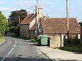
 2010 , Road junction in Lower Whatley - geograph.org.uk - 2068305.jpg 800 × 551; 197 KB
-
 2010 , Road through Whatley - geograph.org.uk - 2049824.jpg 800 × 599; 155 KB
-
 A little hop for a horse - geograph.org.uk - 6337835.jpg 3,296 × 2,472; 3.22 MB
-
 A move to make movement better - geograph.org.uk - 6338104.jpg 3,296 × 2,472; 3.32 MB
-
 Arms but no branches - geograph.org.uk - 6335547.jpg 2,472 × 3,296; 3.43 MB
-
 Bottom of the valley near Manor Farm - geograph.org.uk - 1019046.jpg 640 × 404; 116 KB
-
 Chantry church - geograph.org.uk - 5335634.jpg 640 × 480; 130 KB
-
 Church of the Holy Trinity, Whatley, Mendip.jpg 2,816 × 2,112; 2.64 MB
-

-
 Door out of Chantry churchyard - geograph.org.uk - 5536499.jpg 640 × 480; 195 KB
-
 East from Mary's Grave crossroads - geograph.org.uk - 999709.jpg 640 × 446; 80 KB
-
 Entering Chantry from the west - geograph.org.uk - 5335625.jpg 640 × 480; 175 KB
-
 Farmland and woods near Bulls Green - geograph.org.uk - 999880.jpg 640 × 497; 83 KB
-
 Ford with a roof - geograph.org.uk - 6335549.jpg 2,472 × 3,296; 3.42 MB
-
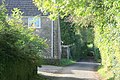
 Gatehouse, Manor Farm, Whatley - geograph.org.uk - 5536134.jpg 640 × 480; 137 KB
-
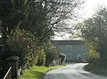
 Green Farm, on the old road to Nunney - geograph.org.uk - 1018220.jpg 640 × 426; 120 KB
-
 Green steps - geograph.org.uk - 6335551.jpg 3,296 × 2,472; 3.36 MB
-
 Heading west at Egford - geograph.org.uk - 1599171.jpg 640 × 485; 219 KB
-
 Horse in field, Whatley - geograph.org.uk - 5536147.jpg 640 × 480; 138 KB
-

-
 Looking south near Orr Farm, Chantry - geograph.org.uk - 1593404.jpg 640 × 480; 192 KB
-
 Maize near Chantry - geograph.org.uk - 1559002.jpg 640 × 480; 149 KB
-
 Maize, Chantry - geograph.org.uk - 1500248.jpg 640 × 480; 174 KB
-
 Manor Farm, near Chantry - geograph.org.uk - 999901.jpg 640 × 530; 112 KB
-
 Manor Farmhouse, Whatley - geograph.org.uk - 1559699.jpg 640 × 480; 131 KB
-
 Minor road between Chantry and Whatley - geograph.org.uk - 1593620.jpg 640 × 521; 304 KB
-
-
 Minor road leaving Chantry - geograph.org.uk - 1593396.jpg 640 × 504; 251 KB
-

-
 Minor road to Frome - geograph.org.uk - 1598955.jpg 640 × 503; 196 KB
-
 Murdercombe Tunnel - DBS 59205.JPG 1,366 × 1,024; 567 KB
-

-

-
 Old house near the church (Whatley, Somerset, 2007).jpg 2,816 × 2,112; 2.6 MB
-
 Old reflector in Bulls Green - geograph.org.uk - 6332415.jpg 3,296 × 2,472; 3.34 MB
-
 Pasture near Egford, Frome - geograph.org.uk - 1080223.jpg 640 × 491; 212 KB
-
 Pasture near Rock House farm (2) - geograph.org.uk - 1018241.jpg 640 × 458; 76 KB
-
 Pasture near Rock House farm - geograph.org.uk - 1018231.jpg 640 × 424; 83 KB
-
 Paths and pleasures in Murder Combe - geograph.org.uk - 6687629.jpg 2,472 × 3,296; 1.65 MB
-

-
 Postbox, Lower Whatley - geograph.org.uk - 1559743.jpg 640 × 480; 165 KB
-
 Red Barn Farm, Frome - geograph.org.uk - 1080216.jpg 640 × 463; 165 KB
-
 Restricted by a gate - geograph.org.uk - 6337825.jpg 2,472 × 3,296; 3.7 MB
-
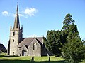
 St George's Church, Whatley - geograph.org.uk - 1559664.jpg 640 × 480; 115 KB
-
 Step stile, Whatley - geograph.org.uk - 1559713.jpg 640 × 480; 191 KB
-
 The Chantry, Chantry - geograph.org.uk - 5536937.jpg 640 × 480; 222 KB
-
 The Egford Brook - geograph.org.uk - 4957527.jpg 2,048 × 3,648; 2.7 MB
-
 The road to Frome leaving Chantry - geograph.org.uk - 999927.jpg 640 × 510; 115 KB
-
 The valley of Egford Brook - geograph.org.uk - 1583435.jpg 640 × 478; 252 KB
-
 West from the road to Frome - geograph.org.uk - 1598979.jpg 640 × 550; 246 KB
-
 Whatley church - geograph.org.uk - 5335639.jpg 640 × 428; 120 KB
-
 Whatley church - geograph.org.uk - 5536157.jpg 640 × 480; 106 KB
-
 Whatley Quarry - DBS 59205.JPG 1,024 × 1,366; 584 KB
-
 Whatley Quarry - Dogfish DB983030.JPG 1,366 × 1,024; 820 KB
-
 Whatley Quarry - Dogfish DB992827.JPG 1,366 × 910; 468 KB
-
 Whatley Quarry - SR Bogie Bolster.JPG 1,366 × 820; 839 KB
-
 Whatley Quarry wagons for repair.JPG 1,366 × 910; 501 KB


.jpg)


_-_geograph.org.uk_-_1018241.jpg)


